I have a goal of riding all the trails that head on the Mount Nebo Loop Road, south of Payson, Utah, within the next year, so I try to hit a new trail every chance I get. As I get through those trails, I will start on the trails on and around Mount Loafer.

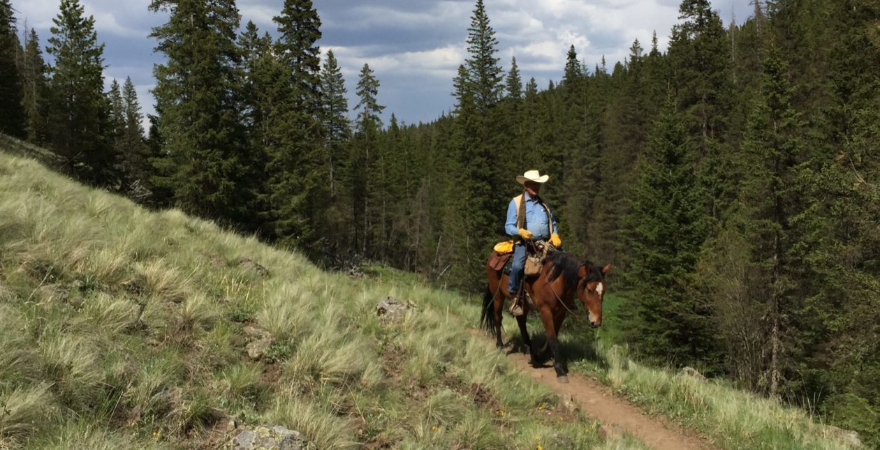
Yesterday, my wife and I tried a new trail which heads at the Jones Ranch parking area about 9 miles south of Payson on Mount Nebo Loop Road. It was a nice three-hour ride. Linda rode my mustang Jimbo, and I rode my paint Quarter Horse, Reno. I ponied my Fox Trotter, Lizzy, along just for the exercise and because she really wanted to go with us. She got pretty upset when I took the other two to the trailer and didn’t take her.
The Jones Ranch parking area is adequate for even pretty large rigs to enter and turn around. There are no services offered. There are some primitive campsites around the parking area, but no hookups or conveniences. Some folks set up camp and spend several days riding out on the various trails. The best campsites seem to be right at the trailheads, so expect to have folks passing through or next to your campsite. These trails are “multi-use” trails, so they are open to hikers, horses, bicycles, and motorcycles. Most of the trails are well-maintained and fairly well-traveled. Expect to pass other folks on the trail. Dogs are allowed and not required to be on leash, as long as you are outside fee areas, like Payson Lakes.
On this ride, Linda and I chose to ride the Jones Ranch Creek trail, Forest Trail #123, which heads south from the parking area. The trailhead is on the south side of the road and continues southward. Again, the trail is well-marked and well-traveled. Can’t miss it.

The trail starts out climbing at a slight grade and heads up through spruce and fir forest, as well as aspen groves and a couple of nice open areas. It crosses two or three spring-fed creeks and is a very pleasant ride, suitable for even the very youngest and most inexperienced of riders. The elevation at the trailhead is around 7,000 to about 7,200 feet. This trail is about three and a half miles long and ends up back at Mount Nebo Loop Road near the Payson Lakes ranger station a little higher up the mountain.
The “scariest” obstacles we encountered on the trail were a couple of places where small culverts have been placed and covered with gravel and lined with landscape timbers. Our horses sort of eyeballed them, but passed over without complaint. There is plenty of room to go around these bridges if necessary. There is one gate to be opened and shut about 3/4 mile from the trailhead.

About two miles up the trail, the Rock Spring trail, Forest Trail #101, intersects it. We elected to take the Rock Spring trail to check it out. This trail heads southwesterly, climbs a bit, then descends, then climbs again, offering some very nice views of the surrounding area. Again, this trail is not challenging and is suitable for anyone who enjoys riding in the mountains. We followed it about a mile and a half, then turned south on an intersecting trail, Forest Trail #097, that shows on my USFS map as a “Jeep Trail”.
We followed this trail south, climbing steadily, about another mile and a half to its head at Mount Nebo Loop Road. I noticed that near this trailhead, on the south side of the road, there were a few nice primitive campsites. It occurred to me that one could set up camp here and enjoy several days of nice riding.
 At this point we turned around and headed back. My USFS map from about 1967 or so, showed a separate trail paralleling trail #097 back to Rock Spring Trail, so we decided have a look. It is not marked and started out as a two-track that descended into a canyon (ergo the “Jeep trail designation on the map), ending at a “yurt” type domicile. We avoided that and tried to continue on the trail indicated on the map. Following my GPS we found where the trail was supposed to be, but it was nowhere to be found. It appears that it was a trail at one time, possibly used by the old ranchers, but through disuse it has simply disappeared. We bushwhacked for about a half mile to get back to Rock Spring Trail. The bushwhacking wasn’t bad, as the terrain has a gentle slope and the vegetation is not closed, like an oak thicket would be, so I actually enjoyed just following my nose. My wife, however, did not enjoy it and expressed concern that I might be lost (Word to the wise: Don’t try bushwhacking in the mountains with someone who isn’t comfortable with it). Alas, we found the trail right where we left it. Of course, I knew where we were the whole time.

The ride back to the trailhead was as enjoyable and relaxed as the ride out. It took us two hours to get to the Forest Trail #097 trailhead and, as usual, about half that to get back to the Jones Ranch trailhead. It was a very pleasant three-hour ride in which we covered just under five miles (we take things pretty easy).
My horses were barefoot on this ride. I pulled their shoes and trimmed them all in the past week. They got a bit tender toward the end of the ride, due to the sharp rocks on the hard trail. None of the horses got stone bruises or received any injury, however, and were simply a little tender toward the end. I feel like this trail is suitable for barefoot horses for a day ride, but if one were camping and riding for a week in that area they might get uncomfortably tender.

Trail notes:
From the junction of #097 with Rock Spring Trail (#101), you can also head northward and explore several other trails down in that area. You can get back to Mount Nebo Loop road at two or three other places as well. I’ll be riding and reporting on those trails in the future.
You must be logged in to post a comment.