Well, sad as I am to say it, our pack trip has ended at Flagstaff, after about 197 miles of travel.
Temperatures are at record highs. Fire danger is extreme. There is no water in northern Arizona anywhere along the Arizona Trail.
Last Monday we made 23.8 miles and the last water we saw was near Marshall Lake at about mile 3-4. By the time we made Flagstaff we knew we were in trouble. The last 6 or so water holes we passed were bone dry. We finally had to call Gwen and Bruce Kahler, who hauled about 70 gallons out to us and met us where the AZ Trail meets Route 66. That supplied ourselves and our horses for that night and the next morning.
Gwen Kahler, our guide through the Flagstaff area
Gwen stayed and rode with us on Tuesday, as we finished the AZT Equine Bypass route through the mountains and around Flagstaff. We passed one running stream (only the second we had seen the whole trip) as we headed back up to higher elevations. We made Schultz Tank, which had water, by about 3pm. From there it was only about four more hours of riding to reach Gwen’s place, so we decided to make the push. We reached her place by about 7pm, making a 19.2 mile day.
On Wednesday, as we were running errands, re-supplying ourselves for the second half of the trip, I contacted the USFS to ask about conditions between Flag and the Grand Canyon National Park. The answer I got was disheartening. He said we would find water in the higher elevations just north of Flagstaff, but once we dropped down into the lower elevations on the AZT we would find none. That meant we would have about 95 miles of dry terrain with no water for ourselves or our stock.
Gwen got on the phone and started making calls and texts and was able to recruit help in hauling and locating water for us so that we could make our dates at the Grand Canyon. Gwen was going to ride with us to the South Rim, so she had a vested interest. It began to look as though we were going to make it at least that far.
Once at the Grand Canyon, we would have water, as the park has provisions for both potable water and stock troughs. However, once we left the North Rim campground, we would face another 100 miles, approximately, to the next reliable water source, the Paria Creek. As for feed, we had plenty of grass in the higher elevations, but there was very little once we dropped down into the Junipers. We could not pack more than enough feed for a day or two.
This is the driest year I can remember for Arizona. There are fires all over the state, we have already had to re-route around one major fire and were lucky enough to have passed through a couple more areas before they were restricted due to fires.
On Wednesday, the USFS announced open-flame prohibitions on the areas north of Flagstaff, through which we would be riding. We used a small single-burner stove for all our cooking needs, so that didn’t restrict us, but it shows just how dangerous the situation has become.
At the Kahler’s place we were able to find a large animal vet to come out and do the health checks on our horses and mule, so that we had current certificates to enter the Grand Canyon National Park with. We also found a farrier who was willing to come out and re-shoe all our stock on short notice. We were in the middle of getting that done on Thursday, when we got the phone call that was the last straw.
My mother had a very rare and serious reaction to a prescription medicine and had been hospitalized.
It was time to stop and take care of more important business. My sister and brother-in-law came up and picked us up at the Kahler’s place that evening. Dad and I drove back up and hauled the horses back to Eagar on Saturday.
Mom is doing better now and the emergency has passed. She was home before we got home. Dad and I got to thinking we might haul the horses to the Grand Canyon and do the ride there, since I already have the permits and reservations in place and paid for. Mom gave us the go-ahead, but looking at the forecast for the next week, it appears the Grand Canyon will be experiencing record high temperatures. This has been one of the hottest and driest springs on record for Arizona. I have already lost one horse on this trip. I am not willing to risk losing another to the extreme heat in the Grand Canyon, nor to risk Dad’s or my own health any further.
Fact is, this just isn’t the right year to be attempting this ride.
On our pack trip last year, everything worked like clock-work. Things simply fell into place. This year has been different. We have fought through every kind of complication. If something could go wrong, it did. It’s time to stop before something goes really wrong and somebody gets hurt. This trip has already cost me a very good horse. The warning signs have been getting louder as we go. It’s time to concede and head home.
On the Mogollon Rim. Thanks to the Bergs for the photo
Be assured, the trip has not been wasted; Dad and I had some very rewarding days and we passed through some beautiful country. We have been pleased with the AZT and impressed with the care and maintenance most of it has received. We have seen dozens of elk, deer, and antelope, and ridden trails most folks will never see. We have enjoyed the ride immensely. We have experienced something most fathers and sons will never experience.
We’re sorry we aren’t going to make it all the way, but we want to assure all those who have helped and encouraged us along the way, that this was not wasted time. It was all a good and rewarding experience for Dad and me. We are truly grateful for all the help and support we have received.
I will post photos and a trip log after I get home and get settled. The Internet service here in Eagar is not sufficient for me to upload photos. I expect it will be a couple weeks.
This post will conclude the documentation of the horse pack trip Dad and I did from April 11 through May 8, 2015 from the US/Mexico border to Eagar, Arizona. The trip was 355.2 miles, according to my DeLorme InReach Explorer GPS, and spanned 28 days. This post covers Days 24 through 28.
When we left it at the end of the last post, it was somewhere around 3:00am Sunday night and I awoke to the sound of a whinney off in the distance, up the canyon a ways, where five of our horses had wandered during the night as they grazed, leaving the Queen Bee, Lizzy, staked at the edge of our camp.
The next sound I heard was the rumble of thundering hooves, as the whole herd came at a full gallop toward camp. I don’t think Dad even woke up, but I was curled up in the fetal position in my mummy-style sleeping bag expecting to be trampled at any moment. Well, the horses galloped into camp, but luckily, as they did Sunday afternoon, they stayed to the trail and passed by us about 30 feet away. Whew! They immediately settled down to their grazing again and all was well. I went right back to sleep.
Down in the Blue
We broke camp the following morning, as usual. I decided to ride Lizzy, as her back was doing much better, and pack Daisy and Ranger. Daisy’s saddle sores had gotten pretty bad, so we put the salve on her and put a pack saddle on her with no packs. We just rolled up the manty canvasses and tied them to the saddle. Ranger had a light pack as well, because we were down to the last of our feed. We divided the rest of the gear and supplies evenly among the three pack animals that were carrying a load, and all three were fairly light. Clancy was doing a bit better, so he was going to be walking, rather than riding.
Black was doing better. His swelling had gone down quite a bit and he was moving better. The bute had been helping. We gave him his morning dose and by the time we got started he was doing better. Dad was riding Jimbo, so Black had a light pack on.
The travel was pretty good, as we were able to follow the designated trail much of the day, however, since the USFS and BLM have removed livestock, for the most part, in the Wilderness area, the trails are quickly disappearing. Cattle no longer move through the areas, cowboys no longer use the trails, fires have swept through some areas, and so they are simply disappearing. Trails that have been in existence for hundreds of years are now just gone. It’s rather sad.
Anyway, for much of the day we simply made our own way, but it wasn’t too bad. The Blue was running low and there was plenty of open ground in the riverbed and surrounding benches to allow us to pass through most areas with no problem. At one point we spied a couple of caves up on a sidehill. I just had to explore them (my brain still thinks I’m 15), so Dad took a break and the horses grazed while I took a look. They were deep enough to make a small room, but I found no buried treasures.
The weather was a bit wet, broken clouds, sprinkling just enough to get things wet in the morning. Later in the day we could see clouds building south of us. Eventually, those clouds began to build in our direction, so we were watching for a storm.
We expected to be able to find adequate grass for our horses down in the Blue riverbed, but surprisingly we found very little. We saw a few head of cattle, but they were very wild, obviously holdovers from many years back. Still, the grass in the area was grazed low. Apparently the elk herds are strong in that area. Whenever we found any quantity of grass at all, we stopped to let the horses get a few mouthfuls.
We passed the HU-Bar ranch about mid-morning. We were back into familiar territory, as Dad had been down in that area in the past. About lunchtime we found a patch of grass and decided to let the horses graze while we ate lunch. We also pulled out our slickers, as the sky started to spit a bit of rain.
Just as we were about to wrap up our lunch break, a couple cowboys with their dogs showed up. They were hunting stray cattle. Back in the old days, this would have been known as “rustling”, but what they were doing was removing lost cattle from areas where they had been restricted by the USFS. These were cattle that had once belonged to some local rancher, but that he wasn’t claiming, in order to avoid being fined by the USFS. So, these locals would go out and find the strays, then take them to market. At today’s prices, it brings in a little extra to keep their families fed or spare change in the pockets. It wasn’t easy work, because those cows we saw were wilder than deer!
The cowboys hadn’t brought their slickers along, so as the drops started falling, they headed out at a pretty quick pace. That worked out pretty well for us, because they were familiar with the actual trail. On our way forward, we simply followed their tracks, which likely saved us a couple hours by the time we covered the next six miles or so to the Blue Road. As it turned out, we got enough rain to get everything wet, but no downpour. We heard some thunder back down the canyon, but none close enough to be of concern.
We hit the Blue Road about 4:30pm. We had made about 16 miles, but figured we needed to make another eight miles to make it to our stopover place at Blue. We contacted Dick Goodman by text to let him know where we were and when to expect us and about two miles farther along he and his wife, Jean, showed up in their pickup. Clancy was about done-in and I was carrying him on my saddle as much as I could (the strain on my back was quite painful). We put Clancy in Dick’s pickup and they took him on to the house for us. Although he was in pain, he left us barking and howling to let us know he didn’t want to go. Dick returned a bit later and went ahead of us, opening all the gates as we approached. That was a big help, as getting on and off the horses this late in the day was a chore.
We finally arrived at Dick’s place, where he had made arrangements for us to use a corral, around 8:15pm, long after dark. We unpacked the horses, fed and brushed them, then headed for Dick’s house. We were beat. Our horses had fared well, but were tired as well. We had made 26 miles on the day, in just short of 12 hours of riding.
Dick had an RV he let us stay in. It was nice to get a shower and rest in a bed that night. Dick and Jean treated us to baked beans and hamburgers. The following day, Tuesday, was wet and rainy. We decided to stay the day. It was a good break for us all after a 26-mile day on Monday. Mom and my sister visited and brought a lemon pie. We had a fine dinner that evening.
During the day on Tuesday we were able to talk to a couple fellows who know the Blue Wilderness area very well. Our plan was to ride Grant Creek Trail from the Blue River, near Dick’s place, to the top near Hannagan Meadow. We’ve made that ride several times before and know it to be a beautiful and pleasant ride. The advice we got, however, was to abandon that idea, as the trail system had received no maintenance in the past several years, and fires and disuse had made most of them impassable by horse. It was a tough decision, but in the end we decided to ride the Red Hills Road to the top. We figured we were about fifty miles from Eagar, by the route we would ride and that it would take us about three days.
Ranger’s lump on his back
We also decided to leave Lizzy and Daisy. Lizzy’s back was sore again and the lump on her back had swollen overnight. She also had several rub sores on her shoulders and rump from the straps of the pack saddle. Daisy’s saddle sores had gotten worse as well, and, quite frankly, we were tired of her mare-ish antics. Even after all this time, she was disruptive to our string. Neither horse was of much use to us and there was enough grass available now that we did not need to haul feed, so we called my brother-in-law to come pick them up. My mother took Clancy home with her. We also sorted out some items of gear we wouldn’t need and left them with Dick. He’d bring them up to us in Eagar later. We ended up with only two pack animals, using paniers, rather than Decker-style packing. We found our process of packing and getting ready to move went much faster and easier.
So, for the last three days of the trip, it was just Dad and me, three horses, and one goofy mule.
On Wednesday morning, after an excellent breakfast provided by the Goodmans, we packed up and headed up Blue Road. About two miles up, we came to Red Hills Road, which we took and started the climb up out of the Blue. We ascended more than 4,500 feet in a matter of twelve miles. It was a fairly easy day on Dad and me, but was tough on the horses.
Once on top, at an elevation of over 9,000 feet, the land levels out a bit. There was plenty of grass and we stopped several times to graze the horses. In the late afternoon we stopped near US 191 at a set of corrals used by the USFS. Although there was plenty of grass, we had made previous arrangements with a friend to leave a bale of hay there at the corrals. We released the horses into the corrals and fed them. It was still fairly early in the day, around 5:00pm, so we had time to gather firewood and make a nice campfire. We enjoyed the evening sitting around the fire talking about our trip and our plans going forward. We made 14 miles and climbed over 4,500 feet. Our camp was at about 8,090 feet elevation.
Camp at the corrals on Highway 191
Our original plan had been to use this first leg of the trip as a “shake-out” that would let us know how well we had prepared and whether we had the right horses and gear to continue. If the answer was yes, we would continue on to the second leg of the trip, to Panguitch, Utah. We made the decision several days earlier that we would stop at Eagar this year. Our gear proved to be good, although we had taken quite a bit of gear that we never used, but we found pretty early on that two of our horses were not the right animals for a trip of this kind. In particular, Daisy was a horse we wished we hadn’t brought from the very first day. Lizzy, on the other hand, was a good horse on the trail, but she has a very fine coat of hair that doesn’t offer sufficient protection to her from abrasion. She gets a rub sore wherever a strap rubs her. Additionally, as she lost weight, the saddle put pressure on her spine, which caused the lump on her back. I have seen this on other Fox Trotters, and even Ranger was somewhat affected the same way late in the ride. She just wasn’t the right horse for a ride like this. We decided the wisest course for us was to stop at Eagar, learn from our experience, and plan to make the second leg, from Eagar to Panguitch, the following year.
We passed a pleasant evening. We watched a herd of elk pass near our camp. We slept well and were well rested the following day, Day 27. Packing up and getting rolling was a much quicker and easier process, as I said before, with just four animals. We were up and moving before 8:30am.
We stayed mostly to USFS roads, passing by Springdale and seeing a few houses here and there. We traveled at a very good pace and made good time. I was riding Ranger during the morning, but he kept walking with a short-strided and choppy gait, which worked on my back and made things quite painful for me. Before lunchtime I switched my saddle to Jimbo and rode him the rest of the day. I like riding Jimbo. He has the best training of all our horses and is very pleasant to ride. Later that evening I found Ranger had two loose shoes, which I tightened. I think his sore back contributed to his choppy stride. He is normally very smooth to ride.
Camp near Big Lake off USFS 24
Again, this day, traveling by USFS roads, we found that the topo maps provided with my DeLorme InReach Explorer, were grossly inaccurate. We found mislabeled roads and roads shown on the map that were nonexistent, as well as roads on the ground that did not show on the maps. That was a very frustrating thing. We found during this trip that our good old-fashioned paper maps were indispensable. Between the three – GPS, electronic topos, and the paper topo maps – we did ok.
We made camp that night about 3 miles or so west of Big Lake, near a stock pond. It was a pleasant spot with good grass. We were lucky to get it, as a couple pickups and motorcycles stopped by looking for a campsite that evening. It was a cold night, at about 8,500 feet elevation. We had made 19.6 miles.
Ice from our bed cover
In the middle of the night we had an unexpected shower. I jumped up and spent the next few minutes running around in the cold rain in my underwear trying to cover everything up. It was nice to jump back in the sack and cover up. The following morning we had small puddles of ice on top of the top cover of our bed.
The next morning, Day 28, Friday, May 8, 2015, was a nice day, with broken clouds and just a hint of a breeze. At 8,500 feet, though, that doesn’t make for a warm day. We slept-in a bit and didn’t roll out of our bags until 6:00am. We were packed and rolling by 9:15am. We were thinking that if we made good time and didn’t make any navigation mistakes, we might reach Eagar that day. It would be a long day, however, and we had no desire to push things like we did down on the Blue. We considered that we might need to make camp short of Eagar and finish on Saturday.
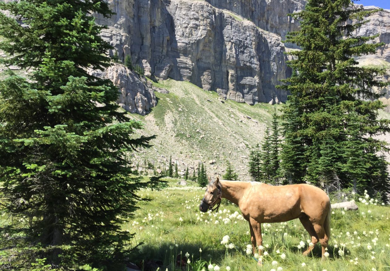
Out on top, White Mountains
We passed through some beautiful country, with which we were already familiar. Dad and I love that area, up in the tops of the White Mountains. The Wallow Fire of 2011 blackened much of the area, but not all. We passed through some burned areas, but for the most part it was green and nice. We passed a very pleasant day. As we passed the Black River, we filled our canteens and watered the horses. We gave them a break to graze on the grass, which was abundant here.
We did, in fact, make very good time on the dirt roads and we were coming down Water Canyon, above Eagar in the late afternoon. As we came into town on the south side, about a quarter mile from where our trailer had been dropped off for us, Black started limping. By the time we got to the edge of town he was limping badly, so Dad dismounted and waited with the horses while I went on to the trailer and came back for him.
Wouldn’t you know, that by the time I got back to pick up Dad, he had lost Honey the mule. Honey, recognizing the area, since she had been kept for a while near where we were, and seeing her buddy, Jimbo riding away from her, she pulled away and ran off, still packed with our gear. It took us a while to finally locate her. A local fellow found her wandering around and corralled her. With Honey in the back of the trailer with the horses, we drove the four miles or so to the pasture and home.
I have to admit that the end of the trip was somewhat anticlimactic, but we were glad to be home. We made 22.4 miles that day, arriving at Eagar at 6:30pm.
Our total travel mileage was 355.2 miles from the US/Mexico border to Eagar, Arizona, in 28 total days, 21 travel days.
Black was back to normal after a few days of rest, as were the rest of the horses. Only Jimbo and Honey arrived at the destination without a single mark on them. The others all had their bumps, bruises, and scrapes. After all the headaches and problems he gave us during the first few days of the trip, Jimbo turned out to be the most solid, capable, and reliable horse of the bunch. We were lucky to have him along. Daisy’s saddle sores have since healed up, leaving only the white telltale marks, but her disposition hasn’t changed any. I still want to spit on the ground every time I think about her. Lizzy is still my favorite trail horse, but she won’t be coming this year, due to her propensity for rub sores. We’re keeping her at Eagar as a backup, just in case. Dad’s Little Black will be with us this year. He and Dad are a package deal.
On the Trail
There was one day on the ride last year, during which I had thoughts of regret at dragging my dad out into this difficult and somewhat dangerous endeavor. Thoughts that it was my selfish desire to drag him along and I shouldn’t have done it. I thought, “What in the world am I doing out here with my 81 year-old dad?”
Two months ago, Dad and I were out for a ride south of Moab, Utah, tuning up for this year’s ride. As we walked along side-by-side on the horses, I mentioned those thoughts and feelings to him, expressing to him that I was having doubts about our plans for this year’s ride from Eagar to Panguitch. Last year’s ride was 355 miles in 28 days. My figuring has this year’s ride estimated at about 620 miles and 42 days on the trail (not counting rest days). Dad looked at me with a wry grin and told me not to worry. He hadn’t had even one minute’s regret during that ride last year. The thought hadn’t even entered his mind.
That was all the confirmation I needed.
So, Dad’s 82nd Birthday is Monday, May 23, 2016. We will be mounting up on Tuesday to head for his hometown, Panguitch, Utah, planning to ride into town just in time to ride in their Pioneer’s Day Parade on July 23. His high school class will be holding their 64th class reunion that week as well. A fine homecoming for Dad.
This post will cover Days 20-23 of our pack trip last year.
Day 19 left us camped out on a hilltop overlooking the Phelps-Dodge mine at Morenci, Arizona, just north of the northeast end of the Gila Box Conservation Area. We were only about a mile or so west of US 191, just south of Clifton. Our route this day would take us east for several miles, then northward toward the southern part of the Blue Range Primitive area. This day would see the last of the harsh terrain and conditions of the low Arizona desert and start putting us into the higher, greener elevations.
On Day 20, April 30, 2015, we arose early, as always, fed the horses, rolled up our beds, had breakfast, and hit the trail again. We hit US 191 before 10:00am. Our first challenge of the day. The State of Arizona, or maybe the Bureau of Land Management, made this very nice gate there at the cattle guard at the approach to the crossing. Problem was, the gate would not open. The bottom foot or so was buried in sand. Took me about a half hour to dig it out, so we could open it far enough to get the horses through.
Lunchtime and a rest
After that, we crossed the highway and rode the shoulder for about a quarter mile north to join Table Top Road, which took us north, then turned southeast for several miles to a small township, of which I cannot recall the name. It was more like a housing development than a town. As we entered the town, we found a small grassy spot near a diversion dam, where we let the horses graze for an hour while we had lunch and rested in the shade of a tree. It was a good stop for us, because little did we know what was waiting for us.
After passing through another small township, on Ward Canyon Road, we turned northeast on Skyline View Road, then took a right on Rattlesnake Road. Rattlesnake Road was a dirt road that headed northeast toward the mountains. The terrain we had been passing through up to this point was regular old Arizona desert. Very little vegetation, other than greasewood and the occasional mesquite tree. The rocky ground was not quite as bad as what he passed through the previous two days, but it was still rough. It was nice to have a dirt road going in the direction we needed. After several more miles we came to the end of the road. Well, at least the maintained road. We found ourselves coming to a USFS road that obviously hadn’t been maintained in a while. We could see it stretching before us, climbing straight up a narrow, very steep canyon. Rattlesnake Canyon.
From the top of Rattlesnake Canyon
Luckily, there was a good waterhole at the foot of the road, where we watered the horses. We were joined there by a herd of horses. I doubt they were mustangs, but they were pretty wild. The road was extremely rocky, but at least it wasn’t all volcanic rock. The canyon was scenic, but the climb was so steep we didn’t get to look around a lot. I recorded a short clip or two on my iphone, but the battery started to go, so about half way up the canyon I got my GoPro out and tried to get a couple more clips.
We climbed 1200 feet in under a mile. We had to stop a number of times to rest the horses. By the time we crested the saddle at the top of the canyon, we were resting the horses every 100 yards or so. We got a good laugh as we came to the last hairpin turn before the crest. There was a “dangerous curve” sign just after the turn, on the high side. Yep. Big as life, a real live Arizona road sign. I can tell you that even a rock climbing Jeep, or a 4-wheeler, for that matter, would think twice before tackling that road! Lucky for us, our horse feed was running low, so our horses were packed lightly.
This day I rode Ranger and Dad rode Jimbo. Daisy was again developing saddle sores on her withers and Lizzy had a sore back. Lizzy had started developing a lump on her back, about where my saddle cantle rode, on Wednesday. I suspected there were two factors involved: my having to carry Clancy in the saddle for much of the day on Wednesday and the fact that she had started to drop a little weight, which made her already prominent spine (Fox Trotters are built that way) even more prominent, which caused the saddle to put pressure there. I had given her a helping of bute with her morning feeding and she was packed very lightly. The pack saddle allowed her to move with no pressure on her sore spot. I hoped that would help.
Clancy was making work of things. His paws were very sore and his strength wasn’t recovering with a night’s rest as he had early in the trip. He was simply wearing down. On this day I carried him most of the day on my saddle on Ranger.
The pond at the top of Rattlesnake
We took a short break at the top, looked around, rested the horses, then headed on down the road. The descent on the other side was not steep, but quite gradual. It was also treed with oak, juniper, and cedar. There was grass and other vegetation. It was a completely different world that the other side of the hill. After a short distance we came to a small pond with an old line cabin. We watered the horses there, but didn’t stop long. We had to make several more miles before we could stop for camp.
I don’t know whose ranch land we were passing through (I’m sure it was BLM range), but I can tell you they had some good cowboys. This land was very well maintained, with well-maintained stock ponds every mile or so. We saw evidence at every turn of hard work having been put into keeping up that range over many years. What a beautiful ranch it was.
Just before sunset we came upon a stock pond with a very nice corral. There were nice trees and a perfect level spot for camp. Problem was that there was this huge black angus bull occupying the campsite. Eventually we were able to crowd him off our selected spot, but he stayed close by all night. Seemed like he liked the company. We watered the horses, then released them into the corral. They enjoyed the freedom of not being tied and all had a good roll. We enjoyed our camp that evening, although we were beat, having made 16.4 miles.
After a short night, we were up again at sunrise. We were packed and moving by 9:00 am. Our goal for the day was to pass the Martinez Ranch, on the San Francisco River, about a couple miles from the confluence with the Blue River, start up the Blue, then camp at a stock tank on Pat Mesa. After that, we would head north on the Blue, entering the Blue Wilderness Area. We had a stopover planned at a friend’s place at Blue, Arizona, which we believed we would reach by Sunday. Turned out that was very optimistic. We hoped to be able to have someone meet us there to take Clancy back to Eagar with them. He was having a hard time of it.
We enjoyed Day 21. As I said, we passed through some very nice ranch land. We passed through rolling hills for most of the day, and the weather was pleasant. We passed the Martinez Ranch just before lunchtime. It didn’t look like there was anybody around, so we kept going. We rode down to the San Francisco River, watered the horses, then let them graze for an hour. We had our lunch there and refilled our canteens. That was about the 250-mile mark on our journey.
From there we followed the river west for about two miles, to the confluence of the Blue River. These were tough miles, during which we crossed the river six times. One crossing was deep enough to come up over my boot tops, but not deep enough to flood our pack paniers. The trail along the river had not been maintained, so it was difficult to follow, however we were again blessed. A four-wheeler had passed through not many days before us (judging by the tracks) and the rider had marked the trail with ribbons. Without that, we would have had a very difficult time finding our way those two miles.
At the confluence of the Blue, we turned north to follow it. The Blue River bed was much wider and more spread-out than the San Francisco. It was quite beautiful and was much easier traveling. We followed the river for a quarter mile or so, but saw that it was coming from a very narrow canyon. The map showed that if we entered that canyon we’d be stuck in it for several miles before it spread out. Not knowing what we might find in there and being concerned about quick sand and the thick willows growing along the banks, and just having bushwhacked along the San Francisco for two miles, we elected to seek a route up out of the canyon and to keep to the mesa until we reached Juan Miller Road the next day.
Our 1967 USGS map showed a trail that ascended up out of the canyon where we were, but our current topo map did not show it. We searched around a bit, expecting that the trail was not maintained anymore. We finally came upon it and found the USFS or BLM had plowed it up and put up berms to keep it from being used. Lucky for us they did, or we would never have been able to follow the trail! Had they just left it alone, it would have grown over and disappeared, but their efforts to close the trail by placing a berm in it every twenty yards or so, guided us up the steep trail until we reached the top at Pat Mesa. By this time, Dad and I were bushed, as were the horses. The last three or four miles had been tough ones. We began looking for a camp, still about three or four miles short of our goal.
We saw a stock tank on the map, which gave us hope, but when we reached it, it was dry. We continued on, thinking we would be making a dry camp. We finally came upon a suitable place, with a small clearing among cedar and juniper trees, but as we were about to dismount, I noticed across a canyon that a two-track road turned up into the mouth of a canyon. At the mouth of the canyon I could see some sort of structure. I told Dad I thought it might indicate a water source, as I could think of no other reason for a road and a structure out in this area. It was only about two more miles to round the head of the canyon and cross over, so we continued.
Lucky we did, because we came upon an improved and running spring, with a cowboy camp and a corral. Apparently it was a working camp, but every body had headed to town for the weekend (it was Friday evening). We imposed ourselves on their hospitality and set up camp, tossing our sleeping bags in their tent. It was nice and we slept well. We left them a “thank you” note and let them know we left the camp like we found it. Ruth Brockman, of the Turkey Creek Ranch, sent me an email later, saying she had received my note and were glad we had made ourselves comfortable. She invited us back for a visit whenever we get back down that way. I’d like to do that sometime. We made 16 miles that Day.
Saturday, May 2, Day 22, was more of the same, traveling across Pat Mesa, following a “cat track” that was used as a ranch road. Again, we saw much evidence of hard work being put it to maintain the range and keep it in good condition, which it was. The road was fairly easy until we got a couple miles short of Juan Miller Road, at which point it became very hilly and rocky. It became a lot of work on the horses. That’s one problem with following a “cat track”. They are named that, because they are bulldozed out of the mountains. Bulldozers are nicknamed Cats, after the company Caterpillar. Cats don’t necessarily take the easy route and don’t make many switchbacks. When they do, you know it’s a steep hillside.
We had just descended down into Pigeon Creek and were looking at two options: we could turn east about a quarter mile and strike the Blue River, following it upstream for less than two miles to Juan Miller Road, or we could stick with the cat track for another 4 miles to get there. We were still leery of following the river, so we decided to go with the known-quantity and continue on the cat track. We climbed the very steep ascent out of Pigeon Creek and were just cresting out when we came upon a hiker. We stopped and talked to him for a few minutes. It took me about two minutes to recognize him as a man with whom I had communicated online about two years before regarding possible routes for us through these mountains. What are the chances?
Brett Tucker is a long-distance hiker, who knows southeastern Arizona like the back of his hand. He has the website “Grand Enchantment Trail“, which documents a long-distance trail he designed through several mountain ranges in southeastern Arizona. He just happened to be out scouting a new route for a trail. Much of the route I selected for our trip was based on his advice. Once I realized who he was (he recognized me at about the same time) we asked his advice for our route to Juan Miller Road. He suggested that we turn around and head down Pigeon Creek to the Blue and follow it. He assured us it was a safe, easy, and scenic passage for horses. We followed along with him until we reached the Blue, at which point we said our goodbyes and he turned south while we went north.
Incidentally, after we finished the trip, Brett sent me an email. He said he returned to Juan Miller road via the cat track. When he reached the road he found the gate locked. Our passage would have been blocked. What a disappointment that would have been for us. Another of those simple little “tender mercies” of the Lord to help us along on our trip.
And thus began the most pleasant part of our trip, traveling up the Blue River to Blue, then up Red Hills Road and over the top to Eagar.
We headed up the Blue then, crossing back and forth across the crystal clear water about ankle deep most of the time. Cottonwood trees grow along the banks and willows are thick in many places, but we were always able to find a decent way through. In some places the cliff walls became very tall, imposing, and beautiful. There were places where the river passed through narrow cracks in the cliff walls, and we passed through in the river. Travel wasn’t easy, but it was pleasant. We made the short couple miles to Juan Miller Road, then headed west until we found a two-track designated 4-wheel-drive road that headed north. That road took us to the historic Fritz Ranch, now a USFS property. We took Blue Trail #101, which heads there at Fritz Ranch. The trail follows the Blue River all the way to Blue Road, and that was our plan. We planned to make camp about 6 miles or so up the trail at the HU-Bar Ranch, which is an old abandoned ranch house, used by many passers-by as a camp stop.
This day I was riding Daisy. I had both Ranger and Lizzy under pack. Turned out that Ranger showed a sore back the night before. Had to be from carrying Clancy in the saddle. Not only that, but holding Clancy in my lap caused me to sit back farther in the saddle and caused me some back strain. I was developing a very painful knot in my upper back.
The days on the trail, through very difficult country, had taken its toll on us. Dad and I had found ourselves becoming increasingly short-tempered with ourselves, with each other, and with our horses. We were tired, the horses were tired, Clancy was tired…we were just beat. It was Saturday afternoon and we were looking forward to a much-needed Sunday rest.
No more than about 1/2 mile up Blue Trail #101, one of the horses started acting up a little and I was getting angry at him. My anger was spreading through the whole bunch of us pretty quickly. Suddenly, I looked around us and saw that we were in a pretty decent place for a camp. I turned to Dad and said, “We’re camping right here tonight!” We were about five or six miles short of our goal for the day, but we were done. We made camp right there. We made 17.2 miles that day, 273 total miles on the trip.
We didn’t spend a lot of time with things that afternoon. We simply cared for the horses and staked them out on the plentiful grass, then went to work setting up our camp. We had a couple hours before sunset, so we just rested and relaxed while the horses grazed. Turned out this was a good decision and we were camped in a pleasant spot.
On Sunday morning we stayed in bed a little longer than usual. The weather was pleasant, the morning cool, and we were comfortable. After we arose, we fed the horses a bit and moved them to new areas to graze. We found that Black was a bit lame. Both his rear fetlocks were quite swollen. We gave him some bute with the feed and hoped that rest and some prayers would have him ready to go again the following day.
Lizzy and Ranger seemed to be doing better. Their backs were much better. Daisy’s saddle sores were getting worse, though. Nothing we could do about it. We had taken it as easy on Daisy as we could, to the detriment of the other horses. All we could do was to keep salve on them to keep them soft and lubricated. Clancy was doing a little better, after having been hauled in my saddle for much of the previous day. Dad and I were losing weight quite rapidly. The miles were showing on all of us, except Jimbo the mustang and Honey the mule. They seemed impervious to all the travel and work. They looked just about like they did when we started the trip 23 days before. Not a mark on them.
We had learned by now that our herd of horses…and one silly mule…would follow Ranger about wherever he went, but that Lizzy was the Queen Bee of the herd. Ranger would generally stay where she was and the rest would hang around Ranger. We had also learned that Lizzy tended not to stay in one place very long. She would graze for a couple minutes in one place, then walk off 20-30 feet and start again, which kept our whole herd moving constantly. We found that if we staked Lizzy the rest of the horses would settle down and graze lazily in the same general area. So, that’s what we did for Sunday. I tied Lizzy and moved her to a new spot every couple hours and the rest of the herd stayed around in the general area, calm and relaxed.
I went down to the river to wash clothes and take a bath. It was…refreshing, to say the least! While I was down at the river, I suddenly heard a whinney from way down the canyon, maybe a quarter mile, then an answer from Lizzy, tied there at the edge of camp. Suddenly there was the drum of hooves at full gallop rushing toward camp. I got to where I could see, just in time to watch our entire herd run full speed through camp! Luckily, they stayed mostly to the trail and didn’t actually run over our camp. They stopped immediately after passing through camp, turned around and came back to see Lizzy. Then they all settled down to grazing calmly again.
Dad and I passed a particularly lazy and restful day. The horses and Clancy did the same. We were all healing and resting our tired bodies and minds. The horses seemed to particularly enjoy the day off. A fresh bath put me in a very restful and relaxed mood. We all felt pretty good. It was a good day.
That night, Dad and I were sound asleep, sleeping very well indeed, when I was awakened by a whinney way off in the distance, then an answer from Lizzy, tied right there at the edge of camp…OH NO!!!!!
Stay tuned for the last five days of our wonderful horse packing adventure in my next post.
P.S.
I have discovered a work-around to fix my upside-down photos on the posts. Eventually I’ll go back and repair the older posts. Thanks for your patience.
On Day 9, Sunday April 19, Dad and I had spent the day in camp at the mouth of Whitetail Canyon. Feeling refreshed, both in body and spirit, and the horses and Clancy being well rested from a day of rest, we were ready for the trip across the desert to Safford, Arizona. Joshua Jensen and Al Smith, our capable guides through the Chiricahuas, had left us with a new supply of 200 pounds of Equidyne pelletized alfalfa for the passage across the desert. The saddle sores that had been starting to show on Daisy’s back were healing up after four days of being ponied bareback. We were in good shape. Our only concern now was being able to find water. We had about 80 miles across some very flat, dry desert country before we reached our next destination, Joshua’s place in Safford.
We had a good morning and it looked like for the first time we would be able to make an early start. Just as we were getting ready to mount, a fellow wanders into camp and we get to chatting. It was interesting conversation. The fellow was a local conservationist and birdwatcher. I neglected to take down his name and have forgotten it. It was he who had made the rock cairns we tried to follow on Saturday. Anyway, we talked too long and didn’t make it out of camp again until about 9:30am.
I was riding Lizzy, and, as usual, she set a pretty good pace for us. We left the mountains and joined Nolan Road and headed north, keeping just off the road to avoid vehicular traffic. Our goal was to reach San Simon, where we would cross under I-10 and find a place to make camp.
Somewhere along the route between Whitetail Canyon and San Simon on Nolan Road, we passed the 100-mile mark of our trip.
About half way to San Simon we found a water hole where we took a break and let the horses graze on some nice grass we found there, while Dad and I ate our lunch. For the entire trip our lunches consisted of a few bites of beef jerky, a Cliff Bar, raisins, and a bit of trail mix. We seldom stopped for lunch, usually eating a little at a time as we rode. As small as our lunches were, it was sufficient and we fared well. We were definitely hungry by the time we made camp in the evenings, though.
Dinner and Supper!
Our breakfasts and suppers consisted of dehydrated meals, made from ingredients mixed and matched from a food storage kit we bought from Walmart for the purpose. We had a variety of vegetable soup, creamed potato soup, corn chowder, and various combinations of those. Breakfasts included dehydrated eggs, the occasional packet of oatmeal, potato shreds, and some bacon bits. We cooked everything over a single coleman burner on a small propane can. Quite frankly, I don’t remember well what we ate most of the time. I’m sorry to say that some of the food wasn’t all that appetizing. Dad and I lost quite a bit of weight on the trip. I think the thing we missed most, in our suppers and breakfasts, was the fact that the dehydrated food kit included absolutely no meat! The imitation meat was also imitation tasty.
By nightfall, after 22.6 miles on the day, we made San Simon. We stopped by a ranch house, and finding nobody home, we helped ourselves to a spigot to water our horses and fill our canteens. We met a good friend of the rancher the following day, who happened to stop by for some friendly conversation, so we passed on our thanks for the use of the water spigot.
Finding no good place for a camp, we pulled off into a thicket that offered some concealment from the locals and made a dry camp. It was dusty, dirty, and full of thorny brush. We hit the hay early and departed early as well. Josh and Al stopped by in the morning on their way through town and helped us get loaded up and started. We then went back to the ranch where we watered the evening before and watered our stock. On our way back into town we ran into the fellow I mentioned above, Ron Mahan, who was able to give us some good directions for getting us into a wash, the San Pedro River, and under I-10 without having to concern ourselves with road traffic.
A nice pond in the desert
On this day we headed up the San Pedro River bed (otherwise known as a dry wash), which ran generally in our direction. We stuck to that for several miles, but knew we needed to find water for the horses. We struck a road heading east-west that Mr. Mahan had told us about. We followed it west about a mile and found two or three houses and a very nice pond. The pond had bass and panfish in good numbers. I suspect the locals had stocked the pond for their own fishing and eating pleasure. Strangely enough, our horses weren’t very thirsty. We left there and got back into our wash and continued northward.
As we were passing through a part of the wash that was thick with brush, I heard a muffled grunting and looked around to see what it was, knowing the area was prime for Javelina. I spotted a little pig no larger than a small puppy rooting and playing in the grass. We tried to get a picture of it, but the darn thing was so well camouflaged that when we saw the pictures we couldn’t find the little Javelina in it! The mother was nearby, so we let them be. An angry javelina is nothing to mess with. We moved on.
Shortly thereafter the wash became rather problematic to follow. It became deep, to where we could no locate ourselves with regard to the mountains and we could not see to find the next waterhole we were aiming for. It was also so choked with mesquite that it was tough, and painful, to get through in places. We climbed up out of the wash and began to head overland on higher ground. Once on top, we spotted in the distance what looked like a cottonwood tree, which often indicates a well or water hole, so we headed that way. It was, in fact, a cattle watering tank, but it hadn’t been maintained in a few years. It was choked with algae and moss. The horses drank from it, but not deeply. They didn’t like it.
Camp at Butte Well
By nightfall, we had again traveled about 18 miles. We camped that night at Butte Well, located just about a half-mile east of Orange Butte. There was a decent water trough for the horses, but nothing for us. Again, the water was full of green algae. At this camp we had to watch for cactus, because there was a low-growing species of prickly pear that you really had to watch out for. This area was very dry, with few trees even tall enough to tie the horses to. Again, not a very hospitable camp. This day, Clancy’s feet got pretty sore and I ended up with him on my saddle for several miles. The mileage we were making was getting to him. I ended up with him on my saddle quite a bit over the following few days. That night I checked his paws and found a mesquite thorn about 3/8″ long stuck all the way up in one pad.
The following morning I attempted to filter some of the water from the trough, with my Katadyn gravity-feed water filter, to fill our canteens. Lesson learned: Don’t try to filter filthy water! The algae plugged my filter before I had gotten a quart of drinkable water. That was a problem, since we didn’t have a spare filter. That meant we had no means of replenishing our drinking water until we reached Safford, another 40 or so miles farther along the trail. Well, we could have boiled water in a pinch, but that takes propane and time.
No, he’s not dead.
We got back on the trail the following morning and followed a two-track ranch road westward. About five miles farther along we came to a solar-powered well with running water. We were able to fill our canteens, but the water tasted salty. The horses were fine with it, though. We ended up doing a lot of cross-country bushwhacking that day. It was a long one. Around lunch time we located another waterhole that was apparently privately owned. There were a few improvements around it, such as a pathway and a small picnic area. We watered there then went a mile or so farther on, where we found some good grass. We let the horses graze for about an hour, while Dad and I ate lunch and rested.
We crossed the San Simon Fan area that day, which is a stretch where the government build low spreader dams to spread out the rain runoff to control erosion and spread the water over a wider area to benefit the local ecology. What it did, however, was to spread very fine silt over a very large area. Here’s a video that shows the area. It took us several hours to cross it. Here’s a video.
We made camp at Bailey Well that night, after having made a total of 21.2 miles. We had hoped to make Tanque, but would have arrived long after dark and we were completely bushed. We were tired!
Bailey Well was another solar-powered well, but we arrived after the sun was setting behind Mount Graham, so we obtained no water for our canteens. Horses were watered well, though. We ran out of drinking water the following morning, having just enough to make a breakfast.
The next day, Day 14, Friday , April 24, we headed north on a dirt road. Safford was about 20 miles away, so we hoped to make it all the way. We made Tanque around noon. We were lucky enough to find it a running well, so we were able to fill our canteens. The water tasted a bit better than the water we got from the previous well.
We followed dirt roads the rest of the way to Josh’s place, which was lucky for us, because it got us through the numerous cholla forests in the area. The cholla was flowering, so it was quite beautiful, but cholla is a true hazard for one traveling by horse. It is also commonly called “jumping cactus” because it grows in clumps, little balls of spines, that break off and stick when one brushes up against them. The plants propagate in this way, so the cactus grows in patches, or forests, as the case may be. We passed by several “cholla forests”.
Josh’s place
We made Josh’s place late that afternoon, after a day of 20.8 miles. It was good to release the horses into a corral and feed them hay. Josh and his family were not home for the weekend, but left us the use of the house. He also left us the use of his pickup, so we headed into town immediately after tending the horses, to look for a water filter for my Katadyne filter. No such luck, so I contacted Outfitter’s Supply in Columbia Falls, Montana, from whom I purchased the filter, and they overnight expressed two filters to me.
That evening, Josh’s neighbors, the Bodines, brought us a home-cooked meal of wild turkey. Their 14 year-old boy, Evan, had killed the turkey during the spring hunt. Jessica Bodine cooked it up with dumplings. It was heavenly!
The best part of the evening, though, were the showers at the end of the day! In order to not abuse the hospitality shown by Josh and his wife, Dad and I made our beds in the garage. We really didn’t want to get their house filthy. We availed ourselves, however, of their washer and dryer. It was wonderful to feel clean and have clean clothing again.
Dad on our mustang, Jimbo
On Saturday morning, the Bodines brought us a very tasty breakfast, Al came to put shoes on our mule, Honey. After he arrived, we headed for town to buy shoes and some other supplies. While we were driving around town, Al took us for a drive to sort of scout out a route past Safford. We located a power line that offered a decent route. While we were scouting, another of those little helps from heaven happened. We met Clay Gomez, who owns a ranch through which that power line runs. He owns the only gate in the fence for many miles. He was very cordial and gave us permission to pass through his gate. When we arrived there later that evening, he had left the gate unlocked for us.
Me on Ranger, with our string
By the time we arrived in Safford, we had traveled about 170 miles. Our mule, Honey, had been barefoot all that way. She started getting tender on Wednesday, so we had Al put shoes on her. We also re-stocked with the last of the Equidyne feed we had stashed with Josh before we started the trip. Our Katadyne filters arrived via UPS by 9:30am. Amazing! We got ourselves packed up and hit the road about 11:30am. We followed the power line route, as planned, and made good time. We passed through several fences, but none was locked. We ended up making it about 19.8 miles that afternoon and made camp on the Gila River, just north of a small town named San Jose.
The following day was Sunday, our rest day. We had a nice camp, with water, grass, a place to tie our horses, and a nice spot for our bedding. It was a good day to pass the Sabbath. We needed it, as the mileage we made over the past few days was starting to show on the horses. They needed a rest. So did Clancy. So did we.
Stay tuned for days 16 and 17 later this week, and some trail stories you are sure to enjoy.
Sorry it’s been a while since I made my last post about the trip from the US/Mexico border to Eagar, Az, leg 1 of the Mexico-to-Canada trip. This post is about days 7-9 of the pack trip, which took place in the Chiricahua Mountains, mostly just outside the Chiricahua National Monument. Joshua Jensen and Al Smith and their mules were our guides.
When we left off on Day 6, we had made camp on the east side of the top of Fly Peak, it was very cold, and our drinking water froze by the time we hit the sack.
On Friday morning, day 7 of our pack trip, April 17, we got up and went through the usual routine of feeding and brushing horses, breakfast, packing up, loading up, then getting started. Dad and I had taken our horses over to the spring earlier for a good drink before saddling up. While we were there at the spring with our six animals, a couple horses got tangled up and Dad got a good knock from a horse’s head. No harm done. I led my horses out of the way while Dad watered his, then we both led them all the quarter-mile back to camp.
After mounting up, we all started off up the trail. We hadn’t gone but a hundred yards or so, when Dad suddenly realized he didn’t have his glasses on. After going over everything we had done that morning in our minds, we arrived at the conclusion that Dad had lost his glasses on the trail back at the spring, when he got knocked by the fussing horses. I held all the horses while Dad headed down the trail to the spring to see if he could find them. A few silent prayers and about 20 minutes later and Dad was back with his glasses. He had found them on the trail, right where all of our five horses and a mule had passed after drinking at the spring. It was nothing short of miraculous that none of the animals had stepped on them.
Hand’s Pass
So, that was a good start for the day. We needed one, because the next couple of miles were pretty tough. We had to cut our way through deadfall after deadfall and make our way around those we couldn’t cut out. After that it got easier. The trail was better and we made good time. At Rustler Park we joined USFS 42D and followed it several miles. Along that road we sort of let the horses have their head. I was riding Lizzy for the day and she loves to walk out. My GPS said we traveled along at up to 6 miles per hour for a while. Not bad for our little pack string. We turned east on Pinery Road and followed it to the North Fork of the Pinery River.
As we wound our way down Pinery Road, suddenly Dad and I heard a clatter of hooves behind us. We moved to the side just in time to have Al on his mule pass us at a full gallop! As he passed, Al yelled for us not to worry and to just keep on like we were. We wondered what had gotten into him, but just passed it off as a matter of Al’s way of training his mule. About two miles farther on we caught up with Al and learned the truth. The chinstrap on his bridle had broken and he had no control of the mule at all, so he just hung on until the mule decided he’d had enough fun for the day. After that, all was well. Like I’ve said before, one never knew who was in charge at any one time with that pair. Theirs was sort of a cooperative partnership; sometimes one was in charge, sometimes the other. It was a lot of fun to watch them work.
Hand’s Pass
At North Fork, we turned north and followed a two-track to Hand’s Pass. The last couple miles up to the pass were steep. It was a tough climb for the horses. Once over the pass we descended into Bloomberg Canyon and followed it down past the mouth to Whitetail Canyon. We camped alongside Indian Creek there in the canyon bottom.
For the day we made 17 miles, which was excellent, considering the first couple miles that day of cutting through the deadfalls. I didn’t get many pictures that day, because all my batteries were exhausted. We had been in thick brush and trees for two days and I hadn’t been able to get enough sunshine to charge anything. My GPS was still at about 50%, so it was ok, but about everything else was dead. During the latter part of the day I was able to tie a solar panel to the back of my saddle and got a 31% charge in my iphone.
Solar panel tied behind the saddle
On Saturday, day 8, after our obligatory morning oblations, we headed into the mouth of Whitetail Canyon (I think). We started up a trail that hadn’t been maintained in many years, but the trail was marked with rock cairns along the way. Josh had ridden up part of the trail during one of his scouting forays before the pack trip and believed we could make it through the canyon to hit another trail that would take us farther north and exit the mountains at the far north end of the Chiricahuas. As it turned out, we made it up the canyon about 2.5 miles before we just couldn’t go any further. The trail had long before petered out and the canyon narrowed to a mere slit in the rock that was simply too dangerous for us to attempt. We had to backtrack and ended up making camp about a half mile or so farther east down Whitetail Canyon than our camp the night before.
I will say this about the day’s experience: We learned a lot about our little string. Bushwhacking our way up that canyon bottom was some of the toughest trail I have ever been on and our horses handled it very well. I was riding Ranger for the day, and found him to be extremely sure-footed and willing. At one point we had Dad and Josh stay with the pack string, while Al and I went on ahead to scout the trail, to see whether the rest could make it. Al’s mule, I’m pretty sure, is part mountain goat, and he would go through places with ease that I would normally have tried to go around. However, Ranger followed right behind the mule, doing everything the mule did. In fact, there were places Al went around that Ranger went right on through. I was quite impressed and proud of Ranger.
Dad and I set up camp for the evening there in the mouth of Whitetail Canyon, not more than a mile from several houses and what would be our exit from the Chiricahuas. Josh and Al moved on down the canyon and were able to get a ride back to their truck and trailer, parked where we met in Rucker Canyon.
Camp at Whitetail Canyon
Dad and I enjoyed a nice evening, though we were pretty tired and a bit frustrated at having traveled more than seven miles that day and only making about two miles of actual progress.
The next day was Sunday, so we spent our rest day there in camp in Whitetail Canyon. There was a dry stream bed nearby that had a few small ponds of water in it. We washed laundry in one and I bathed in another. It certainly was refreshing. We had a day of full sun, so I set out my solar panels and was able to get full charges in all our batteries. I took a look at our maps and the topo on my iphone (DeLorme map app) and took a good look at the trail we tried the day before. From what I could tell, we had made it to within 1,000 feet of the trail we were trying to reach. So close and yet so far, as they say. At the trailhead we followed, we had passed a sign that read, “Horse Trail 1 mile.” We must have missed the that trail, if it even exists anymore, because we went in and out of that canyon and never found it.
Washing in a puddle
That afternoon, Josh and Al showed up and brought the gear we had left in their trailer back at Rucker Canyon, including the pack saddle for Daisy (you might recall we had been ponying Daisy bareback the past several days to allow a saddle sore to heal up). They also brought another four sacks of Equidyne for the horses. That was to last us for the next several days until we reached Safford. They left us then and headed back to civilization and their jobs. We sure enjoyed the time we traveled with them and and appreciated their guidance through the mountains. We never would have made it without their help.
Cochise Peak
So, my next post will cover days 10-14, Monday April 20 through Friday April 24 as we crossed the desert from the Chiricahuas to Safford, AZ.
Over the past several months, a number of friends and followers of my blog have asked how they might contribute to helping Dad and me get underway on the second leg of our Mexico-to-Canada horse pack trip. I have always been pretty much a “do-it-yourself” kind of guy, having been raised by a father who was that way, so asking for assistance is sometimes difficult. However, we have been the grateful recipients of help in many ways, including support on the trail, guides, farriers, transportation, gear, stopover points, and also a bit of financial help.
Over the years, I have enjoyed the good feelings I get when I have had opportunity to share in another’s success by helping in any way I can. Sometimes the only way I can help is by a small financial contribution. While time is always more valuable than money, good causes are always worthy of help and sometimes there is no other way for me to contribute positively than to donate financially. Well, maybe it’s our turn to be on the receiving end.
This adventure of ours has been far more expensive than I had anticipated. I have had to draw from family savings because the expenses have exceeded the income I have been able to bring in from my current post-retirement work. I purchased almost all our gear last year, including a well-used 4-horse trailer. Our total expenses for last year’s trip exceeded $23,000.
This year I purchased about $1,500 worth of gear as well as a new horse for the trip, as I had to replace my Fox Trotter mare, who is game, but proved not to be the right horse for the trip. Many of the expenses for this year’s trip have been unanticipated. Last month, on the return from our tune-up trip to Moab, Utah, I blew the engine in my truck. The rebuild and other repairs associated with getting the truck ready for this year’s trip have run in excess of $10,000 over the past two months. Since I bought the horse trailer I have blown four tires on the rear axle. Two were brand new tires. Last week I took the trailer in to have it checked, to see what might be the cause. The problem was diagnosed as a slightly bent rear axle. Having a new axle installed, along with having the front bearings repacked and the brakes and backing plates replaced, ran me $2170. The trailer is still at the shop with further adjustments being made. Hopefully, this will fix the problem of having to buy a new set of trailer tires every other trip. Last week I replaced four tires on my truck. There went another $1,000.
My plan for the year was to be able to cover all our expenses for gear, vehicle, fuel, etc, and have $5,000 in my trip account before I started. All the above unanticipated expenses have shot that plan all to heck and I’m back into family savings. My good wife, bless her heart, is still supportive of our trip.
Recently we received good news that much of our horse feed would be donated by an anonymous donor. Friends and family are donating time. Still to come are expenses for fuel for the trip, including fuel for our support help, horse feed, people feed, and other expenses we will incur once we actually start making tracks.
For those of you who have been following the blog and enjoying our father and son adventure through my writing and who have been asking how you may help, I have created a “Donate” button on the website. It connects to my PayPal account. You will find a “Donate” menu item on the main menu. It will take you to the page with the PayPal Donate button. For those who wish it, I will keep the donations confidential. For those who don’t mind, I will create a list of contributors to post on the website after the ride this year is done.


You must be logged in to post a comment.