I recently created a new website for a sports fan group I have belonged to for more than ten years. We are die-hard fans of everything related to Brigham Young University sports, especially football. We had been using a forum service, YUKU, for a lot of years and finally got tired of the poor service and goofy advertisements they slipped into our forum. We had to pay a fee not to see advertisements. Finally we got so fed up with it that we began to talk about looking for a new home for our forum. As we discussed it, I realized that it would be a pretty simple solution for us to buy a domain name and create our own website and forum. So, that’s what we did, using my web hosting account with Bluehost. So, I created byufans.net. It is a closed group, though, so membership is limited to the current members and those individuals who are personally invited by a member. Sorry.
Anyway, what does that have to do with Western Trail Rider? Well, the new website looks so good and works so well and is so easy to manage that I was quite impressed with myself (hehehe). But, when I switch over to my WTR site, well, it started looking a bit drab and old. Now, every time I look at WTR I think I need to update it.
So, I’m going to be looking at new themes and other apps and programs that might sort of dress up the site and make it more user-friendly and easier to manage. Once I decide what to do, I’ll let everybody know that it may be down for a few hours…that is, if everything goes well…or a few days, if I mess up. Now, nobody need suppose that I am a website developer or otherwise expert, or even knowledgeable, about websites and blogs. I just trip along until something looks pretty good and works ok. WordPress has made things pretty simple for guys like me. It is mostly a matter of figuring out what I like, then plug-and-play. Still, I seem to be able to mess things up pretty well, as I try mixing and matching different services on the site. The challenge is going to be ensuring that I don’t lose any of the photos, information, posts, and serviceability of the current site.
Also, I understand how each provider of an app or service can spend thousands of hours developing a simple app for dummies like me to “plug-and-play” and that they certainly deserve to be paid for their efforts. However, when a guy like me starts adding up the various fees and subscriptions and donations, the cost starts to reach a significant level per year, particularly when I am not making a penny on the website.
I created the website shortly after I started planning my big horse pack trip a few years ago. A number of folks suggested that I start a blog, so they could keep up with my planning, gear purchases and reviews, and other developments, as well as documentation of the trip itself. It occurred to me that I might just as well purchase a domain name, start a website of my own, and invite other horse and trail riding folks to blog along with me. The thought was that we, together, might create a website where like-minded people might come to find information about horse trails in the western U.S. and to get first-hand information from people who had actually ridden those trails. I’m not talking about state and national park trails – there are numerous websites for those places. I’m talking about the backtrails and places that are almost unknown except to riders from the local areas. Places folks hear about, but few ever see. I figured that eventually there might be enough bloggers on the site that a little advertising income might be generated, to pay for the website maintenance. That hasn’t developed, so I’m content with simply using the site as a place to document my horse adventures for a few faithful followers to enjoy.
Still, I’d like to make it an attractive and interesting website. So, I’ll be working on updating it over the coming couple of months.
Stay tuned to see what I come up with!
P.S. The invitation is still open for anybody who would like to start their own horse-related blog under the WTR banner or to link an existing blog through WTR. The only requirement is that it be related to horse trails in the western U.S. or some aspect of horse or mule packing. There is no charge and I maintain the site at no expense to you…unless you would like to help out. If you have interest, send me an email at tony.henrie@westerntrailrider.com.
I recently found an old email from Nancy Hood, one of the many people Dad and I encountered on our pack trip last summer, who so generously helped us out time and again with fresh drinking water and good conversation. Nancy had a photograph of Dad and me that she took. She emailed it to me just a couple days ago. Made me think I should post some of the photos from the trip.
I still need to make a post or two to document the last two weeks of the trip for my followers. Time has been at a premium for me lately and I just haven’t been able to get the time and energy together at the same time.
These photos are roughly in order from our departure at Eagar, AZ to the end of our trail at Flagstaff, AZ. Many of these photos were taken on the Arizona Trail.
Enjoy the photos, and much thanks again to all those who so generously contributed to our successful ride.
Mom and Dad before we departed Eagar
At the Corral on my place at Eagar
Me and Ranger getting ready to head out
Packing up at Eagar
Heading out from Eagar, facing about a 50mph headwind.
Camp off of Fish Creek
My last ride on Ranger
In Camp on Gillespie Flat
Heading out at Woods Lake
Traveling on the General Crook Trail
On the General Crook Trail
Ryan and Ashley Berg. Thanks for the water!
Pic by Ashley and Ryan Berg on the Mogollon Rim
On the Mogollon Rim
On the Mogollon Rim
The Lundberg family. Thanks for the water!
Arrival at the Arizona Trail, about 150 miles east of our starting point, Eagar, AZ
I thought I’d write up the first few days of our Eagar to Panguitch trip this year, so our followers would understand what took place to cause our current delay.
Packing up
Last Tuesday, our departure day, we got out to my pasture, where the horses were kept, and started sorting and packing our gear. Of course, it took longer than we hoped to get packed up. Separating our food supplies and gear into separate piles, packing them into paniers, saddling the horses, etc, is a real chore. We eventually just started stuffing things into paniers and figured we’d reorganize stuff in camp the first night. We just wanted to get underway.
We finally got saddled and underway about 12:50pm. Three of my grand nieces rode with us the first several miles.
Heading out through Eagar, AZ
The day was clear, not a cloud in the sky, but we faced a direct headwind blowing at about 40 miles per hour, gusting, I’m pretty sure, to over 60. At over 7,000 feet elevation, any wind is a cool one. Our first 11 miles were across a treeless high plateau, just west of Eagar, with that wind blowing in our faces. It was absolutely miserable! I fixed my eye on a cinder pit in the distance, which marked an uphill grade that would eventually take us into the trees and give us some shelter from the wind, and just kept heading for it, one step at a time.
Facing a headwind across this with no shelter in sight
The going was quite slow, as the horses didn’t like the wind any more than we did and we didn’t push them. We averaged about 2.89 miles per hour for the day, according to my GPS.
Late in the afternoon we reached the trees and worked our way along Route 260 to Forest Road (FR) 1325, which we took northward. We looked around and ended up settling on a campsite just off of FR1325, about a quarter mile from Rt 260. There was plenty of lush grass, a small stream of water for the horses, and a nice, level spot for us. We stopped around 6:30pm and settled-in for the night.
First night’s camp
We picketed the horses on the grass and let them get their fill. We let Reno and Jimbo go free and picketed Ranger and Black, since they were the leaders of the bunch. However, when I poked my head up out of my sleeping bag in the morning, all the horses were gone. While Dad started breakfast, I headed out to look for them.
It didn’t take me long to find them. Apparently the grass was just too good for them to leave it, so they just stopped at a fence at the end of the grassy pasture. Not long after, I had them tied back in camp and we were working on getting loaded up. Seemed like we had plenty of time, so we took it, and ended up heading out around 9:30am.
The plan was to head north on FR1325 about 3/4 mile to a point where the road changes direction. We would head off the road and bushwhack about 3/4 of a mile west to get out on top of the plateau, about 400 feet higher. Right off the bat we found an old logging road that took us precisely in the direction we wanted to go, so we followed it about a half mile before it simply petered-out. By our maps, we could see that we were only a few hundred feet short of the top, where it would open up into high meadows on the plateau. We tried several different routes before giving up. We just could not find a way through the trees that a pack horse could negotiate going up that last sidehill.
We turned around and headed back the way we had come and decided to head back out to Rt 260 and follow it on up to the top. That turned out to be a wise decision for us, as it was an easy climb and the road easement is very wide. At one point we found a tunnel that crossed under the highway for cattle to pass through. It was about 8′ tall and 6′ wide, or so. We took the horses through it and back, thinking it would be good experience for them for when we hit that tunnel at the bottom of the South Kaibab Trail in the Grand Canyon.
Once we made the crest of the hill and started out onto the plateau, we again hit the wind. Just as strong as the day before, but colder. We were now somewhere around 9,500′ elevation. We had to push through the wind again, with no shelter at all, for about another mile, before we found a gate in the fence that allowed us to head back into the trees.
A herd of elk at Fish Creek
We followed a little two-track northward about a half mile and found a valley. The map indicated this was the valley of Fish Creek. As we approached the valley we spied an elk watching us. It eventually headed down over a drop-off into the valley. As we got closer we saw about 10-15 elk reposing and grazing in the valley. It was a beautiful sight.
A spring on Fish Creek
We found our way down a steep decline into the valley, by way of an elk trail, where we located a running spring. We stopped there and let the horses graze a bit while we refilled our drinking water containers. By that time we were tired and Reno was obviously uncomfortable. He was starting to give us trouble, pulling back and having to be dragged along. We decided to find a campsite and call it a day. We located a site just a couple hundred yards away that suited us perfectly: lots of grass, running stream, and a nice, level spot that was somewhat sheltered from the wind.
When we had unloaded all the horses, we found that Reno had a very tender back. He had been carrying a heavy load, over 200 pounds, for two days now, and he was very sore. We decided to make the following day a rest day, despite the fact that we had made only about 20 miles in our first two days, about 3 of which were in the wrong direction.
Finding plenty of firewood at this campsite, we decided to make a campfire for cooking, to conserve our propane. It was pleasant, sitting around the campfire that evening, but we were tired and went to bed directly after eating our supper. We again tied two horses – this time to trees – and let the other two graze freely all night.
Camp on Fish Creek
The following morning we slept-in a bit, since we were not going to be moving that day. We got up at around 6:30am. We still had all our horses there in the pasture. Dad untied Black and let him graze, but, out of an abundance of caution, I kept Ranger tied. I’m glad I did, because while we were busy cooking our breakfast, the other three horses headed for home without us noticing. Ranger started snorting and we looked up and only had one horse.
I saddled Ranger and went after the other horses. I was able to follow their tracks well enough to see that they were heading directly down the valley southeastward, following Fish Creek. I found them about a mile and a half down the valley, where the trees began to choke the valley. When they saw me and Ranger, they walked our direction and were easy to catch up. I took Black’s lead and headed back, assuming Jimbo and Reno would follow. They did…for a few hundred yards, but then began falling behind, grazing along the way. Figuring they would continue to follow and eventually get back to camp, I headed on back.
I arrived back at camp, tied Black and Ranger, and ate breakfast, which Dad had prepared in the meantime. When the other two horses hadn’t appeared by the time I finished, I decided I had better go find them. I figured they’d be right about where I last saw them, grazing in the valley. I mounted Ranger and headed out, but they were nowhere to be found. I headed back to camp and Dad saddled up Black and we headed out together to search for our lost pack horses.
Not far from where I last saw them, I located their tracks heading up a cow trail that led back out on top. We followed until we lost the trail, but it was apparent they were heading back towards Eagar. I eventually caught up with them about a half-mile from our last camp. Again, they were glad to see Ranger and came right to me. I caught up Jimbo’s lead and led them back toward camp, with Reno following. He, in fact, did follow this time.
Having learned our lesson, or so we thought, we then tied three horses and let one graze freely, but being the enterprising individuals we are, we devised a method whereby all the horses could get their fill of grazing. We tied rather large rocks to the leads of Jimbo, Ranger, and Black. We tied the horses by their front left foot with a bowline hitch, such that the rock acted as a stake. When we wanted to move the horse to better graze, we simply moved the rock. We were pretty pleased with ourselves, until the next morning, when I poked my head out of my sleeping bag and found that we were horseless. All four had left the valley.
After looking around, it became apparent that something, elk or maybe a coyote or lion, had spooked them during the night and they had dragged their rocks until they had come off the leads and the horses ran freely with their 35′ foot leads attached.
This time, while Dad made breakfast, I headed out on foot to locate our wayward herd. I was pretty sure I knew where they had gone, so I headed out. I again located their tracks on that same trail as before, heading up onto the plateau and off toward Eagar. This time they didn’t make it quite as far as before, and I might have walked right by them, except that Ranger nickered at me when he saw me. There they were, standing back in the trees, looking like they were waiting for me to find them.
They let me approach and I started catching up leads and tying them to trees, while I untied the foot-ropes. Ranger had a knot and scrape on his nose, but other than that all the horses were unharmed. As far as I knew, none of the horses had ever been ridden bareback. I would have trusted Ranger, but at 16 hands, there was no way I was going to be able to get on his back. So, I led them all back to camp on foot. When I got back, my GPS indicated I had walked about 3 miles, not counting the distance I walked earlier without the GPS. I figure I walked about 5 miles that morning. I was pooped!
So, there it was Friday morning and we had made a total of about 17 miles, and a bit.
Reno’s back was nearly back to normal now, as we had been giving him a helping of bute each morning to ease his pain and reduce the swelling. He was still a little tender, but wasn’t flinching when I brushed his back. We realized that our packs were overloaded, due to the fact that we had brought 100 pounds of Equidyne pelletized alfalfa feed with us to supplement the horses’ feed. We made the decision to dump the feed, since there was plenty of grass available. This brought our loads back down to far better levels and allowed us to redistribute the weight among the two pack horses more evenly. In an effort to take it easy on Reno, we decided to put the heavier load, the hard-sided paniers and top pack, on Jimbo and let Reno carry the soft paniers.
Back on the trail, leaving Fish Creek
We got packed up and were back on the trail by about 1pm, heading west along Fish Creek, toward FR 117.
What a beautiful ride it was. We met FR 117 less than an hour later and headed northward. We joined FR 61 several miles up the road, near the base of Green’s Peak. We followed it about 7 miles west and north toward FR 96, but stopped about 3/4 of a mile short of it, making about 11 miles for the day. We had decided to keep our mileage around ten miles to take it easy on the horses and to avoid soring Reno’s back again.
What a ride!
This day’s ride was the kind of ride Dad and I had dreamed about. We had horses that got along well, so we could ride side-by-side, which we did almost all day. We talked, dreamed, schemed, spoke of the ranches we wished we had, and talked of horses and dogs we had known over the years. I loved hearing Dad’s stories of his youth, growing up in Panguitch, Utah and surrounding areas. As badly as the day started, this day became one of those perfect days for us.
Look closely in the middle and you’ll see the antelope fawn
Several miles up FR 61, we came upon several Pronghorn Antelope. One of them had a fawn that could not have been more than a day old. Dad had seen the fawn, but I hadn’t. Suddenly it jumped up and ran across the road in front of me. I was able to snap a quick photo of it. It was something one does not often see.
We had hoped to reach FR 96 before stopping for the night, but as we passed through Gillespie Flat, we saw a beautiful campsite, several hundred yards off the road, back in some Ponderosa pines, at 8,653′ elevation, with a spring and good grass a short distance away. It was too nice to pass up.
Elk checking us out
As we were unpacking the horses, we heard something snort from back in the trees. We eventually spied a cow elk watching us from about two hundred yards away. None of our horses took note at all, except Jimbo, our mustang. He located that elk the first time it blew and was watching her with piqued interest. The elk would snort at us and Jimbo would snort right back. This went on for several minutes, with the elk working its way closer all the time. Eventually, the elk approached to within about 30 yards of camp, inspecting us and our horses closely, before moving off.
Camp Day four, on Gillespie Flat
We again decided to make a campfire for cooking and it was a good decision, because it got very cold that night, down into the 20s. We let the horses graze freely for the early evening, but made sure we kept a good eye on them. After eating our supper, we tied all four horses, Ranger and Reno by foot-ropes, so they could graze freely on the good grass. It was their turn. After supper, Dad and I sat around the fire and enjoyed the evening. We hit the sack around 9pm.
About 2:00am I was awakened by the sound of pounding hooves. I jumped up out of my sleeping bag, grabbed my flashlight and shined it toward the sound. I saw Ranger tied up against a tree and struggling. I ran to him and found he had wrapped his foot rope, around the tree until he was snubbed against the tree with his right side against the tree and his left front crossed in front of him and twisted around the tree trunk tight against the rope. He was pulling back against it with all his strength. I tried to calm him, but he was in a panic and there was no way for me to help him but to cut the rope. I ran to my bed to grab my knife, and about halfway there I heard a loud “snap”, like a large tree branch breaking, and I knew I was too late. I grabbed my knife and was back at his side within seconds. I slashed the rope with one pass, releasing his leg, but I could see his left front leg was broken, up high near the elbow. It hung awkwardly and useless, as he stood three-legged.
Ranger didn’t struggle, didn’t try to walk. He just stood there looking at me as if I might be able to help him. I held his neck and talked to him as I sobbed, knowing there was nothing I could do; knowing I would have to put him down.
By this time, Dad had made it to us. He held Ranger while I went to my saddle and retrieved my .22 rifle. I loaded it with several rounds of ammunition and carried it back to where Ranger was standing with his head held low. I spoke a few comforting words to him, mostly of comfort to me I suppose, but maybe it helped him too. I rubbed his face, said my goodbyes, then I placed the end of the barrel on his forehead and squeezed the trigger. Ranger went down immediately, shuddered a little, then relaxed. It was all I could do to contain myself.
After putting Ranger down, Dad and I went back and slid into our sleeping bags. We both shed tears as we tried to console ourselves, me for my horse, Dad for me. Surprisingly, I fell back asleep.
About 3:30am I was suddenly wide awake, with the words ringing in my brain, “Go re-tie Reno!” I had forgotten all about him being foot-tied as well. During the incident with Ranger, he had been twenty feet from his tree, grazing calmly. I jumped out of bed immediately, grabbed my flashlight and ran to Reno. I found him with about one more turn around the tree left in the lead rope before he would have been in the same predicament as Ranger. I tied him by his halter rope, then untied the foot-rope and went back to bed, passing the lifeless body of my dear friend, Ranger.
This has been difficult for me to type. The image of Ranger struggling against the rope and the sound of his leg breaking are fresh in my mind. The knowledge that just ten seconds more would have turned that tragic incident into a simple learning experience fills my heart and mind with ”what-ifs”. Knowing that if I had tied him by his halter rope, rather than a foot-rope, fills me with regret and sorrow. I just didn’t know.
The following morning, we contacted some friends, who drove out and helped us load up our horses and gear and return to Eagar.
I left Ranger there at our camp, feeling like there was no better resting place than right where he lay. I, myself, have often thought I would prefer meeting my end leaning up against a tree overlooking a beautiful valley high in the mountains, to being buried in a cemetery. His body will eventually return to the earth, providing nourishment for plants and animals alike. I like that thought. Nothing wasted.
I clipped a few locks from Ranger’s beautiful tail. I plan to make a hat band from them, which I will keep in his memory, so that part of him is always with me as I ride my trails.
I hope I am not judged too harshly for what happened to Ranger. He had been foot-tied many, many times in the past and never worried me in the least. I never considered that such a thing could happen. I had no idea. I have learned. It was a hard lesson, one that will not be forgotten.
See you on the other side, Ranger. I miss you already.
After making several drives and looking over our proposed route, as well as a lot of Internet research, here is what we know so far about our route and time frames for travel.
First of all, there are a couple of dates that are hard and cannot be changed. I have Backcountry Camping Permits for the Grand Canyon National Park for June 29 and 30, 2016 for four horses and two people. Those are very hard to come by, and I was very lucky to have landed it. Those dates are fixed. The second date is the Pioneer Day Parade at Panguitch, Utah. That will be on July 23, 2016. This will also coincide with the 64th class reunion of Panguitch High School’s Class of 1952, Dad’s graduating class. We cannot miss those dates.
So, with that in mind, here goes.
We originally planned to depart on Dad’s 82nd birthday. We had to postpone that one day, so I could see one of my grandkids…and my daughter of course., who will visit from Texas to see us off. So, we will start making tracks on Tuesday, May 24, 2016, from my pasture at 217 N. Poverty Flat Road, Eagar, AZ, 85925. Anybody who would like to start the ride with us should be there ready to ride by about 10:00am. There is plenty of parking for trucks and trailers.
We will follow Route 260 west until we start up into the mountains, at which time we will take Forest Road 1235 north for a short ways. We will depart that road when it turns northeasterly and head directly west, cross-country. We will then join FR 117, which we will follow until we come to FR 61. We will take that to FR 96, then on to FR187, until we arrive at Sky Hi Road, Pinetop, Arizona, at the trailhead for Maverick Trail in the White Mountain Offroad Trail Association trail system.
This trailhead may be reached by taking Route 260 in Pinetop to Buck Springs Road, then north about 1/2 mile to Sky Hi Road. Turn left and follow Sky Hi north for two miles, until you come to the trailhead on the left.
We will follow the Maverick trail 50 miles to Clay Springs. We hope to be re-supplied for horse feed there by a friend from Pinetop. We will then connect with the General George Crook National Recreation Trail, which we will follow westward to join the Arizona Trail (AZT). We expect to reach the AZT by about Tuesday, June 6. We estimate 150 miles for that leg of the trip. The Mogollon Rim Road generally parallels the Crook Trail, so anybody wanting to find us may do so at a number of points along that route.
We will then follow the AZT north to Flagstaff, about 105 miles, more or less, and re-supply at the home of Gwen Kahler. We should arrive there about June 16 or so. We will probably rest there a day to have our horses re-shod and to get new health certificates for the horses (they must be current within 30 days to enter the Grand Canyon National Park). Once we hit the trail again, Gwen will ride with us for a few days. She will guide us through the area, hopefully bypassing a section of the AZT that is currently in bad shape with blow-downs. Anybody wanting to find us along that leg of the route may do so at various points where the trail intersects a number of Forest Service roads or at Mormon Lake.
The distance from Flagstaff to the South Rim of the Grand Canyon is about 108 miles. That should take us about 6-7 days of travel. Add two rest days in there and we should arrive on or about June 27. We have an equine campsite reserved at Mather Campground at the South Rim from June 25 through July 2. We hope to be able to make up a little time en route, so we can arrive on June 25, to allow ourselves and the horses some time to rest before our crossing of the “big ditch”. We have some help who will be there to re-supply us and to keep some of our gear while we make the crossing. They will meet us on the North Rim after the crossing, to again re-supply us and get us reloaded to continue our trip.
Our crossing is scheduled for Wednesday and Thursday, June 29-30. We will descend the South Kaibab Trail about 7.4 miles and stay the first night at Bright Angel Campground. On Thursday we will cross the Colorado River and ascend the North Kaibab Trail about 14 miles to the North Rim Campground. On Friday, July 1, we will exit the Grand Canyon National Park and camp outside the park boundary. While no one will be able to cross the Grand Canyon with us, due to the camping restrictions, anyone can ride with us from Flagstaff to the South Rim or from the North Rim on northward.
We will have about another 65 miles, or thereabouts to the Arizona/Utah border, which we should make by July 5. We will cross US 89 about 34 miles east of Kanab, where the highway takes a north-south jog to cross through a hogback ridge. We should cross the highway on or about Wednesday, July 6. We will be due a rest day about then. We may be meeting several people there, who would like to ride with us for a few days, but we haven’t yet confirmed that. If they meet us there, they will re-supply us and provide water for us and the horses there.
After that, we plan to continue northward, crossing the ridge to the east and entering the Paria River drainage. We will follow that northward until we reach the entrance to a canyon on the west side that leads to Willis Creek. We will follow Willis Creek through the slot canyon and on up to the lower trail that enters Bryce Canyon. That should take us about a day and a half from US 89.
We’ll likely find a nice campsite and rest a day there at the trailhead for Willis Canyon, while we contact the Bryce Canyon National Park park service. Our hope is that we may be able to make arrangements with the park service to allow us to enter the park from the trail at the bottom, ride the canyon, then end up at the top to exit the park. If that works, we will leave the park, then cross the Paunsaugunt Plateau to the Losee Canyon trail and descend to Casto Road, which we will follow on in to Panguitch. The route from Willis to Panguitch should take us no more than four days, putting us in Panguitch some time around Saturday, July 16.
If we are not allowed to enter the park, we will turn south on the Grand View Trail and skirt outside the park, then ascend the plateau to Tropic Reservoir. From there we will continue as outlined above. Travel time may increase by one day, but probably not.
After having made 355 miles in 28 days last year, this seems pretty optimistic. However, if we deduct the rest days and the days we were delayed at Safford, we averaged about 17 miles per day. My estimates put our total mileage this year at about 620 miles. At 17 miles per day, that puts our travel days for this trip at about 36, not including rest days. That includes a “fudge-factor” of 25% for those portions of the route that are not on the AZT. The AZT is, in fact, measured and marked, so there is no guesswork for that portion. We will be on the AZT for exactly 320.5 miles. I estimate the route from Eagar to the AZT at about 150 miles, and the portion from the Arizona/Utah border to Panguitch at about 85, before fudge factors. If my estimates are correct, and if we average 15 miles per day, with two rest days per week, we should have about 60 days on the trail, putting us at Panguitch on about July 23. That estimate is the long estimate. The short estimate has us arriving the week before, on or about July 16. Hopefully, the reality will fall somewhere in the middle.
We’ll see how it goes. The dates shown above, with the exception of the fixed dates mentioned, are our travel goals. While we have planned for 15 miles per day with two rest days per week, we can make up time by increasing our mileage and by eliminating some mid-week rest days, as necessary. Our only concern is that the mileage for the first two legs of the trip, from Eagar to the AZT may be underestimated. If we find that to be the case, we will increase our daily mileage to ensure we make our dates at the Grand Canyon. We will have plenty of time to slow down and take it easy after that.
So, there it is. That’s the plan.
Again, the invitation is there for anybody who would like to ride with us for any amount of time. If it is just a day or two, you can simply show up and ride with us. We will be able to accommodate your sleeping bag, food, and clothing on our pack horses. If you wish to stay with us for longer than two days, however, you’ll have to bring your own pack animal and provisions.
You can keep track of our progress, just like last year, on the live map. Just click on the “Map” link on the main menu of westerntrailrider.com and it will come up. The map will constantly update, so it will show where we are in “real-time”. I’ll also be posting updates almost daily from my DeLorme InReach Explorer, via satellite, to my facebook personal account and Western Trail Rider page.
My cell phone number is 540-422-1990. You can call or text me, but most of the time we won’t have signal (smile).
This post will conclude the documentation of the horse pack trip Dad and I did from April 11 through May 8, 2015 from the US/Mexico border to Eagar, Arizona. The trip was 355.2 miles, according to my DeLorme InReach Explorer GPS, and spanned 28 days. This post covers Days 24 through 28.
When we left it at the end of the last post, it was somewhere around 3:00am Sunday night and I awoke to the sound of a whinney off in the distance, up the canyon a ways, where five of our horses had wandered during the night as they grazed, leaving the Queen Bee, Lizzy, staked at the edge of our camp.
The next sound I heard was the rumble of thundering hooves, as the whole herd came at a full gallop toward camp. I don’t think Dad even woke up, but I was curled up in the fetal position in my mummy-style sleeping bag expecting to be trampled at any moment. Well, the horses galloped into camp, but luckily, as they did Sunday afternoon, they stayed to the trail and passed by us about 30 feet away. Whew! They immediately settled down to their grazing again and all was well. I went right back to sleep.
Down in the Blue
We broke camp the following morning, as usual. I decided to ride Lizzy, as her back was doing much better, and pack Daisy and Ranger. Daisy’s saddle sores had gotten pretty bad, so we put the salve on her and put a pack saddle on her with no packs. We just rolled up the manty canvasses and tied them to the saddle. Ranger had a light pack as well, because we were down to the last of our feed. We divided the rest of the gear and supplies evenly among the three pack animals that were carrying a load, and all three were fairly light. Clancy was doing a bit better, so he was going to be walking, rather than riding.
Black was doing better. His swelling had gone down quite a bit and he was moving better. The bute had been helping. We gave him his morning dose and by the time we got started he was doing better. Dad was riding Jimbo, so Black had a light pack on.
The travel was pretty good, as we were able to follow the designated trail much of the day, however, since the USFS and BLM have removed livestock, for the most part, in the Wilderness area, the trails are quickly disappearing. Cattle no longer move through the areas, cowboys no longer use the trails, fires have swept through some areas, and so they are simply disappearing. Trails that have been in existence for hundreds of years are now just gone. It’s rather sad.
Anyway, for much of the day we simply made our own way, but it wasn’t too bad. The Blue was running low and there was plenty of open ground in the riverbed and surrounding benches to allow us to pass through most areas with no problem. At one point we spied a couple of caves up on a sidehill. I just had to explore them (my brain still thinks I’m 15), so Dad took a break and the horses grazed while I took a look. They were deep enough to make a small room, but I found no buried treasures.
The weather was a bit wet, broken clouds, sprinkling just enough to get things wet in the morning. Later in the day we could see clouds building south of us. Eventually, those clouds began to build in our direction, so we were watching for a storm.
We expected to be able to find adequate grass for our horses down in the Blue riverbed, but surprisingly we found very little. We saw a few head of cattle, but they were very wild, obviously holdovers from many years back. Still, the grass in the area was grazed low. Apparently the elk herds are strong in that area. Whenever we found any quantity of grass at all, we stopped to let the horses get a few mouthfuls.
We passed the HU-Bar ranch about mid-morning. We were back into familiar territory, as Dad had been down in that area in the past. About lunchtime we found a patch of grass and decided to let the horses graze while we ate lunch. We also pulled out our slickers, as the sky started to spit a bit of rain.
Just as we were about to wrap up our lunch break, a couple cowboys with their dogs showed up. They were hunting stray cattle. Back in the old days, this would have been known as “rustling”, but what they were doing was removing lost cattle from areas where they had been restricted by the USFS. These were cattle that had once belonged to some local rancher, but that he wasn’t claiming, in order to avoid being fined by the USFS. So, these locals would go out and find the strays, then take them to market. At today’s prices, it brings in a little extra to keep their families fed or spare change in the pockets. It wasn’t easy work, because those cows we saw were wilder than deer!
The cowboys hadn’t brought their slickers along, so as the drops started falling, they headed out at a pretty quick pace. That worked out pretty well for us, because they were familiar with the actual trail. On our way forward, we simply followed their tracks, which likely saved us a couple hours by the time we covered the next six miles or so to the Blue Road. As it turned out, we got enough rain to get everything wet, but no downpour. We heard some thunder back down the canyon, but none close enough to be of concern.
We hit the Blue Road about 4:30pm. We had made about 16 miles, but figured we needed to make another eight miles to make it to our stopover place at Blue. We contacted Dick Goodman by text to let him know where we were and when to expect us and about two miles farther along he and his wife, Jean, showed up in their pickup. Clancy was about done-in and I was carrying him on my saddle as much as I could (the strain on my back was quite painful). We put Clancy in Dick’s pickup and they took him on to the house for us. Although he was in pain, he left us barking and howling to let us know he didn’t want to go. Dick returned a bit later and went ahead of us, opening all the gates as we approached. That was a big help, as getting on and off the horses this late in the day was a chore.
We finally arrived at Dick’s place, where he had made arrangements for us to use a corral, around 8:15pm, long after dark. We unpacked the horses, fed and brushed them, then headed for Dick’s house. We were beat. Our horses had fared well, but were tired as well. We had made 26 miles on the day, in just short of 12 hours of riding.
Dick had an RV he let us stay in. It was nice to get a shower and rest in a bed that night. Dick and Jean treated us to baked beans and hamburgers. The following day, Tuesday, was wet and rainy. We decided to stay the day. It was a good break for us all after a 26-mile day on Monday. Mom and my sister visited and brought a lemon pie. We had a fine dinner that evening.
During the day on Tuesday we were able to talk to a couple fellows who know the Blue Wilderness area very well. Our plan was to ride Grant Creek Trail from the Blue River, near Dick’s place, to the top near Hannagan Meadow. We’ve made that ride several times before and know it to be a beautiful and pleasant ride. The advice we got, however, was to abandon that idea, as the trail system had received no maintenance in the past several years, and fires and disuse had made most of them impassable by horse. It was a tough decision, but in the end we decided to ride the Red Hills Road to the top. We figured we were about fifty miles from Eagar, by the route we would ride and that it would take us about three days.
Ranger’s lump on his back
We also decided to leave Lizzy and Daisy. Lizzy’s back was sore again and the lump on her back had swollen overnight. She also had several rub sores on her shoulders and rump from the straps of the pack saddle. Daisy’s saddle sores had gotten worse as well, and, quite frankly, we were tired of her mare-ish antics. Even after all this time, she was disruptive to our string. Neither horse was of much use to us and there was enough grass available now that we did not need to haul feed, so we called my brother-in-law to come pick them up. My mother took Clancy home with her. We also sorted out some items of gear we wouldn’t need and left them with Dick. He’d bring them up to us in Eagar later. We ended up with only two pack animals, using paniers, rather than Decker-style packing. We found our process of packing and getting ready to move went much faster and easier.
So, for the last three days of the trip, it was just Dad and me, three horses, and one goofy mule.
On Wednesday morning, after an excellent breakfast provided by the Goodmans, we packed up and headed up Blue Road. About two miles up, we came to Red Hills Road, which we took and started the climb up out of the Blue. We ascended more than 4,500 feet in a matter of twelve miles. It was a fairly easy day on Dad and me, but was tough on the horses.
Once on top, at an elevation of over 9,000 feet, the land levels out a bit. There was plenty of grass and we stopped several times to graze the horses. In the late afternoon we stopped near US 191 at a set of corrals used by the USFS. Although there was plenty of grass, we had made previous arrangements with a friend to leave a bale of hay there at the corrals. We released the horses into the corrals and fed them. It was still fairly early in the day, around 5:00pm, so we had time to gather firewood and make a nice campfire. We enjoyed the evening sitting around the fire talking about our trip and our plans going forward. We made 14 miles and climbed over 4,500 feet. Our camp was at about 8,090 feet elevation.
Camp at the corrals on Highway 191
Our original plan had been to use this first leg of the trip as a “shake-out” that would let us know how well we had prepared and whether we had the right horses and gear to continue. If the answer was yes, we would continue on to the second leg of the trip, to Panguitch, Utah. We made the decision several days earlier that we would stop at Eagar this year. Our gear proved to be good, although we had taken quite a bit of gear that we never used, but we found pretty early on that two of our horses were not the right animals for a trip of this kind. In particular, Daisy was a horse we wished we hadn’t brought from the very first day. Lizzy, on the other hand, was a good horse on the trail, but she has a very fine coat of hair that doesn’t offer sufficient protection to her from abrasion. She gets a rub sore wherever a strap rubs her. Additionally, as she lost weight, the saddle put pressure on her spine, which caused the lump on her back. I have seen this on other Fox Trotters, and even Ranger was somewhat affected the same way late in the ride. She just wasn’t the right horse for a ride like this. We decided the wisest course for us was to stop at Eagar, learn from our experience, and plan to make the second leg, from Eagar to Panguitch, the following year.
We passed a pleasant evening. We watched a herd of elk pass near our camp. We slept well and were well rested the following day, Day 27. Packing up and getting rolling was a much quicker and easier process, as I said before, with just four animals. We were up and moving before 8:30am.
We stayed mostly to USFS roads, passing by Springdale and seeing a few houses here and there. We traveled at a very good pace and made good time. I was riding Ranger during the morning, but he kept walking with a short-strided and choppy gait, which worked on my back and made things quite painful for me. Before lunchtime I switched my saddle to Jimbo and rode him the rest of the day. I like riding Jimbo. He has the best training of all our horses and is very pleasant to ride. Later that evening I found Ranger had two loose shoes, which I tightened. I think his sore back contributed to his choppy stride. He is normally very smooth to ride.
Camp near Big Lake off USFS 24
Again, this day, traveling by USFS roads, we found that the topo maps provided with my DeLorme InReach Explorer, were grossly inaccurate. We found mislabeled roads and roads shown on the map that were nonexistent, as well as roads on the ground that did not show on the maps. That was a very frustrating thing. We found during this trip that our good old-fashioned paper maps were indispensable. Between the three – GPS, electronic topos, and the paper topo maps – we did ok.
We made camp that night about 3 miles or so west of Big Lake, near a stock pond. It was a pleasant spot with good grass. We were lucky to get it, as a couple pickups and motorcycles stopped by looking for a campsite that evening. It was a cold night, at about 8,500 feet elevation. We had made 19.6 miles.
Ice from our bed cover
In the middle of the night we had an unexpected shower. I jumped up and spent the next few minutes running around in the cold rain in my underwear trying to cover everything up. It was nice to jump back in the sack and cover up. The following morning we had small puddles of ice on top of the top cover of our bed.
The next morning, Day 28, Friday, May 8, 2015, was a nice day, with broken clouds and just a hint of a breeze. At 8,500 feet, though, that doesn’t make for a warm day. We slept-in a bit and didn’t roll out of our bags until 6:00am. We were packed and rolling by 9:15am. We were thinking that if we made good time and didn’t make any navigation mistakes, we might reach Eagar that day. It would be a long day, however, and we had no desire to push things like we did down on the Blue. We considered that we might need to make camp short of Eagar and finish on Saturday.
Out on top, White Mountains
We passed through some beautiful country, with which we were already familiar. Dad and I love that area, up in the tops of the White Mountains. The Wallow Fire of 2011 blackened much of the area, but not all. We passed through some burned areas, but for the most part it was green and nice. We passed a very pleasant day. As we passed the Black River, we filled our canteens and watered the horses. We gave them a break to graze on the grass, which was abundant here.
We did, in fact, make very good time on the dirt roads and we were coming down Water Canyon, above Eagar in the late afternoon. As we came into town on the south side, about a quarter mile from where our trailer had been dropped off for us, Black started limping. By the time we got to the edge of town he was limping badly, so Dad dismounted and waited with the horses while I went on to the trailer and came back for him.
Wouldn’t you know, that by the time I got back to pick up Dad, he had lost Honey the mule. Honey, recognizing the area, since she had been kept for a while near where we were, and seeing her buddy, Jimbo riding away from her, she pulled away and ran off, still packed with our gear. It took us a while to finally locate her. A local fellow found her wandering around and corralled her. With Honey in the back of the trailer with the horses, we drove the four miles or so to the pasture and home.
I have to admit that the end of the trip was somewhat anticlimactic, but we were glad to be home. We made 22.4 miles that day, arriving at Eagar at 6:30pm.
Our total travel mileage was 355.2 miles from the US/Mexico border to Eagar, Arizona, in 28 total days, 21 travel days.
Black was back to normal after a few days of rest, as were the rest of the horses. Only Jimbo and Honey arrived at the destination without a single mark on them. The others all had their bumps, bruises, and scrapes. After all the headaches and problems he gave us during the first few days of the trip, Jimbo turned out to be the most solid, capable, and reliable horse of the bunch. We were lucky to have him along. Daisy’s saddle sores have since healed up, leaving only the white telltale marks, but her disposition hasn’t changed any. I still want to spit on the ground every time I think about her. Lizzy is still my favorite trail horse, but she won’t be coming this year, due to her propensity for rub sores. We’re keeping her at Eagar as a backup, just in case. Dad’s Little Black will be with us this year. He and Dad are a package deal.
On the Trail
There was one day on the ride last year, during which I had thoughts of regret at dragging my dad out into this difficult and somewhat dangerous endeavor. Thoughts that it was my selfish desire to drag him along and I shouldn’t have done it. I thought, “What in the world am I doing out here with my 81 year-old dad?”
Two months ago, Dad and I were out for a ride south of Moab, Utah, tuning up for this year’s ride. As we walked along side-by-side on the horses, I mentioned those thoughts and feelings to him, expressing to him that I was having doubts about our plans for this year’s ride from Eagar to Panguitch. Last year’s ride was 355 miles in 28 days. My figuring has this year’s ride estimated at about 620 miles and 42 days on the trail (not counting rest days). Dad looked at me with a wry grin and told me not to worry. He hadn’t had even one minute’s regret during that ride last year. The thought hadn’t even entered his mind.
That was all the confirmation I needed.
So, Dad’s 82nd Birthday is Monday, May 23, 2016. We will be mounting up on Tuesday to head for his hometown, Panguitch, Utah, planning to ride into town just in time to ride in their Pioneer’s Day Parade on July 23. His high school class will be holding their 64th class reunion that week as well. A fine homecoming for Dad.
This post will cover Days 20-23 of our pack trip last year.
Day 19 left us camped out on a hilltop overlooking the Phelps-Dodge mine at Morenci, Arizona, just north of the northeast end of the Gila Box Conservation Area. We were only about a mile or so west of US 191, just south of Clifton. Our route this day would take us east for several miles, then northward toward the southern part of the Blue Range Primitive area. This day would see the last of the harsh terrain and conditions of the low Arizona desert and start putting us into the higher, greener elevations.
On Day 20, April 30, 2015, we arose early, as always, fed the horses, rolled up our beds, had breakfast, and hit the trail again. We hit US 191 before 10:00am. Our first challenge of the day. The State of Arizona, or maybe the Bureau of Land Management, made this very nice gate there at the cattle guard at the approach to the crossing. Problem was, the gate would not open. The bottom foot or so was buried in sand. Took me about a half hour to dig it out, so we could open it far enough to get the horses through.
Lunchtime and a rest
After that, we crossed the highway and rode the shoulder for about a quarter mile north to join Table Top Road, which took us north, then turned southeast for several miles to a small township, of which I cannot recall the name. It was more like a housing development than a town. As we entered the town, we found a small grassy spot near a diversion dam, where we let the horses graze for an hour while we had lunch and rested in the shade of a tree. It was a good stop for us, because little did we know what was waiting for us.
After passing through another small township, on Ward Canyon Road, we turned northeast on Skyline View Road, then took a right on Rattlesnake Road. Rattlesnake Road was a dirt road that headed northeast toward the mountains. The terrain we had been passing through up to this point was regular old Arizona desert. Very little vegetation, other than greasewood and the occasional mesquite tree. The rocky ground was not quite as bad as what he passed through the previous two days, but it was still rough. It was nice to have a dirt road going in the direction we needed. After several more miles we came to the end of the road. Well, at least the maintained road. We found ourselves coming to a USFS road that obviously hadn’t been maintained in a while. We could see it stretching before us, climbing straight up a narrow, very steep canyon. Rattlesnake Canyon.
From the top of Rattlesnake Canyon
Luckily, there was a good waterhole at the foot of the road, where we watered the horses. We were joined there by a herd of horses. I doubt they were mustangs, but they were pretty wild. The road was extremely rocky, but at least it wasn’t all volcanic rock. The canyon was scenic, but the climb was so steep we didn’t get to look around a lot. I recorded a short clip or two on my iphone, but the battery started to go, so about half way up the canyon I got my GoPro out and tried to get a couple more clips.
We climbed 1200 feet in under a mile. We had to stop a number of times to rest the horses. By the time we crested the saddle at the top of the canyon, we were resting the horses every 100 yards or so. We got a good laugh as we came to the last hairpin turn before the crest. There was a “dangerous curve” sign just after the turn, on the high side. Yep. Big as life, a real live Arizona road sign. I can tell you that even a rock climbing Jeep, or a 4-wheeler, for that matter, would think twice before tackling that road! Lucky for us, our horse feed was running low, so our horses were packed lightly.
This day I rode Ranger and Dad rode Jimbo. Daisy was again developing saddle sores on her withers and Lizzy had a sore back. Lizzy had started developing a lump on her back, about where my saddle cantle rode, on Wednesday. I suspected there were two factors involved: my having to carry Clancy in the saddle for much of the day on Wednesday and the fact that she had started to drop a little weight, which made her already prominent spine (Fox Trotters are built that way) even more prominent, which caused the saddle to put pressure there. I had given her a helping of bute with her morning feeding and she was packed very lightly. The pack saddle allowed her to move with no pressure on her sore spot. I hoped that would help.
Clancy was making work of things. His paws were very sore and his strength wasn’t recovering with a night’s rest as he had early in the trip. He was simply wearing down. On this day I carried him most of the day on my saddle on Ranger.
The pond at the top of Rattlesnake
We took a short break at the top, looked around, rested the horses, then headed on down the road. The descent on the other side was not steep, but quite gradual. It was also treed with oak, juniper, and cedar. There was grass and other vegetation. It was a completely different world that the other side of the hill. After a short distance we came to a small pond with an old line cabin. We watered the horses there, but didn’t stop long. We had to make several more miles before we could stop for camp.
I don’t know whose ranch land we were passing through (I’m sure it was BLM range), but I can tell you they had some good cowboys. This land was very well maintained, with well-maintained stock ponds every mile or so. We saw evidence at every turn of hard work having been put into keeping up that range over many years. What a beautiful ranch it was.
Just before sunset we came upon a stock pond with a very nice corral. There were nice trees and a perfect level spot for camp. Problem was that there was this huge black angus bull occupying the campsite. Eventually we were able to crowd him off our selected spot, but he stayed close by all night. Seemed like he liked the company. We watered the horses, then released them into the corral. They enjoyed the freedom of not being tied and all had a good roll. We enjoyed our camp that evening, although we were beat, having made 16.4 miles.
After a short night, we were up again at sunrise. We were packed and moving by 9:00 am. Our goal for the day was to pass the Martinez Ranch, on the San Francisco River, about a couple miles from the confluence with the Blue River, start up the Blue, then camp at a stock tank on Pat Mesa. After that, we would head north on the Blue, entering the Blue Wilderness Area. We had a stopover planned at a friend’s place at Blue, Arizona, which we believed we would reach by Sunday. Turned out that was very optimistic. We hoped to be able to have someone meet us there to take Clancy back to Eagar with them. He was having a hard time of it.
We enjoyed Day 21. As I said, we passed through some very nice ranch land. We passed through rolling hills for most of the day, and the weather was pleasant. We passed the Martinez Ranch just before lunchtime. It didn’t look like there was anybody around, so we kept going. We rode down to the San Francisco River, watered the horses, then let them graze for an hour. We had our lunch there and refilled our canteens. That was about the 250-mile mark on our journey.
From there we followed the river west for about two miles, to the confluence of the Blue River. These were tough miles, during which we crossed the river six times. One crossing was deep enough to come up over my boot tops, but not deep enough to flood our pack paniers. The trail along the river had not been maintained, so it was difficult to follow, however we were again blessed. A four-wheeler had passed through not many days before us (judging by the tracks) and the rider had marked the trail with ribbons. Without that, we would have had a very difficult time finding our way those two miles.
At the confluence of the Blue, we turned north to follow it. The Blue River bed was much wider and more spread-out than the San Francisco. It was quite beautiful and was much easier traveling. We followed the river for a quarter mile or so, but saw that it was coming from a very narrow canyon. The map showed that if we entered that canyon we’d be stuck in it for several miles before it spread out. Not knowing what we might find in there and being concerned about quick sand and the thick willows growing along the banks, and just having bushwhacked along the San Francisco for two miles, we elected to seek a route up out of the canyon and to keep to the mesa until we reached Juan Miller Road the next day.
Our 1967 USGS map showed a trail that ascended up out of the canyon where we were, but our current topo map did not show it. We searched around a bit, expecting that the trail was not maintained anymore. We finally came upon it and found the USFS or BLM had plowed it up and put up berms to keep it from being used. Lucky for us they did, or we would never have been able to follow the trail! Had they just left it alone, it would have grown over and disappeared, but their efforts to close the trail by placing a berm in it every twenty yards or so, guided us up the steep trail until we reached the top at Pat Mesa. By this time, Dad and I were bushed, as were the horses. The last three or four miles had been tough ones. We began looking for a camp, still about three or four miles short of our goal.
We saw a stock tank on the map, which gave us hope, but when we reached it, it was dry. We continued on, thinking we would be making a dry camp. We finally came upon a suitable place, with a small clearing among cedar and juniper trees, but as we were about to dismount, I noticed across a canyon that a two-track road turned up into the mouth of a canyon. At the mouth of the canyon I could see some sort of structure. I told Dad I thought it might indicate a water source, as I could think of no other reason for a road and a structure out in this area. It was only about two more miles to round the head of the canyon and cross over, so we continued.
Lucky we did, because we came upon an improved and running spring, with a cowboy camp and a corral. Apparently it was a working camp, but every body had headed to town for the weekend (it was Friday evening). We imposed ourselves on their hospitality and set up camp, tossing our sleeping bags in their tent. It was nice and we slept well. We left them a “thank you” note and let them know we left the camp like we found it. Ruth Brockman, of the Turkey Creek Ranch, sent me an email later, saying she had received my note and were glad we had made ourselves comfortable. She invited us back for a visit whenever we get back down that way. I’d like to do that sometime. We made 16 miles that Day.
Saturday, May 2, Day 22, was more of the same, traveling across Pat Mesa, following a “cat track” that was used as a ranch road. Again, we saw much evidence of hard work being put it to maintain the range and keep it in good condition, which it was. The road was fairly easy until we got a couple miles short of Juan Miller Road, at which point it became very hilly and rocky. It became a lot of work on the horses. That’s one problem with following a “cat track”. They are named that, because they are bulldozed out of the mountains. Bulldozers are nicknamed Cats, after the company Caterpillar. Cats don’t necessarily take the easy route and don’t make many switchbacks. When they do, you know it’s a steep hillside.
We had just descended down into Pigeon Creek and were looking at two options: we could turn east about a quarter mile and strike the Blue River, following it upstream for less than two miles to Juan Miller Road, or we could stick with the cat track for another 4 miles to get there. We were still leery of following the river, so we decided to go with the known-quantity and continue on the cat track. We climbed the very steep ascent out of Pigeon Creek and were just cresting out when we came upon a hiker. We stopped and talked to him for a few minutes. It took me about two minutes to recognize him as a man with whom I had communicated online about two years before regarding possible routes for us through these mountains. What are the chances?
Brett Tucker is a long-distance hiker, who knows southeastern Arizona like the back of his hand. He has the website “Grand Enchantment Trail“, which documents a long-distance trail he designed through several mountain ranges in southeastern Arizona. He just happened to be out scouting a new route for a trail. Much of the route I selected for our trip was based on his advice. Once I realized who he was (he recognized me at about the same time) we asked his advice for our route to Juan Miller Road. He suggested that we turn around and head down Pigeon Creek to the Blue and follow it. He assured us it was a safe, easy, and scenic passage for horses. We followed along with him until we reached the Blue, at which point we said our goodbyes and he turned south while we went north.
Incidentally, after we finished the trip, Brett sent me an email. He said he returned to Juan Miller road via the cat track. When he reached the road he found the gate locked. Our passage would have been blocked. What a disappointment that would have been for us. Another of those simple little “tender mercies” of the Lord to help us along on our trip.
And thus began the most pleasant part of our trip, traveling up the Blue River to Blue, then up Red Hills Road and over the top to Eagar.
We headed up the Blue then, crossing back and forth across the crystal clear water about ankle deep most of the time. Cottonwood trees grow along the banks and willows are thick in many places, but we were always able to find a decent way through. In some places the cliff walls became very tall, imposing, and beautiful. There were places where the river passed through narrow cracks in the cliff walls, and we passed through in the river. Travel wasn’t easy, but it was pleasant. We made the short couple miles to Juan Miller Road, then headed west until we found a two-track designated 4-wheel-drive road that headed north. That road took us to the historic Fritz Ranch, now a USFS property. We took Blue Trail #101, which heads there at Fritz Ranch. The trail follows the Blue River all the way to Blue Road, and that was our plan. We planned to make camp about 6 miles or so up the trail at the HU-Bar Ranch, which is an old abandoned ranch house, used by many passers-by as a camp stop.
This day I was riding Daisy. I had both Ranger and Lizzy under pack. Turned out that Ranger showed a sore back the night before. Had to be from carrying Clancy in the saddle. Not only that, but holding Clancy in my lap caused me to sit back farther in the saddle and caused me some back strain. I was developing a very painful knot in my upper back.
The days on the trail, through very difficult country, had taken its toll on us. Dad and I had found ourselves becoming increasingly short-tempered with ourselves, with each other, and with our horses. We were tired, the horses were tired, Clancy was tired…we were just beat. It was Saturday afternoon and we were looking forward to a much-needed Sunday rest.
No more than about 1/2 mile up Blue Trail #101, one of the horses started acting up a little and I was getting angry at him. My anger was spreading through the whole bunch of us pretty quickly. Suddenly, I looked around us and saw that we were in a pretty decent place for a camp. I turned to Dad and said, “We’re camping right here tonight!” We were about five or six miles short of our goal for the day, but we were done. We made camp right there. We made 17.2 miles that day, 273 total miles on the trip.
We didn’t spend a lot of time with things that afternoon. We simply cared for the horses and staked them out on the plentiful grass, then went to work setting up our camp. We had a couple hours before sunset, so we just rested and relaxed while the horses grazed. Turned out this was a good decision and we were camped in a pleasant spot.
On Sunday morning we stayed in bed a little longer than usual. The weather was pleasant, the morning cool, and we were comfortable. After we arose, we fed the horses a bit and moved them to new areas to graze. We found that Black was a bit lame. Both his rear fetlocks were quite swollen. We gave him some bute with the feed and hoped that rest and some prayers would have him ready to go again the following day.
Lizzy and Ranger seemed to be doing better. Their backs were much better. Daisy’s saddle sores were getting worse, though. Nothing we could do about it. We had taken it as easy on Daisy as we could, to the detriment of the other horses. All we could do was to keep salve on them to keep them soft and lubricated. Clancy was doing a little better, after having been hauled in my saddle for much of the previous day. Dad and I were losing weight quite rapidly. The miles were showing on all of us, except Jimbo the mustang and Honey the mule. They seemed impervious to all the travel and work. They looked just about like they did when we started the trip 23 days before. Not a mark on them.
We had learned by now that our herd of horses…and one silly mule…would follow Ranger about wherever he went, but that Lizzy was the Queen Bee of the herd. Ranger would generally stay where she was and the rest would hang around Ranger. We had also learned that Lizzy tended not to stay in one place very long. She would graze for a couple minutes in one place, then walk off 20-30 feet and start again, which kept our whole herd moving constantly. We found that if we staked Lizzy the rest of the horses would settle down and graze lazily in the same general area. So, that’s what we did for Sunday. I tied Lizzy and moved her to a new spot every couple hours and the rest of the herd stayed around in the general area, calm and relaxed.
I went down to the river to wash clothes and take a bath. It was…refreshing, to say the least! While I was down at the river, I suddenly heard a whinney from way down the canyon, maybe a quarter mile, then an answer from Lizzy, tied there at the edge of camp. Suddenly there was the drum of hooves at full gallop rushing toward camp. I got to where I could see, just in time to watch our entire herd run full speed through camp! Luckily, they stayed mostly to the trail and didn’t actually run over our camp. They stopped immediately after passing through camp, turned around and came back to see Lizzy. Then they all settled down to grazing calmly again.
Dad and I passed a particularly lazy and restful day. The horses and Clancy did the same. We were all healing and resting our tired bodies and minds. The horses seemed to particularly enjoy the day off. A fresh bath put me in a very restful and relaxed mood. We all felt pretty good. It was a good day.
That night, Dad and I were sound asleep, sleeping very well indeed, when I was awakened by a whinney way off in the distance, then an answer from Lizzy, tied right there at the edge of camp…OH NO!!!!!
Stay tuned for the last five days of our wonderful horse packing adventure in my next post.
P.S.
I have discovered a work-around to fix my upside-down photos on the posts. Eventually I’ll go back and repair the older posts. Thanks for your patience.
Day 19 for us was a difficult one for us. On this day we came very close to having to put a horse down.
We made camp the night before at a waterhole near the Double C Ranch, in the Black Hills, between Clifton and Safford, Arizona. This area is extremely rough terrain, not so much in the form of canyons and mountains, but in the form of volcanic rock for ground cover. We were lucky to have been able to follow a power line service road through the mountain behind us, because cross country travel would have been nearly impossible on horses. In fact, we had to leave the road once, as we made our way to a cattle watering trough and found it to be extremely slow and careful going. Had we not re-shod the horses the day before, we would have been in real trouble.
On the Black Hills Scenic Byway
On Day 19, however, we were on a dirt road, the old Clifton Highway, now known as the Black Hills Scenic Byway. It is a well-maintained road with little traffic, but it winds up and down and round and round through the Black Hills and seems to go on forever. We found several stock watering tanks, however, so that was nice. We had to watch those, though, because several of them were infested with bees. I’m pretty sure Ranger got a sting on the nose while drinking at one, because he has been scared of metal troughs ever since.
Several miles up the road, a fellow stopped to talk. He was Rocky Menuz, who owns the Double C Ranch. We had elected not to ride up to his ranch the night before, not wanting to bother anyone. It seems some of the ranchers are leery of strange horses, because of communicable equine diseases. Rocky, however, was disappointed we hadn’t called on him. He is a former municipal judge in Clifton. He was raised in the area, his father having founded the ranch many years ago. He knows everybody. What a nice man. He invited us to come back and visit him. He also told us where we would find water along our route.
Grazing in the Gila Box
We finally descended out of the east side of the mountains in the early afternoon. As we reached the valley floor, the terrain softened and we found a very nice grass pasture. We took a lunch break and let the horses graze for an hour or so. It was a nice rest for all of us.
A few hundred feet farther along, we entered the Gila Box Conservation Area. We continued on down the road and came to a ranch a short distance from the Gila River. We met Mr. Menges, who owns the ranch. He gave us some directions for our passage across Highway 191 and on up into the mountains east of Clifton. Turns out there just wasn’t any way to cross that area by trails. We were going to be following dirt roads until we got up into the mountains again. As it was getting late in the day, we asked about water and places to camp on up the road a few miles. He gave us directions to one of his stock tanks a few miles farther up and gave us permission to camp there. He said there was a large covered water tank there, with an access hole on one side, through which we would be able to get clean water for our canteens. We thanked him and headed on down the road.
Another mile along, we came to a cattle guard on the road where the road was cut out of a sidehill. The stock gate was on the downhill side, where the sidehill had been washed out by the water running through the cattle guard. It was Dad’s turn to get the gate, so he dismounted and led “that stupid mare”, Daisy, through, with his gelding, Black, and the mule, Honey, following. They made it through with no trouble, after a short scramble back up to the road. As I came through, leading Ranger and Jimbo, however, Ranger’s right side pack hit the gatepost, causing him to stumble and nearly go down in the washout. He scrambled back up, but he had Jimbo pigtailed to his pack. About the time he started scrambling, Jimbo’s pack also hit the gatepost and down he went with Ranger tugging on his lead. Jimbo scrambled back to his feet and made it back up to the road, but his pack saddle was listing a bit to the left and his saddle pad was sliding out the back.
About 50 yards down the road we stopped to re-settle Jimbo’s pack. With nothing to tie to, I just dropped the leads of Lizzy and Ranger and went back to work on Jimbo. Dad dismounted from Daisy and tied her to a nearby road sign, with Black and Honey tied to her. Dad and I dropped the packs from Jimbo’s pack saddle and had just started to work on his pack saddle, when all hell broke loose.
That stupid mare, Daisy, trying to grab some grass, tugged on her lead, which was tied to the road sign. That caused the road sign to rock back and forth. Daisy must have thought that sign was about to get her, because she pulled back, pulling the sign right out of the ground! When that happened, Jimbo spooked and started to run down the road away from the ruckus, taking Lizzy and Ranger with him. Meanwhile, that stupid mare was backing right toward the steep sidehill, dragging Black and Honey with him.
I let my horses go and started after Daisy. I tried to calm her as I chased her, but the faster I ran, the faster she backed away. Keep in mind that she was dragging the road sign along in front of her as she backed down the road and it was banging her front legs, with two scared pack animals in tow. Once she realized she was about to back off a near cliff, she corrected and started to back straight down the road…right toward the cattle guard. It didn’t take me long to realize I wasn’t going to catch up with her before the three horses hit the cattle guard.
At that point I did the only thing I could do. I dropped into a crouch and prayed, “Oh Lord, please help us!”
I watched in horror as Daisy backed Black and Honey right out onto the cattle guard. I was amazed to see that both Black and Honey were actually standing on the cattle guard and hadn’t fallen through. Daisy had backed one rear hoof onto the cattle guard, and it went through, so she pulled it back out and stopped. I caught her then, grabbing her lead rope and pulling her forward to allow Black and Honey to move off the cattle guard.
I was able to get her to move forward just a step or two, which allowed Black to move forward. He took one step and his front right went through. He jerked it up, but his right rear slipped through the cattle guard. By this time he had both fronts on solid ground. He jerked his right rear up and out and immediately his left rear slipped through the last rail. He lunged forward and fell. He just laid there. I was absolutely certain he had broken his leg.
By that time, Dad caught up with us. I told him, while I worked to untie the sign from Daisy’s lead rope, that I was afraid Black had broken his leg and we would have to put him down. Suddenly, Black lunged to his feet, standing on all fours. He came up with his head under the hind quarters of Daisy, with his lead rope all wrapped around her, nearly lifting her off the ground. We scrambled to free the lead ropes and get the dang road sign out of the way, and were able to allow Black to slip out from under Daisy.
All three were shaken and upset, but it appeared there were no serious injuries. What a relief. We carefully inspected all three animals and found that Daisy had a scrape on her leg and a cut on the back of her left rear hoof, where she had jerked her hoof out of the cattle guard. Black had similar scrapes and cuts on both his rear hooves, but none of these were serious enough for concern. Black, however, was favoring his left rear and it appeared he had twisted his fetlock joint. It immediately started to swell, but he could walk on it.
Meanwhile, in all this confusion, Honey, simply tiptoed off the cattle guard with no problem at all. She had not a scratch on her. That’s a mule for you.
We got Daisy and Black settled down and checked over, then turned out attention to the other three horses that had run off down the road. There they were, standing in the road about 200 yards away, all three side-by-side, heads up, ears perked, looking at us like they were very concerned about their traveling mates. They let me walk right up to them. While Dad led his horses, I gathered mine up and we got off on to a side road, where we could work on Jimbo’s pack saddle and get him loaded back up without blocking the main road.
Dad and I were both physically drained as the adrenalin eased off. We were tired and shaky after the event, and very grateful for our good fortune in what might have been a true disaster. Prayers of thanks were offered. After re-packing Jimbo, we mounted up and continued on our way. Black’s rear fetlock swelled, but seemed to go down and become less painful as we went along. He did not limp or favor it, so we felt confident in continuing. We gave him some of Daisy’s bute that evening in his feed (another providential blessing that traced back to our friendly lost dogs back on the Gila River).
We passed two nice camp grounds right on the Gila River, but horses were prohibited in both.
About another half mile, we came to another cattle guard. This one had no stock gate at all! It was unbelievable to us that in cattle country the state would make a cattle guard with no way to get livestock around it at all! So, we did what any self-respecting horse packers would do. We headed back into the nearby campground and found our way up a wash behind it, to that same fence line, and we lowered the fence. After crossing all the horses, we re-attached the fence and left it as good as before. In order to get back to the road, however, we had to climb some bluffs that were steep, but not too high. Once back on the road, we went about another three miles and located the stock tank Mr. Menges had directed us to. It was a fine sight for us after a hard day.
We watered our horses at the trough, then looked around us. There was absolutely nothing growing in the area but greasewood bushes. Nothing to tie our horses to for the night. We ended up tying a loose bowline around the bases of several greasewoods, tethering the horses by their front left pastern. It took a little getting used to for them, but after a few slight tangles and tugs they figured it out. Ranger gave us a humorous moment. While he was looking for grass, he turned around several times, effectively hog tying himself with his stake rope. Then he simply tipped over. No big fuss or struggle, just tipped over. Dad got over to him and untangled him before he got upset. All the animals were fine the rest of the night. We fed them a good helping of Equidyne in their nosebags.
Phelps-Dodge mine at night
By this time it was dark. We enjoyed the view of the Phelps-Dodge mine at night, with all its lights. What a marvel of engineering that place is. There were plenty of stars overhead as well. It was a peaceful evening.
Dad and I ate our usual re-hydrated corn chowder and hit the sack. The excitement of the near-disaster had completely drained us and we slept soundly. We made 16.8 miles that day.
At the end of my last post, Dad and I had arrived at the Gila River, just a bit north of the small town of San Jose, Arizona. We arrived on a Saturday evening, after having made nearly 20 miles on a late start that day. Poor Clancy was very foot-sore, so I had carried him on my saddle much of the day. We arrived at the river, at a place called Diversion Dam, which, as the name indicates, was near an irrigation diversion dam. We crossed the river, very shallow at that point, and made camp in a small sandy area on the north side of the river.
It was becoming pretty obvious, by the gathering clouds, that we were going to get rain that evening, so after unsaddling and unpacking the horses, and caring for them, Dad and I stacked our gear and covered it in preparation for the moisture. We then had our dinner of re-hydrated corn chowder. After dinner we selected a decent sleeping area, laid out our bedding, and covered it with a plastic tarp.
Camp on the Gila River
Now, that plastic tarp had been pretty ill-used, having been the cover over the pack of our mustang, Jimbo, who had gotten it hooked up in a barbed wire fence early in our trip. Still, it was better than nothing. By the time we got our bedding prepared, it was after dark and we were both absolutely exhausted. With Clancy already asleep between our sleeping bags, Dad and I pulled our cover canvas up over our heads and passed out.
About 3:30am, I awoke with water dripping directly onto my face. It was raining, a nice light, steady rain. I crawled out of my sleeping bag in my skivies and tugged and pulled and tightened lines, and finally was able to redirect all the drips so that they fell on our bedding where it would run off without soaking us. I was cold and wet and by the time I slid back into my bag, I was shivering. As I got back in bed, however, out of the corner of my eye I saw something dash by the foot of our bed. I looked, thinking Clancy had gotten up with me. I growled at him to get in out of the rain. When I did, something next to me moved and Clancy poked his sleepy head up out of his place between our sleeping bags, where he was snug and warm.
Two extra dogs for the night
Whatever I had seen, it wasn’t Clancy. I was worried that maybe a coyote or bobcat had invaded our camp, so I got out my flashlight to look. As I strained to see into the dark, something licked me on the back of my neck! Startled, I turned to find two wet and cold dogs wagging their tails at me and trying to lick my face. They were both soaked to the skin and shivering. Rather than waste time trying to run them off (I didn’t have the heart to do that) I simply told them to come on under the tarp and lay down on the canvas between Dad and Me. Clancy simply wagged his tail and tucked his head back under the tarp. The two dogs laid down comfortably and went right to sleep. They were still there when we awoke at sunrise on Sunday morning.
When I got up I noticed both dogs had collars and tags. I took a look and found the telephone number of the veterinarian out of Thatcher, only about 20 miles away. I had sufficient cell phone coverage, so I called. Of course, being a Sunday, they weren’t open, so I left a telephone message that we had found the dogs and a description of where we were camped. She called me later that day, told me she had gotten the message and had passed the information on to the owner. She said the owner would pick the dogs up later in the day. About 3pm or so, a lady did, in fact drive down to the river and picked up the dogs. She told me she owns a nearby ranch and that the dogs, who belonged to her late mother, would occasionally take off on a little walkabout and be gone for a few days. She appreciated us taking care of them for the day.
That afternoon, Al Smith, who guided us through the Chiricahuas, showed up at camp with an apple pie and some soda pops. We passed an enjoyable hour or so just talking, and that apple pie sure hit the spot! Later in the afternoon, a couple dropped by, having seen our horses, to meet us and see what we were about. They were Josh and Melissa Patton. Turns out we were in Josh’s regular horse camp, so he was just checking us out. They ended up very generously bringing us a bale of wheat hay for the horses. It was a welcome supplement to the horse’s diet. They certainly enjoyed it.
That evening, as I was feeding the horses, I noticed that Daisy was acting sore. I checked her over and discovered she had a very swollen udder. It appeared to be lactating a bit as well. Though she had not recently foaled, her udder looked as if she had mastitis. I told Dad we had a problem. As we checked her and discussed the possibilities, it suddenly occurred to me that I had the veterinarian’s telephone number still in my iphone, thanks to the two lost dogs that visited us for the previous night!
The following morning, Monday, I put in a call for the vet, which she returned shortly thereafter. I told her our problem with the mare. She was out to see us at our camp by 9:45am. Her diagnosis was that Daisy had likely been poked in the udder by a mesquite thorn, which had caused the infection. The actual puncture wound was right on the nipple. The vet was able to drain quite a lot of the infection, relieving much of Daisy’s discomfort. She provided us with antibiotic for the infection and bute for the pain. She gave us instructions for medication and told us Daisy should be fine to continue. What a relief.
Al Smith stopped by again, so with his help we got the horses saddled and packed and were ready to make tracks by about 11:30am. Our original plan had been to follow the Gila River, however, after talking to Al, the Pattons, and checking with the local BLM office, we were convinced that following the Gila was a bad idea. Much of the Gila River in that area flows through the Gila Box National Conservation Area. In recent years the Bureau of Land Management has removed cattle from the area, which has had a very detrimental effect on the trails. There are no more trails through the area along the river, so we would be fighting our way through brush, quicksand, and deep areas of the river with no marked trails to show us safe routes of passage. The quicksand in the Gila is a real danger, not just a bit of mud. We were told of a hunter who lost several mules recently, when they were stuck in quicksand and could not be extricated before they drowned.
The route we decided upon led across the Black Hills, which lie between Safford and Clifton, south of the Gila River. My DeLorme Explorer iphone application, Earthmate, which provides topographical maps on my iphone, showed a jeep trail that took off from a dirt road not far from our location, which led in the general direction we needed to travel, and eventually joined with the old Clifton highway, now the Black Hills byway. We headed that direction, generally following the guidance of my GPS and the topographical map. We wandered around for a couple hours looking for that jeep trail before we were convinced that our topo map was wrong. According to the map and my GPS, we were standing exactly on the road…but there was no road to be seen anywhere and we were in the middle of some very rough and difficult terrain, with prickly pear and volcanic rock everywhere.
From the location where the road should have been, we could see a power line heading over the mountains toward Clifton. We decided we would follow the power line service road, knowing it would be a rough and steep road, but would eventually get us where we needed to go. Experience also told us that any fences we might encounter would likely have unlocked gates or gaps on the service road. Ranchers also tend to use them for access to the back country, so we hoped we would be able to find cattle water troughs every few miles within striking distance of the service road. That turned out to be the case, once we got underway.
As we headed in that direction, though, I started hearing a “clink-clink” sound from Ranger’s right rear hoof. When I got off and lifted his hoof, I was quite surprised to find we had worn out the shoe and it was literally falling off his hoof! The shoe itself was no thicker than a nickel and the nail heads were completely worn off. The shoe had not been pulled of, but was simply falling off. A quick check of the other horses told us we were in trouble. I tacked Ranger’s shoe back in place and we headed back to our camp on the Gila. We traveled about five miles that day and ended right back where we started.
On the way back, seeing I had cell phone signal, I called Al Smith and asked if he might be able to assist us again. He showed up at camp shortly after we arrived and drove me into town to buy some horse shoes and nails. While we were in town, I had Al stop by the local Sonic Drive-in and I bought us all hamburgers and Cherry Limeades (I don’t ever remember a better tasting hamburger!). We spent that evening pulling shoes and cleaning up hooves, but we ran out of daylight and energy before we finished. We completed the shoeing job the following morning. Al came back out to lend a hand and we had all the horses re-shod and ready to hit the trail just before noon.
I did the shoeing on Lizzy and Ranger. While I have been trimming my horse’s hooves for about ten years, this was my first experience of actually shoeing a horse. With Dad and Al coaching me, I did a fair job. I am proud to say that neither horse became sore or lost a shoe the rest of the trip, more than 170 miles through some of the roughest terrain on earth. I learned a lot…among other things, that I’m glad I don’t do that for a living. It’s hard work!
At camp on the Gila River
Our stay in the Safford area was supposed to have taken two days, Saturday and Sunday. Due to some unplanned delays and problems, we ended up staying four days. However, looking back at it, everything that happened there was providential. There is not one thing that could have happened differently without creating a potential disaster for our trip. We were able to order new water filters which were overnight expressed to us from Montana on Friday night. On Saturday night, we had two wet and cold lost dogs join us for the night. They provided us with the phone number for the local veterinarian, who was able to come to our camp to provide the necessary care for the mare with the infected udder. Then, our little misadventure with the missing road allowed us to discover that our horses needed to be re-shod before we got out into the middle of the lava rock of the Black Hills, which likely would have lamed horses and put us afoot. The four day delay also allowed Clancy’s feet to heal up and gave us and the horses some much needed rest. We were very well blessed by the Good Lord that all those things happened right there near Safford, where we had all the help we needed. Those things could not have happened in any other way that would have allowed us to continue our adventure without serious problems.
Thank you Lord.
That day, Tuesday, Day 18, we made only 11.6 miles, having shod five horses (the mule was shod the previous Saturday), started late, and having passed through some steep and extremely rough terrain. We camped that evening at a water hole not far from the Double C Ranch in the middle of the Black Hills, south of the northern end of the Gila Box. It was the first decent campsite we had seen all day, so we called it quits a little early. We made ourselves a small campfire and enjoyed a restful evening.
On Day 9, Sunday April 19, Dad and I had spent the day in camp at the mouth of Whitetail Canyon. Feeling refreshed, both in body and spirit, and the horses and Clancy being well rested from a day of rest, we were ready for the trip across the desert to Safford, Arizona. Joshua Jensen and Al Smith, our capable guides through the Chiricahuas, had left us with a new supply of 200 pounds of Equidyne pelletized alfalfa for the passage across the desert. The saddle sores that had been starting to show on Daisy’s back were healing up after four days of being ponied bareback. We were in good shape. Our only concern now was being able to find water. We had about 80 miles across some very flat, dry desert country before we reached our next destination, Joshua’s place in Safford.
We had a good morning and it looked like for the first time we would be able to make an early start. Just as we were getting ready to mount, a fellow wanders into camp and we get to chatting. It was interesting conversation. The fellow was a local conservationist and birdwatcher. I neglected to take down his name and have forgotten it. It was he who had made the rock cairns we tried to follow on Saturday. Anyway, we talked too long and didn’t make it out of camp again until about 9:30am.
I was riding Lizzy, and, as usual, she set a pretty good pace for us. We left the mountains and joined Nolan Road and headed north, keeping just off the road to avoid vehicular traffic. Our goal was to reach San Simon, where we would cross under I-10 and find a place to make camp.
Somewhere along the route between Whitetail Canyon and San Simon on Nolan Road, we passed the 100-mile mark of our trip.
About half way to San Simon we found a water hole where we took a break and let the horses graze on some nice grass we found there, while Dad and I ate our lunch. For the entire trip our lunches consisted of a few bites of beef jerky, a Cliff Bar, raisins, and a bit of trail mix. We seldom stopped for lunch, usually eating a little at a time as we rode. As small as our lunches were, it was sufficient and we fared well. We were definitely hungry by the time we made camp in the evenings, though.
Dinner and Supper!
Our breakfasts and suppers consisted of dehydrated meals, made from ingredients mixed and matched from a food storage kit we bought from Walmart for the purpose. We had a variety of vegetable soup, creamed potato soup, corn chowder, and various combinations of those. Breakfasts included dehydrated eggs, the occasional packet of oatmeal, potato shreds, and some bacon bits. We cooked everything over a single coleman burner on a small propane can. Quite frankly, I don’t remember well what we ate most of the time. I’m sorry to say that some of the food wasn’t all that appetizing. Dad and I lost quite a bit of weight on the trip. I think the thing we missed most, in our suppers and breakfasts, was the fact that the dehydrated food kit included absolutely no meat! The imitation meat was also imitation tasty.
By nightfall, after 22.6 miles on the day, we made San Simon. We stopped by a ranch house, and finding nobody home, we helped ourselves to a spigot to water our horses and fill our canteens. We met a good friend of the rancher the following day, who happened to stop by for some friendly conversation, so we passed on our thanks for the use of the water spigot.
Finding no good place for a camp, we pulled off into a thicket that offered some concealment from the locals and made a dry camp. It was dusty, dirty, and full of thorny brush. We hit the hay early and departed early as well. Josh and Al stopped by in the morning on their way through town and helped us get loaded up and started. We then went back to the ranch where we watered the evening before and watered our stock. On our way back into town we ran into the fellow I mentioned above, Ron Mahan, who was able to give us some good directions for getting us into a wash, the San Pedro River, and under I-10 without having to concern ourselves with road traffic.
A nice pond in the desert
On this day we headed up the San Pedro River bed (otherwise known as a dry wash), which ran generally in our direction. We stuck to that for several miles, but knew we needed to find water for the horses. We struck a road heading east-west that Mr. Mahan had told us about. We followed it west about a mile and found two or three houses and a very nice pond. The pond had bass and panfish in good numbers. I suspect the locals had stocked the pond for their own fishing and eating pleasure. Strangely enough, our horses weren’t very thirsty. We left there and got back into our wash and continued northward.
As we were passing through a part of the wash that was thick with brush, I heard a muffled grunting and looked around to see what it was, knowing the area was prime for Javelina. I spotted a little pig no larger than a small puppy rooting and playing in the grass. We tried to get a picture of it, but the darn thing was so well camouflaged that when we saw the pictures we couldn’t find the little Javelina in it! The mother was nearby, so we let them be. An angry javelina is nothing to mess with. We moved on.
Shortly thereafter the wash became rather problematic to follow. It became deep, to where we could no locate ourselves with regard to the mountains and we could not see to find the next waterhole we were aiming for. It was also so choked with mesquite that it was tough, and painful, to get through in places. We climbed up out of the wash and began to head overland on higher ground. Once on top, we spotted in the distance what looked like a cottonwood tree, which often indicates a well or water hole, so we headed that way. It was, in fact, a cattle watering tank, but it hadn’t been maintained in a few years. It was choked with algae and moss. The horses drank from it, but not deeply. They didn’t like it.
Camp at Butte Well
By nightfall, we had again traveled about 18 miles. We camped that night at Butte Well, located just about a half-mile east of Orange Butte. There was a decent water trough for the horses, but nothing for us. Again, the water was full of green algae. At this camp we had to watch for cactus, because there was a low-growing species of prickly pear that you really had to watch out for. This area was very dry, with few trees even tall enough to tie the horses to. Again, not a very hospitable camp. This day, Clancy’s feet got pretty sore and I ended up with him on my saddle for several miles. The mileage we were making was getting to him. I ended up with him on my saddle quite a bit over the following few days. That night I checked his paws and found a mesquite thorn about 3/8″ long stuck all the way up in one pad.
The following morning I attempted to filter some of the water from the trough, with my Katadyn gravity-feed water filter, to fill our canteens. Lesson learned: Don’t try to filter filthy water! The algae plugged my filter before I had gotten a quart of drinkable water. That was a problem, since we didn’t have a spare filter. That meant we had no means of replenishing our drinking water until we reached Safford, another 40 or so miles farther along the trail. Well, we could have boiled water in a pinch, but that takes propane and time.
No, he’s not dead.
We got back on the trail the following morning and followed a two-track ranch road westward. About five miles farther along we came to a solar-powered well with running water. We were able to fill our canteens, but the water tasted salty. The horses were fine with it, though. We ended up doing a lot of cross-country bushwhacking that day. It was a long one. Around lunch time we located another waterhole that was apparently privately owned. There were a few improvements around it, such as a pathway and a small picnic area. We watered there then went a mile or so farther on, where we found some good grass. We let the horses graze for about an hour, while Dad and I ate lunch and rested.
We crossed the San Simon Fan area that day, which is a stretch where the government build low spreader dams to spread out the rain runoff to control erosion and spread the water over a wider area to benefit the local ecology. What it did, however, was to spread very fine silt over a very large area. Here’s a video that shows the area. It took us several hours to cross it. Here’s a video.
We made camp at Bailey Well that night, after having made a total of 21.2 miles. We had hoped to make Tanque, but would have arrived long after dark and we were completely bushed. We were tired!
Bailey Well was another solar-powered well, but we arrived after the sun was setting behind Mount Graham, so we obtained no water for our canteens. Horses were watered well, though. We ran out of drinking water the following morning, having just enough to make a breakfast.
The next day, Day 14, Friday , April 24, we headed north on a dirt road. Safford was about 20 miles away, so we hoped to make it all the way. We made Tanque around noon. We were lucky enough to find it a running well, so we were able to fill our canteens. The water tasted a bit better than the water we got from the previous well.
We followed dirt roads the rest of the way to Josh’s place, which was lucky for us, because it got us through the numerous cholla forests in the area. The cholla was flowering, so it was quite beautiful, but cholla is a true hazard for one traveling by horse. It is also commonly called “jumping cactus” because it grows in clumps, little balls of spines, that break off and stick when one brushes up against them. The plants propagate in this way, so the cactus grows in patches, or forests, as the case may be. We passed by several “cholla forests”.
Josh’s place
We made Josh’s place late that afternoon, after a day of 20.8 miles. It was good to release the horses into a corral and feed them hay. Josh and his family were not home for the weekend, but left us the use of the house. He also left us the use of his pickup, so we headed into town immediately after tending the horses, to look for a water filter for my Katadyne filter. No such luck, so I contacted Outfitter’s Supply in Columbia Falls, Montana, from whom I purchased the filter, and they overnight expressed two filters to me.
That evening, Josh’s neighbors, the Bodines, brought us a home-cooked meal of wild turkey. Their 14 year-old boy, Evan, had killed the turkey during the spring hunt. Jessica Bodine cooked it up with dumplings. It was heavenly!
The best part of the evening, though, were the showers at the end of the day! In order to not abuse the hospitality shown by Josh and his wife, Dad and I made our beds in the garage. We really didn’t want to get their house filthy. We availed ourselves, however, of their washer and dryer. It was wonderful to feel clean and have clean clothing again.
Dad on our mustang, Jimbo
On Saturday morning, the Bodines brought us a very tasty breakfast, Al came to put shoes on our mule, Honey. After he arrived, we headed for town to buy shoes and some other supplies. While we were driving around town, Al took us for a drive to sort of scout out a route past Safford. We located a power line that offered a decent route. While we were scouting, another of those little helps from heaven happened. We met Clay Gomez, who owns a ranch through which that power line runs. He owns the only gate in the fence for many miles. He was very cordial and gave us permission to pass through his gate. When we arrived there later that evening, he had left the gate unlocked for us.
Me on Ranger, with our string
By the time we arrived in Safford, we had traveled about 170 miles. Our mule, Honey, had been barefoot all that way. She started getting tender on Wednesday, so we had Al put shoes on her. We also re-stocked with the last of the Equidyne feed we had stashed with Josh before we started the trip. Our Katadyne filters arrived via UPS by 9:30am. Amazing! We got ourselves packed up and hit the road about 11:30am. We followed the power line route, as planned, and made good time. We passed through several fences, but none was locked. We ended up making it about 19.8 miles that afternoon and made camp on the Gila River, just north of a small town named San Jose.
The following day was Sunday, our rest day. We had a nice camp, with water, grass, a place to tie our horses, and a nice spot for our bedding. It was a good day to pass the Sabbath. We needed it, as the mileage we made over the past few days was starting to show on the horses. They needed a rest. So did Clancy. So did we.
Stay tuned for days 16 and 17 later this week, and some trail stories you are sure to enjoy.
Sorry it’s been a while since I made my last post about the trip from the US/Mexico border to Eagar, Az, leg 1 of the Mexico-to-Canada trip. This post is about days 7-9 of the pack trip, which took place in the Chiricahua Mountains, mostly just outside the Chiricahua National Monument. Joshua Jensen and Al Smith and their mules were our guides.
When we left off on Day 6, we had made camp on the east side of the top of Fly Peak, it was very cold, and our drinking water froze by the time we hit the sack.
On Friday morning, day 7 of our pack trip, April 17, we got up and went through the usual routine of feeding and brushing horses, breakfast, packing up, loading up, then getting started. Dad and I had taken our horses over to the spring earlier for a good drink before saddling up. While we were there at the spring with our six animals, a couple horses got tangled up and Dad got a good knock from a horse’s head. No harm done. I led my horses out of the way while Dad watered his, then we both led them all the quarter-mile back to camp.
After mounting up, we all started off up the trail. We hadn’t gone but a hundred yards or so, when Dad suddenly realized he didn’t have his glasses on. After going over everything we had done that morning in our minds, we arrived at the conclusion that Dad had lost his glasses on the trail back at the spring, when he got knocked by the fussing horses. I held all the horses while Dad headed down the trail to the spring to see if he could find them. A few silent prayers and about 20 minutes later and Dad was back with his glasses. He had found them on the trail, right where all of our five horses and a mule had passed after drinking at the spring. It was nothing short of miraculous that none of the animals had stepped on them.
Hand’s Pass
So, that was a good start for the day. We needed one, because the next couple of miles were pretty tough. We had to cut our way through deadfall after deadfall and make our way around those we couldn’t cut out. After that it got easier. The trail was better and we made good time. At Rustler Park we joined USFS 42D and followed it several miles. Along that road we sort of let the horses have their head. I was riding Lizzy for the day and she loves to walk out. My GPS said we traveled along at up to 6 miles per hour for a while. Not bad for our little pack string. We turned east on Pinery Road and followed it to the North Fork of the Pinery River.
As we wound our way down Pinery Road, suddenly Dad and I heard a clatter of hooves behind us. We moved to the side just in time to have Al on his mule pass us at a full gallop! As he passed, Al yelled for us not to worry and to just keep on like we were. We wondered what had gotten into him, but just passed it off as a matter of Al’s way of training his mule. About two miles farther on we caught up with Al and learned the truth. The chinstrap on his bridle had broken and he had no control of the mule at all, so he just hung on until the mule decided he’d had enough fun for the day. After that, all was well. Like I’ve said before, one never knew who was in charge at any one time with that pair. Theirs was sort of a cooperative partnership; sometimes one was in charge, sometimes the other. It was a lot of fun to watch them work.
Hand’s Pass
At North Fork, we turned north and followed a two-track to Hand’s Pass. The last couple miles up to the pass were steep. It was a tough climb for the horses. Once over the pass we descended into Bloomberg Canyon and followed it down past the mouth to Whitetail Canyon. We camped alongside Indian Creek there in the canyon bottom.
For the day we made 17 miles, which was excellent, considering the first couple miles that day of cutting through the deadfalls. I didn’t get many pictures that day, because all my batteries were exhausted. We had been in thick brush and trees for two days and I hadn’t been able to get enough sunshine to charge anything. My GPS was still at about 50%, so it was ok, but about everything else was dead. During the latter part of the day I was able to tie a solar panel to the back of my saddle and got a 31% charge in my iphone.
Solar panel tied behind the saddle
On Saturday, day 8, after our obligatory morning oblations, we headed into the mouth of Whitetail Canyon (I think). We started up a trail that hadn’t been maintained in many years, but the trail was marked with rock cairns along the way. Josh had ridden up part of the trail during one of his scouting forays before the pack trip and believed we could make it through the canyon to hit another trail that would take us farther north and exit the mountains at the far north end of the Chiricahuas. As it turned out, we made it up the canyon about 2.5 miles before we just couldn’t go any further. The trail had long before petered out and the canyon narrowed to a mere slit in the rock that was simply too dangerous for us to attempt. We had to backtrack and ended up making camp about a half mile or so farther east down Whitetail Canyon than our camp the night before.
I will say this about the day’s experience: We learned a lot about our little string. Bushwhacking our way up that canyon bottom was some of the toughest trail I have ever been on and our horses handled it very well. I was riding Ranger for the day, and found him to be extremely sure-footed and willing. At one point we had Dad and Josh stay with the pack string, while Al and I went on ahead to scout the trail, to see whether the rest could make it. Al’s mule, I’m pretty sure, is part mountain goat, and he would go through places with ease that I would normally have tried to go around. However, Ranger followed right behind the mule, doing everything the mule did. In fact, there were places Al went around that Ranger went right on through. I was quite impressed and proud of Ranger.
Dad and I set up camp for the evening there in the mouth of Whitetail Canyon, not more than a mile from several houses and what would be our exit from the Chiricahuas. Josh and Al moved on down the canyon and were able to get a ride back to their truck and trailer, parked where we met in Rucker Canyon.
Camp at Whitetail Canyon
Dad and I enjoyed a nice evening, though we were pretty tired and a bit frustrated at having traveled more than seven miles that day and only making about two miles of actual progress.
The next day was Sunday, so we spent our rest day there in camp in Whitetail Canyon. There was a dry stream bed nearby that had a few small ponds of water in it. We washed laundry in one and I bathed in another. It certainly was refreshing. We had a day of full sun, so I set out my solar panels and was able to get full charges in all our batteries. I took a look at our maps and the topo on my iphone (DeLorme map app) and took a good look at the trail we tried the day before. From what I could tell, we had made it to within 1,000 feet of the trail we were trying to reach. So close and yet so far, as they say. At the trailhead we followed, we had passed a sign that read, “Horse Trail 1 mile.” We must have missed the that trail, if it even exists anymore, because we went in and out of that canyon and never found it.
Washing in a puddle
That afternoon, Josh and Al showed up and brought the gear we had left in their trailer back at Rucker Canyon, including the pack saddle for Daisy (you might recall we had been ponying Daisy bareback the past several days to allow a saddle sore to heal up). They also brought another four sacks of Equidyne for the horses. That was to last us for the next several days until we reached Safford. They left us then and headed back to civilization and their jobs. We sure enjoyed the time we traveled with them and and appreciated their guidance through the mountains. We never would have made it without their help.
Cochise Peak
So, my next post will cover days 10-14, Monday April 20 through Friday April 24 as we crossed the desert from the Chiricahuas to Safford, AZ.
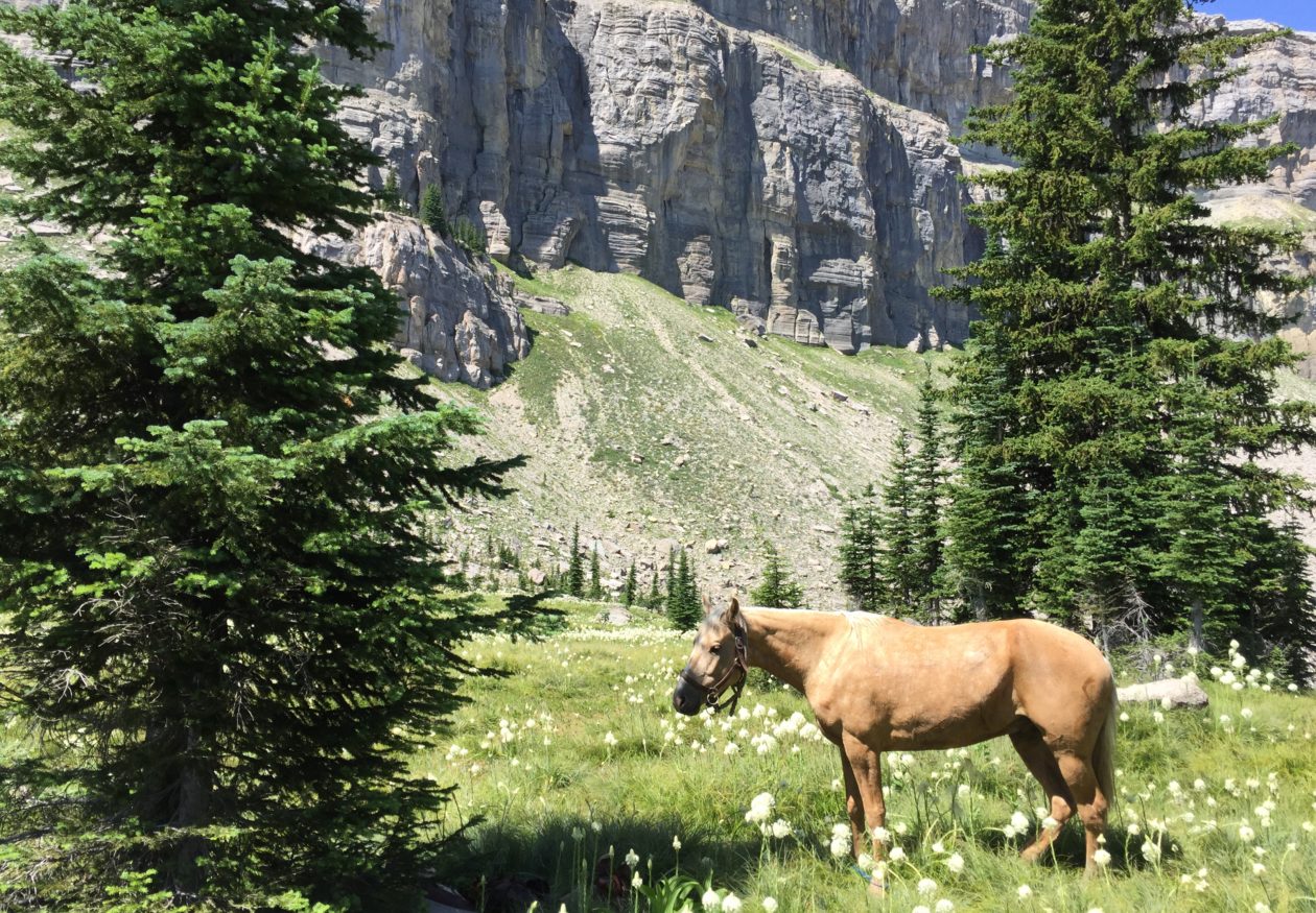


You must be logged in to post a comment.