I recently found an old email from Nancy Hood, one of the many people Dad and I encountered on our pack trip last summer, who so generously helped us out time and again with fresh drinking water and good conversation. Nancy had a photograph of Dad and me that she took. She emailed it to me just a couple days ago. Made me think I should post some of the photos from the trip.
I still need to make a post or two to document the last two weeks of the trip for my followers. Time has been at a premium for me lately and I just haven’t been able to get the time and energy together at the same time.
These photos are roughly in order from our departure at Eagar, AZ to the end of our trail at Flagstaff, AZ. Many of these photos were taken on the Arizona Trail.
Enjoy the photos, and much thanks again to all those who so generously contributed to our successful ride.
Mom and Dad before we departed Eagar
At the Corral on my place at Eagar
Me and Ranger getting ready to head out
Packing up at Eagar
Heading out from Eagar, facing about a 50mph headwind.
Camp off of Fish Creek
My last ride on Ranger
In Camp on Gillespie Flat
Heading out at Woods Lake
Traveling on the General Crook Trail
On the General Crook Trail
Ryan and Ashley Berg. Thanks for the water!
Pic by Ashley and Ryan Berg on the Mogollon Rim
On the Mogollon Rim
On the Mogollon Rim
The Lundberg family. Thanks for the water!
Arrival at the Arizona Trail, about 150 miles east of our starting point, Eagar, AZ
Well, sad as I am to say it, our pack trip has ended at Flagstaff, after about 197 miles of travel.
Temperatures are at record highs. Fire danger is extreme. There is no water in northern Arizona anywhere along the Arizona Trail.
Last Monday we made 23.8 miles and the last water we saw was near Marshall Lake at about mile 3-4. By the time we made Flagstaff we knew we were in trouble. The last 6 or so water holes we passed were bone dry. We finally had to call Gwen and Bruce Kahler, who hauled about 70 gallons out to us and met us where the AZ Trail meets Route 66. That supplied ourselves and our horses for that night and the next morning.
Gwen Kahler, our guide through the Flagstaff area
Gwen stayed and rode with us on Tuesday, as we finished the AZT Equine Bypass route through the mountains and around Flagstaff. We passed one running stream (only the second we had seen the whole trip) as we headed back up to higher elevations. We made Schultz Tank, which had water, by about 3pm. From there it was only about four more hours of riding to reach Gwen’s place, so we decided to make the push. We reached her place by about 7pm, making a 19.2 mile day.
On Wednesday, as we were running errands, re-supplying ourselves for the second half of the trip, I contacted the USFS to ask about conditions between Flag and the Grand Canyon National Park. The answer I got was disheartening. He said we would find water in the higher elevations just north of Flagstaff, but once we dropped down into the lower elevations on the AZT we would find none. That meant we would have about 95 miles of dry terrain with no water for ourselves or our stock.
Gwen got on the phone and started making calls and texts and was able to recruit help in hauling and locating water for us so that we could make our dates at the Grand Canyon. Gwen was going to ride with us to the South Rim, so she had a vested interest. It began to look as though we were going to make it at least that far.
Once at the Grand Canyon, we would have water, as the park has provisions for both potable water and stock troughs. However, once we left the North Rim campground, we would face another 100 miles, approximately, to the next reliable water source, the Paria Creek. As for feed, we had plenty of grass in the higher elevations, but there was very little once we dropped down into the Junipers. We could not pack more than enough feed for a day or two.
This is the driest year I can remember for Arizona. There are fires all over the state, we have already had to re-route around one major fire and were lucky enough to have passed through a couple more areas before they were restricted due to fires.
On Wednesday, the USFS announced open-flame prohibitions on the areas north of Flagstaff, through which we would be riding. We used a small single-burner stove for all our cooking needs, so that didn’t restrict us, but it shows just how dangerous the situation has become.
At the Kahler’s place we were able to find a large animal vet to come out and do the health checks on our horses and mule, so that we had current certificates to enter the Grand Canyon National Park with. We also found a farrier who was willing to come out and re-shoe all our stock on short notice. We were in the middle of getting that done on Thursday, when we got the phone call that was the last straw.
My mother had a very rare and serious reaction to a prescription medicine and had been hospitalized.
It was time to stop and take care of more important business. My sister and brother-in-law came up and picked us up at the Kahler’s place that evening. Dad and I drove back up and hauled the horses back to Eagar on Saturday.
Mom is doing better now and the emergency has passed. She was home before we got home. Dad and I got to thinking we might haul the horses to the Grand Canyon and do the ride there, since I already have the permits and reservations in place and paid for. Mom gave us the go-ahead, but looking at the forecast for the next week, it appears the Grand Canyon will be experiencing record high temperatures. This has been one of the hottest and driest springs on record for Arizona. I have already lost one horse on this trip. I am not willing to risk losing another to the extreme heat in the Grand Canyon, nor to risk Dad’s or my own health any further.
Fact is, this just isn’t the right year to be attempting this ride.
On our pack trip last year, everything worked like clock-work. Things simply fell into place. This year has been different. We have fought through every kind of complication. If something could go wrong, it did. It’s time to stop before something goes really wrong and somebody gets hurt. This trip has already cost me a very good horse. The warning signs have been getting louder as we go. It’s time to concede and head home.
On the Mogollon Rim. Thanks to the Bergs for the photo
Be assured, the trip has not been wasted; Dad and I had some very rewarding days and we passed through some beautiful country. We have been pleased with the AZT and impressed with the care and maintenance most of it has received. We have seen dozens of elk, deer, and antelope, and ridden trails most folks will never see. We have enjoyed the ride immensely. We have experienced something most fathers and sons will never experience.
We’re sorry we aren’t going to make it all the way, but we want to assure all those who have helped and encouraged us along the way, that this was not wasted time. It was all a good and rewarding experience for Dad and me. We are truly grateful for all the help and support we have received.
I will post photos and a trip log after I get home and get settled. The Internet service here in Eagar is not sufficient for me to upload photos. I expect it will be a couple weeks.
I thought I’d write up the first few days of our Eagar to Panguitch trip this year, so our followers would understand what took place to cause our current delay.
Packing up
Last Tuesday, our departure day, we got out to my pasture, where the horses were kept, and started sorting and packing our gear. Of course, it took longer than we hoped to get packed up. Separating our food supplies and gear into separate piles, packing them into paniers, saddling the horses, etc, is a real chore. We eventually just started stuffing things into paniers and figured we’d reorganize stuff in camp the first night. We just wanted to get underway.
We finally got saddled and underway about 12:50pm. Three of my grand nieces rode with us the first several miles.
Heading out through Eagar, AZ
The day was clear, not a cloud in the sky, but we faced a direct headwind blowing at about 40 miles per hour, gusting, I’m pretty sure, to over 60. At over 7,000 feet elevation, any wind is a cool one. Our first 11 miles were across a treeless high plateau, just west of Eagar, with that wind blowing in our faces. It was absolutely miserable! I fixed my eye on a cinder pit in the distance, which marked an uphill grade that would eventually take us into the trees and give us some shelter from the wind, and just kept heading for it, one step at a time.
Facing a headwind across this with no shelter in sight
The going was quite slow, as the horses didn’t like the wind any more than we did and we didn’t push them. We averaged about 2.89 miles per hour for the day, according to my GPS.
Late in the afternoon we reached the trees and worked our way along Route 260 to Forest Road (FR) 1325, which we took northward. We looked around and ended up settling on a campsite just off of FR1325, about a quarter mile from Rt 260. There was plenty of lush grass, a small stream of water for the horses, and a nice, level spot for us. We stopped around 6:30pm and settled-in for the night.
First night’s camp
We picketed the horses on the grass and let them get their fill. We let Reno and Jimbo go free and picketed Ranger and Black, since they were the leaders of the bunch. However, when I poked my head up out of my sleeping bag in the morning, all the horses were gone. While Dad started breakfast, I headed out to look for them.
It didn’t take me long to find them. Apparently the grass was just too good for them to leave it, so they just stopped at a fence at the end of the grassy pasture. Not long after, I had them tied back in camp and we were working on getting loaded up. Seemed like we had plenty of time, so we took it, and ended up heading out around 9:30am.
The plan was to head north on FR1325 about 3/4 mile to a point where the road changes direction. We would head off the road and bushwhack about 3/4 of a mile west to get out on top of the plateau, about 400 feet higher. Right off the bat we found an old logging road that took us precisely in the direction we wanted to go, so we followed it about a half mile before it simply petered-out. By our maps, we could see that we were only a few hundred feet short of the top, where it would open up into high meadows on the plateau. We tried several different routes before giving up. We just could not find a way through the trees that a pack horse could negotiate going up that last sidehill.
We turned around and headed back the way we had come and decided to head back out to Rt 260 and follow it on up to the top. That turned out to be a wise decision for us, as it was an easy climb and the road easement is very wide. At one point we found a tunnel that crossed under the highway for cattle to pass through. It was about 8′ tall and 6′ wide, or so. We took the horses through it and back, thinking it would be good experience for them for when we hit that tunnel at the bottom of the South Kaibab Trail in the Grand Canyon.
Once we made the crest of the hill and started out onto the plateau, we again hit the wind. Just as strong as the day before, but colder. We were now somewhere around 9,500′ elevation. We had to push through the wind again, with no shelter at all, for about another mile, before we found a gate in the fence that allowed us to head back into the trees.
A herd of elk at Fish Creek
We followed a little two-track northward about a half mile and found a valley. The map indicated this was the valley of Fish Creek. As we approached the valley we spied an elk watching us. It eventually headed down over a drop-off into the valley. As we got closer we saw about 10-15 elk reposing and grazing in the valley. It was a beautiful sight.
A spring on Fish Creek
We found our way down a steep decline into the valley, by way of an elk trail, where we located a running spring. We stopped there and let the horses graze a bit while we refilled our drinking water containers. By that time we were tired and Reno was obviously uncomfortable. He was starting to give us trouble, pulling back and having to be dragged along. We decided to find a campsite and call it a day. We located a site just a couple hundred yards away that suited us perfectly: lots of grass, running stream, and a nice, level spot that was somewhat sheltered from the wind.
When we had unloaded all the horses, we found that Reno had a very tender back. He had been carrying a heavy load, over 200 pounds, for two days now, and he was very sore. We decided to make the following day a rest day, despite the fact that we had made only about 20 miles in our first two days, about 3 of which were in the wrong direction.
Finding plenty of firewood at this campsite, we decided to make a campfire for cooking, to conserve our propane. It was pleasant, sitting around the campfire that evening, but we were tired and went to bed directly after eating our supper. We again tied two horses – this time to trees – and let the other two graze freely all night.
Camp on Fish Creek
The following morning we slept-in a bit, since we were not going to be moving that day. We got up at around 6:30am. We still had all our horses there in the pasture. Dad untied Black and let him graze, but, out of an abundance of caution, I kept Ranger tied. I’m glad I did, because while we were busy cooking our breakfast, the other three horses headed for home without us noticing. Ranger started snorting and we looked up and only had one horse.
I saddled Ranger and went after the other horses. I was able to follow their tracks well enough to see that they were heading directly down the valley southeastward, following Fish Creek. I found them about a mile and a half down the valley, where the trees began to choke the valley. When they saw me and Ranger, they walked our direction and were easy to catch up. I took Black’s lead and headed back, assuming Jimbo and Reno would follow. They did…for a few hundred yards, but then began falling behind, grazing along the way. Figuring they would continue to follow and eventually get back to camp, I headed on back.
I arrived back at camp, tied Black and Ranger, and ate breakfast, which Dad had prepared in the meantime. When the other two horses hadn’t appeared by the time I finished, I decided I had better go find them. I figured they’d be right about where I last saw them, grazing in the valley. I mounted Ranger and headed out, but they were nowhere to be found. I headed back to camp and Dad saddled up Black and we headed out together to search for our lost pack horses.
Not far from where I last saw them, I located their tracks heading up a cow trail that led back out on top. We followed until we lost the trail, but it was apparent they were heading back towards Eagar. I eventually caught up with them about a half-mile from our last camp. Again, they were glad to see Ranger and came right to me. I caught up Jimbo’s lead and led them back toward camp, with Reno following. He, in fact, did follow this time.
Having learned our lesson, or so we thought, we then tied three horses and let one graze freely, but being the enterprising individuals we are, we devised a method whereby all the horses could get their fill of grazing. We tied rather large rocks to the leads of Jimbo, Ranger, and Black. We tied the horses by their front left foot with a bowline hitch, such that the rock acted as a stake. When we wanted to move the horse to better graze, we simply moved the rock. We were pretty pleased with ourselves, until the next morning, when I poked my head out of my sleeping bag and found that we were horseless. All four had left the valley.
After looking around, it became apparent that something, elk or maybe a coyote or lion, had spooked them during the night and they had dragged their rocks until they had come off the leads and the horses ran freely with their 35′ foot leads attached.
This time, while Dad made breakfast, I headed out on foot to locate our wayward herd. I was pretty sure I knew where they had gone, so I headed out. I again located their tracks on that same trail as before, heading up onto the plateau and off toward Eagar. This time they didn’t make it quite as far as before, and I might have walked right by them, except that Ranger nickered at me when he saw me. There they were, standing back in the trees, looking like they were waiting for me to find them.
They let me approach and I started catching up leads and tying them to trees, while I untied the foot-ropes. Ranger had a knot and scrape on his nose, but other than that all the horses were unharmed. As far as I knew, none of the horses had ever been ridden bareback. I would have trusted Ranger, but at 16 hands, there was no way I was going to be able to get on his back. So, I led them all back to camp on foot. When I got back, my GPS indicated I had walked about 3 miles, not counting the distance I walked earlier without the GPS. I figure I walked about 5 miles that morning. I was pooped!
So, there it was Friday morning and we had made a total of about 17 miles, and a bit.
Reno’s back was nearly back to normal now, as we had been giving him a helping of bute each morning to ease his pain and reduce the swelling. He was still a little tender, but wasn’t flinching when I brushed his back. We realized that our packs were overloaded, due to the fact that we had brought 100 pounds of Equidyne pelletized alfalfa feed with us to supplement the horses’ feed. We made the decision to dump the feed, since there was plenty of grass available. This brought our loads back down to far better levels and allowed us to redistribute the weight among the two pack horses more evenly. In an effort to take it easy on Reno, we decided to put the heavier load, the hard-sided paniers and top pack, on Jimbo and let Reno carry the soft paniers.
Back on the trail, leaving Fish Creek
We got packed up and were back on the trail by about 1pm, heading west along Fish Creek, toward FR 117.
What a beautiful ride it was. We met FR 117 less than an hour later and headed northward. We joined FR 61 several miles up the road, near the base of Green’s Peak. We followed it about 7 miles west and north toward FR 96, but stopped about 3/4 of a mile short of it, making about 11 miles for the day. We had decided to keep our mileage around ten miles to take it easy on the horses and to avoid soring Reno’s back again.
What a ride!
This day’s ride was the kind of ride Dad and I had dreamed about. We had horses that got along well, so we could ride side-by-side, which we did almost all day. We talked, dreamed, schemed, spoke of the ranches we wished we had, and talked of horses and dogs we had known over the years. I loved hearing Dad’s stories of his youth, growing up in Panguitch, Utah and surrounding areas. As badly as the day started, this day became one of those perfect days for us.
Look closely in the middle and you’ll see the antelope fawn
Several miles up FR 61, we came upon several Pronghorn Antelope. One of them had a fawn that could not have been more than a day old. Dad had seen the fawn, but I hadn’t. Suddenly it jumped up and ran across the road in front of me. I was able to snap a quick photo of it. It was something one does not often see.
We had hoped to reach FR 96 before stopping for the night, but as we passed through Gillespie Flat, we saw a beautiful campsite, several hundred yards off the road, back in some Ponderosa pines, at 8,653′ elevation, with a spring and good grass a short distance away. It was too nice to pass up.
Elk checking us out
As we were unpacking the horses, we heard something snort from back in the trees. We eventually spied a cow elk watching us from about two hundred yards away. None of our horses took note at all, except Jimbo, our mustang. He located that elk the first time it blew and was watching her with piqued interest. The elk would snort at us and Jimbo would snort right back. This went on for several minutes, with the elk working its way closer all the time. Eventually, the elk approached to within about 30 yards of camp, inspecting us and our horses closely, before moving off.
Camp Day four, on Gillespie Flat
We again decided to make a campfire for cooking and it was a good decision, because it got very cold that night, down into the 20s. We let the horses graze freely for the early evening, but made sure we kept a good eye on them. After eating our supper, we tied all four horses, Ranger and Reno by foot-ropes, so they could graze freely on the good grass. It was their turn. After supper, Dad and I sat around the fire and enjoyed the evening. We hit the sack around 9pm.
About 2:00am I was awakened by the sound of pounding hooves. I jumped up out of my sleeping bag, grabbed my flashlight and shined it toward the sound. I saw Ranger tied up against a tree and struggling. I ran to him and found he had wrapped his foot rope, around the tree until he was snubbed against the tree with his right side against the tree and his left front crossed in front of him and twisted around the tree trunk tight against the rope. He was pulling back against it with all his strength. I tried to calm him, but he was in a panic and there was no way for me to help him but to cut the rope. I ran to my bed to grab my knife, and about halfway there I heard a loud “snap”, like a large tree branch breaking, and I knew I was too late. I grabbed my knife and was back at his side within seconds. I slashed the rope with one pass, releasing his leg, but I could see his left front leg was broken, up high near the elbow. It hung awkwardly and useless, as he stood three-legged.
Ranger didn’t struggle, didn’t try to walk. He just stood there looking at me as if I might be able to help him. I held his neck and talked to him as I sobbed, knowing there was nothing I could do; knowing I would have to put him down.
By this time, Dad had made it to us. He held Ranger while I went to my saddle and retrieved my .22 rifle. I loaded it with several rounds of ammunition and carried it back to where Ranger was standing with his head held low. I spoke a few comforting words to him, mostly of comfort to me I suppose, but maybe it helped him too. I rubbed his face, said my goodbyes, then I placed the end of the barrel on his forehead and squeezed the trigger. Ranger went down immediately, shuddered a little, then relaxed. It was all I could do to contain myself.
After putting Ranger down, Dad and I went back and slid into our sleeping bags. We both shed tears as we tried to console ourselves, me for my horse, Dad for me. Surprisingly, I fell back asleep.
About 3:30am I was suddenly wide awake, with the words ringing in my brain, “Go re-tie Reno!” I had forgotten all about him being foot-tied as well. During the incident with Ranger, he had been twenty feet from his tree, grazing calmly. I jumped out of bed immediately, grabbed my flashlight and ran to Reno. I found him with about one more turn around the tree left in the lead rope before he would have been in the same predicament as Ranger. I tied him by his halter rope, then untied the foot-rope and went back to bed, passing the lifeless body of my dear friend, Ranger.
This has been difficult for me to type. The image of Ranger struggling against the rope and the sound of his leg breaking are fresh in my mind. The knowledge that just ten seconds more would have turned that tragic incident into a simple learning experience fills my heart and mind with ”what-ifs”. Knowing that if I had tied him by his halter rope, rather than a foot-rope, fills me with regret and sorrow. I just didn’t know.
The following morning, we contacted some friends, who drove out and helped us load up our horses and gear and return to Eagar.
I left Ranger there at our camp, feeling like there was no better resting place than right where he lay. I, myself, have often thought I would prefer meeting my end leaning up against a tree overlooking a beautiful valley high in the mountains, to being buried in a cemetery. His body will eventually return to the earth, providing nourishment for plants and animals alike. I like that thought. Nothing wasted.
I clipped a few locks from Ranger’s beautiful tail. I plan to make a hat band from them, which I will keep in his memory, so that part of him is always with me as I ride my trails.
I hope I am not judged too harshly for what happened to Ranger. He had been foot-tied many, many times in the past and never worried me in the least. I never considered that such a thing could happen. I had no idea. I have learned. It was a hard lesson, one that will not be forgotten.
See you on the other side, Ranger. I miss you already.
This post will conclude the documentation of the horse pack trip Dad and I did from April 11 through May 8, 2015 from the US/Mexico border to Eagar, Arizona. The trip was 355.2 miles, according to my DeLorme InReach Explorer GPS, and spanned 28 days. This post covers Days 24 through 28.
When we left it at the end of the last post, it was somewhere around 3:00am Sunday night and I awoke to the sound of a whinney off in the distance, up the canyon a ways, where five of our horses had wandered during the night as they grazed, leaving the Queen Bee, Lizzy, staked at the edge of our camp.
The next sound I heard was the rumble of thundering hooves, as the whole herd came at a full gallop toward camp. I don’t think Dad even woke up, but I was curled up in the fetal position in my mummy-style sleeping bag expecting to be trampled at any moment. Well, the horses galloped into camp, but luckily, as they did Sunday afternoon, they stayed to the trail and passed by us about 30 feet away. Whew! They immediately settled down to their grazing again and all was well. I went right back to sleep.
Down in the Blue
We broke camp the following morning, as usual. I decided to ride Lizzy, as her back was doing much better, and pack Daisy and Ranger. Daisy’s saddle sores had gotten pretty bad, so we put the salve on her and put a pack saddle on her with no packs. We just rolled up the manty canvasses and tied them to the saddle. Ranger had a light pack as well, because we were down to the last of our feed. We divided the rest of the gear and supplies evenly among the three pack animals that were carrying a load, and all three were fairly light. Clancy was doing a bit better, so he was going to be walking, rather than riding.
Black was doing better. His swelling had gone down quite a bit and he was moving better. The bute had been helping. We gave him his morning dose and by the time we got started he was doing better. Dad was riding Jimbo, so Black had a light pack on.
The travel was pretty good, as we were able to follow the designated trail much of the day, however, since the USFS and BLM have removed livestock, for the most part, in the Wilderness area, the trails are quickly disappearing. Cattle no longer move through the areas, cowboys no longer use the trails, fires have swept through some areas, and so they are simply disappearing. Trails that have been in existence for hundreds of years are now just gone. It’s rather sad.
Anyway, for much of the day we simply made our own way, but it wasn’t too bad. The Blue was running low and there was plenty of open ground in the riverbed and surrounding benches to allow us to pass through most areas with no problem. At one point we spied a couple of caves up on a sidehill. I just had to explore them (my brain still thinks I’m 15), so Dad took a break and the horses grazed while I took a look. They were deep enough to make a small room, but I found no buried treasures.
The weather was a bit wet, broken clouds, sprinkling just enough to get things wet in the morning. Later in the day we could see clouds building south of us. Eventually, those clouds began to build in our direction, so we were watching for a storm.
We expected to be able to find adequate grass for our horses down in the Blue riverbed, but surprisingly we found very little. We saw a few head of cattle, but they were very wild, obviously holdovers from many years back. Still, the grass in the area was grazed low. Apparently the elk herds are strong in that area. Whenever we found any quantity of grass at all, we stopped to let the horses get a few mouthfuls.
We passed the HU-Bar ranch about mid-morning. We were back into familiar territory, as Dad had been down in that area in the past. About lunchtime we found a patch of grass and decided to let the horses graze while we ate lunch. We also pulled out our slickers, as the sky started to spit a bit of rain.
Just as we were about to wrap up our lunch break, a couple cowboys with their dogs showed up. They were hunting stray cattle. Back in the old days, this would have been known as “rustling”, but what they were doing was removing lost cattle from areas where they had been restricted by the USFS. These were cattle that had once belonged to some local rancher, but that he wasn’t claiming, in order to avoid being fined by the USFS. So, these locals would go out and find the strays, then take them to market. At today’s prices, it brings in a little extra to keep their families fed or spare change in the pockets. It wasn’t easy work, because those cows we saw were wilder than deer!
The cowboys hadn’t brought their slickers along, so as the drops started falling, they headed out at a pretty quick pace. That worked out pretty well for us, because they were familiar with the actual trail. On our way forward, we simply followed their tracks, which likely saved us a couple hours by the time we covered the next six miles or so to the Blue Road. As it turned out, we got enough rain to get everything wet, but no downpour. We heard some thunder back down the canyon, but none close enough to be of concern.
We hit the Blue Road about 4:30pm. We had made about 16 miles, but figured we needed to make another eight miles to make it to our stopover place at Blue. We contacted Dick Goodman by text to let him know where we were and when to expect us and about two miles farther along he and his wife, Jean, showed up in their pickup. Clancy was about done-in and I was carrying him on my saddle as much as I could (the strain on my back was quite painful). We put Clancy in Dick’s pickup and they took him on to the house for us. Although he was in pain, he left us barking and howling to let us know he didn’t want to go. Dick returned a bit later and went ahead of us, opening all the gates as we approached. That was a big help, as getting on and off the horses this late in the day was a chore.
We finally arrived at Dick’s place, where he had made arrangements for us to use a corral, around 8:15pm, long after dark. We unpacked the horses, fed and brushed them, then headed for Dick’s house. We were beat. Our horses had fared well, but were tired as well. We had made 26 miles on the day, in just short of 12 hours of riding.
Dick had an RV he let us stay in. It was nice to get a shower and rest in a bed that night. Dick and Jean treated us to baked beans and hamburgers. The following day, Tuesday, was wet and rainy. We decided to stay the day. It was a good break for us all after a 26-mile day on Monday. Mom and my sister visited and brought a lemon pie. We had a fine dinner that evening.
During the day on Tuesday we were able to talk to a couple fellows who know the Blue Wilderness area very well. Our plan was to ride Grant Creek Trail from the Blue River, near Dick’s place, to the top near Hannagan Meadow. We’ve made that ride several times before and know it to be a beautiful and pleasant ride. The advice we got, however, was to abandon that idea, as the trail system had received no maintenance in the past several years, and fires and disuse had made most of them impassable by horse. It was a tough decision, but in the end we decided to ride the Red Hills Road to the top. We figured we were about fifty miles from Eagar, by the route we would ride and that it would take us about three days.
Ranger’s lump on his back
We also decided to leave Lizzy and Daisy. Lizzy’s back was sore again and the lump on her back had swollen overnight. She also had several rub sores on her shoulders and rump from the straps of the pack saddle. Daisy’s saddle sores had gotten worse as well, and, quite frankly, we were tired of her mare-ish antics. Even after all this time, she was disruptive to our string. Neither horse was of much use to us and there was enough grass available now that we did not need to haul feed, so we called my brother-in-law to come pick them up. My mother took Clancy home with her. We also sorted out some items of gear we wouldn’t need and left them with Dick. He’d bring them up to us in Eagar later. We ended up with only two pack animals, using paniers, rather than Decker-style packing. We found our process of packing and getting ready to move went much faster and easier.
So, for the last three days of the trip, it was just Dad and me, three horses, and one goofy mule.
On Wednesday morning, after an excellent breakfast provided by the Goodmans, we packed up and headed up Blue Road. About two miles up, we came to Red Hills Road, which we took and started the climb up out of the Blue. We ascended more than 4,500 feet in a matter of twelve miles. It was a fairly easy day on Dad and me, but was tough on the horses.
Once on top, at an elevation of over 9,000 feet, the land levels out a bit. There was plenty of grass and we stopped several times to graze the horses. In the late afternoon we stopped near US 191 at a set of corrals used by the USFS. Although there was plenty of grass, we had made previous arrangements with a friend to leave a bale of hay there at the corrals. We released the horses into the corrals and fed them. It was still fairly early in the day, around 5:00pm, so we had time to gather firewood and make a nice campfire. We enjoyed the evening sitting around the fire talking about our trip and our plans going forward. We made 14 miles and climbed over 4,500 feet. Our camp was at about 8,090 feet elevation.
Camp at the corrals on Highway 191
Our original plan had been to use this first leg of the trip as a “shake-out” that would let us know how well we had prepared and whether we had the right horses and gear to continue. If the answer was yes, we would continue on to the second leg of the trip, to Panguitch, Utah. We made the decision several days earlier that we would stop at Eagar this year. Our gear proved to be good, although we had taken quite a bit of gear that we never used, but we found pretty early on that two of our horses were not the right animals for a trip of this kind. In particular, Daisy was a horse we wished we hadn’t brought from the very first day. Lizzy, on the other hand, was a good horse on the trail, but she has a very fine coat of hair that doesn’t offer sufficient protection to her from abrasion. She gets a rub sore wherever a strap rubs her. Additionally, as she lost weight, the saddle put pressure on her spine, which caused the lump on her back. I have seen this on other Fox Trotters, and even Ranger was somewhat affected the same way late in the ride. She just wasn’t the right horse for a ride like this. We decided the wisest course for us was to stop at Eagar, learn from our experience, and plan to make the second leg, from Eagar to Panguitch, the following year.
We passed a pleasant evening. We watched a herd of elk pass near our camp. We slept well and were well rested the following day, Day 27. Packing up and getting rolling was a much quicker and easier process, as I said before, with just four animals. We were up and moving before 8:30am.
We stayed mostly to USFS roads, passing by Springdale and seeing a few houses here and there. We traveled at a very good pace and made good time. I was riding Ranger during the morning, but he kept walking with a short-strided and choppy gait, which worked on my back and made things quite painful for me. Before lunchtime I switched my saddle to Jimbo and rode him the rest of the day. I like riding Jimbo. He has the best training of all our horses and is very pleasant to ride. Later that evening I found Ranger had two loose shoes, which I tightened. I think his sore back contributed to his choppy stride. He is normally very smooth to ride.
Camp near Big Lake off USFS 24
Again, this day, traveling by USFS roads, we found that the topo maps provided with my DeLorme InReach Explorer, were grossly inaccurate. We found mislabeled roads and roads shown on the map that were nonexistent, as well as roads on the ground that did not show on the maps. That was a very frustrating thing. We found during this trip that our good old-fashioned paper maps were indispensable. Between the three – GPS, electronic topos, and the paper topo maps – we did ok.
We made camp that night about 3 miles or so west of Big Lake, near a stock pond. It was a pleasant spot with good grass. We were lucky to get it, as a couple pickups and motorcycles stopped by looking for a campsite that evening. It was a cold night, at about 8,500 feet elevation. We had made 19.6 miles.
Ice from our bed cover
In the middle of the night we had an unexpected shower. I jumped up and spent the next few minutes running around in the cold rain in my underwear trying to cover everything up. It was nice to jump back in the sack and cover up. The following morning we had small puddles of ice on top of the top cover of our bed.
The next morning, Day 28, Friday, May 8, 2015, was a nice day, with broken clouds and just a hint of a breeze. At 8,500 feet, though, that doesn’t make for a warm day. We slept-in a bit and didn’t roll out of our bags until 6:00am. We were packed and rolling by 9:15am. We were thinking that if we made good time and didn’t make any navigation mistakes, we might reach Eagar that day. It would be a long day, however, and we had no desire to push things like we did down on the Blue. We considered that we might need to make camp short of Eagar and finish on Saturday.
Out on top, White Mountains
We passed through some beautiful country, with which we were already familiar. Dad and I love that area, up in the tops of the White Mountains. The Wallow Fire of 2011 blackened much of the area, but not all. We passed through some burned areas, but for the most part it was green and nice. We passed a very pleasant day. As we passed the Black River, we filled our canteens and watered the horses. We gave them a break to graze on the grass, which was abundant here.
We did, in fact, make very good time on the dirt roads and we were coming down Water Canyon, above Eagar in the late afternoon. As we came into town on the south side, about a quarter mile from where our trailer had been dropped off for us, Black started limping. By the time we got to the edge of town he was limping badly, so Dad dismounted and waited with the horses while I went on to the trailer and came back for him.
Wouldn’t you know, that by the time I got back to pick up Dad, he had lost Honey the mule. Honey, recognizing the area, since she had been kept for a while near where we were, and seeing her buddy, Jimbo riding away from her, she pulled away and ran off, still packed with our gear. It took us a while to finally locate her. A local fellow found her wandering around and corralled her. With Honey in the back of the trailer with the horses, we drove the four miles or so to the pasture and home.
I have to admit that the end of the trip was somewhat anticlimactic, but we were glad to be home. We made 22.4 miles that day, arriving at Eagar at 6:30pm.
Our total travel mileage was 355.2 miles from the US/Mexico border to Eagar, Arizona, in 28 total days, 21 travel days.
Black was back to normal after a few days of rest, as were the rest of the horses. Only Jimbo and Honey arrived at the destination without a single mark on them. The others all had their bumps, bruises, and scrapes. After all the headaches and problems he gave us during the first few days of the trip, Jimbo turned out to be the most solid, capable, and reliable horse of the bunch. We were lucky to have him along. Daisy’s saddle sores have since healed up, leaving only the white telltale marks, but her disposition hasn’t changed any. I still want to spit on the ground every time I think about her. Lizzy is still my favorite trail horse, but she won’t be coming this year, due to her propensity for rub sores. We’re keeping her at Eagar as a backup, just in case. Dad’s Little Black will be with us this year. He and Dad are a package deal.
On the Trail
There was one day on the ride last year, during which I had thoughts of regret at dragging my dad out into this difficult and somewhat dangerous endeavor. Thoughts that it was my selfish desire to drag him along and I shouldn’t have done it. I thought, “What in the world am I doing out here with my 81 year-old dad?”
Two months ago, Dad and I were out for a ride south of Moab, Utah, tuning up for this year’s ride. As we walked along side-by-side on the horses, I mentioned those thoughts and feelings to him, expressing to him that I was having doubts about our plans for this year’s ride from Eagar to Panguitch. Last year’s ride was 355 miles in 28 days. My figuring has this year’s ride estimated at about 620 miles and 42 days on the trail (not counting rest days). Dad looked at me with a wry grin and told me not to worry. He hadn’t had even one minute’s regret during that ride last year. The thought hadn’t even entered his mind.
That was all the confirmation I needed.
So, Dad’s 82nd Birthday is Monday, May 23, 2016. We will be mounting up on Tuesday to head for his hometown, Panguitch, Utah, planning to ride into town just in time to ride in their Pioneer’s Day Parade on July 23. His high school class will be holding their 64th class reunion that week as well. A fine homecoming for Dad.
This post will cover Days 20-23 of our pack trip last year.
Day 19 left us camped out on a hilltop overlooking the Phelps-Dodge mine at Morenci, Arizona, just north of the northeast end of the Gila Box Conservation Area. We were only about a mile or so west of US 191, just south of Clifton. Our route this day would take us east for several miles, then northward toward the southern part of the Blue Range Primitive area. This day would see the last of the harsh terrain and conditions of the low Arizona desert and start putting us into the higher, greener elevations.
On Day 20, April 30, 2015, we arose early, as always, fed the horses, rolled up our beds, had breakfast, and hit the trail again. We hit US 191 before 10:00am. Our first challenge of the day. The State of Arizona, or maybe the Bureau of Land Management, made this very nice gate there at the cattle guard at the approach to the crossing. Problem was, the gate would not open. The bottom foot or so was buried in sand. Took me about a half hour to dig it out, so we could open it far enough to get the horses through.
Lunchtime and a rest
After that, we crossed the highway and rode the shoulder for about a quarter mile north to join Table Top Road, which took us north, then turned southeast for several miles to a small township, of which I cannot recall the name. It was more like a housing development than a town. As we entered the town, we found a small grassy spot near a diversion dam, where we let the horses graze for an hour while we had lunch and rested in the shade of a tree. It was a good stop for us, because little did we know what was waiting for us.
After passing through another small township, on Ward Canyon Road, we turned northeast on Skyline View Road, then took a right on Rattlesnake Road. Rattlesnake Road was a dirt road that headed northeast toward the mountains. The terrain we had been passing through up to this point was regular old Arizona desert. Very little vegetation, other than greasewood and the occasional mesquite tree. The rocky ground was not quite as bad as what he passed through the previous two days, but it was still rough. It was nice to have a dirt road going in the direction we needed. After several more miles we came to the end of the road. Well, at least the maintained road. We found ourselves coming to a USFS road that obviously hadn’t been maintained in a while. We could see it stretching before us, climbing straight up a narrow, very steep canyon. Rattlesnake Canyon.
From the top of Rattlesnake Canyon
Luckily, there was a good waterhole at the foot of the road, where we watered the horses. We were joined there by a herd of horses. I doubt they were mustangs, but they were pretty wild. The road was extremely rocky, but at least it wasn’t all volcanic rock. The canyon was scenic, but the climb was so steep we didn’t get to look around a lot. I recorded a short clip or two on my iphone, but the battery started to go, so about half way up the canyon I got my GoPro out and tried to get a couple more clips.
We climbed 1200 feet in under a mile. We had to stop a number of times to rest the horses. By the time we crested the saddle at the top of the canyon, we were resting the horses every 100 yards or so. We got a good laugh as we came to the last hairpin turn before the crest. There was a “dangerous curve” sign just after the turn, on the high side. Yep. Big as life, a real live Arizona road sign. I can tell you that even a rock climbing Jeep, or a 4-wheeler, for that matter, would think twice before tackling that road! Lucky for us, our horse feed was running low, so our horses were packed lightly.
This day I rode Ranger and Dad rode Jimbo. Daisy was again developing saddle sores on her withers and Lizzy had a sore back. Lizzy had started developing a lump on her back, about where my saddle cantle rode, on Wednesday. I suspected there were two factors involved: my having to carry Clancy in the saddle for much of the day on Wednesday and the fact that she had started to drop a little weight, which made her already prominent spine (Fox Trotters are built that way) even more prominent, which caused the saddle to put pressure there. I had given her a helping of bute with her morning feeding and she was packed very lightly. The pack saddle allowed her to move with no pressure on her sore spot. I hoped that would help.
Clancy was making work of things. His paws were very sore and his strength wasn’t recovering with a night’s rest as he had early in the trip. He was simply wearing down. On this day I carried him most of the day on my saddle on Ranger.
The pond at the top of Rattlesnake
We took a short break at the top, looked around, rested the horses, then headed on down the road. The descent on the other side was not steep, but quite gradual. It was also treed with oak, juniper, and cedar. There was grass and other vegetation. It was a completely different world that the other side of the hill. After a short distance we came to a small pond with an old line cabin. We watered the horses there, but didn’t stop long. We had to make several more miles before we could stop for camp.
I don’t know whose ranch land we were passing through (I’m sure it was BLM range), but I can tell you they had some good cowboys. This land was very well maintained, with well-maintained stock ponds every mile or so. We saw evidence at every turn of hard work having been put into keeping up that range over many years. What a beautiful ranch it was.
Just before sunset we came upon a stock pond with a very nice corral. There were nice trees and a perfect level spot for camp. Problem was that there was this huge black angus bull occupying the campsite. Eventually we were able to crowd him off our selected spot, but he stayed close by all night. Seemed like he liked the company. We watered the horses, then released them into the corral. They enjoyed the freedom of not being tied and all had a good roll. We enjoyed our camp that evening, although we were beat, having made 16.4 miles.
After a short night, we were up again at sunrise. We were packed and moving by 9:00 am. Our goal for the day was to pass the Martinez Ranch, on the San Francisco River, about a couple miles from the confluence with the Blue River, start up the Blue, then camp at a stock tank on Pat Mesa. After that, we would head north on the Blue, entering the Blue Wilderness Area. We had a stopover planned at a friend’s place at Blue, Arizona, which we believed we would reach by Sunday. Turned out that was very optimistic. We hoped to be able to have someone meet us there to take Clancy back to Eagar with them. He was having a hard time of it.
We enjoyed Day 21. As I said, we passed through some very nice ranch land. We passed through rolling hills for most of the day, and the weather was pleasant. We passed the Martinez Ranch just before lunchtime. It didn’t look like there was anybody around, so we kept going. We rode down to the San Francisco River, watered the horses, then let them graze for an hour. We had our lunch there and refilled our canteens. That was about the 250-mile mark on our journey.
From there we followed the river west for about two miles, to the confluence of the Blue River. These were tough miles, during which we crossed the river six times. One crossing was deep enough to come up over my boot tops, but not deep enough to flood our pack paniers. The trail along the river had not been maintained, so it was difficult to follow, however we were again blessed. A four-wheeler had passed through not many days before us (judging by the tracks) and the rider had marked the trail with ribbons. Without that, we would have had a very difficult time finding our way those two miles.
At the confluence of the Blue, we turned north to follow it. The Blue River bed was much wider and more spread-out than the San Francisco. It was quite beautiful and was much easier traveling. We followed the river for a quarter mile or so, but saw that it was coming from a very narrow canyon. The map showed that if we entered that canyon we’d be stuck in it for several miles before it spread out. Not knowing what we might find in there and being concerned about quick sand and the thick willows growing along the banks, and just having bushwhacked along the San Francisco for two miles, we elected to seek a route up out of the canyon and to keep to the mesa until we reached Juan Miller Road the next day.
Our 1967 USGS map showed a trail that ascended up out of the canyon where we were, but our current topo map did not show it. We searched around a bit, expecting that the trail was not maintained anymore. We finally came upon it and found the USFS or BLM had plowed it up and put up berms to keep it from being used. Lucky for us they did, or we would never have been able to follow the trail! Had they just left it alone, it would have grown over and disappeared, but their efforts to close the trail by placing a berm in it every twenty yards or so, guided us up the steep trail until we reached the top at Pat Mesa. By this time, Dad and I were bushed, as were the horses. The last three or four miles had been tough ones. We began looking for a camp, still about three or four miles short of our goal.
We saw a stock tank on the map, which gave us hope, but when we reached it, it was dry. We continued on, thinking we would be making a dry camp. We finally came upon a suitable place, with a small clearing among cedar and juniper trees, but as we were about to dismount, I noticed across a canyon that a two-track road turned up into the mouth of a canyon. At the mouth of the canyon I could see some sort of structure. I told Dad I thought it might indicate a water source, as I could think of no other reason for a road and a structure out in this area. It was only about two more miles to round the head of the canyon and cross over, so we continued.
Lucky we did, because we came upon an improved and running spring, with a cowboy camp and a corral. Apparently it was a working camp, but every body had headed to town for the weekend (it was Friday evening). We imposed ourselves on their hospitality and set up camp, tossing our sleeping bags in their tent. It was nice and we slept well. We left them a “thank you” note and let them know we left the camp like we found it. Ruth Brockman, of the Turkey Creek Ranch, sent me an email later, saying she had received my note and were glad we had made ourselves comfortable. She invited us back for a visit whenever we get back down that way. I’d like to do that sometime. We made 16 miles that Day.
Saturday, May 2, Day 22, was more of the same, traveling across Pat Mesa, following a “cat track” that was used as a ranch road. Again, we saw much evidence of hard work being put it to maintain the range and keep it in good condition, which it was. The road was fairly easy until we got a couple miles short of Juan Miller Road, at which point it became very hilly and rocky. It became a lot of work on the horses. That’s one problem with following a “cat track”. They are named that, because they are bulldozed out of the mountains. Bulldozers are nicknamed Cats, after the company Caterpillar. Cats don’t necessarily take the easy route and don’t make many switchbacks. When they do, you know it’s a steep hillside.
We had just descended down into Pigeon Creek and were looking at two options: we could turn east about a quarter mile and strike the Blue River, following it upstream for less than two miles to Juan Miller Road, or we could stick with the cat track for another 4 miles to get there. We were still leery of following the river, so we decided to go with the known-quantity and continue on the cat track. We climbed the very steep ascent out of Pigeon Creek and were just cresting out when we came upon a hiker. We stopped and talked to him for a few minutes. It took me about two minutes to recognize him as a man with whom I had communicated online about two years before regarding possible routes for us through these mountains. What are the chances?
Brett Tucker is a long-distance hiker, who knows southeastern Arizona like the back of his hand. He has the website “Grand Enchantment Trail“, which documents a long-distance trail he designed through several mountain ranges in southeastern Arizona. He just happened to be out scouting a new route for a trail. Much of the route I selected for our trip was based on his advice. Once I realized who he was (he recognized me at about the same time) we asked his advice for our route to Juan Miller Road. He suggested that we turn around and head down Pigeon Creek to the Blue and follow it. He assured us it was a safe, easy, and scenic passage for horses. We followed along with him until we reached the Blue, at which point we said our goodbyes and he turned south while we went north.
Incidentally, after we finished the trip, Brett sent me an email. He said he returned to Juan Miller road via the cat track. When he reached the road he found the gate locked. Our passage would have been blocked. What a disappointment that would have been for us. Another of those simple little “tender mercies” of the Lord to help us along on our trip.
And thus began the most pleasant part of our trip, traveling up the Blue River to Blue, then up Red Hills Road and over the top to Eagar.
We headed up the Blue then, crossing back and forth across the crystal clear water about ankle deep most of the time. Cottonwood trees grow along the banks and willows are thick in many places, but we were always able to find a decent way through. In some places the cliff walls became very tall, imposing, and beautiful. There were places where the river passed through narrow cracks in the cliff walls, and we passed through in the river. Travel wasn’t easy, but it was pleasant. We made the short couple miles to Juan Miller Road, then headed west until we found a two-track designated 4-wheel-drive road that headed north. That road took us to the historic Fritz Ranch, now a USFS property. We took Blue Trail #101, which heads there at Fritz Ranch. The trail follows the Blue River all the way to Blue Road, and that was our plan. We planned to make camp about 6 miles or so up the trail at the HU-Bar Ranch, which is an old abandoned ranch house, used by many passers-by as a camp stop.
This day I was riding Daisy. I had both Ranger and Lizzy under pack. Turned out that Ranger showed a sore back the night before. Had to be from carrying Clancy in the saddle. Not only that, but holding Clancy in my lap caused me to sit back farther in the saddle and caused me some back strain. I was developing a very painful knot in my upper back.
The days on the trail, through very difficult country, had taken its toll on us. Dad and I had found ourselves becoming increasingly short-tempered with ourselves, with each other, and with our horses. We were tired, the horses were tired, Clancy was tired…we were just beat. It was Saturday afternoon and we were looking forward to a much-needed Sunday rest.
No more than about 1/2 mile up Blue Trail #101, one of the horses started acting up a little and I was getting angry at him. My anger was spreading through the whole bunch of us pretty quickly. Suddenly, I looked around us and saw that we were in a pretty decent place for a camp. I turned to Dad and said, “We’re camping right here tonight!” We were about five or six miles short of our goal for the day, but we were done. We made camp right there. We made 17.2 miles that day, 273 total miles on the trip.
We didn’t spend a lot of time with things that afternoon. We simply cared for the horses and staked them out on the plentiful grass, then went to work setting up our camp. We had a couple hours before sunset, so we just rested and relaxed while the horses grazed. Turned out this was a good decision and we were camped in a pleasant spot.
On Sunday morning we stayed in bed a little longer than usual. The weather was pleasant, the morning cool, and we were comfortable. After we arose, we fed the horses a bit and moved them to new areas to graze. We found that Black was a bit lame. Both his rear fetlocks were quite swollen. We gave him some bute with the feed and hoped that rest and some prayers would have him ready to go again the following day.
Lizzy and Ranger seemed to be doing better. Their backs were much better. Daisy’s saddle sores were getting worse, though. Nothing we could do about it. We had taken it as easy on Daisy as we could, to the detriment of the other horses. All we could do was to keep salve on them to keep them soft and lubricated. Clancy was doing a little better, after having been hauled in my saddle for much of the previous day. Dad and I were losing weight quite rapidly. The miles were showing on all of us, except Jimbo the mustang and Honey the mule. They seemed impervious to all the travel and work. They looked just about like they did when we started the trip 23 days before. Not a mark on them.
We had learned by now that our herd of horses…and one silly mule…would follow Ranger about wherever he went, but that Lizzy was the Queen Bee of the herd. Ranger would generally stay where she was and the rest would hang around Ranger. We had also learned that Lizzy tended not to stay in one place very long. She would graze for a couple minutes in one place, then walk off 20-30 feet and start again, which kept our whole herd moving constantly. We found that if we staked Lizzy the rest of the horses would settle down and graze lazily in the same general area. So, that’s what we did for Sunday. I tied Lizzy and moved her to a new spot every couple hours and the rest of the herd stayed around in the general area, calm and relaxed.
I went down to the river to wash clothes and take a bath. It was…refreshing, to say the least! While I was down at the river, I suddenly heard a whinney from way down the canyon, maybe a quarter mile, then an answer from Lizzy, tied there at the edge of camp. Suddenly there was the drum of hooves at full gallop rushing toward camp. I got to where I could see, just in time to watch our entire herd run full speed through camp! Luckily, they stayed mostly to the trail and didn’t actually run over our camp. They stopped immediately after passing through camp, turned around and came back to see Lizzy. Then they all settled down to grazing calmly again.
Dad and I passed a particularly lazy and restful day. The horses and Clancy did the same. We were all healing and resting our tired bodies and minds. The horses seemed to particularly enjoy the day off. A fresh bath put me in a very restful and relaxed mood. We all felt pretty good. It was a good day.
That night, Dad and I were sound asleep, sleeping very well indeed, when I was awakened by a whinney way off in the distance, then an answer from Lizzy, tied right there at the edge of camp…OH NO!!!!!
Stay tuned for the last five days of our wonderful horse packing adventure in my next post.
P.S.
I have discovered a work-around to fix my upside-down photos on the posts. Eventually I’ll go back and repair the older posts. Thanks for your patience.
Well, we’re getting down to the proverbial “brass tacks.”
In six days I will load up my horses and gear and head for Arizona. I have a number of things I still have to get done this week, but we’re about there.
Dad and I would like to re-open the same offer we made last year: Anyone who would like to ride with us for any portion of the ride is welcome to join up with us for a day, for several days, or any portion of the trip. The one condition is that if you plan to join us for more than a couple days, you will need your own pack animal and supplies.
Last year we had Joshua Jensen and Al Smith join up with us as we made our way through the Chiricahua Mountains and their help was indispensable to us. We would never have made it through the Chiricahuas without their guidance. They also made it possible for us to get through some nearly disastrous difficulties as we passed through the Safford, AZ area. We will be forever grateful to Al and Josh.
Thanks also to Jesus and Araceli, who gave us a place to stay and keep our horses at the Bar M Ranch on our first night, to the Pattons, who brought us a bale of hay at our camp on the Gila River, and to all the other folks who have pitched in to help us during our preparations and during the trip. Thanks also to my son, Nate, and to the Sniders, who both donated funds to help us out last year.
Thanks to Anna Halford, who made a horse pack trip across South America, for her kind donation to this year’s trip, and also to my best life-long friends, Dan and Jackie Graber for their donation to the cause. Jackie also hand made beaded hat bands for Dad and me to decorate our hats for the trip.
Also thanks to Aaron LeSueur and Dick and Jean Goodman for their help and support with our transportation needs last year. Thanks also to Dick and Jean for putting us up for a couple days as we passed through the Blue Wilderness Area.
This year, Gwen Kahler has offered her place near Flagstaff, Az as a stopover place for us. We will rest a couple days at her place, while we get new health certificates on the horses (so they will be current for our passage through the Grand Canyon National Park), have the horses re-shod, if necessary, and purchase a few supplies. Gwen will then ride with us for a few days, as we head on north toward the Grand Canyon. We appreciate her help very much and look forward to meeting her in person.
Kelly and Tina LeSueur (my sister) are planning to meet us at the Grand Canyon National Park, to assist us with resupply and logistics as we prepare for our passage through the Grand Canyon. Thanks very much for your help. Wish you were going with us.
Thanks to Cyndie Edelblute, my sister, who has cheered us on all the way.
For our ride this year, we will be departing on Dad’s 82nd birthday, May 23, 2016, from my pasture at 217 N. Poverty Flat Road, Eagar, AZ, 85925. We expect to start making tracks around 10:00 am. Anybody who would like to ride with us a few miles and give us a good sendoff is more than welcome.
From there we will head westward, through town, and head out on State Route 260 toward the White Mountains. We will generally follow that route until we find USFS 117, which we will follow past Green’s Peak, keeping north of the White Mountain Apache Reservation. We will make our way westward, following various Forest Service roads to get to Show Low. We will then follow the Rim Road past Show Low and eventually join the Mogollon Rim Trail/High Line Trail. We will follow that westward until we join the Arizona Trail near Washington Park. We will follow the Arizona Trail northward past Flagstaff, stopover at Gwen’s place, then head on to the Grand Canyon National Park.
We have reserved a campsite at Mather Campground, at the South Rim of the Grand Canyon, from June 25 through July 2. We have GCNP Back Country Permits for two nights, June 29-30, for our passage through the Grand Canyon. We will descend the South Kaibab Trail, spend a night at Bright Angel Campground (equine camp), then ascend the North Kaibab Trail and spend a night at the North Rim Campground, before heading north on the Arizona Trail to the Utah border.
From the Utah border we will head north, crossing US 89 where it makes a big northerly jog east of Kanab. We will follow that canyon north until we join Paria River, which we will continue to follow northward until we get near Canonville. We will take Willis Creek westward toward Bryce Canyon. We hope to be able to cross through Bryce Canyon, if we can make arrangements with the park service once we arrive, however, failing that, we will take the Grand View Trail around the south end of Paunsaugunt Plateau and on around to Red Canyon. We will make our way over to Casto Road, which we will follow up to Panguitch, Utah.
Panguitch, where Dad was born and raised, is our goal for this year. We expect to arrive there about July 20 or so, just in time to ride in their Pioneer Day parade. Dad will also plan to attend the 64th Panguitch High School reunion for the class of 1952.
As for mileage and time frames, we estimate 150 miles from Eagar to the junction with the Arizona Trail, another 220 miles from there to the Grand Canyon South Rim, 34 miles from there to the GCNP border, and about 66 more miles to the Arizona/Utah border. We estimate about another 150 miles from there to Panguitch, making a total of about 620 miles. We expect the trip to take us about eight to nine weeks, traveling about 15 miles per day and five days per week.
We expect to make the Show Low area in three days. We should make the Arizona Trail junction about June 5. We should make Gwen Kahler’s place at Flagstaff by about June 16. We have reserved an equine camp space at Mather Campground, as I said, from June 25 through July 2. We hope to arrive there about June 25, giving us a bit of a buffer and respite before making the canyon passage on June 29-30. Those dates at GCNP are the only hard dates for the entire trip. From there we expect to make Bryce Canyon by about July 14 and Panguitch by about July 20. Except for the portion of the trip on the Arizona Trail, for which the mileage is actually measured, we have added a 25% buffer to our mileage estimates.
Last year, we had planned to attempt to make it from the US/Mexico border to Eagar, AZ as a “shake-out” trip, and, if all was well when we made Eagar, to continue on to Panguitch. By the time we made Eagar, however, we knew we would not be making the second leg of the trip. We started the trip later than we wanted, because of some unavoidable delays, then pushed harder than we wanted, in order to try to make up time. Regardless, we ended up averaging only 15 miles per day. We did 355 miles in 28 days, traveling 6 days per week. The trail was about 50 miles longer and took a week longer than we had estimated.
This year we feel a lot better prepared for the trip in a lot of ways. We feel we have a better selection of horses for the trip and we have pared down our gear selection to what we absolutely know we will need. We will have only four horses with us this time, rather than six, so handling the stock will be much less of a chore. Most of all, we feel we have a much better feel for planning our travel mileage and time. Most of our trail will be on the Arizona Trail, rather than making our own trail, so we are much better able to plan for mileage, camps, water, etc. There is little worry about crossing private property and our planning is much more accurate.
This year we plan on averaging 15 miles per day and traveling five days per week, rather than 6. We have planned for a mid-week rest day, in addition to our regular Sunday rest, which should keep our horses in better shape and make the trip easier on Dad and me physically. It will also make it so we can make up time, if necessary, by omitting the mid-week rest day on occasion.
We expect to find much better grazing for the horses through most of this year’s route, as compared to last year’s passage through the low desert areas of southern Arizona. We also expect most of this year’s route to be much easier traveling. Most of the trail will be better maintained than what we traveled last year, as well, which should help, and there will be fewer extreme changes in elevation. Last fall and winter the weather provided some much-needed moisture throughout northern Arizona and southern Utah, so we expect water to be less of a concern for us. We are starting later in the year, which will be hotter, but will also provide better availability of grass for our horses, which will allow us to carry less feed with us.
As we did last year, we will be posting regular updates on the website and facebook during the trip via satellite. Our followers will be able to keep track of our progress by clicking on the “Map” link on the main menu of the website.
Overall, we believe the hardest part of our trip is behind us. This leg of our big pack trip is the trip Dad and I have talked about for more than forty years. The “Crown Jewel” of this trip will be our crossing through the Grand Canyon on our own horses. This is something we have talked dreamed about since I was in high school. We almost attempted the trip 34 years ago, but life got in the way. We are finally going to be able to do it. We both feel it is somewhat of a miracle in both our lives that we are both in a position to be able to do this while we are both healthy and strong – together.
I am thankful for a father who raised me up with a love of the pioneer life, horses, and all that goes with that. I am grateful for a true pioneer heritage, forefathers who crossed the plains in wagons and settled much of the western United States. I am thankful for my wonderful mother, who actually brought horses into our family when I was young. I am grateful for my excellent wife, who has supported and helped me in preparing for and making this trip. What a marvelous thing it is that all these things have come together at this time to allow Dad and me to make this trip.
This is our chance to join with our pioneer heritage, to live some of their life, experience some of what they experienced, to be, at least in a small part, what they were.
At the end of my last post, Dad and I had arrived at the Gila River, just a bit north of the small town of San Jose, Arizona. We arrived on a Saturday evening, after having made nearly 20 miles on a late start that day. Poor Clancy was very foot-sore, so I had carried him on my saddle much of the day. We arrived at the river, at a place called Diversion Dam, which, as the name indicates, was near an irrigation diversion dam. We crossed the river, very shallow at that point, and made camp in a small sandy area on the north side of the river.
It was becoming pretty obvious, by the gathering clouds, that we were going to get rain that evening, so after unsaddling and unpacking the horses, and caring for them, Dad and I stacked our gear and covered it in preparation for the moisture. We then had our dinner of re-hydrated corn chowder. After dinner we selected a decent sleeping area, laid out our bedding, and covered it with a plastic tarp.
Camp on the Gila River
Now, that plastic tarp had been pretty ill-used, having been the cover over the pack of our mustang, Jimbo, who had gotten it hooked up in a barbed wire fence early in our trip. Still, it was better than nothing. By the time we got our bedding prepared, it was after dark and we were both absolutely exhausted. With Clancy already asleep between our sleeping bags, Dad and I pulled our cover canvas up over our heads and passed out.
About 3:30am, I awoke with water dripping directly onto my face. It was raining, a nice light, steady rain. I crawled out of my sleeping bag in my skivies and tugged and pulled and tightened lines, and finally was able to redirect all the drips so that they fell on our bedding where it would run off without soaking us. I was cold and wet and by the time I slid back into my bag, I was shivering. As I got back in bed, however, out of the corner of my eye I saw something dash by the foot of our bed. I looked, thinking Clancy had gotten up with me. I growled at him to get in out of the rain. When I did, something next to me moved and Clancy poked his sleepy head up out of his place between our sleeping bags, where he was snug and warm.
Two extra dogs for the night
Whatever I had seen, it wasn’t Clancy. I was worried that maybe a coyote or bobcat had invaded our camp, so I got out my flashlight to look. As I strained to see into the dark, something licked me on the back of my neck! Startled, I turned to find two wet and cold dogs wagging their tails at me and trying to lick my face. They were both soaked to the skin and shivering. Rather than waste time trying to run them off (I didn’t have the heart to do that) I simply told them to come on under the tarp and lay down on the canvas between Dad and Me. Clancy simply wagged his tail and tucked his head back under the tarp. The two dogs laid down comfortably and went right to sleep. They were still there when we awoke at sunrise on Sunday morning.
When I got up I noticed both dogs had collars and tags. I took a look and found the telephone number of the veterinarian out of Thatcher, only about 20 miles away. I had sufficient cell phone coverage, so I called. Of course, being a Sunday, they weren’t open, so I left a telephone message that we had found the dogs and a description of where we were camped. She called me later that day, told me she had gotten the message and had passed the information on to the owner. She said the owner would pick the dogs up later in the day. About 3pm or so, a lady did, in fact drive down to the river and picked up the dogs. She told me she owns a nearby ranch and that the dogs, who belonged to her late mother, would occasionally take off on a little walkabout and be gone for a few days. She appreciated us taking care of them for the day.
That afternoon, Al Smith, who guided us through the Chiricahuas, showed up at camp with an apple pie and some soda pops. We passed an enjoyable hour or so just talking, and that apple pie sure hit the spot! Later in the afternoon, a couple dropped by, having seen our horses, to meet us and see what we were about. They were Josh and Melissa Patton. Turns out we were in Josh’s regular horse camp, so he was just checking us out. They ended up very generously bringing us a bale of wheat hay for the horses. It was a welcome supplement to the horse’s diet. They certainly enjoyed it.
That evening, as I was feeding the horses, I noticed that Daisy was acting sore. I checked her over and discovered she had a very swollen udder. It appeared to be lactating a bit as well. Though she had not recently foaled, her udder looked as if she had mastitis. I told Dad we had a problem. As we checked her and discussed the possibilities, it suddenly occurred to me that I had the veterinarian’s telephone number still in my iphone, thanks to the two lost dogs that visited us for the previous night!
The following morning, Monday, I put in a call for the vet, which she returned shortly thereafter. I told her our problem with the mare. She was out to see us at our camp by 9:45am. Her diagnosis was that Daisy had likely been poked in the udder by a mesquite thorn, which had caused the infection. The actual puncture wound was right on the nipple. The vet was able to drain quite a lot of the infection, relieving much of Daisy’s discomfort. She provided us with antibiotic for the infection and bute for the pain. She gave us instructions for medication and told us Daisy should be fine to continue. What a relief.
Al Smith stopped by again, so with his help we got the horses saddled and packed and were ready to make tracks by about 11:30am. Our original plan had been to follow the Gila River, however, after talking to Al, the Pattons, and checking with the local BLM office, we were convinced that following the Gila was a bad idea. Much of the Gila River in that area flows through the Gila Box National Conservation Area. In recent years the Bureau of Land Management has removed cattle from the area, which has had a very detrimental effect on the trails. There are no more trails through the area along the river, so we would be fighting our way through brush, quicksand, and deep areas of the river with no marked trails to show us safe routes of passage. The quicksand in the Gila is a real danger, not just a bit of mud. We were told of a hunter who lost several mules recently, when they were stuck in quicksand and could not be extricated before they drowned.
The route we decided upon led across the Black Hills, which lie between Safford and Clifton, south of the Gila River. My DeLorme Explorer iphone application, Earthmate, which provides topographical maps on my iphone, showed a jeep trail that took off from a dirt road not far from our location, which led in the general direction we needed to travel, and eventually joined with the old Clifton highway, now the Black Hills byway. We headed that direction, generally following the guidance of my GPS and the topographical map. We wandered around for a couple hours looking for that jeep trail before we were convinced that our topo map was wrong. According to the map and my GPS, we were standing exactly on the road…but there was no road to be seen anywhere and we were in the middle of some very rough and difficult terrain, with prickly pear and volcanic rock everywhere.
From the location where the road should have been, we could see a power line heading over the mountains toward Clifton. We decided we would follow the power line service road, knowing it would be a rough and steep road, but would eventually get us where we needed to go. Experience also told us that any fences we might encounter would likely have unlocked gates or gaps on the service road. Ranchers also tend to use them for access to the back country, so we hoped we would be able to find cattle water troughs every few miles within striking distance of the service road. That turned out to be the case, once we got underway.
As we headed in that direction, though, I started hearing a “clink-clink” sound from Ranger’s right rear hoof. When I got off and lifted his hoof, I was quite surprised to find we had worn out the shoe and it was literally falling off his hoof! The shoe itself was no thicker than a nickel and the nail heads were completely worn off. The shoe had not been pulled of, but was simply falling off. A quick check of the other horses told us we were in trouble. I tacked Ranger’s shoe back in place and we headed back to our camp on the Gila. We traveled about five miles that day and ended right back where we started.
On the way back, seeing I had cell phone signal, I called Al Smith and asked if he might be able to assist us again. He showed up at camp shortly after we arrived and drove me into town to buy some horse shoes and nails. While we were in town, I had Al stop by the local Sonic Drive-in and I bought us all hamburgers and Cherry Limeades (I don’t ever remember a better tasting hamburger!). We spent that evening pulling shoes and cleaning up hooves, but we ran out of daylight and energy before we finished. We completed the shoeing job the following morning. Al came back out to lend a hand and we had all the horses re-shod and ready to hit the trail just before noon.
I did the shoeing on Lizzy and Ranger. While I have been trimming my horse’s hooves for about ten years, this was my first experience of actually shoeing a horse. With Dad and Al coaching me, I did a fair job. I am proud to say that neither horse became sore or lost a shoe the rest of the trip, more than 170 miles through some of the roughest terrain on earth. I learned a lot…among other things, that I’m glad I don’t do that for a living. It’s hard work!
At camp on the Gila River
Our stay in the Safford area was supposed to have taken two days, Saturday and Sunday. Due to some unplanned delays and problems, we ended up staying four days. However, looking back at it, everything that happened there was providential. There is not one thing that could have happened differently without creating a potential disaster for our trip. We were able to order new water filters which were overnight expressed to us from Montana on Friday night. On Saturday night, we had two wet and cold lost dogs join us for the night. They provided us with the phone number for the local veterinarian, who was able to come to our camp to provide the necessary care for the mare with the infected udder. Then, our little misadventure with the missing road allowed us to discover that our horses needed to be re-shod before we got out into the middle of the lava rock of the Black Hills, which likely would have lamed horses and put us afoot. The four day delay also allowed Clancy’s feet to heal up and gave us and the horses some much needed rest. We were very well blessed by the Good Lord that all those things happened right there near Safford, where we had all the help we needed. Those things could not have happened in any other way that would have allowed us to continue our adventure without serious problems.
Thank you Lord.
That day, Tuesday, Day 18, we made only 11.6 miles, having shod five horses (the mule was shod the previous Saturday), started late, and having passed through some steep and extremely rough terrain. We camped that evening at a water hole not far from the Double C Ranch in the middle of the Black Hills, south of the northern end of the Gila Box. It was the first decent campsite we had seen all day, so we called it quits a little early. We made ourselves a small campfire and enjoyed a restful evening.
On Day 9, Sunday April 19, Dad and I had spent the day in camp at the mouth of Whitetail Canyon. Feeling refreshed, both in body and spirit, and the horses and Clancy being well rested from a day of rest, we were ready for the trip across the desert to Safford, Arizona. Joshua Jensen and Al Smith, our capable guides through the Chiricahuas, had left us with a new supply of 200 pounds of Equidyne pelletized alfalfa for the passage across the desert. The saddle sores that had been starting to show on Daisy’s back were healing up after four days of being ponied bareback. We were in good shape. Our only concern now was being able to find water. We had about 80 miles across some very flat, dry desert country before we reached our next destination, Joshua’s place in Safford.
We had a good morning and it looked like for the first time we would be able to make an early start. Just as we were getting ready to mount, a fellow wanders into camp and we get to chatting. It was interesting conversation. The fellow was a local conservationist and birdwatcher. I neglected to take down his name and have forgotten it. It was he who had made the rock cairns we tried to follow on Saturday. Anyway, we talked too long and didn’t make it out of camp again until about 9:30am.
I was riding Lizzy, and, as usual, she set a pretty good pace for us. We left the mountains and joined Nolan Road and headed north, keeping just off the road to avoid vehicular traffic. Our goal was to reach San Simon, where we would cross under I-10 and find a place to make camp.
Somewhere along the route between Whitetail Canyon and San Simon on Nolan Road, we passed the 100-mile mark of our trip.
About half way to San Simon we found a water hole where we took a break and let the horses graze on some nice grass we found there, while Dad and I ate our lunch. For the entire trip our lunches consisted of a few bites of beef jerky, a Cliff Bar, raisins, and a bit of trail mix. We seldom stopped for lunch, usually eating a little at a time as we rode. As small as our lunches were, it was sufficient and we fared well. We were definitely hungry by the time we made camp in the evenings, though.
Dinner and Supper!
Our breakfasts and suppers consisted of dehydrated meals, made from ingredients mixed and matched from a food storage kit we bought from Walmart for the purpose. We had a variety of vegetable soup, creamed potato soup, corn chowder, and various combinations of those. Breakfasts included dehydrated eggs, the occasional packet of oatmeal, potato shreds, and some bacon bits. We cooked everything over a single coleman burner on a small propane can. Quite frankly, I don’t remember well what we ate most of the time. I’m sorry to say that some of the food wasn’t all that appetizing. Dad and I lost quite a bit of weight on the trip. I think the thing we missed most, in our suppers and breakfasts, was the fact that the dehydrated food kit included absolutely no meat! The imitation meat was also imitation tasty.
By nightfall, after 22.6 miles on the day, we made San Simon. We stopped by a ranch house, and finding nobody home, we helped ourselves to a spigot to water our horses and fill our canteens. We met a good friend of the rancher the following day, who happened to stop by for some friendly conversation, so we passed on our thanks for the use of the water spigot.
Finding no good place for a camp, we pulled off into a thicket that offered some concealment from the locals and made a dry camp. It was dusty, dirty, and full of thorny brush. We hit the hay early and departed early as well. Josh and Al stopped by in the morning on their way through town and helped us get loaded up and started. We then went back to the ranch where we watered the evening before and watered our stock. On our way back into town we ran into the fellow I mentioned above, Ron Mahan, who was able to give us some good directions for getting us into a wash, the San Pedro River, and under I-10 without having to concern ourselves with road traffic.
A nice pond in the desert
On this day we headed up the San Pedro River bed (otherwise known as a dry wash), which ran generally in our direction. We stuck to that for several miles, but knew we needed to find water for the horses. We struck a road heading east-west that Mr. Mahan had told us about. We followed it west about a mile and found two or three houses and a very nice pond. The pond had bass and panfish in good numbers. I suspect the locals had stocked the pond for their own fishing and eating pleasure. Strangely enough, our horses weren’t very thirsty. We left there and got back into our wash and continued northward.
As we were passing through a part of the wash that was thick with brush, I heard a muffled grunting and looked around to see what it was, knowing the area was prime for Javelina. I spotted a little pig no larger than a small puppy rooting and playing in the grass. We tried to get a picture of it, but the darn thing was so well camouflaged that when we saw the pictures we couldn’t find the little Javelina in it! The mother was nearby, so we let them be. An angry javelina is nothing to mess with. We moved on.
Shortly thereafter the wash became rather problematic to follow. It became deep, to where we could no locate ourselves with regard to the mountains and we could not see to find the next waterhole we were aiming for. It was also so choked with mesquite that it was tough, and painful, to get through in places. We climbed up out of the wash and began to head overland on higher ground. Once on top, we spotted in the distance what looked like a cottonwood tree, which often indicates a well or water hole, so we headed that way. It was, in fact, a cattle watering tank, but it hadn’t been maintained in a few years. It was choked with algae and moss. The horses drank from it, but not deeply. They didn’t like it.
Camp at Butte Well
By nightfall, we had again traveled about 18 miles. We camped that night at Butte Well, located just about a half-mile east of Orange Butte. There was a decent water trough for the horses, but nothing for us. Again, the water was full of green algae. At this camp we had to watch for cactus, because there was a low-growing species of prickly pear that you really had to watch out for. This area was very dry, with few trees even tall enough to tie the horses to. Again, not a very hospitable camp. This day, Clancy’s feet got pretty sore and I ended up with him on my saddle for several miles. The mileage we were making was getting to him. I ended up with him on my saddle quite a bit over the following few days. That night I checked his paws and found a mesquite thorn about 3/8″ long stuck all the way up in one pad.
The following morning I attempted to filter some of the water from the trough, with my Katadyn gravity-feed water filter, to fill our canteens. Lesson learned: Don’t try to filter filthy water! The algae plugged my filter before I had gotten a quart of drinkable water. That was a problem, since we didn’t have a spare filter. That meant we had no means of replenishing our drinking water until we reached Safford, another 40 or so miles farther along the trail. Well, we could have boiled water in a pinch, but that takes propane and time.
No, he’s not dead.
We got back on the trail the following morning and followed a two-track ranch road westward. About five miles farther along we came to a solar-powered well with running water. We were able to fill our canteens, but the water tasted salty. The horses were fine with it, though. We ended up doing a lot of cross-country bushwhacking that day. It was a long one. Around lunch time we located another waterhole that was apparently privately owned. There were a few improvements around it, such as a pathway and a small picnic area. We watered there then went a mile or so farther on, where we found some good grass. We let the horses graze for about an hour, while Dad and I ate lunch and rested.
We crossed the San Simon Fan area that day, which is a stretch where the government build low spreader dams to spread out the rain runoff to control erosion and spread the water over a wider area to benefit the local ecology. What it did, however, was to spread very fine silt over a very large area. Here’s a video that shows the area. It took us several hours to cross it. Here’s a video.
We made camp at Bailey Well that night, after having made a total of 21.2 miles. We had hoped to make Tanque, but would have arrived long after dark and we were completely bushed. We were tired!
Bailey Well was another solar-powered well, but we arrived after the sun was setting behind Mount Graham, so we obtained no water for our canteens. Horses were watered well, though. We ran out of drinking water the following morning, having just enough to make a breakfast.
The next day, Day 14, Friday , April 24, we headed north on a dirt road. Safford was about 20 miles away, so we hoped to make it all the way. We made Tanque around noon. We were lucky enough to find it a running well, so we were able to fill our canteens. The water tasted a bit better than the water we got from the previous well.
We followed dirt roads the rest of the way to Josh’s place, which was lucky for us, because it got us through the numerous cholla forests in the area. The cholla was flowering, so it was quite beautiful, but cholla is a true hazard for one traveling by horse. It is also commonly called “jumping cactus” because it grows in clumps, little balls of spines, that break off and stick when one brushes up against them. The plants propagate in this way, so the cactus grows in patches, or forests, as the case may be. We passed by several “cholla forests”.
Josh’s place
We made Josh’s place late that afternoon, after a day of 20.8 miles. It was good to release the horses into a corral and feed them hay. Josh and his family were not home for the weekend, but left us the use of the house. He also left us the use of his pickup, so we headed into town immediately after tending the horses, to look for a water filter for my Katadyne filter. No such luck, so I contacted Outfitter’s Supply in Columbia Falls, Montana, from whom I purchased the filter, and they overnight expressed two filters to me.
That evening, Josh’s neighbors, the Bodines, brought us a home-cooked meal of wild turkey. Their 14 year-old boy, Evan, had killed the turkey during the spring hunt. Jessica Bodine cooked it up with dumplings. It was heavenly!
The best part of the evening, though, were the showers at the end of the day! In order to not abuse the hospitality shown by Josh and his wife, Dad and I made our beds in the garage. We really didn’t want to get their house filthy. We availed ourselves, however, of their washer and dryer. It was wonderful to feel clean and have clean clothing again.
Dad on our mustang, Jimbo
On Saturday morning, the Bodines brought us a very tasty breakfast, Al came to put shoes on our mule, Honey. After he arrived, we headed for town to buy shoes and some other supplies. While we were driving around town, Al took us for a drive to sort of scout out a route past Safford. We located a power line that offered a decent route. While we were scouting, another of those little helps from heaven happened. We met Clay Gomez, who owns a ranch through which that power line runs. He owns the only gate in the fence for many miles. He was very cordial and gave us permission to pass through his gate. When we arrived there later that evening, he had left the gate unlocked for us.
Me on Ranger, with our string
By the time we arrived in Safford, we had traveled about 170 miles. Our mule, Honey, had been barefoot all that way. She started getting tender on Wednesday, so we had Al put shoes on her. We also re-stocked with the last of the Equidyne feed we had stashed with Josh before we started the trip. Our Katadyne filters arrived via UPS by 9:30am. Amazing! We got ourselves packed up and hit the road about 11:30am. We followed the power line route, as planned, and made good time. We passed through several fences, but none was locked. We ended up making it about 19.8 miles that afternoon and made camp on the Gila River, just north of a small town named San Jose.
The following day was Sunday, our rest day. We had a nice camp, with water, grass, a place to tie our horses, and a nice spot for our bedding. It was a good day to pass the Sabbath. We needed it, as the mileage we made over the past few days was starting to show on the horses. They needed a rest. So did Clancy. So did we.
Stay tuned for days 16 and 17 later this week, and some trail stories you are sure to enjoy.
Over the past several months, a number of friends and followers of my blog have asked how they might contribute to helping Dad and me get underway on the second leg of our Mexico-to-Canada horse pack trip. I have always been pretty much a “do-it-yourself” kind of guy, having been raised by a father who was that way, so asking for assistance is sometimes difficult. However, we have been the grateful recipients of help in many ways, including support on the trail, guides, farriers, transportation, gear, stopover points, and also a bit of financial help.
Over the years, I have enjoyed the good feelings I get when I have had opportunity to share in another’s success by helping in any way I can. Sometimes the only way I can help is by a small financial contribution. While time is always more valuable than money, good causes are always worthy of help and sometimes there is no other way for me to contribute positively than to donate financially. Well, maybe it’s our turn to be on the receiving end.
This adventure of ours has been far more expensive than I had anticipated. I have had to draw from family savings because the expenses have exceeded the income I have been able to bring in from my current post-retirement work. I purchased almost all our gear last year, including a well-used 4-horse trailer. Our total expenses for last year’s trip exceeded $23,000.
This year I purchased about $1,500 worth of gear as well as a new horse for the trip, as I had to replace my Fox Trotter mare, who is game, but proved not to be the right horse for the trip. Many of the expenses for this year’s trip have been unanticipated. Last month, on the return from our tune-up trip to Moab, Utah, I blew the engine in my truck. The rebuild and other repairs associated with getting the truck ready for this year’s trip have run in excess of $10,000 over the past two months. Since I bought the horse trailer I have blown four tires on the rear axle. Two were brand new tires. Last week I took the trailer in to have it checked, to see what might be the cause. The problem was diagnosed as a slightly bent rear axle. Having a new axle installed, along with having the front bearings repacked and the brakes and backing plates replaced, ran me $2170. The trailer is still at the shop with further adjustments being made. Hopefully, this will fix the problem of having to buy a new set of trailer tires every other trip. Last week I replaced four tires on my truck. There went another $1,000.
My plan for the year was to be able to cover all our expenses for gear, vehicle, fuel, etc, and have $5,000 in my trip account before I started. All the above unanticipated expenses have shot that plan all to heck and I’m back into family savings. My good wife, bless her heart, is still supportive of our trip.
Recently we received good news that much of our horse feed would be donated by an anonymous donor. Friends and family are donating time. Still to come are expenses for fuel for the trip, including fuel for our support help, horse feed, people feed, and other expenses we will incur once we actually start making tracks.
For those of you who have been following the blog and enjoying our father and son adventure through my writing and who have been asking how you may help, I have created a “Donate” button on the website. It connects to my PayPal account. You will find a “Donate” menu item on the main menu. It will take you to the page with the PayPal Donate button. For those who wish it, I will keep the donations confidential. For those who don’t mind, I will create a list of contributors to post on the website after the ride this year is done.
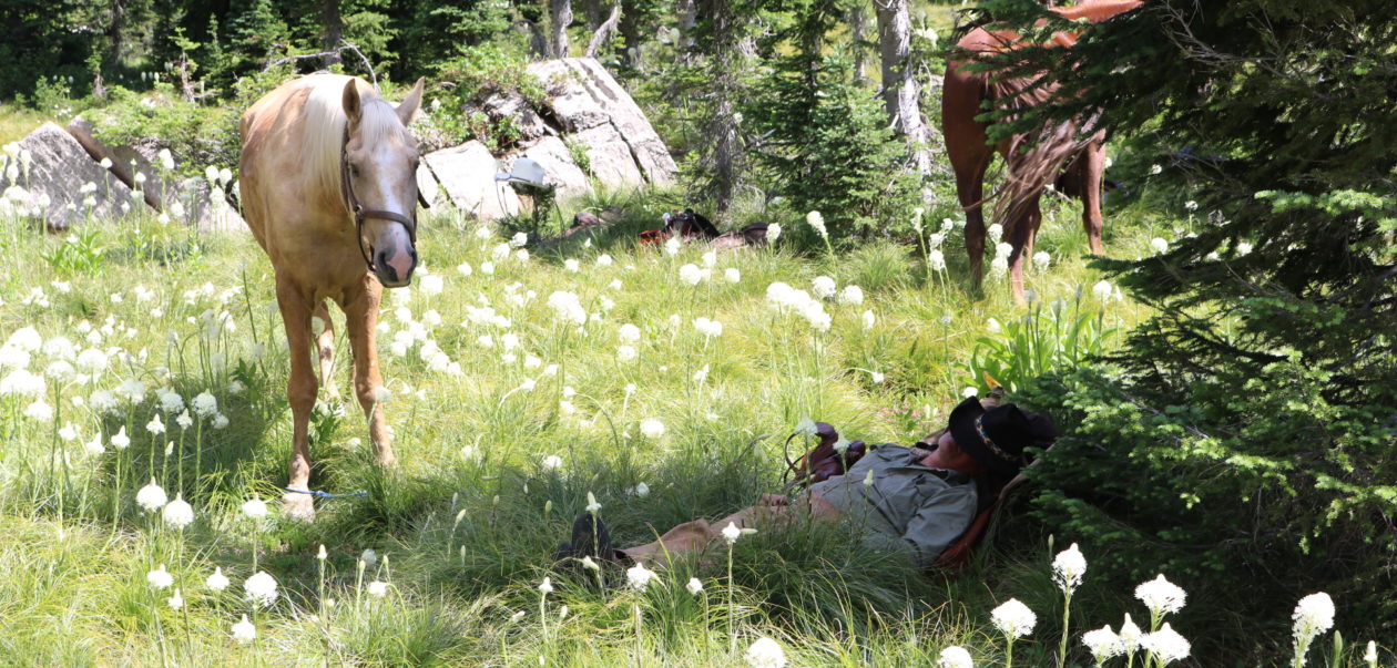


You must be logged in to post a comment.