I am blessed to live in a beautiful area that many consider a bucket list for riding their horse in. For me it’s always been just what is out the back door, and I guess, I’ve kinda taken it for granted. As I’ve met more folks from across the country and listen to their accolades for the area that I grew up in, I’ve started to develop a greater appreciation for what Utah has to offer.
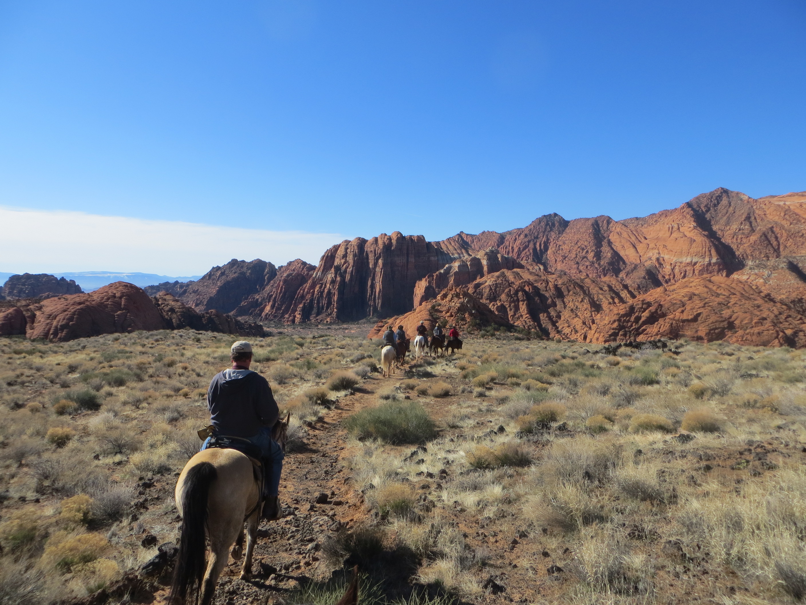
So what do people want to know about Utah. It’s the 13th largest state and the 10th least densely populated. Most of the population lives along the Wasatch Front in northern Utah. 75.2% of the state is Public Land. Meaning it is managed by the Forest Service, BLM, National Park Service or State trust lands. There are five National Parks in Utah. Most of the private land is the farm land that early settlers homesteaded in the mid 1800’s. Most of the public land is made up of land too difficult to farm. These mountains, deserts and slick rock areas offer some of the most scenic areas to ride. You are not riding in a flat corn field, but rather a narrow trail up a canyon to a mountain pass.
Utah has the highest average elevation of any of the 50 states. This offers year round riding. In the summer heat, riders just go to higher elevation trails where it’s cooler. During the winter, we join the snow birds and flock to southern and lower elevation trails where it’s warmer. Visitors coming to Utah, should pick a season that is favorable for the area they want to ride. Or choose an area that will be comfortable for the time that they will be visiting. That’s not to say you could not ride the desert areas during the summer heat or ride the mountains in the snow. You will just have to make adjustments in you clothing or schedule to be comfortable.
I often haul down to the St George area and ride in the winter months. Utah’s Dixie is usually 20° warmer than my home in Northern Utah. So in January when it’s 25° during the day and 10° for a nighttime low, I can drive 4 hours and ride in 45° daytime temps and camp in 25° night time temps or get a motel room and put the horses in a stall somewhere in the area.
In the summer when it’s 90° at home and 70° up on the mountain top, the St George area is 110°. Residents that live there, either ride early or late in the day or trailer an hour away to higher elevations in the nearby mountains. So you can ride any area of the state, regardless of the season. It’s just what your idea of a comfortable temp is.
Remember that Utah is a desert state, Utah has extremely low humidity. So when it’s 100° outside, the humidity will usually be single digit. So even hot days are tolerable if you can get into a shady area out of the direct sun.
So what do people want to know about Utah
I posted online the question. Asking what people wanted to know about bringing their horses to Utah to ride. There is no possible way any one person could visit every trail in the state. In no way do I want to present myself as the absolute authority for trail riding in Utah. But I will try to cover all the question, at least in general terms and will be more specific if I have firsthand knowledge.
I’ll answer the questions in order of how often they were asked.
1. Where are the horse camps with hook ups?
They don’t exist in Utah. Since 75% of the state is public land it is very difficult for a private land owner to develop a horse camp and charge money for camping when people can just pull off the road a half mile away and camp for free.
I’ve had people tell me they are not coming to Utah if they cannot find a camp ground with hook ups. So let me ask you. Why do you need hook ups and what hook ups are important to you? The most common answer I get to that question is folks wanting electricity to run A/C. I think once in the last 20 years did I wish I had A/C in my trailer. I frequently need heat, but almost never need A/C. This goes back to the fact that Utah has lots of mountains and folks are usually riding at much higher elevation than their home. I may want A/C in my home in the valley when it’s 90° outside, but I usually camp at higher elevations where it is much cooler. 70-75° day time temps and 45° at night usually have me carrying a spare jacket. If you choose to ride in the St George area during the 100 days of 100° plus heat, I can understand needing A/C.
Most trailers that folks are concerned about having hook ups, carry water, have black and grey water tanks and can be self sufficient for a couple of days before needing to dump holding tanks or refill fresh water. Using a generator during cooking hours provides almost all the electricity that most folks need. If they choose to cook inside their trailer vs over campfires.
Most recreation areas that are frequented by the public have dump stations in the area, also truck stops, gas stations and companies that sell RV’s and trailers also offer dump
stations where you could pull in and dump your holding tanks every few days and restock your water.
Another issue with hook ups is that most of the areas that people want to see and ride in Utah, are remote areas. Tourist are not going to haul their horse across 6 states to ride in our cities. They come to see the remote and wild part of the state. Remote areas don’t have the services that folks expect in developed areas. Who is going to pay to run a power line 32 miles down a gravel road, if the only thing at the end of the road is a trailhead, where you access a wilderness area? Don’t expect to find many campgrounds with hook ups!
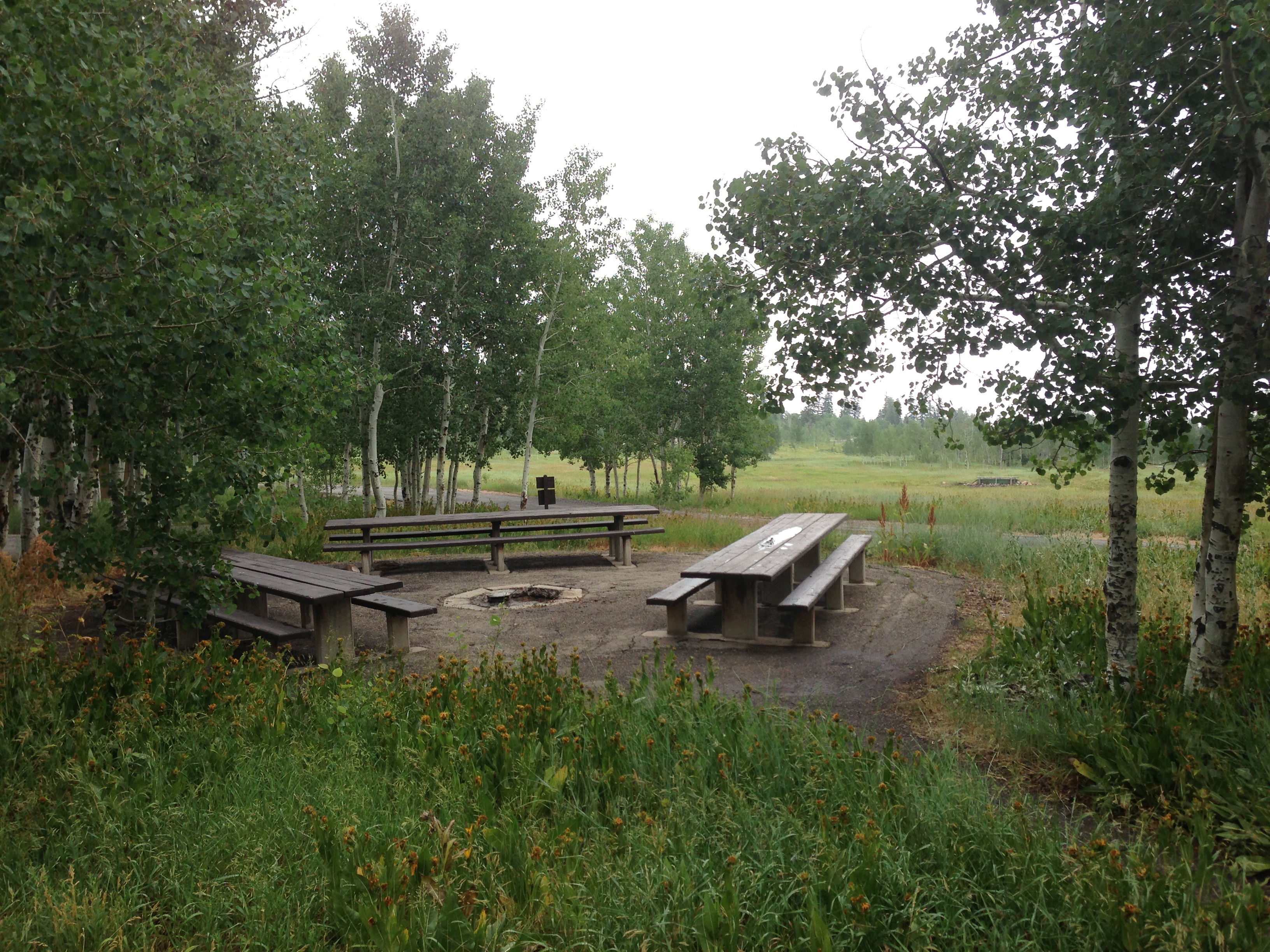
The State of Utah and the Forest Service have developed several camp grounds across the state that are designed for equestrians. These camp grounds usually offer a flat camp spot, a hitching rail or possibly a corral, a picnic table and fire ring and usually an pit toilet. None of them include any hook ups. Some of them do have water at hose bibs somewhere in the campground. But not at each camp. They are managed by the camp ground host for each and charge a small fee. Usually $12-$20 per night.
If not in use and the camp ground is busy, the host will often give the equestrian spots away to any camper. So you may want to call ahead and reserve a site. And while the host will let non-equestrians camp in the equestrian campsites, they usually will not let horses into the section of the campground designated as non-equestrian.
The five equestrian camp grounds that I know of in the state are: Pine Valley near St George Utah at 7,000 foot elevation, Coyote Hollow near Bryce Canyon at 8,200 foot elevation, Tasha Equestrian camp ground near Fish Lake at 9,000 foot elevation, Black Hawk campground on the Mt Nebo Scenic Byway near Payson Lake at 8,000 foot, and Current Creek Equestrian Camp ground near Current Creek Reservoir also around 8,000 foot. Based on the elevation at these campsites, you can see they are summer and not winter campsite. Google the above names or check with the Forest Service for more information or making reservation for each.
Each of these camp grounds have trails riding out directly from camp. Some like Pine Valley have trails from camp going up and over the mountain or you can trailer 20-60 minutes to other area trailheads for day rides, returning to your camp ground at night.
The Thunder Mountain trail head is just a few hundred yards past Coyote Hollow camp ground and Bryce Canyon National Park is just 20 minutes away in your trailer.
Tasha Equestrian Campground is located on the Old Spanish Trail that traders used between El Paso and California so technically you could ride all the way to California
or Texas if you could follow the old trail the entire distance. It also sits on part of the North/South Great Western trail that traverses from Mexico to Canada. But in general most folks stay at the campgrounds and ride the general area for several days then move on.
Blackhawk camp ground is located more or less on top of a mountain, it’s trail system circles around the campsite and top of the mountain with views off toward the valleys. The circle is intersected with trails like spokes on a wheel, you can ride as far as you want and cut back to camp at any of the intersecting trails.
Most of these campgrounds are located in the mountain areas of, they make great June thru October campsites. But other than Pine Mountain in the southern corner of the state probably not a place where you want to be in January unless you are on a snowmobile. Hitching rails at Blackhawk campground. Each campsite has several rails like these.
Trailer parking at Blackhawk
This is a group campsite at Blackawk. Individual campsite usually have one table.
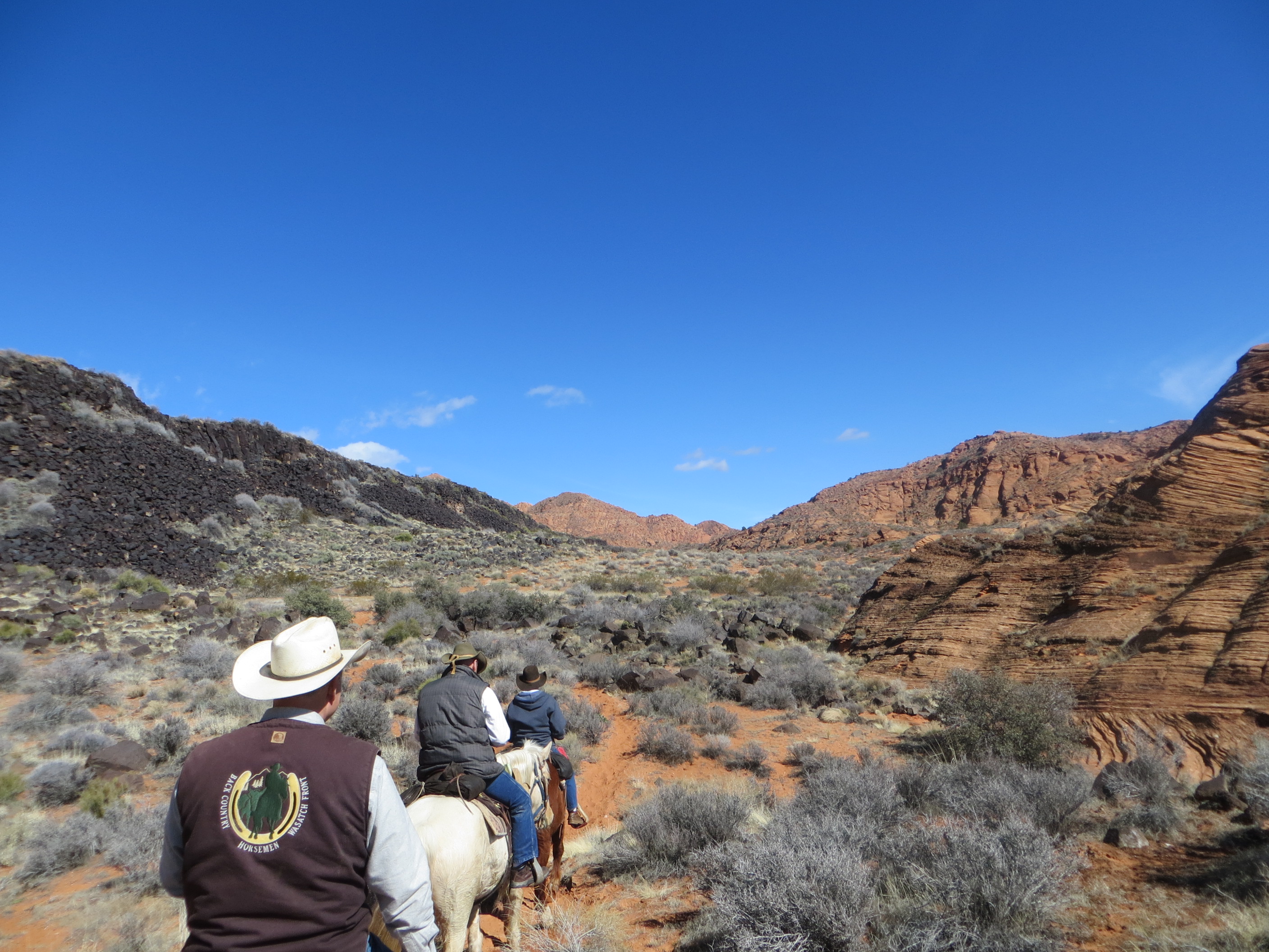
Back Country Horsemen have done a lot of work here in Utah. Each of the 13 chapters in the state have worked to maintain trails, and improve trailheads. They often build corrals or hitch rails at the trail heads. These are typically done in conjunction with the forest service or BLM to improve the trail head. Camp grounds usually have a general camping area where horses are not allowed for regular campers and a section near the corrals where horse trailers are permitted.
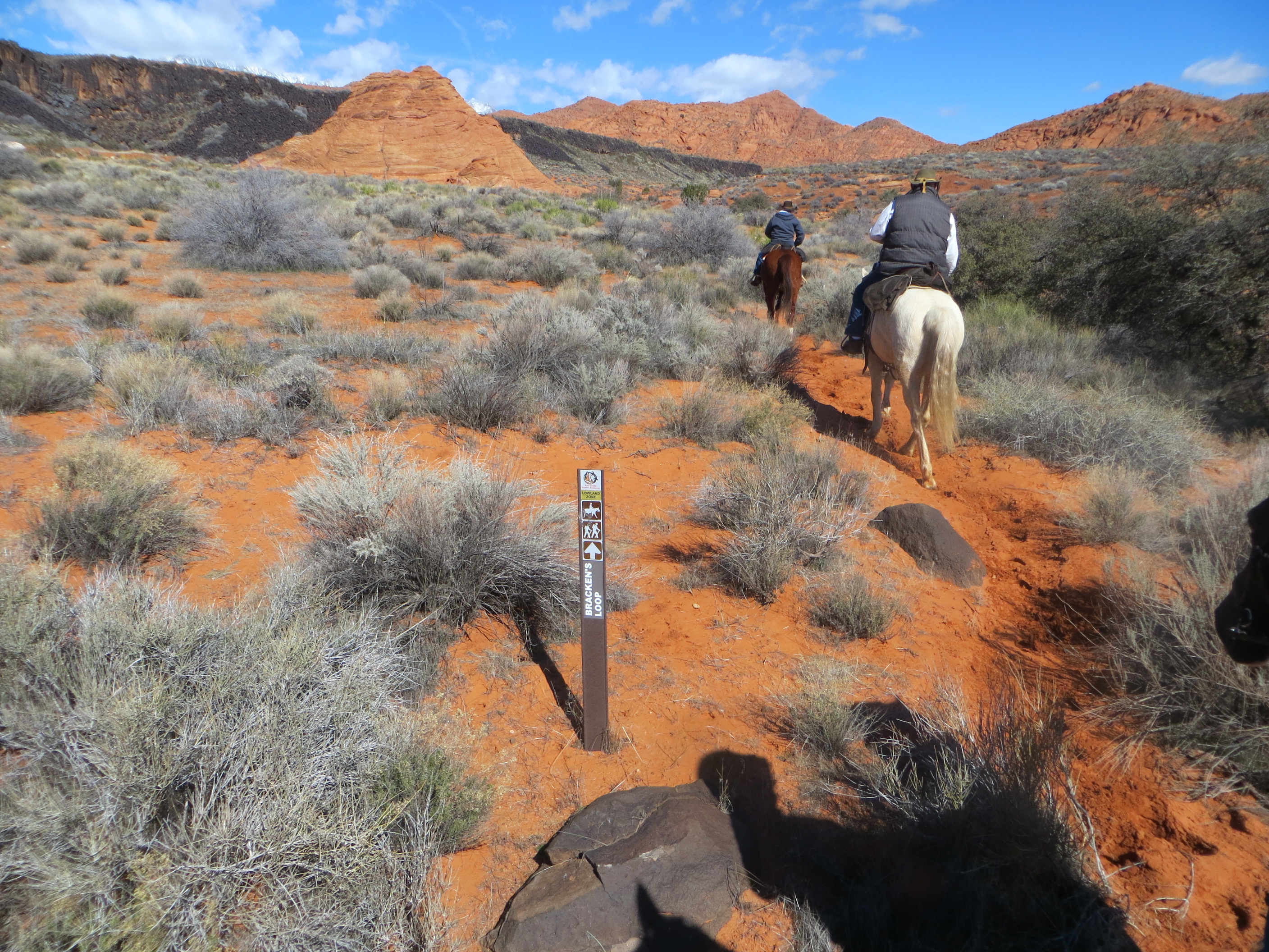
Forest Service trail heads usually have a sign in board where you can sign in what trail, how many riders and how many days you will be in the back country. Most have a large map of the area behind the glass showing where the trails go. Campground host may have smaller paper maps that you can purchase and put in your pocket. But I recommend that you download or purchase your map before heading out.
Back Country corrals at China Meadows camp ground This is a wilderness trail head. Most corrals are built in 6 wedge shaped pens. Depending on how many are available, I often double or triple up my horses so others can also have a pen for their horses. These are on a first come basis. I usually leave a bucket in the corral and paper plate on the gate while out riding claiming the corral for my campsite. Or you might come back after a ride on a busy weekend and find the corrals full.

Most of these campsites are a flat spot to park, a picnic table and a fire ring with a pit toilet nearby. Access to water will be a nearby stream. You will need to bring your own potable water for human consumption.
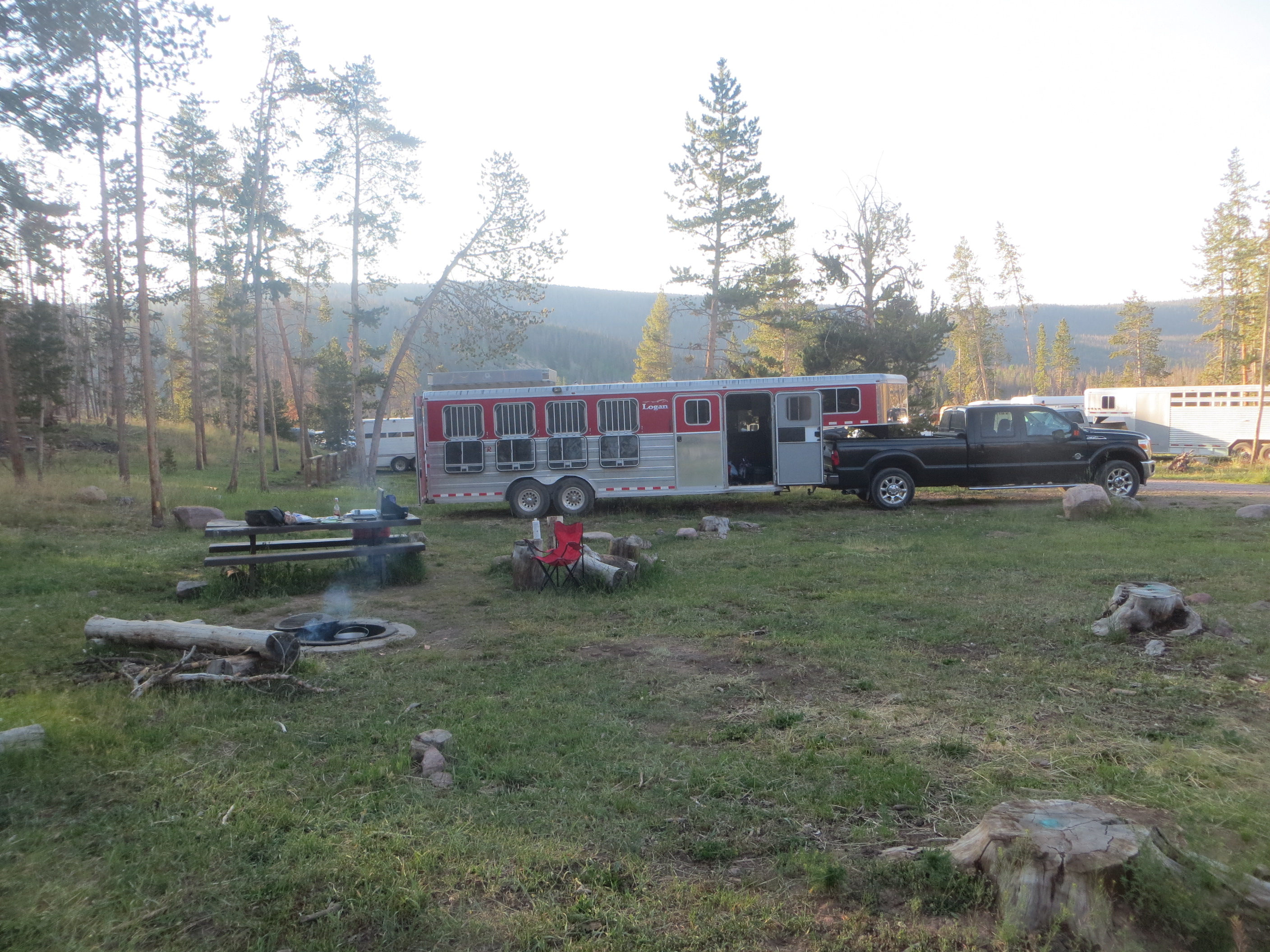
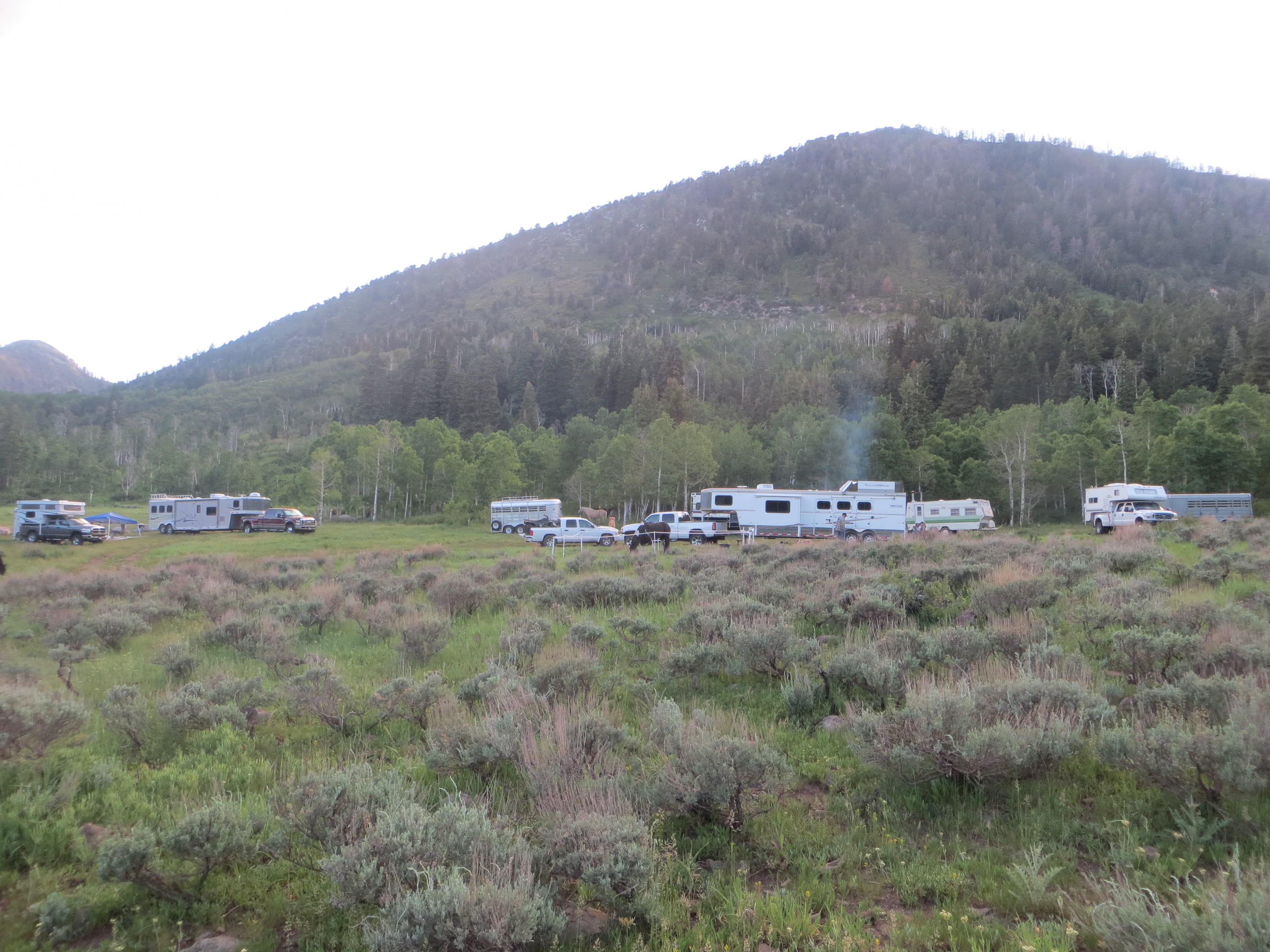
The most popular option is Utah is just dispersed primitive camping. With 75% of the state being public lands, you can almost just pull off the road any place it is flat and camp. In high use areas, the Forest Service or BLM get a little fussy about soil erosion and restrict off road use. These areas are usually marked with signs warning against leaving the road. And private land is usually fenced or being actively farmed and pretty obvious to see. Only a fool would pull into a farmer’s grain or hay field.
Primitive dispersed camping means just that. You are responsible for all your camping needs. There are no picnic tables, fire rings or pit toilets. Back Country Horsemen have built a few corrals at favorite primitive camp sites. Also in Utah cattle grazing is a big deal. Ranchers under Forest Service supervision have built corrals at locations where they collect cattle that might be grazing on the grazing permits. These corals are reserved for first use by the ranchers. The ranchers build and maintain the corrals at their expense. But most ranchers are willing to share their corrals if they are not in use with the cows or sheep. But I’m always prepared to pull my horses out if a rancher pulls up and says he needs the corral.
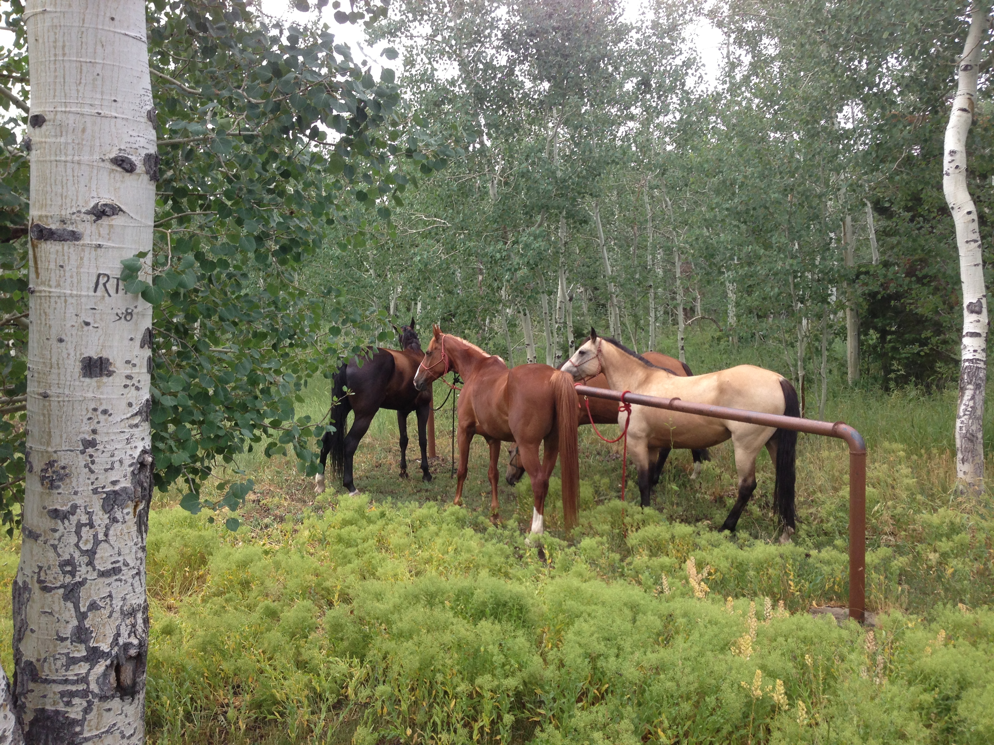
We usually just find a flat spot and setup a highline in the trees or some hot wire.
Often times there is enough grass that I can just turn my horse loose and let him graze.

Desert camps often have no trees and require tying to the trailer over night or some kind of highline between trailers or hot wire corrals. I’m not as worried about using hot wire in the desert as I am in the alpine areas of the state. Too often I’ve had deer/elk moose run through alpine camps and knock down hot wires because they don’t know what they are. But that kind of wild life is much rarer to see in the desert areas of the state. But you do need to beware of mustang trying to steal your mares if they are in season. Mustangs are primarily found in the desert areas of the state.
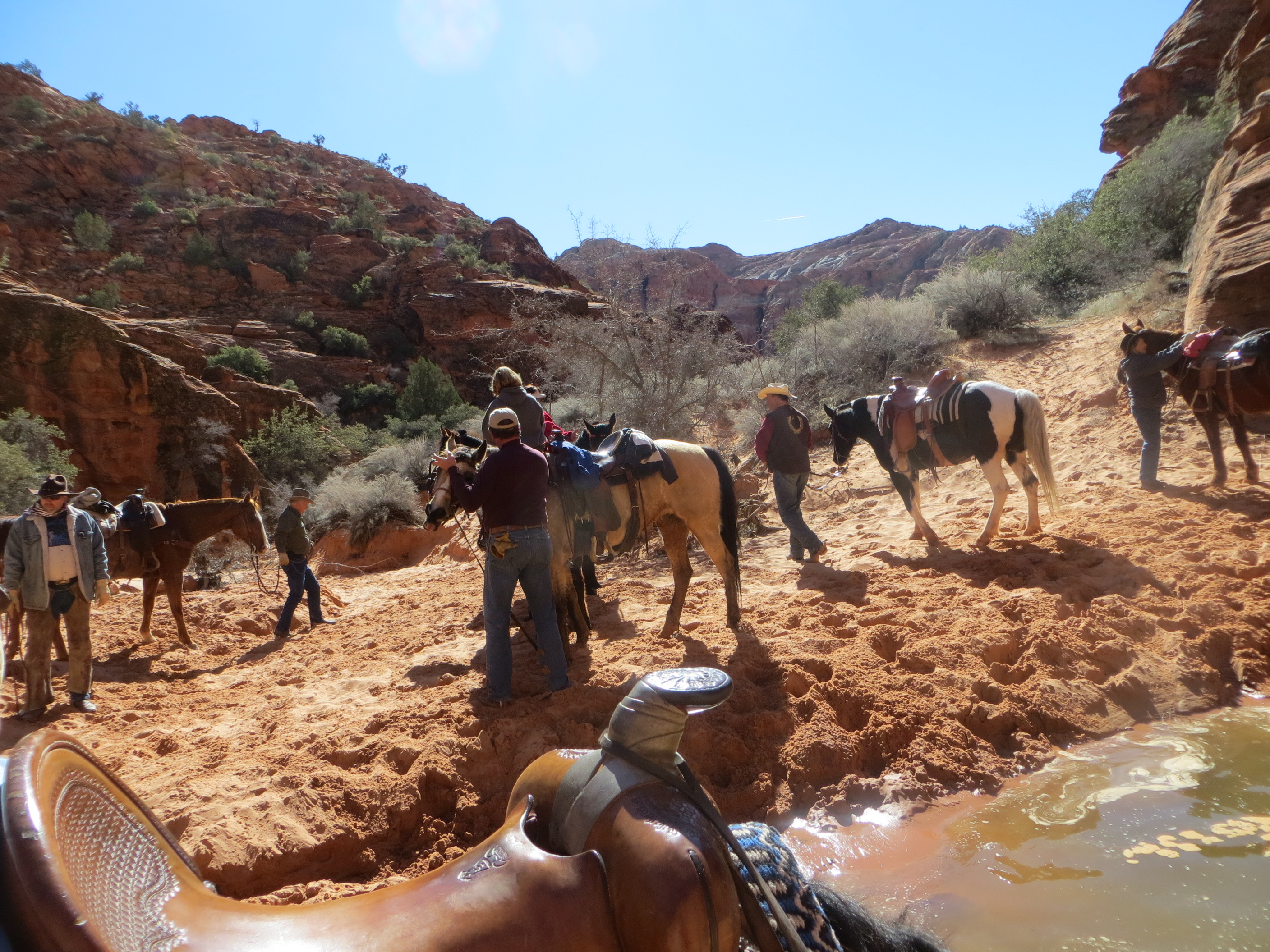
Most of the alpine trail heads have water in the area, and you will probably cross streams during the day for the horses to drink. But desert campsites are often dry. If there is a small spring, it is supplying the local wildlife with water and I need to be considerate of their needs. So I usually haul water in for at least what the horses will drink in camp. We can often find small seeps, bathtubs or large tanks of water along the trail during the day for the horses to drink from. And I typically don’t ride the desert areas during the heat of the summer, so the amount of water the horses need is less during the cold weather months.
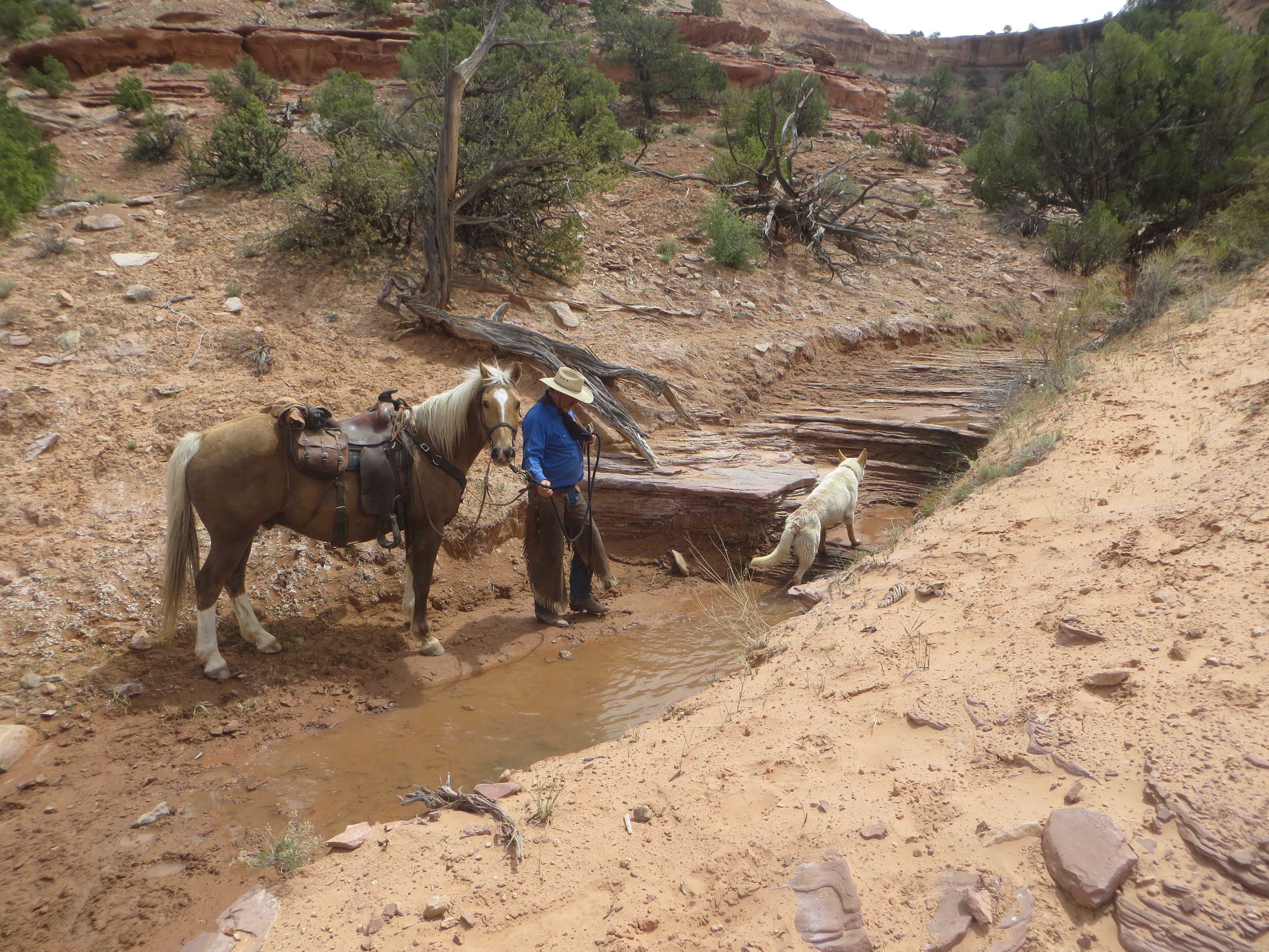
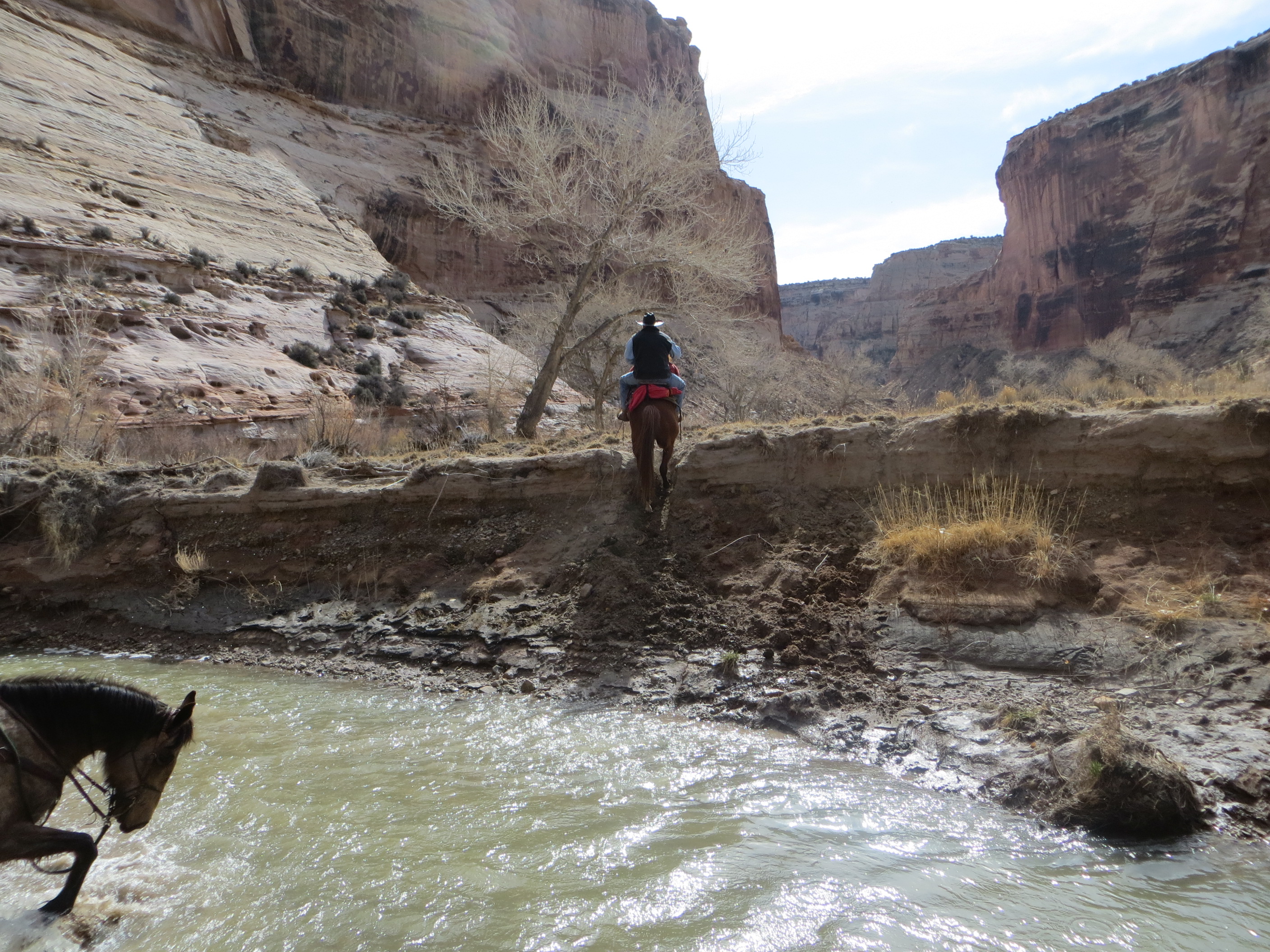
A small spring where we watered the horses and dogs in Robbers Roost in the San Rafael Swell. This was about 10 miles into the ride and the first water we had encountered. So we took time to make sure that everybody’s horse drank.
There are a few dude ranches that will allow you to bring your own horses and stay. But most prefer you rent their horses and avoid the risk of a sick horse coming on their property and risking their livelihood by getting all of their horses sick.
My last bit of advice about camping is this: Don’t plan on staying in the same camp for two weeks and not moving. Utah is a large state and most folks bucket list contains trails from the extremes of the state, You will need to move every couple of days in order to see more than one bucket list trail.
2. What time of year should I come?
The second most common question I get asked. I personally ride my horses year round. In the winter, if I have to ride in Northern Utah, I bundle up in layers and go out and enjoy a day with the horses. If opportunity allows me to, I’ll load up and haul my horses four hours to Southern Utah and spend a weekend. This usually gets me out of the snow, frozen ground and cold temps.
My question to you as a tourist coming to Utah is, What do you want to see? Are you flexible in your scheduling or are the days of your visit fixed? Just how much risk are you willing to accept that weather may mess up your trip?
If you want to see the Aspens in their fall color. Then you need to come in late September or early October. If you want to ride or hike the narrow slot canyons, you don’t want to be in them during the Monsoon season and risk a flash flood. So avoid late July and August. If you are concerned about sleeping without A/C in your trailer in the summer, Don’t spend the night in the desert, but rather choose your camp site at higher elevation where the mountain air is cooler.
My personal schedule starts with trips to St George area in Southern Utah ( elevation 2,500 foot) in late February. I start going down into the San Rafael Swell area ( elevation 4,500-5,500 foot) in March and April. During May I usually make a trip down into the Bryce Canyon area. The rim of Bryce Canyon is at 8,000 foot and a May ride there may be 80° or 35° depending on the weekend weather that blows in. Any earlier in the year and I run the risk of the trails being closed for snow or mud. I usually want to ride in Bryce in May, because in June I start getting back into the high country of Northern Utah. June thru October, I spend riding in the higher alpine forest of Northern Utah. And I usually try to get November ride back south to Zion National park before the holiday season sets in and my schedule gets busy with holiday parties.
Do folks have wonderful rides in the Bryce Canyon are in March or April. Yes, But they also could be snowed under depending on the weather pattern. There is a huge difference in elevation in the trails around Bryce Canyon. Most folks who travel to Bryce want to ride in the park one day. That trail starts at 8,000. They usually also want to ride Casto and Losee canyons that are nearby. But they are at 6,000 foot. Willis Canyon is also nearby in the Grand Staircase Escalante and is 5,500 foot elevation. Each elevation will have a different temperature. So dress in layers and enjoy.
Another consideration is Southern Utah can be very windy. Most of the famous rock formation of Southern Utah were formed by the wind. Spring time in Southern Utah can be extremely windy. If we get caught on a camping trip with winds, we adjust our agenda are ride more down in the lower canyons where we can get out of the wind vs riding trails on ridge tops or open spaces.
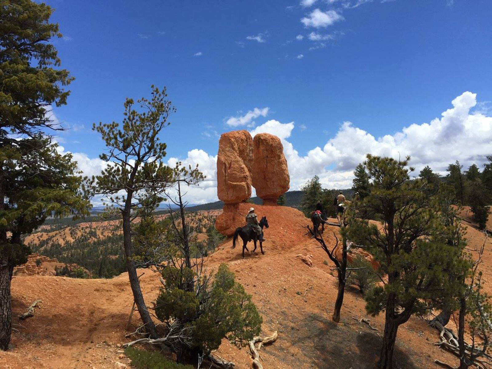
This photo is from riding the Grand View trail near Bryce Canyon on May 24th
The next day we rode Thunder Mountain and had a beautiful ride in the sun shine
My suggestion on when to come are.
Bryce Canyon May thru October
Zions National Park October thru April (exclude December and January ) You can ride in Zion in the summer months, but would need to ride early or late to beat the heat.
San Rafael Swell is great in March-April and again in October November.
Alpine forest areas of the state above 8,000 foot. mid June to late October.
Wild flowers in the Alpine forest will peak in July
Quaken Aspen will peak in their fall colors the 20th of September and be gone by about the 10th of October.
Buffalo Round up on Antelope Island is usually the last weekend of October.
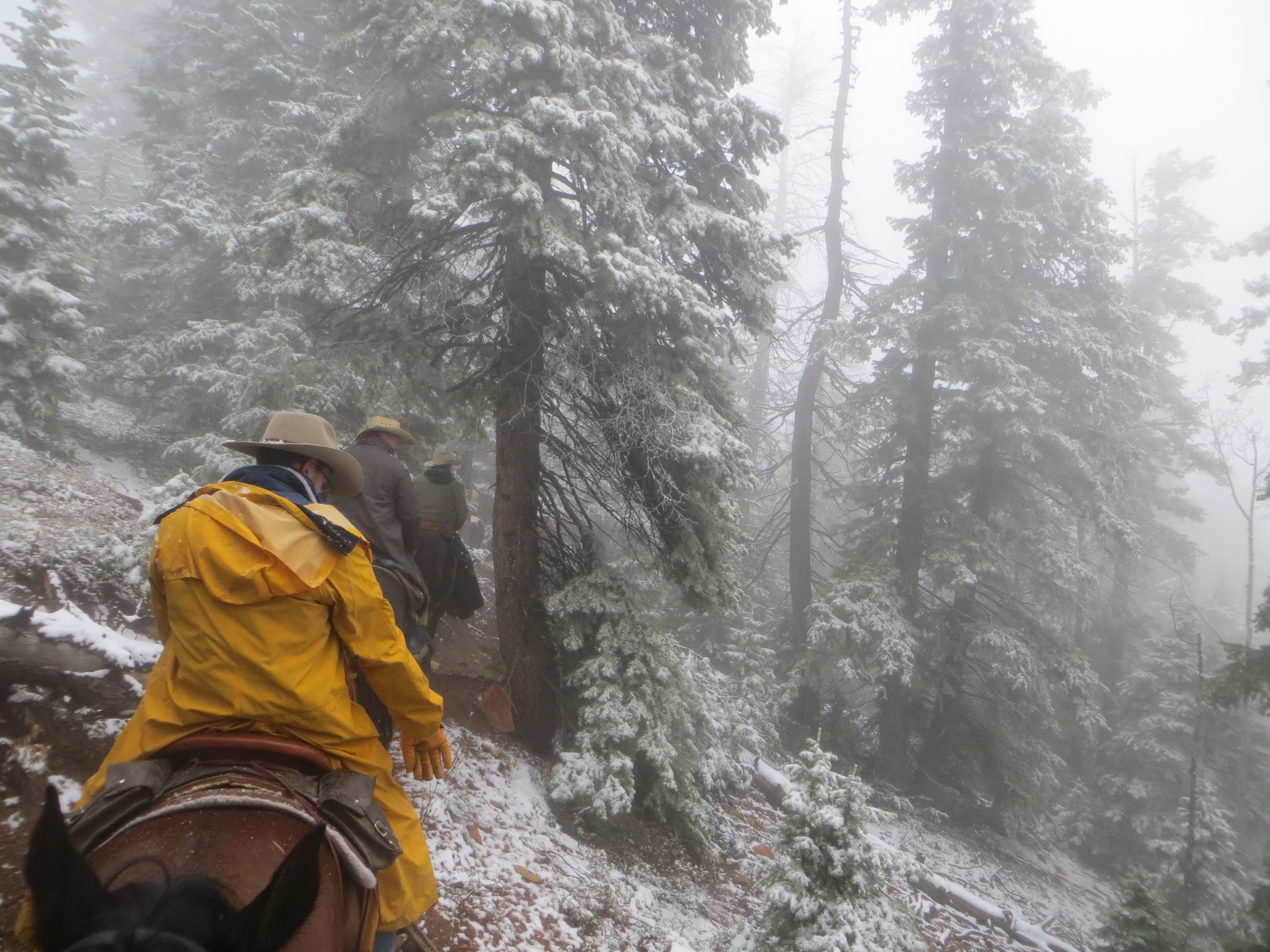
I’ve ridden in and set up my tent on Labor Day weekend in 8” of snow when camping above 10,000 foot. I’ve been hot and sweaty in late October. So be prepared for both extremes.
One last point. Utah’s fall hunting season begins with bow hunting in mid August, Limited Entry rifle trophy hunts usually start mid September, with general season rifle hunts in October. I’m a hunter and I usually spend most of October on the mountain with my horses. I’ve never been concerned about being on the mountain during hunting season. It’s not like some eastern states where hunting season is a crazy time to be out. October in particular for general hunting season you will find almost every flat spot to camp occupied. If that bothers you, then choose to ride places in October that don’t attract hunters. All national and state parks are closed to hunting. Most big game (Deer and Elk) are found in alpine settings, so desert rides will see very few hunters. If you choose to ride alpine areas where there are lots of hunters in October, Put on a bright orange sweatshirt.
3. Where to camp and how to find trails
My 3rd most asked question, dealt with where to camp and ride. I can in no way tell you all the places to camp or ride. The list would a mile long. But let me give you several suggestions.
1st, Janet Carver runs a facebook page called “Southern Utah Trail Riders” she keeps a list of trails and directions to access those trails and often gps tracks on her page. Check under the Files tab.
2nd Utah Back Country Horsemen have a website. BCHU.com On the left side under links scroll down to “Utah Horse Trails”. They list trails for each of the 13 chapters in the state. They give directions to the trail, how difficult the trail is and often where to board your horses in the area.
3rd. Judy keeps an excellent blog of trails she and her husband have ridden in Utah and surrounding states. Her blog usually has photos of the area, directions to the trail head and a gps track of the trail. Find her at http://dreampackertrail.blogspot.com/
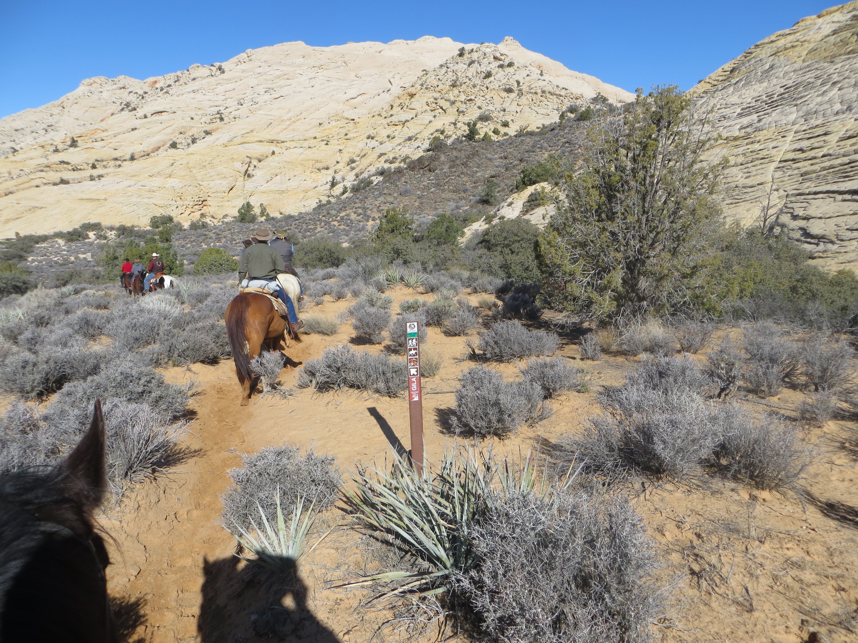
In general, most trails in Utah are not marked. You may find an area map at Forest Service trail head and see a few blazes on trees along Forest Service trail. There is very, if any marks along trails on BLM land. The more heavily used trails, will be well defined and easy to follow. But you should carry a map to help orient yourself.
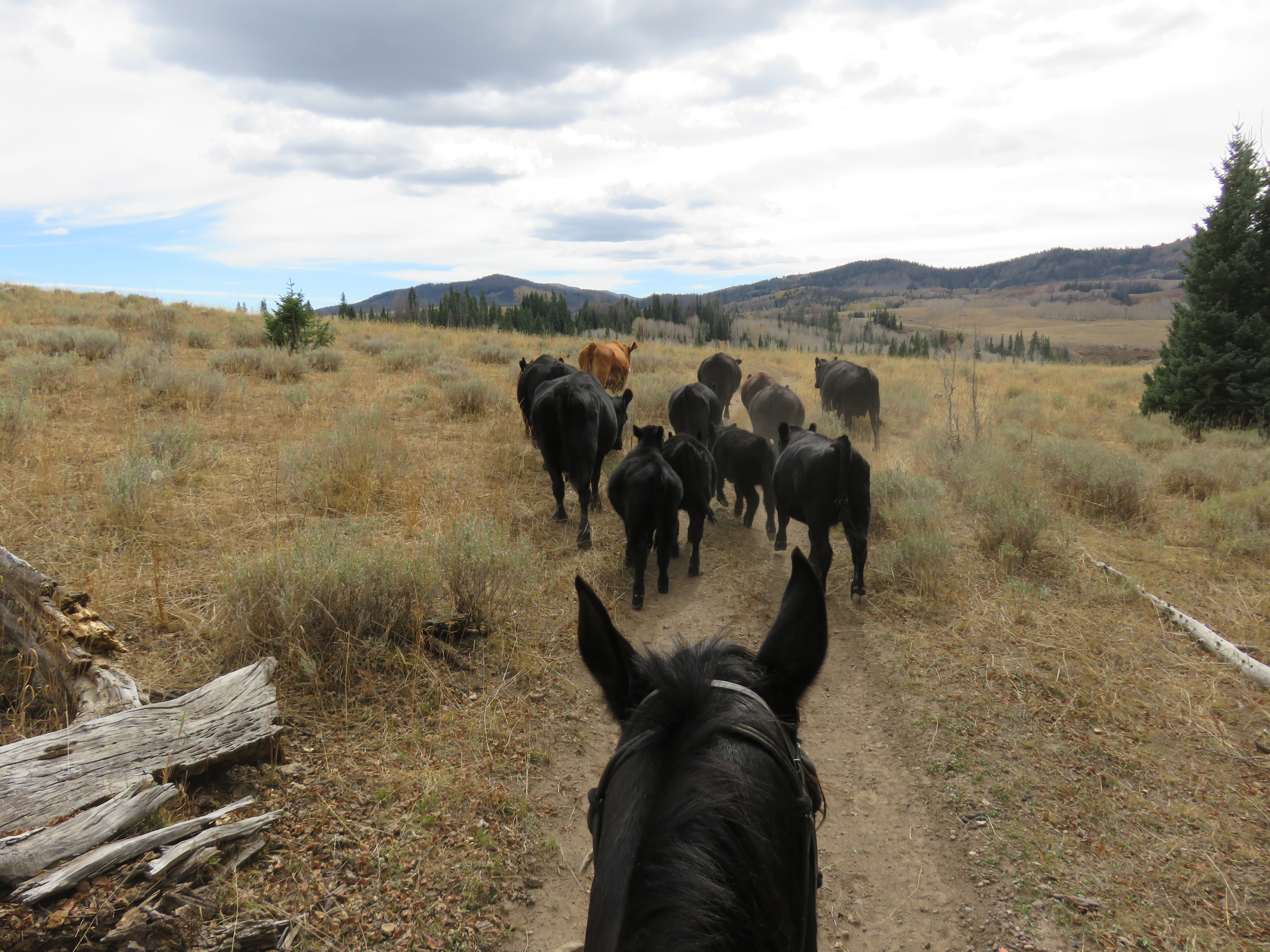
Grazing is an important part of range management in Utah. Both sheep and cattle ranchers bring their herds to the mountains for the summer grazing and often to the desert areas for winter grazing. I can’t tell you how many trail rides I’ve been on where we just followed the cow trails. Cattle have a tendency to graze up the mountain and then when thirsty, return to water in the bottom of canyons or drainages. Their trails wander and are not direct routes. But if you question how to get back down off a mountain, you can always follow the cow trails.
Utah has a lot of big game on the mountains. Deer usually spend the summer months in singles or small groups of 2-3 animals So their trails are fainter. Elk usually stay in herds. In the winter they may have 200-300 members in their herd. In the summer the bulls drift off and form smaller bachelor herds. While the cows with their young calves will stay together in larger groups. It’s not uncommon to come across 50 to 100 cow elk and calves in the summer. Their trails between water and feed will be more defined than the deer trails.
Human trails usually follow the drainages. They go from a trail head following up a river to a destination at a lake. Official trails are usually cleared of blow down timber. Cow trails usually wander between the best grass and daily water and skirt around natural obstacles like down trees. Game trails just wander all over the mountains as the animals wander.
Maps you purchase from book stores, sporting goods stores, or online usually are based on surveys from the 1970’s and may reflect old trails that no longer exist. If you are riding in popular areas, the maps will be close to what you will find along the trail. But if you are off the beaten path, the maps will be best used to evaluate the topology of the land. Helping you avoid cliffs and ledges.
At some camp areas, for example on the Paunsaugunt Plateau near Bryce Canyon, you could ride in any direction. Just wander on your horse for the day. But most visitors want to follow a specific trail and get to see the view off the Grand View trail or Thunder Mountain vs just wandering around the plateau following cow trails.
Following cow trails on the Paunsaugunt.
I personally kinda of avoid the favored trails. First off, I’ve ridden most of them before and am looking for new experiences. Second the more popular trails will have more people on them and I’m often looking to get away from the crowds. The more popular trails usually have better trail maintenance and are on a more gentle or family suitable type of direction. I’ve been riding long enough, I enjoy a little more challenging trail. Some of you flatlanders, will find some of the trails I ride more than you are comfortable with.
4. Camping on Public Lands
Another frequent question is camping on public land. Each management group will have their rules. Forest Service and BLM both will restrict off road use if they deem soil erosion might be a problem. Certain areas may be closed during wet or muddy season. But generally if the surface area is durable, you camp more than 200 feet away from water, you can camp just about anywhere you want. Since you are not the first person to cross Utah, you will probably see areas where somebody else camped the week before. Grass flattened, existing fire rings, or other signs of previous campers. Be a good steward of the land and leave it cleaner than you found it. Don’t leave garbage. I hate it when people pull and build a second or 3rd fire ring. Now you have rings of rocks and ashes here there and everywhere. Just use the existing fire ring or better yet, remove any signs that you had a fire when you leave. No Trace Camping is here to stay.
All public lands require Certified Weed Free Feed. Since Utah is 75% public lands, that means just about any place you ride will require you to use Certified Hay. In fact the rules say you are supposed to feed certified hay for 3 days prior to traveling on public lands. There is no way a ranger can check to see what you have been feeding other than asking you. It’s easy to say, Sure I’ve been feeding certified feed. The rule is in place to prevent invasive weeds from spreading across the west. You might be willing to fight weeds in your pasture, but it’s cost prohibitive to try and kills weeds on the mountain.
Certified hay is available at most feed stores in Utah. The problem is that most farmers who get their hay certified in Utah, grow and certify Alfalfa hay. The certification process involves a department of ag inspector coming out and looking at a field of hay before it is cut. If there is no signs of weeds or plants going to seed, the inspector will approve the cut and the farmer will report back that he baled “X” number of bales of hay and the state will provide him with “X” number of tags for his bales of hay. Round Up Ready Alfalfa has made this much easier for the hay growers. They spray their alfalfa to kill off anything but the alfalfa and as long as the alfalfa is cut pre-bloom, there is no chance of seeds in the bales. My horses do fine on the occasional alfalfa.
If your horses don’t, then do some research on other feed types. Most pelletized feeds are considered weed free, since the process of grinding the forage, heating and extruding pellets is deemed sufficient to kill most seeds. Hay Cubes are not considered Weed Free unless they are processed from certified hay. IFA is an established feed store across the state and CAL Ranch and Tractor Supply are both expanding into the state. Also the Utah State Department of Ag usually keeps a list of hay growers that they have worked with in past years on their website. Google it and see if any of the growers on the list close to your route still have hay for sale.
5. Activities for my Non-Horsey family members
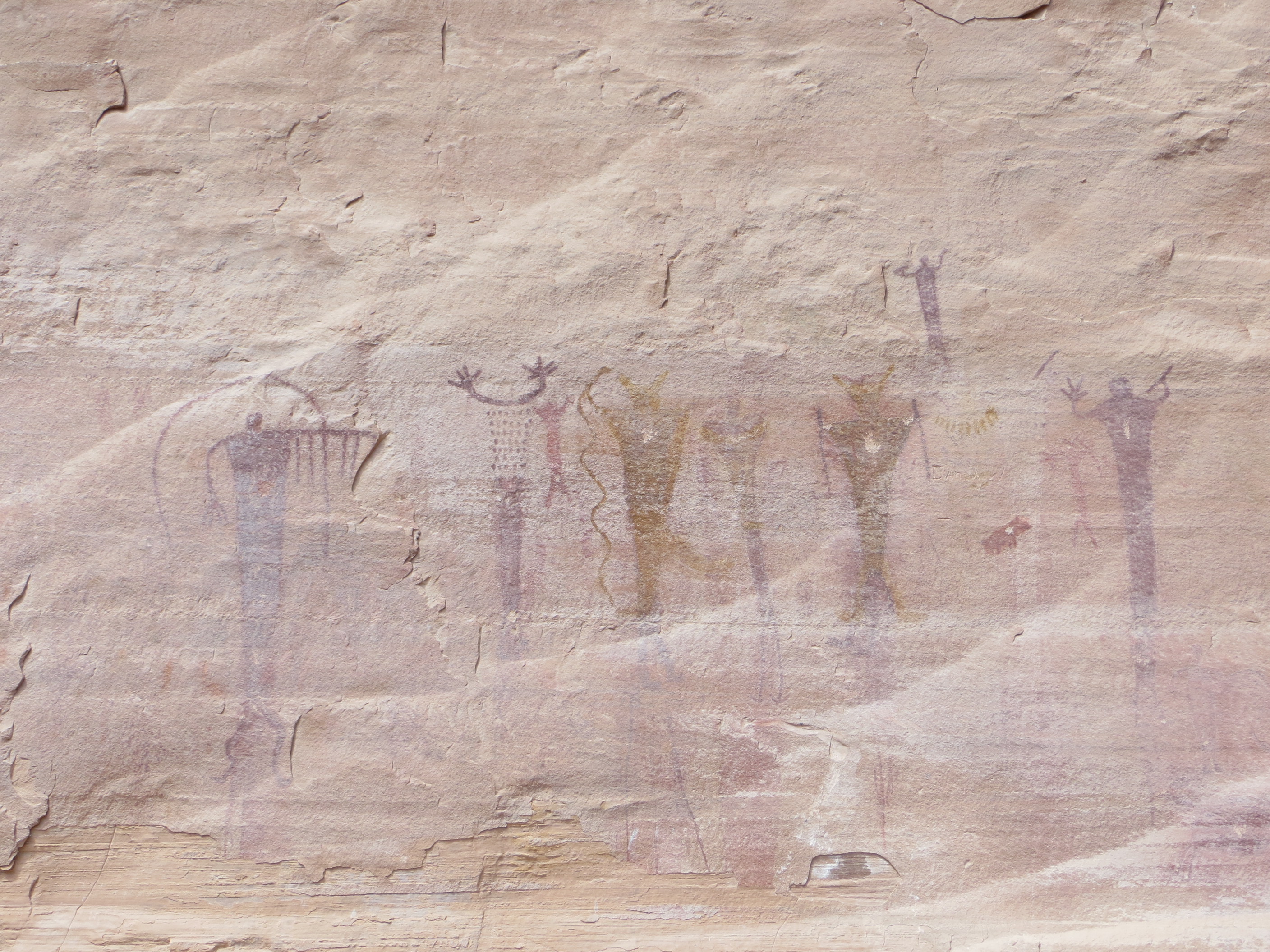
Utah is well known for it’s outdoor activities. If you have a spouse orkids coming with you on the trip and they don’t ride horses, there is lots of activities for them to enjoy. Utah’s higher elevation waters are primarily trout fishing. While the desert and warmer water lakes and streams are developing into bass or panfish fisheries. Hiking, rock climbing, mountain biking are often seen in the same areas as horse trails. Indian Pictographs and ancient ruins can be found across the state and many areas have historical museums that display the artifacts.
A large portion of the Great Western Trail through Utah is designated as multi-use and frequented by ATVs and Motorcycles as well as horses, hikers and mountain bikers. The area around Moab is famous for it’s Jeep safaris and is a playground off road type of vehicles. Both the Colorado and Green rivers offer some of the best white water rafting in the country.
Utah has lots of horses and has activities around almost any kind of horse sport. Rodeos, cutting, barrel racing can be found at almost all the county fairgrounds across the state.
The Park City area in Northern Utah has lots of summer activities at the ski resorts. Alpine slides, zip lines, mountain biking etc.
6. How long are the rides?
This will really vary depending on the trail and how fast your horse walks out. Any of the trails that are In and out, You could turn around at any point you desire and start the return leg. Loop trails will depend on the length of the trail and your horses speed. Just to list a couple.
Bryce Canyon Peek-a-boo trail takes 3-4 hours.
Red Canyon Thunder Mountain Trail is about 7 miles long but unless you have somebody pick you up at the opposite end, it becomes an in-n-out trail. So depends on where you turn around. Losee-Casto loop is about 9 miles around and takes 3 -4 hours.
Lees Pass to Kolob Arch or Hop Valley to Kolob arch in Zion National Park is 7 miles each way. So if you go all the way in to the Arch, it’s a 14 mile round trip which will take 5-6 hours.
China Meadows into Red Castle is about 11 miles in, So the 22 mile round trips usually takes about 8 hours.
7. Where to stay without a LQ If you don’t want to camp.
There are numerous county fairground across the state. All offer box stalls on a nightly basis. A listing of most can be found at: http://www.allhorseutah.com/utaharenas.php
In addition to arenas and stalls for your horses, each of these is located in a city where motel rooms can be rented.
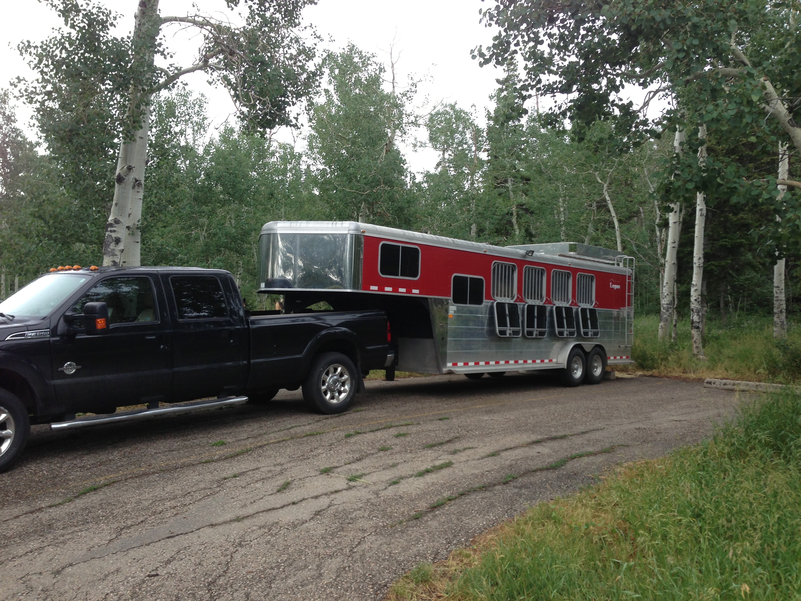
8. Will my Living Quarter trailer fit?
This question is real hard to answer. It needs to be addressed on a per site basis. I have a 4H GN trailer that is 25’ on the floor and I get into most every place. But much longer than that and you would need to be careful about what’s at the end of the road. Since I can’t even start to list all the trail heads in the state, there is just no way I answer this. I’d be happy to answer it on an individual basis, if I have firsthand knowledge of the trail head you intend to visit. Places like Strawberry, the Paunsaugunt Plateau, the Aquarius Plateau are easier. Most of these places either have logging trucks working in the area or ranchers moving cattle in large cattle hauling trucks. My assumption is that if you can get a semi into a corral to load cattle, you can get most LQ trailers in.


 This is in Casto Canyon
 This is on the Thunder Mountain Trail that starts in Lower Red Canyon and ends up in Coyote Hollow.

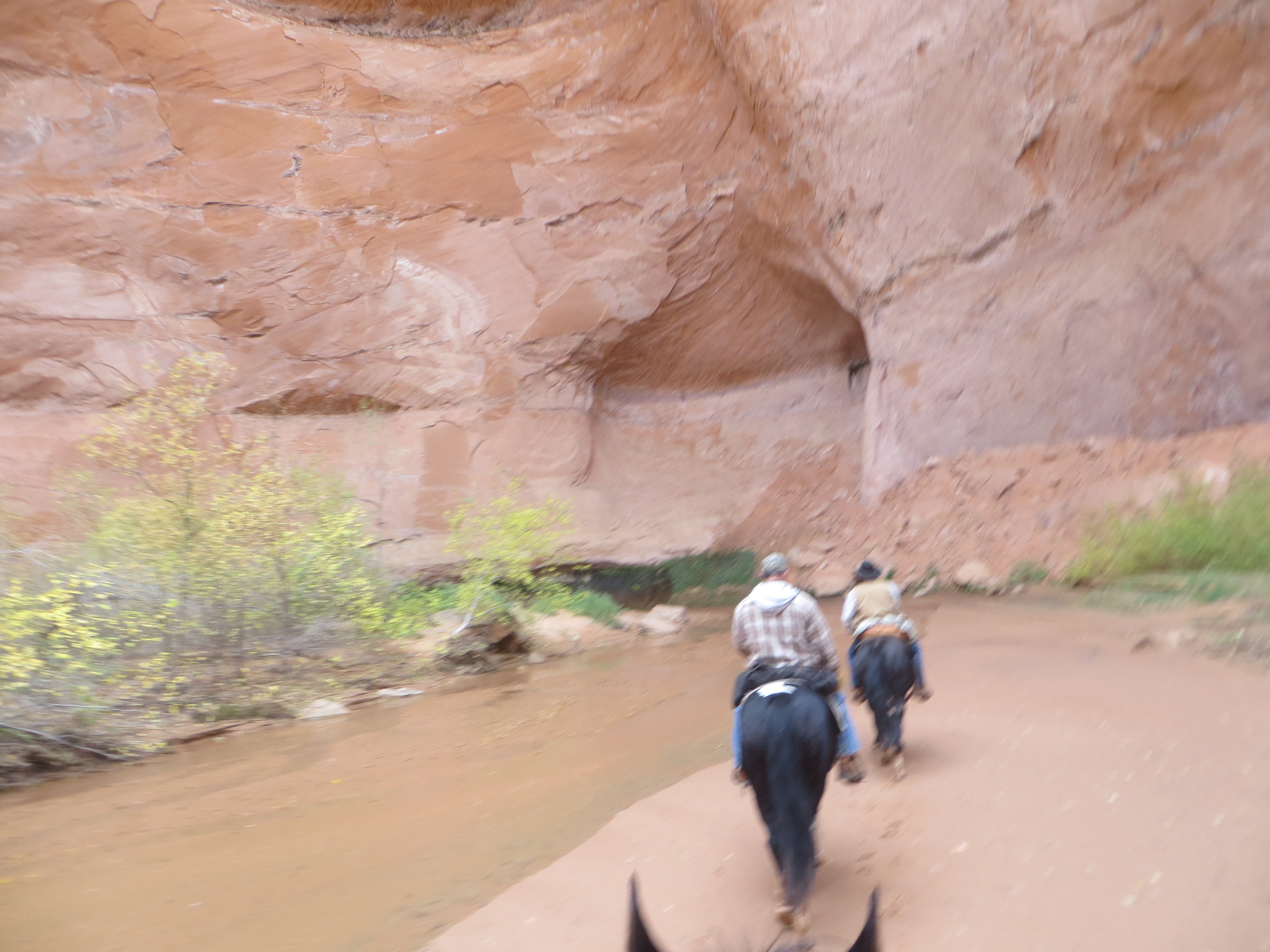
 This is entering into Sheep Creek over in the Grand Staircase Escalante.
 A little farther down Sheep Creek
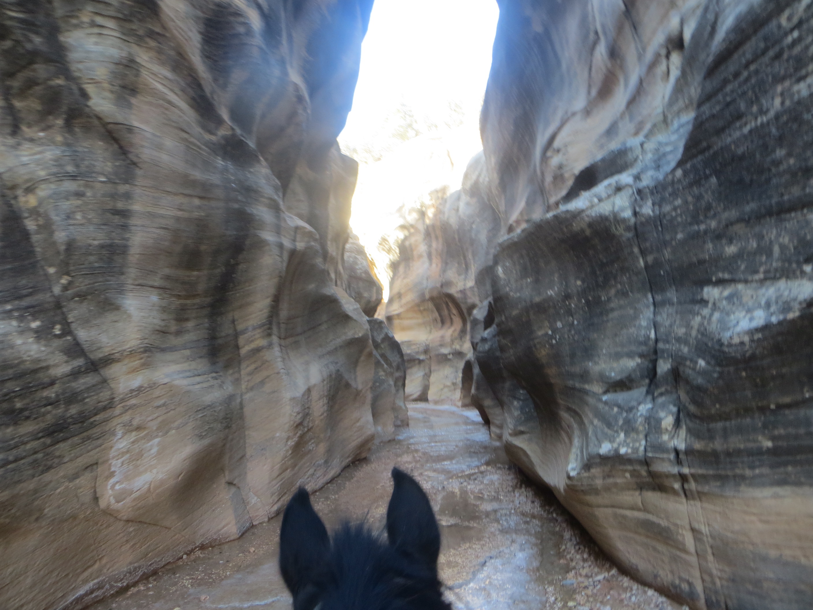
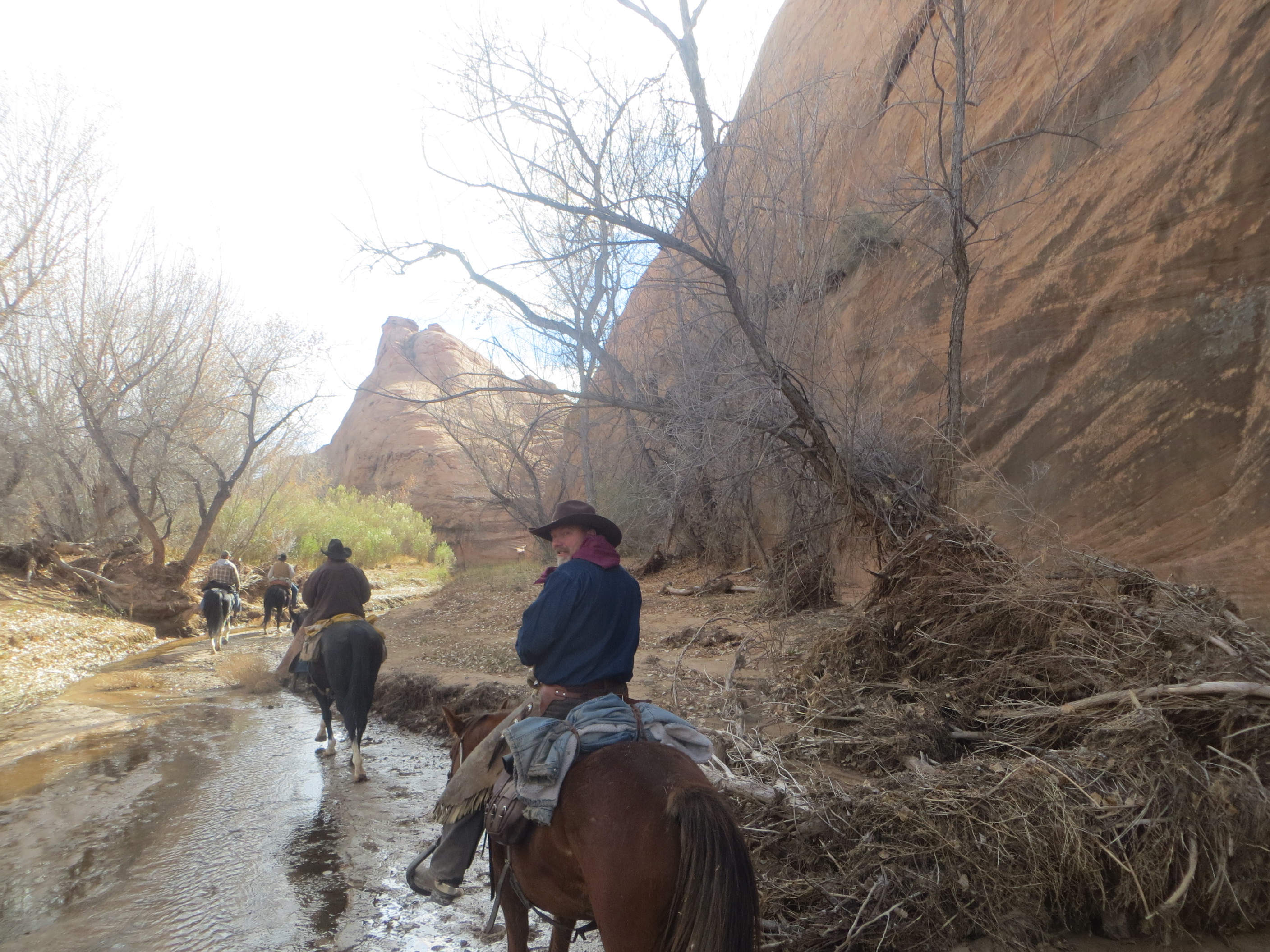
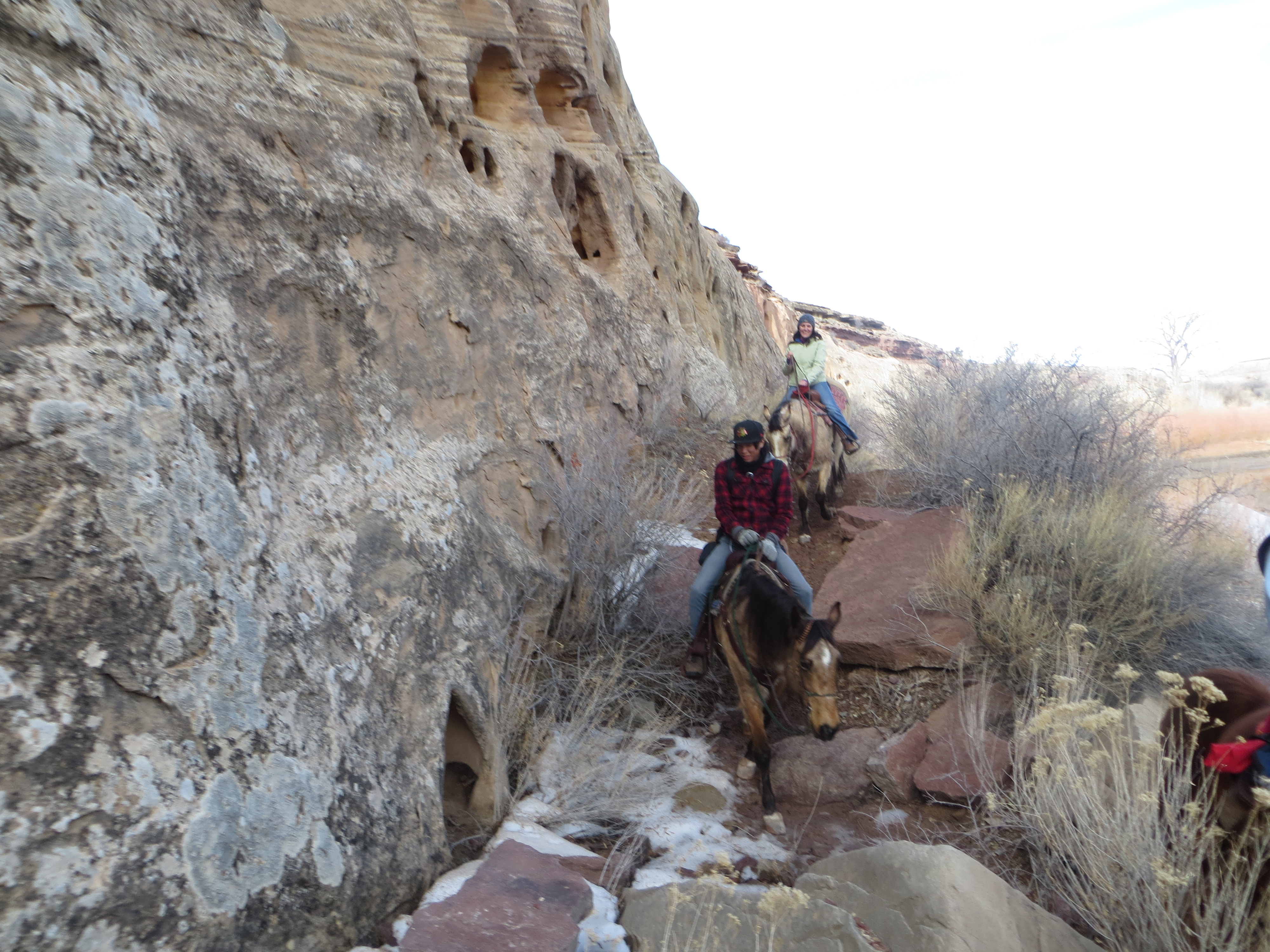
 The canyon walls will close in and you will enter some narrow slots.


You must be logged in to post a comment.