Category Archives: Great Western Trail

Blog posts regarding my planning and preparations for my Mexico to Canada horse pack trip

Riding the Superstitions

For many years I have wanted to ride some of the trails in the Superstition Mountains, near Phoenix, Arizona. Being an Arizona boy myself (currently living in Utah) I am very familiar with the area and the legends of the Lost Dutchman Gold Mine, from which an entire tourism industry arose in the area known as Apache Junction.

As the legends go, way back in the late 1800s a fellow came into town with a sack of gold to deposit in a bank, but he would never tell anyone where he got it. Eventually he died and nobody ever knew where his mine was located, except that he was believed to have been mining in the mountains now known as the Superstitions. Since then, that small, but very rough mountain range has been scoured by treasure hunters to the degree that it eventually became a favorite hiking area that sees very high foot traffic throughout the year.

Being a lover of difficult and challenging trails, I have long wished for an opportunity to ride in the Superstitions. Last week (the weekend of December 29-31, 2022) I finally got my chance. My good friend and riding buddy, Derek Habel, was looking at buying a horse in the Apache Junction area. He decided that he needed to combine a trip to look at that horse with a ride or two in Arizona, where the weather was much warmer and more hospitable than here at home in Utah. So, he called me and tossed out the idea of us heading south for a few days, combining a short visit to my parents in Eagar, AZ with a trip to the valley to check out that horse he was looking at. I, of course, jumped at the chance!

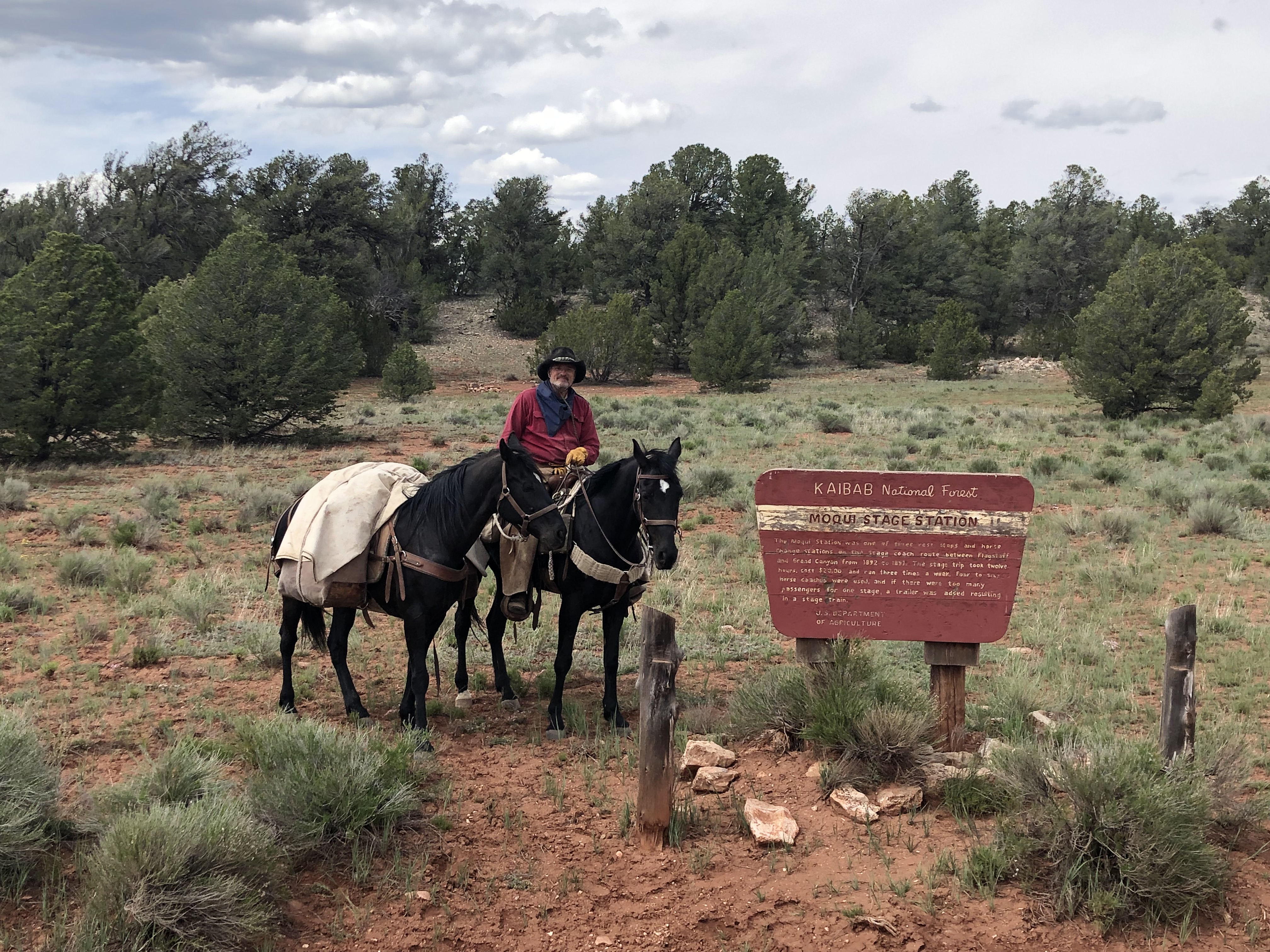
We decided to take a couple of Derek’s horses, as they are trail novices and need some work to make them good trail horses. Big John is a 12 year old Missouri Fox Trotter gelding, standing about 15-3HH, weighing in at around 1200 lbs. That’s the horse you’ll see me riding. Powder is a 6 year old (I think) registered MFT gelding, standing about 15-2HH and about 1000 lbs or so. Derek rode him. Both these horses are well saddle broke and have calm dispositions, but lack a little in good bridle and trail training.

HINT: click on photos for large version

We departed the Spanish Fork, Utah area on Wednesday, December 28 amid a serious snow storm and headed for Arizona. We drove nearly 8 hours through snow, sleet, ice, fog, and rain, finally breaking out into better weather for the last three hours to my folks’ place in Eagar, AZ.

We spent one night there, then headed the following morning toward Apache Junction, which is a suburb of Phoenix, Arizona. I love that drive! It had been more than 30 years since I had driven it and I thoroughly enjoyed describing all my memories to Derek as we passed through Show Low, then the Salt River Canyon, Globe-Miami area, and down Devil’s Canyon, through Superior and on into the Valley of the Sun, by which the Phoenix area is sometimes known. Dangit! Amid all the talking, we forgot to get any photos of the drive!

We arrived at the stable where the horse Derek wanted to see was boarded at about 4pm. After evaluating this registered Missouri Fox Trotter, we were less than impressed, given the asking price, so Derek and the owner were unable to come to agreement. (Derek, being a large man, looks for large Missouri Fox Trotters that have a natural gait. I help him make them into excellent trail horses.) We grabbed a hotel room for the night and began to plan for a ride the following morning.

We decided to take the trail recommendation given us by the owner of the horse we had come to see, so we headed back toward Superior, to the Picket Post Trailhead, located about three miles west of Superior.

The Picket Post Trailhead offers several options for hiking and horseback riding. We selected the loop, which is designated as the Arizona Trail #222. This is a loop of 8.4 miles, much of which is also a section of the 700 mile long Arizona Trail, which stretches from the US/Mexico border all the way to the Utah/Arizona border.

We found the signage on the trail to be somewhat confusing, as apparently someone else did.

We followed the signs for the Arizona Trail, moving in a clockwise loop, which eventually led us through Telegraph Canyon, then along a two-track ranch road, and eventually back to a true trail bearing the Arizona Trail markers, returning to the Picket Post Trailhead. You can find our track on my page on the Ramblr ap @westerntrailrider.

The USFS has graciously provided an ample parking area at the trailhead, including an area specifically designated for trailers, however, as is usually the case, the hiker parking lot can fill up quickly on weekends, after which the trailer parking area begins to fill up. I have learned by sad experience to park with my rig pointing to the exit in such a way that nobody, not even a tiny little electric car, can park in front of me. The trailhead is a little farther off the highway than I expected. You will pass a set of corrals within sight of the highway, but this is not the trailhead. Continue on the dirt road, bearing left at the first intersection. This road will dead-end at the trailhead. There is a pit toilet at the trailhead and covered picnic tables, but no other services. Bring your own water.

The Arizona Trail #222 loop is an excellent desert trail for horseback riders and hikers. No motorized (including E-bikes) traffic is allowed on the portions which are part of the Arizona Trail (all but about a mile of the loop). You should expect to encounter numerous hikers, as this is a very popular hiking destination. This is USFS land, so dispersed primitive camping is allowed. The trail follows two streams, so water for the horses and humans (if filtered) is available most of the year. This is a fairly easy trail, however in Telegraph Canyon we found a couple places where a competent trail horse was called for. Some sites rate this trail as “moderately difficult”, but we thought that was a little higher on the difficulty chart than we would place it. The terrain is rocky, so while I would recommend shoes on horses, we rode it barefoot and our horses never got tender (If you are planning more rides in the area within a couple days, however, unshod horses will definitely get ouchy). Derek and I agreed that on a difficulty scale from 1-10, this trail was about 90% a level 2 (easy) and about 10% level 5.

One caution I will definitely mention is the cactus. There are numerous varieties of cactus in this area, including the mighty and beautiful Saguaro, prickly pear, barrel cactus, and several varieties of cholla, also known as “jumping cactus.” Cholla cactus is what you have to watch out for. It has unbelievably sharp spines, of which even the lightest touch can cause a nodule to attach itself to the victim (ergo the name “jumping cactus”). The horse and/or rider not acquainted with cholla cactus can quickly escalate a simple prick to an emergency 911 situation.

If you or your horse should brush a cholla cactus and get a nodule stuck to you or it, remove the nodule by grasping the spines with a tool, such as a multitool pliars. Grabbing the spines with your fingers usually results in the nodule sticking to your fingers in a never-ending cycle. After removing the nodule, check the area and remove any remaining spines. Infection does not normally occur unless part of the spine is left beneath the skin, like a splinter. Chaps for the riders is a good idea.

One last word about trails in the Phoenix area: These are trails best visited in the cooler months of the year. During the last weekend of 2022 the weather was damp and temperatures hovered around 60 degrees F during the day. During the summer months, this area is a veritable oven, with temperatures regularly rising above 115 degrees F. Also, during the hottest months, it is likely the streams will be dry, offering no water at all.

The following day, Saturday, December 31, 2022, Derek and I decided to give the Bluff Springs Trail – Dutchman’s Trail Loop a try. I had done a couple searches on the Internet for “Equestrian Trails Superstition Mountains Apache Junction, AZ” and come up with the Bluff Springs Trail as the #1 recommended equestrian trail in the area. The Trailhead is the Peralta Trailhead, located northeast of Apache Junction, within about a half-hour of town. The loop is about 9.6 miles long. Our trail track may be found on Ramblr.com @westerntrailrider.

The official trailhead offers inadequate parking for hiker traffic, however, just south about 100 yards or so before you arrive at the official trailhead, there is a designated RV and trailer parking area large enough for several fairly large rigs. However, as stated before, this area serves as overflow for the hiker parking. You can expect both parking areas to fill up during the weekends. There is a pit toilet at the trailhead, but no other services. There are a couple of streams that cross the trails, but I expect they will be dry much of the year. They were running quite well during our visit and offered plenty of water for our horses.

At the trailhead we found a USFS Ranger, who advised us against taking the Bluff Springs Trail on horses. He said that particular trail is “not recommended for equines”. He described some of the trail and allowed that horses are not prohibited, but the Bluff Springs Trail was not recommended for them. After talking with him for a few minutes, we decided to give it a try anyway. Derek and I are both very experienced on difficult trails and felt we are capable judges of a horse’s ability to negotiate any particular trail obstacle. We assured the ranger we would dismount and walk where necessary (and we did a couple times).

Departing the Peralta Trailhead by the regular trail, about 100 yards along, we came to a trail sign where the trail diverged in three directions.

Having read that a clockwise circuit of the loop was recommended (to put the hard climb at the beginning), we selected the Bluff Springs Trail for our start (the loop returns on the Dutchman’s Trail). The Bluff Springs Trail climbs steadily for about 1.5 miles and climbs and descends several times thereafter for another 3 miles or so.  In the first 1.5 miles, we decided we agree with the USFS’s position that this trail is not recommended for equines.

That is not to say that an experienced trail horse and rider team cannot negotiate this trail, but even an experienced team will find it very challenging. I will state emphatically that a horse/rider team that is not experienced in this terrain and is not in condition for a very challenging trail will not enjoy this ride in the least. It is a very difficult and challenging trail! Derek and I agreed that this trail rated about 7/8 on our difficulty scale. If you have followed any of the adventures Derek and I have had, you know our difficulty scale is a bit tougher than some other folks’ scales. Keep in mind that we did not photograph the most difficult spots, as we were busy keeping our horses upright and ourselves on top!

Having said all that, after about 3 miles, the most difficult of the obstacles were behind us and the trail was quite nice. Some of the views of this rocky and broken terrain were quite spectacular to me. Derek, on the other hand, doesn’t appreciate the desert as I do. I guess you love what you grew up with.

For the average trail horse/rider team (and that’s not meant to be derrogatory) a very enjoyable and moderately challenging ride can be made as an in-and-out of about 8-10 miles on the Dutchman’s Trail. Just go right instead of left at the first trail sign out of Peralta Trailhead. This ride will offer several moderately difficult, or as is commonly said, “technical”, spots, but most of the trail is easy, passing through some very scenic desert areas.

The same cautions apply to this area as to the Picket Post area, regarding water, cactus, and heat. This is a trail for the cooler months. Horse shoes are highly recommended for this trail, although Derek and I rode it barefoot. Our horses being barefoot offered them greater traction on the rock faces and boulders in some of the more difficult sections of trail.  Trail boots would help with traction, but it is likely some would be lost in the rocks.  Water will be available for the horses much of the year, but will likely be dry during the hotter months. Again, this area regularly reaches above 115 degrees F during the summer months, but is wonderful during the cooler months…like December and January ; )… During the late summer and fall months, monsoon storms can be spectacular to watch, but very dangerous to be caught out in due to flash floods and lightning and temps start to reach the 100s in April or May…just sayin’…

Due to winter storms threatening Utah, Derek and I headed north immediately after our ride in the Superstitions. We made it to Page, Arizona, within sight of [what’s left of] Lake Powell. On Sunday, we made our way past Kanab before hitting rain, then snow.

Luckily, the snow petered out just north of Panguitch and we made it home in the rain, encountering snow again just a few miles short of Spanish Fork, Utah. We were glad we headed home when we did, because it snowed most of that night and all the next day.

It’s good to be home, but what a nice couple of rides we had down in Arizona while the world was covered in snow here in Utah. Derek and I are talking about making this an annual trip. We’ll see.

TH

PS. I posted a lot of photos of the trails on my Ramblr track, which are correlated with their location on the trail.


Finally! I’m going to cross the Grand Canyon!

Today, I feel very blessed and grateful.
A couple weeks ago I realized I was again going to have to postpone the next leg of my Mexico-to-Canada horse pack trip, which was planned for this month (May 2021).  As it turned out, two issues arose:  First, my recon of the area revealed that the drought had pretty much dried up the water sources along the route between the North Rim and the UT/AZ border, which is the driest part of the Arizona Trail even in the best years. Secondly, my riding partners for the trip had some major events occur in their lives that made it pretty much impossible for them to make the trip. Without the logistical support their involvement brought, I couldn’t see any way to continue.  So it seemed my Mexico-to Canada horse pack trip would remain stuck at the South Rim of the Grand Canyon for at least several more months. That got me a bit down in the mouth.
 
As I considered whether I might be able to at least cross the Grand Canyon by myself, I began to realize that my hopes of eventually continuing my horse pack trip all the way to the Canadian Border are pretty much gone. I thought that if I could at least get across the Grand Canyon, I would have fulfilled one of my last remaining lifetime “bucket list” dreams and, though things looked bleak, if I were to be able to continue the big pack trip, my logistical issues for the future would be greatly simplified.
 
My goal now is to make it from the US/Mexico Border to Panguitch, Utah, which is the destination I originally dreamed of in my youth. That’s the trip Dad and I used to talk about when I was in high school – Tucson, AZ to Panguitch, UT. My dad was born and raised in Panguitch; that’s where my pioneer forefathers settled and my greatest desire for the trip was to re-connect, so to speak, with them, so Panguitch was our original destination. So that’s what I have dreamed about for most of my life – a horse pack trip from Tucson to Panguitch with my dad.
 
During about 2010, a conversation with an old friend, Dale Maples, got me started considering a cross-country trip starting at the US/Mexico Border and ending at the US/Canada Border. Neither of us had any idea what that entailed and we figured we could make it in a couple months. After starting my research, I realized this would be much more of a major undertaking than either of us had imagined.  Eventually, Dale decided he could not make the trip and my dad and I began to make plans.  Very early, we realized we just would not have the financial or logistical support we would need to make the trip in one shot (besides the fact that I was in my mid-50s and Dad in his 80s), so I started planning to divide the mileage into a number of legs, ranging from about 200 to 1,000 miles each. 
The first leg of the trip would be a “shakeout” leg, in which we would get a better idea of the mileage-per-day we could plan on, how our horses and gear would fare, and gain useful experience to help us plan for the rest of the trip. This leg would be from the US/Mexico Border, about 19 miles east of Douglas, Arizona, to Eagar, Arizona.  At Eagar, which is where my parents live, we would evaluate ourselves, our horses, and gear, and decide whether we could continue on and make the second leg of the trip at that time, which would end at Panguitch, Utah around late-July.
We completed the first leg in April 2015, making 355 miles from the US/Mexico border – actually tied up to the border fence – to Eagar, which is where my folks live. This leg took Dad and me 28 days on the trail. It was a wonderful father-and-son experience (you can read my blog posts about it on this site) and an exceptional learning experience.
Our original plan was to make it to Eagar, and if all was well, to continue on to Panguitch, all in one trip. The plan was to arrive in Panguitch, Utah about July 22, just in time to take our place in the Garfield County Pioneer Day Parade on July 24. However, we were not many days on the trail when we realized that making the entire trip, over 900 miles, in one shot was not going to be possible for us. We decided to stop for the year at Eagar and continue on the second leg the following year, planning for much shorter legs in the future.
We continued the trip in 2016, making our way from Eagar, AZ, joining the Arizona Trail above Payson, AZ, and following it to Flagstaff. Again, our plan was to make it to Panguitch this time, but after reaching Flagstaff, we found it impossible to continue. The drought in 2016 was so severe in northern Arizona that wildfires were raging all through the region and we had already found ourselves threatened at one point and diverted by firefighters in another place. Additionally, consultation with the local US Forest Service made it clear that finding water for ourselves and our horses would be a critical issue. We wisely decided to stop there at Flagstaff for the year.  In the end, we made 200 miles in two weeks.
The following year, my father, in his 83rd year, got bucked off his usually trustworthy gelding while out on a ride and got pretty beat up. It took him quite a while to recover from a lacerated spleen and other less severe injuries. That year my mare was pregnant, as well, so we delayed the next leg for another year. It was during that layover that Dad finally decided it was time to hang up his spurs. So, with a heavy heart I began to plan for the rest of the adventure without my best riding partner.
During 2018, a good friend, Jeff Palmer, mentioned he would like to make some of the horse pack trip with me. During the spring of 2019, he and I made our way from Flagstaff, AZ to the South Rim of the Grand Canyon. We made a total of 92 miles in 5 days, ending a couple miles east of Tusayan, Arizona, which is only about 7 miles from the south gate of Grand Canyon National Park.
And there I have been stuck since that time.
Making it across “The Big Ditch” has been a major logistical problem. The Arizona Trail crosses the Grand Canyon via the South Kaibab Trail from the South Rim, continuing from the bottom to the North Rim via the North Kaibab Trail, a total of 22 miles.  The drive for the truck/trailers from the South Rim around to the North Rim, however, is nearly 6 hours, making it necessary to stage vehicles at both the North and South Rims, have places to keep horses with water and feed at both ends, and camp permits for at least three days within the park boundaries. Due to necessary coordination with the mule train outfitters operating on those two trails, crossing from the south to the north presents difficult schedule issues that make it nearly impossible to cross the canyon in one day, not to mention the fact that the park extends another 30 miles or so beyond the trailhead at the North Rim.  Therefore spending a night in the canyon was in the plan, along with another night in the park at the North Rim, before heading out to continue to the UT/AZ border.
However,  securing a Back Country Camp Permit for two nights in the Grand Canyon National Park is a difficult thing.  Applications for these, to have any chance at all at getting one, must be submitted four months before the desired date. Recently the GCNP started allowing submissions 10 days in advance of that 120-day span, but does not actually process them until the opening day of the application time-frame. Of course, I struck out and was unable to secure a permit. The park rangers, however, were very helpful and encouraging. They give some priority to travelers going through the canyon over those just making out-and-back trips, in an effort to assist those making cross-country trips on the Arizona Trail.  I fit into that category and they assured me that if I could come to the park and wait a few days, they would be able to secure a camp permit for me and get me and my horse through and on my way.
Then came the news that my riding companions were not going to be able to make the trip.  So, as mentioned above.  It looked like I was going to have to wait again.  I began to have doubts about the whole trip, as age is starting to catch up with me and I have been feeling the miles lately.  I began to think I might have to just call everything off and just be happy with what I have accomplished so far…which is nothing to sneeze at! I mean who gets to make a horse pack trip of 555 miles with their dad? Still I felt a sense of loss at the thought of giving up on yet another lifetime dream.  At my age, you begin to realize that most of those dreams just aren’t going to happen and I don’t have too many of them left.
Then, last week, someone made a comment on a post on my Western Trail Rider facebook page, to the effect that she and her husband were traveling around southern Utah with their mules, riding at various sites. She mentioned that her husband has always wanted to ride through the Grand Canyon and wondered if it might be possible for him to tag along with us as we crossed. I told her sadly that it looked like my trip was going to be cancelled after all.
Then, a few nights ago, I found I could not sleep for thinking about having to cancel my crossing of the Grand Canyon and the prospect that my opportunities for doing so were quickly waning.  I began to wonder whether my new friends, Ron and Janet Erickson, and I might be able to work out something together. The long and short is that after a few communications back and forth, we have struck a plan!  I decided that the direction in which I crossed the Grand Canyon was less important than the fact that I did, in fact, cross that marvelous natural wonder on my own horses! Besides, riding from north to south makes coordinating with the outfitters easier.  So, if all works according to plan, Ron and I will be dropped off by Janet, with our equines (Ron rides a mule) on Thursday morning at the North Kaibab Trailhead at the North Rim. While Ron and I make our adventure real, she will drive a rig around to the South Rim, where she will pick us up when we emerge from the canyon in the afternoon at the South Kaibab Trailhead.  Looks like this is finally going to happen!
So, I will be heading south on Tuesday to meet Ron and Janet, who are currently staying  at Paria River Ranch, to complete our plans and maybe take a ride with them on Wednesday. Ron and I will cross the Grand Canyon, me with Chief and Missy, him with his mule, from north to south, on Thursday, May 20, 2021.
Yes, today I feel very blessed and grateful. Thanks to the generosity and willingness of the Ericksons and Ron’s dream, like my own, to cross the Grand Canyon on our own worthy steeds.
How great is that?!

Flagstaff to the Grand Canyon National Park

I’m finally getting around to it.

Last May, Jeff Palmer and I completed another leg of the Mexico-to-Canada horse pack trip my father and I started in the spring of 2015. Dad and I made two legs of the trip, starting about 19 miles west of Douglas, Arizona, with our horses actually tied to the border barriers between the United States and Mexico in April 2015, and ending at Flagstaff in May, 2016.

Dad and I stopped there at Flagstaff, at the home of a friend, Gwen Kahler, to resupply, get the horses re-shod, and to get fresh health certificates for the horses, in anticipation of a crossing of the Grand Canyon the following week.

Dad and me just north of the US/Mexico border 2015

However, Mother Nature is unpredictable and sometimes fickle, and as she would have it, northern Arizona was in the midst of a severe drought and wildfires were everywhere. In the last 20+ miles into the Flagstaff area only days before, Dad and I had come across not a single drop of water, no, not even a damp place in the earth. We had to call for help from Gwen and her husband to haul water to our camp, so we could water the horses. We had narrowly escaped one forest fire and had already been re-routed around another. We decided to call ourselves lucky and stop there at Flagstaff for a season.

The following year, my primary horse, Lizzy, was in-foal. That, along with several other unrelated factors, made it necessary to hold off another year for the next leg of the trip. During the intervening time, Dad, at age 84, was bucked off his horse and had sustained some pretty severe internal injuries. After his recovery, he let me know his horse riding days were done. He was ready to call it a great run and hang up his spurs. I have to admit that was a tough time for me. At the same time, I feel very blessed to have been able to ride the trails and mountains and valleys, and cross the streams we have crossed, horseback,  with my dad.

On the Mogollon Rim. Thanks to the Bergs for the photo

What a blessing it has been to me, and I hope to my dad as well. We have seen things and experienced things few fathers and sons will experience together.

So, as I started planning the next leg of the trip, I began to plan without Dad. Luckily, my good friend Jeff Palmer stepped up and said he wanted to give it a try with me. We began to plan for a trip of just over 100 miles, by my calculations, from Flagstaff to the South Rim of the Grand Canyon National Park.

The fact that the two of us would travel to Flagstaff separately made logistics simple. I went down a few days early, during which time I scouted out our route and was able to place jugs of water and sacks of feed at strategic spots along the trail, to ensure we had sufficient feed for the horses and sufficient water for ourselves. As I was traveling along the path we would follow, or as close to it as the ranch roads would take me, it started to rain. Solid dirt turned to deep mud and I found myself at risk for getting stuck out in the middle of nowhere with my horses back at camp near Flagstaff. I found that if I kept my speed up I could float right through the mires and bogs I encountered along the way. My main concern was just keeping the truck on the road as I powered through. To say the least, though, it was a lot of fun! Late in the afternoon I arrived at Tusayan, where we would finish our trip, having scouted the route and placed our feed and water along the way. My odometer read 86 miles.

My truck at the end of the day

While I was looking for a place to stash feed and water near the trail at the Grandview lookout tower, just outside the park boundary about 16 miles east of Tusayan, I came across a couple hikers who had been hiking the entire Arizona Trail. They identified themselves by pseudonyms, wisely, so I do not know their true names, but Southern Comfort (he) and Groceries (she) were making 25 miles per day and were just finishing their day, having passed some of the stretch I had just driven. They were out of water, so I shared my water with them, saving them a couple miles of hiking at the end of a long day to find water. A hearty and happy couple. Their story is enchanting. He is from North Carolina and she is from California. They met on a hike and were married a couple weeks later. They have been hiking together ever since.

The following day, I saddled up Apollo and, leading Calypso, went for a short ride through the trees north of Flagstaff. It was a very pleasant ride. Apollo required a little work to get him used to crossing water again. I’m not sure he had any appreciable experience outside an arena before he came to me, however he was progressing well. Calypso was fine on the trail.

In the past week or so I noticed Apollo was losing weight. I expected him to trim down, due to the mileage I had put on him over the past month and a half, but he was dropping weight too quickly. After our ride, I noticed he was acting like he had pain in the kidney area and was having trouble urinating. That concerned me. It was not colic, as he was passing manure normally. I decided a trip to the vet was in order.

Jeff arrived about 3pm that afternoon (Sunday). I explained the problem, so we put off our departure for the pack trip one day, so I could get Apollo in to see a vet. I was able to contact a vet and received a call-back. I was able to get him in to see the only large-animal vet in the area at 8am Monday morning. The vet’s assessment was that Apollo had a urinary tract infection, possibly occasioned by drinking brackish water on the wagon train expedition we had ridden a couple weeks before, north of Salt Lake City, Utah, for the commemoration of 150 years since the Golden Spike celebration of the joining of the railroads. He prescribed a regimen of antibiotics and a pre-biotic food supplement and sent us on our way. To save explanation later on, suffice it to say the antibiotics worked and Apollo made the trip in good health without pain.

On Monday afternoon, Jeff and I drove our vehicles to Tusayan to stage my truck and trailer at the end of our trail. We parked it about a mile east of Tusayan, along USFS Road 302, where primitive camping is permitted. That evening, Jeff treated me to a mouth-watering medium-rare bone-in ribeye steak in Flagstaff. Jeff is a great guy to have along on a horse pack trip!

We got our pack trip underway around noon on Tuesday, May 14, 2019, which was still within our planned travel dates. The first day of travel was in the foothills of the San Francisco Peaks on the north side of Flagstaff, at an elevation of just over 9,000′, heading northward. This was the most beautiful part of our trip and we took a lot of photos and truly enjoyed the ride. (Click on a photo to see larger versions)

The horses performed well and gave us no trouble. We moved right along and made nearly 21 miles before stopping for the evening.  Surprisingly, we found little water along our route. We made camp near Badger Spring, where we found a little water in the stock pond there.

Camp the first night, near Badger Spring

Jeff and I became aware early on in the trip, that his horses and Calypso would waste no time in heading back toward our camp at Flagstaff at any opportunity, if left free, but Apollo would stay with Calypso, no matter where she was. That evening, while Jeff and I made camp and had our freeze-dried dinners, I let Apollo graze loose, while the rest of the horses were high-lined.  After dinner, I went to check on the horses and give Apollo his medicine and discovered that Calypso had slipped her halter and she and Apollo were nowhere to be found.

Calypso under pack and Apollo under saddle

Jeff and I quickly saddled his horses, Cottontop and Tank, and headed back down the trail to try to head off my horses before they got too far. We found them less than a mile from camp, but they kept ahead of us and would not allow us to come up to them. Finally, about another mile down the trail, they came up to a cattle guard and fence line that stopped them in their progress. They turned and headed along the fence line. As it was long after dark and my horses are black, we could not see them and did not know how far they had gone along the fence line. I had been working on teaching Apollo and Calypso to come at my whistle prior to coming on this trip, so I decided to give that a try. I whistled as loud as I could. Within a few minutes, I heard them coming, with Apollo in the lead. They let me come up to them and seemed glad to see me. We led them back to camp without trouble. After that experience, I tightened Calypso’s halter and we were careful about making sure all four horses were tied securely at night.

The following day we made 24 miles, which included  a stop about 14 miles back, at a ranch where I had staged feed. We were now down out of the pines and into the cedars and junipers and sage. While our campsite had no water or grass, the horses had been fed and watered well around mid-day, so they were fine. We had planned to make it to Lockwood Tank that day, but the horses were tired and so were we. We made the wise choice to camp, rather than push further. This camp was not ideal, but it got us out of the breeze for the night.

The following morning, as we were packing up, we had our first wreck. It wasn’t much, but it added a little excitement to our trip. While Jeff was packing up Cottontop, the pack saddle slipped to the side before he got his second pack on and Cottontop went to bucking!  He finally got it all off and settled down. No harm done and no equipment broken. Those bear-resistant hard panniers, from Outfitters Supply, are tough! We picked up the gear and re-packed Cottontop and all went well from there.

We made Lockwood Tank that day around noon. I had cached feed there, so we took a lunch break and watered and fed the horses.

Taking a nap at Lockwood Tank

After Lockwood, our next waypoint was Moqui Station, where I had staged more feed and a jug of water for ourselves. Since we were making more miles per day than anticipated, my staging points were out of sync with our actual travel. We reached Moqui Station in the early afternoon. Our water jug had been turned over and leaked and was empty. We fed the horses again, but they weren’t much interested. We decided to keep going another 8 miles to Russell Tank, where we would find water for ourselves and another sack of feed for the horses.

My followers will recall that last year, my best trail buddy, Clancy, my Blue Heeler, passed away. Since I had no appropriate place to bury him, I had his body cremated and had planned to spread his ashes somewhere along the trail between Mexico and Canada. As I moved along the trail on a hilltop somewhere between Lockwood and Moqui Station, I decided the time and place were right.

There was a light breeze and the smell of sage was pleasant. I took out the small velvet bag that held Clancy’s ashes, said a small prayer of gratitude for having had Clancy in my life, and gently poured the ashes out along the trail. It was a spiritual experience for me…that is until the breeze picked the ashes out of the air and covered me and my horse in them! Ugh! Ashes in my nose, in my mouth, on my face, in my eyes, on my glasses, all over my saddle and my black horse!

I guess Clancy had the last laugh after all!  So long, buddy. See you on the other side.

Russell Tank is actually a small lake and a beautiful place. It is a place commonly visited for fishing and picnicking and camping. The USFS has built a nice restroom facility, which is where I had cached a sack of feed. We watered and fed our horses and settled down for a nice evening. We had again made 21 miles and we and the horses were tired. We decided a little rest in this place was needed, so we planned for a short day of travel for the following day.

Our arrival at Russell Tank

We enjoyed our camp at Russell Tank. Jeff braved the very cold water and took a bath in the lake. I satisfied myself with a simple cowboy shower (spongebath). We relaxed and spent the morning just resting ourselves and the horses. We all needed it.

In the early afternoon, we packed up and headed on down the trail to Grandview Lookout, only about 12 miles away. That would be our planned travel for the day.

We made Grandview about 5pm and set up camp just off the USFS road. It was a good camp. We got sprinkled on a little, which was the first precipitation we had experienced since Flagstaff.

The following morning, we packed up and started out on the last leg of our pack trip. We knew it was only about 15 miles to the place where we had staged my truck and trailer and we were two days ahead of our planned travel schedule, so we were pleased with the way things had gone, but we were not in a hurry.

It was then, when we were most relaxed, that we had our big wreck.

It was Jeff’s turn to open the next gate and we soon came upon a cattle guard and gate we needed to pass through. Jeff dismounted from Tank and snubbed Cottontop’s lead rope to the saddle horn. Apparently, Cottontop decided to try to graze, which caused a pull on the saddle horn, which caused Tank to pull back, and soon both Tank and Cottontop were galloping away down our backtrail together. As Tank ran, Cottontop ran to keep up, which caused Tank to speed up all the more. I had also let Calypso follow loose along with our string. She joined in the excitement and headed off down the trail, following Tank and Cottontop.

I whistled for Calypso, at which she stopped and looked back, not knowing what to do. She didn’t immediately return to me, but stayed in the area. By this time Tank and Calypso were at a full run. Luckily, I was still mounted and Apollo, although excited, was handling the excitement well. I turned to follow the horses, but they kept well out ahead of me.

Eventually, they turned through the trees and Cottontop’s lead rope pulled loose from the Tank’s saddle horn. Tank then slowed down and turned back toward us, but Cottontop’s packsaddle was slipping by this time and things were flopping. The hard panniers banged loudly on trees as Cottontop ran.  Finally a strap broke as Cottontop ran past a pine tree and banged one of the hard panniers. Things began to unravel at that point.

Finally, both panniers came loose and Cottontop circled back to his human partners, looking for help. I had followed the horses on Apollo, while Jeff followed on foot. Cottontop came right to me and let me catch him, still huffing and puffing from his fright. I tied Apollo and held Cottontop, while Jeff caught up. Tank and Calypso also came back to us. I figure the horses ran nearly two miles in all, maybe that’s an exaggeration, but it can’t be far off. We were lucky they circled back, rather than heading straight down the trail.

We checked Cottontop over and found he had a pretty ugly scrape on the backside of his left front leg, just below the knee, but it wasn’t serious. We were very relieved to find he had some bangs and bruises, but no serious injury.

We were also pretty amazed to find that the only damage to the pack saddle and panniers was that one pack ring in the side of a pannier had pulled out. We were able to make a quick repair for that and shortly thereafter had Cottontop repacked and ready to move on down the trail at a more reasonable pace.

We stopped at Grandview Lookout tower for a few minutes, but, after the excitement of the morning, neither of us had the gumption to climb the stairs of the tower for a look. We decided to just head on down the trail toward Tusayan. Grandview Lookout is, in fact, only a couple miles outside the Grand Canyon National Park boundary. We had thoughts to head down the USFS road to enter the park and maybe get a few photos of the canyon, but we decided to forego that and just finish our pack trip. We will get plenty of photos of the canyon in May 2020, when we plan to cross the canyon and make our way on up to the Arizona/Utah border.

Shortly after leaving Grandview Lookout, we came across the only significant wildlife of our trip. We surprised a fair sized herd of elk, grazing in a meadow. A little later we came upon another, smaller herd of elk. Other than the elk, on the entire trip we saw one coyote, a couple squirrels, a couple horned toads, and a snake. That was it! I have no explanation for it, but it was disappointing.

We made our endpoint near Tusayan at about 3:15pm on Saturday. In all, our GPS units generally agreed that we made approximately 94 miles, beginning to end.  After unloading and brushing the horses down, we loaded them and our gear into the trailer and headed for Flagstaff. We stopped at the McDonalds in Tusayan for a bit of refreshment and feel-good food to enjoy during the drive.

End of the trail near Tusayan, AZ

Back at our base camp at Flagstaff, we highlined the horses, separated our gear, and got ready for the trip back to Utah. We left the horses and drove into town, where Jeff rented a motel room. We each enjoyed a hot shower, after which Jeff again treated me to a steak dinner.

The following day, Sunday, Jeff and I said our goodbyes and separated. He headed back to Utah, while I headed for Eagar, Arizona to visit my parents for a few days.

So, another leg of my Mexico-to-Canada horse pack trip has been completed. As I mentioned before, Jeff an I are planning the next leg for May 2020. We will begin at the Grand Canyon National Park, cross the canyon south-to-north on the Arizona Trail, and make our way up to the Utah/Arizona border…maybe even farther.

Many thanks to Jeff for being a great trail partner and friend.

It’s been a while since I last posted…

Seems I have been so busy with life that I seem to be forgetting to live.

Hehehe. That sounds really good and rolls off the tongue nicely, but it really isn’t the truth. The truth is that I have, in fact, been busy, but not so busy that I couldn’t take the time to hammer out a few posts. I have been lazy and remiss. That is the fact. My mind has simply been on other things.

So, I’ll catch everybody up on what has been going on and what I have planned for the not-too-distant future.

Chief, brand new, not even an hour old.

First off, I’m sure my readers are aware that my mare Lizzy had her colt on September 14. He’s now two months old and growing fast. He’s a handsome fellow and will be a credit to his sire and dam. He was born a sorrel and white tobiano, but has since changed colors drastically, to black and white. He is still showing some sorrel highlights and there is some sorrel still in his mane and tail, but I’m pretty confident he’ll end up black and white. His registered name will be Touch the Clouds, named after a Sioux war chief from the late 1800s, known for his great height (he was about 6’5″ and 260 pounds by one account) and strength. His barn name is Chief. I have the papers in process, but had to call the Missouri Fox Trotter Horse Breeders Association and have them hold off when he started changing colors. His photos and description would have been wrong! I sent in a DNA kit as well, so he’ll be “gold-papered.”

Chief at one month, changing colors

Over the past several months I have been working to earn money to pay for some improvements on my place in Eagar, Arizona. I had actually planned to spend the money on refurbishing my horse trailer and finishing out the camper compartment this year, but after spending some time in Eagar with my parents and spending some time walking over and dreaming about my 20 acre parcel there, I decided my priority should be getting that place to where it can be productive and actually pay for itself.

So, a couple months ago I bought a load of 4-1/2″ pipe, so I could  rebuild some fences, start a pipe fence on one side of the place, and build some corrals and a pole barn. Dad and I got started on it a few weeks ago.

In the process, I came across a tractor in Eagar that had been sitting in a yard for a long time. I made the owner an offer, which she accepted, and I took it home.  Drove it home, actually…well, to my place there in Eagar. So I am now the proud owner of a 1962 John Deere 3010 Diesel tractor and several implements, all in need of some tender loving care to make them work again. I don’t know what it is about old stuff, but I thrill over making broken stuff work again.

My JD 3010 Diesel with post hole digger

The tractor is now running and working, after adding about $2,500 in parts to the initial cost of $1,500 (and $500 for the implements). I’m told I’m still under the value of the tractor, so I’m happy.

Last month I bought a new heavy-duty three-point post hole drill and a couple augers, which ran about $1200. Dad and I punched a bunch of holes with it and set some fence corners and line posts as well as all the upright posts for a pole barn and corrals. I also spent about $1,500 for lumber for the barn and shed roofs. Now I need to save up some money for the metal roofing and siding and some pipe for the pipe corrals and fences.

The corrals will be 16′ wide and 42′ long with a 32′ X 16′ hay barn at the east end and a shed roof covering the south end of the corrals. I like the plan and will likely expand it to add more corrals as the need arises.

Setting posts for corrals

As I increase my little herd, currently three horses and a colt, most of them will be kept on the place in Eagar most of the year. Several close relatives also keep their horses there. I hope to end up with several more horses and a couple mules eventually.

The plan is to split the 20 acres into four 5-acre pastures, with the southernmost being used for barns, corrals, arena, training area, and trailer parking. The other 15 acres will be pasture, which I hope to be able to irrigate from a well. There is a dry irrigation pond at the northwest corner of the place that used to have tail waters from two irrigation ditches running into it. A number of years ago the ditch company put those ditches in pipe and the former owner of my place sold off the irrigation shares, so the pond is dry. My intention is to hire somebody to expand and deepen the pond and level out the banks, so that it actually resembles a pond about an acre or so in extent. I hope to have a well drilled near it and install a windmill on it to fill the pond and maintain a constant flow. I will then irrigate the whole acreage from the pond.

My place, looking northward

My place has a well down at the southwest corner that has been tested at 65 gallons per minute. I’m in the process now of getting it back into working order – new pump and controller, well head, etc. However, 65 GPM is a bit low to effectively irrigate the whole 20 acres. If I can fill that pond from a separate well with a windmill on it, like plan to, I can irrigate directly from the pond at the flow rate I need to maintain the proper pressure and flow rate to the sprinklers.

As I was working all this out in my head (since I don’t actually have the money to do it right now) it occurred to me that my place might make a good place for folks coming to the White Mountains with their horses to stop over. I participate in a number of forums and facebook pages about horses and I have noted that every day there are folks seeking “horse camps” where they can park their living-quarters trailer overnight as they pass through the area, or for several days while they ride local trails. I posted a query to one of those groups to try to gauge the interest and see whether it would be a good idea for me to try to place several short-stay RV spaces on my place for horse-campers. I was surprised by the response. It appears there is plenty of demand for such a place, even in little old Eagar, Arizona! There just aren’t enough places that cater to horse folks.

I also received more than one query in the responses about long-term horse boarding on the place. Maybe I’ve found a way to make the place support itself after all.

So, my plan is to approach the Town of Eagar and find out whether they will allow me a permit to install maybe 10 short-stay RV slots on the place, along with a bathroom and shower, with full hookups and a dump station. If the town allows it, I will start with five spaces and go from there. l’m not sure they will allow it. If not, I’ll just look at boarding horses. We’ll see how it goes.

And now for the grand finale – for this post, at least. I have set the dates (tentatively) for the next leg of my Mexico-to-Canada trek. Dad and I have discussed ways to make our pack trip a bit easier for our better-halves to deal with. We decided that if we cut it up into legs of 7-10 days, rather than a month at a time, we might just be able to finish the ride before we’re both too old to ride.

So, since we had to stop in 2016 at Flagstaff, Arizona, having made a grand total of 555 miles since we started (at least that’s what the GPS said), we plan to start right where we stopped and go to the North Rim of the Grand Canyon. Yes, we will be crossing the Grand Canyon on this leg…finally! As close as I can figure, the distance to the South Rim is about 108 miles. The distance rim-to-rim is about 22 miles or a bit more, so we’re looking at a grand total of about 130 miles. Toss in two rest days and maybe another day at the Grand Canyon as a fudge-factor, and I think this will be a 10 or 11-day trip.

So, I will be applying for a back-country camp permit for the Grand Canyon for May 1 and 2, 2018. Which means we’ll be departing Flagstaff on April 23, 2018. If we have a mild winter, that time frame should have good grass growing along our route to keep the horses in weight without us having to haul all our feed and should have the water sources along the route full. At the same time, it should get us through the Grand Canyon before the mad summer rush begins.

We will end this third leg of our trip at the North Rim, where we’ll be picked up to return us and our horses home. That should have us home by the weekend of May 5.

A couple of my riding friends have expressed a wish to make the trip with us, so this should be fair warning to them! I’ll get in touch with you shortly, so we can all plan toward it.

Me and Chief


Remembering one of the best and worst days of my life

This afternoon I was re-watching a few segments of video I took while my dad and I were trekking across the arid lands of southeastern Arizona, as we embarked on our Mexico-to-Canada horse pack trip in 2015. It inevitably brought to mind the adventures we had on the second segment of the trip, from Eagar, Arizona to Flagstaff, Arizona in 2016.

It is a curious thing to me, how different the two trips were. As I prepared for the trip in 2015, it seemed like everything just fell into place. As we packed across southeastern Arizona, it seemed that every near disaster resulted in a simple learning experience for both men and horses. It was as if we had protection and help from above. It was as if some power unseen was smiling upon our efforts, saying, “Let me help you accomplish your goals.” I believe we had help from our Heavenly Father.

The trip in 2016 was different. Not that I think the Lord abandoned us, but it is apparent to me, in retrospect, that he had other things for us to learn. From the beginning, even during my preparations, things didn’t go smoothly. In the couple of months before we started, I had to get an axle changed out on my trailer, I blew the engine in my truck and had to have it rebuilt. On the trip down to Arizona, fully loaded with all my gear and horses, I blew two tires on the trailer and had to stop in Blanding, Utah to have them replaced. I learned that on a Sunday, there is only one tire shop open between Spanish Fork, Utah and Flagstaff, Arizona…and I had missed it way back at Green River. A kindly soul in Blanding opened his shop for me and replaced my tires. I was sorry to have disturbed his Sabbath Day.

The day Dad and I started out on the horses from Eagar, Arizona, which is home for Mom and Dad, the wind was blowing directly out of the west at about 50 miles per hour, gusting to well above that. At 7,000 feet elevation, that was a cold and stiff wind into which we faced, as we headed west on US 260 across a treeless high plain for the first ten miles. We made camp shortly after we entered the trees not far from Greer, Arizona. We made 13 miles that day and we were beat at the end of it.

Camp about 13 miles west of Eagar, AZ

When we arose the next morning, it was to an empty camp. Our horses were gone. They had headed for home, which was Eagar for two of them. I was lucky enough to find them stopped at a fence less than half a mile from our camp. That day, Dad and I, following a topographical map, attempted to cross through an area from one trail to another. After trying several routes and being stopped by thick stands of young ponderosa pines, choked with undergrowth, we gave up and backtracked. We ended up following US 260 another three miles or so, until we found a gate in the USFS fence that took us back toward the trail we wanted to locate. By the time we had gotten back where we had hoped to be before noon, it was time to be looking for a campsite. We made a total of about seven miles that day, but deducting for the backtracking we had to do, we effectively gained about 3 miles on our trip.

We were lucky enough to find a nice camp area at Fish Creek, with good grass and plenty of water in a stream close by. We let the horses graze, making sure we had at least one tied at all times. but the next morning the loose horses were gone. After having tried a number of combinations to allow our stock to graze, and having to track them down five different times over two days,  we learned that if any three of those horses got together, they would head back down the trail. During our stay there at Fish Creek, we learned that we had to keep three of our five animals tied at all times, and only allow two to graze freely at a time. We kept up that protocol the rest of the trip.

Camp off of Fish Creek

On the fourth day of the trip, Dad and I made our way from Fish Creek, into the Apache-Sitgreaves National Forest, headed toward Show Low, Arizona. We figured to take two days to reach Show Low, where a friend of ours was to meet us and continue with us a couple days. We made a good 17 miles that day, as I recall, and made camp in a nice treed area not far off the road, near a small creek, just at the north end of Gillespie Flat.

Crossing the White Mountains east of Show Low, AZ

That day, Dad and I followed US Forest Service roads, as that was the best way to cross the area. It was one of the most pleasant days of my life. This was the kind of day Dad and I had envisioned all those many years ago, when we first spoke of such a horse pack trip. On this day, the fourth day of the second leg of our big pack trip, we rode side-by-side through the mountains, taking in the beauty of the White Mountains of Arizona, talking of life, aspirations, experiences, religion, faith, and just enjoying each other’s company as father and son, doing something together that we had dreamed of for many years. The riding was easy and our pace was relaxed.  Even the horses seemed to have enjoyed the ride that day. We made camp that evening, two men, father and son, with full hearts, at peace and content with our world.

Ranger, on his last day.

That was the night Ranger, a horse with which I had truly bonded and which had become my favorite trail partner, with which I had hoped to complete my Mexico-to-Canada trip one day, got tangled in his lead rope in the middle of the night and broke his leg before I could free him. He was a horse with which I had expected to spend many pleasant miles over many years in the saddle. That was the night I had to put him down. It was a heart-wrenching experience for me and one I will never forget.

The following morning, Dad and I were able to contact a friend, who came with his trailer and hauled us back to Eagar. After a couple days of grief and consideration, we decided to continue the trip. I had brought Lizzy from Utah with me, but had left her at my pasture in Eagar as a backup horse, in case we had a horse go lame. I continued the trip with Lizzy as my primary horse. She handled the trip well and turned out to be the best trail horse I have ever had, even better than Ranger. The rest of our trip was enjoyable and pleasant, but that last day before I lost Ranger was the highlight of the trip.

Since then, I often think of that day and the power of the emotions  thoughts of the events of that day bring to me, from the joy and fulfillment of riding and conversing with my dad, doing what we enjoy most, to the loss of one of my favorite friends, Ranger. While I miss Ranger as I ride mountain trails on my other horses, I remember the joy and contentment I felt as I rode him alongside my dad, as we made our way through the mountains on that last day of Ranger’s life. It is a good and pleasant memory.

One of the best days of my life.

In Camp on Gillespie Flat

A Fun Pack Trip into the “Bob”

A couple weeks ago I got an unexpected text from a friend. It said something like, “Heading up to the Bob Marshall. Want to go?”

I responded, “When?”

He said, “Next week!”

I started cancelling things and moving appointments.

Our group consisted of Derek Habel, our host, his granddaughter, Kami Painter, his good friend, Jeff Palmer, and myself.  Derek’s brother, Allen, joined us at the trailhead. I was the outsider, but a horse pack trip has a way of bringing folks together in a way few other activities can do. By the end of the trip we were all good friends.

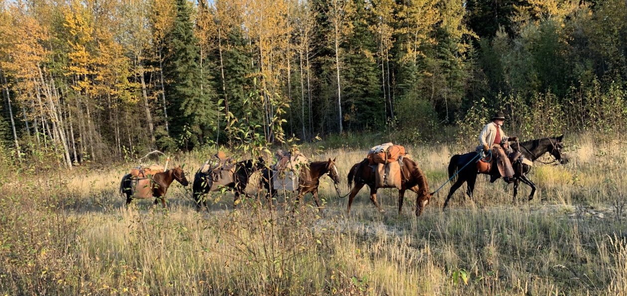
Our horses were Missouri Fox Trotters, preferred by us for their smooth fast gait, sure-footedness on uneven terrain, and their even temperament. It’s a beautiful thing to watch a string of Fox Trotters moving along a trial at six or seven miles per hour. It’s even better to be riding one of them.

We started our pack trip at the Loop Trail trailhead on Friday morning. The trailhead can be found by taking Benchmark Road west out of Augusta, Montana (check a map for mileage). Just past the airstrip, you’ll find a large overflow parking area. Plenty of room for even large rigs. There is a corral there, but the outfitters normally have that. There is plenty of room and plenty of grass for primitive camping. Go on to the end of the road and you’ll find a designated camping area that has several horse camps with tie racks, feeders, and room to back in a decent sized stock or LQ trailer.

Our original intent was to make the loop on the Loop Trail, which loops around the famous Chinese Wall, then back to the main trail. We didn’t make it, so I can’t report on the entire trail.

We made it out about twelve miles, before our new pack horse gave out. She was a new acquisition for Derek and she just wasn’t in condition to carry a 200 lb pack. So, we adapted. We made a base camp just off the trail near a creek, just about two miles past the USFS Ranger Cabin.

There was very little grass there at camp, so it was a good thing we had packed in about 100 lbs of pelletized feed for the horses. Water was no problem, for horses or people.

We packed in a pair of bear-resistant panniers, so we were in compliance with the rules for “The Bob.” This is bear country, both black and grizzly, so pay attention to the food storage rules, or you may be very sorry. Besides, not paying attention to the rules can get you a citation from the rangers.

The following morning we decided to leave the pack horses in camp and make an in-and-out ride up to see the Chinese Wall. What a nice ride it was with spectacular views. The wildflowers were out adding a wondrous array of color against the green foliage. Bear grass blooms into large white fuzzy-looking puffballs on a long stem. I’ve been told it blooms only once every four years. This was a bloom year and it was beautiful, adding an accent of white in every meadow along the way.

We came to a nice pass with an excellent view of the entire Chinese Wall, where we unsaddled and had lunch. The mileage from camp was 9.6, according to my GPS.

As we glassed the Chinese Wall we were privileged to see a couple nice billy mountain goats.

After a lunch and a good nap, we saddled up and headed back. It’s amazing how the views going back are just as spectacular as coming in.

Just before we arrived back at camp, we noticed smoke in the valley near the river. While we rode on into camp, Allen detoured to check out the source of the smoke. As it turned out, an old rotting log had caught fire by spontaneous combustion – no lightning, no sign of a camp, just caught fire due to the extreme heat and a little rain a couple nights before. We spent the rest of the afternoon putting it out. Luckily, we happened on the scene and only about 800 or so square feet was charred. Could have been much worse.

The next day we took things pretty easy. We needed to move camp, but our lame pack horse was barely moving.  She had some pretty sore feet. Late in the afternoon we decided to move our camp about two miles, back to the ranger cabin, where there was plenty of grass and water.  We put a set of boots on the mare and packed her light. At her own speed and she made the move just fine.

That night the temperatures dropped and I awoke with frost on my sleeping bag and me wishing I had brought my winter bag instead. Even in the middle of July, it can get cold in the Bob.

The following day we made another in-and-out up to White River Pass. My horse had thrown both front shoes by then, so I saddled up Derek’s other pack horse.  The trail was good, although there are a couple places that might make some folks shiver. The view from the pass was phenomenal. In every direction lay another panorama of mountains and valleys. I forgot to turn my GPS on, but I reckon it was about a ten-mile ride up to the saddle. Again, coming back down the trail was a beautiful as going up. We stopped for a few photographs in the spray of a small waterfall.

We got back to camp fairly early in the afternoon, so we decided to head back to the trailer and get home a day or two earlier than expected. I suggested that since my horse had now lost a third shoe (remember the short notice I had to prepare for this trip? It caught up with me) and was tender, I might take him and the lame mare and head on out while they packed up camp, figuring that if I were lucky we might make it back to the truck only slightly behind the rest.

Once the mare got to walking, she loosened up a bit and seemed to be fine. I let my gelding and the mare choose their own speed. What a pleasant ride it was! Just me, all alone with the horses. To me, that’s what it’s all about – my relationship with my horses. I talked to the horses, whistled, and even sang out loud at the top of my voice. There was nobody but my horses to hear, and they seemed to enjoy the ride as much as I did.

All-in-all, we did about 65 miles total, through some of the most beautiful landscape on God’s green earth. What a pleasant trip it was!

The Bob Marshall should be on everybody’s horse bucket list.


After a lot of thinking…

I took a trip home last week to visit my parents. I haven’t been down to their place in Arizona for a while. Dad got bucked off his horse several weeks ago and got a little beat up, so I figured I’d better get on down there and check on him. He’s convalescing well and I’m sure he’ll be back to himself in not too long.

Anyway, during my drive home I decided to take the “scenic” route and take a look at some of the country Dad and I would have traveled through, if we had been able to finish last year’s pack trip. Those of you who follow my blog will remember that we had to cut our trip short last year, due to the drought. There wasn’t a drop of water between Flagstaff and the Utah border last summer and there were wildfires all around. It was a bad year for a long-distance horse pack trip.

After we ended last year’s trip, Dad told me it was unlikely he’d be able to continue with me. Dad’s nearly 83 now, so I knew it was coming. Still, the desire to complete the full distance, from the US/Mexico border to the Canadian border, is still with me. I brought up the idea last fall of making the legs of the trip shorter, so that I don’t have to take so much time off work all at once. I wondered if Dad thought he might go on some of the shorter legs, if we kept them down to a week or two. He seemed to like that idea as well as I do. So, that’s what I think I’ll be planning to cover the rest of the distance…another 2,500 miles. It will take several more years.

However, during my drive home, after a lot of thinking about it, I decided not to continue the trip this year. I will push the next leg, from Flagstaff to the North Rim of the Grand Canyon, off until next spring. There is just too much going on this year. My main horse, Lizzy, is in foal, due about September. I’ll need to start taking it easy on her before long. My new horse, J, isn’t even broke to ride yet. Since Dad got rid of his bucker and sold the mule, Honey, I’ll need another horse to bring us up to snuff. That all adds up to a rush job to get ready for this year. I have all the gear, and even the food stuffs, but the horses aren’t ready.

Things have been picking up at work this spring, as well. I could use the extra income to help pay back money I borrowed from savings for the trip. Additionally, I still need to finish the pony saddle I’m making for one of my grandkids. I have several other saddlery projects I need to get done after that. In fact, I have a number of other projects I need to get done.

Not only that, but my second daughter will be having twins this fall, right about the time my extended family will be having our family reunion in Arizona. Some time this year, my wife and I hope to be able to take a trip to celebrate our 35th wedding anniversary (which happens to be March 20).

I think, for this year at least, wisdom dictates that I try to get some of these other things taken care of before I head back out on my Mexico-to-Canada pack trip. The extra preparation time can’t hurt either. By the time next April rolls around, I should have my horses all squared away and in shape, Lizzy’s foal should be weaned, and Dad and I should have ourselves in better shape. I may even have myself a new saddle – one of my own making.

So, after a lot of thinking…that’s the plan going forward.

Hmmm. I need to update the website….

I recently created a new website for a sports fan group I have belonged to for more than ten years. We are die-hard fans of everything related to Brigham Young University sports, especially football. We had been using a forum service, YUKU, for a lot of years and finally got tired of the poor service and goofy advertisements they slipped into our forum. We had to pay a fee not to see advertisements. Finally we got so fed up with it that we began to talk about looking for a new home for our forum. As we discussed it, I realized that it would be a pretty simple solution for us to buy a domain name and create our own website and forum. So, that’s what we did, using my web hosting account with Bluehost. So, I created byufans.net. It is a closed group, though, so membership is limited to the current members and those individuals who are personally invited by a member.  Sorry.

Anyway, what does that have to do with Western Trail Rider? Well, the new website looks so good and works so well and is so easy to manage that I was quite impressed with myself (hehehe). But, when I switch over to my WTR site, well, it started looking a bit drab and old. Now, every time I look at WTR I think I need to update it.

So, I’m going to be looking at new themes and other apps and programs that might sort of dress up the site and make it more user-friendly and easier to manage. Once I decide what to do, I’ll let everybody know that it may be down for a few hours…that is, if everything goes well…or a few days, if I mess up. Now, nobody need suppose that I am a website developer or otherwise expert, or even knowledgeable, about websites and blogs. I just trip along until something looks pretty good and works ok. WordPress has made things pretty simple for guys like me. It is mostly a matter of figuring out what I like, then plug-and-play. Still, I seem to be able to mess things up pretty well, as I try mixing and matching different services on the site. The challenge is going to be ensuring that I don’t lose any of the photos, information, posts, and serviceability of the current site.

Also, I understand how each provider of an app or service can spend thousands of hours developing a simple app for dummies like me to “plug-and-play” and that they certainly deserve to be paid for their efforts. However, when a guy like me starts adding up the various fees and subscriptions and donations, the cost starts to reach a significant level per year, particularly when I am not making a penny on the website.

I created the website shortly after I started planning my big horse pack trip a few years ago. A number of folks suggested that I start a blog, so they could keep up with my planning, gear purchases and reviews, and other developments, as well as documentation of the trip itself. It occurred to me that I might just as well purchase a domain name, start a website of my own, and invite other horse and trail riding folks to blog along with me. The thought was that we, together, might create a website where like-minded people might come to find information about horse trails in the western U.S. and to get first-hand information from people who had actually ridden those trails. I’m not talking about state and national park trails – there are numerous websites for those places. I’m talking about the backtrails and places that are almost unknown except to riders from the local areas. Places folks hear about, but few ever see. I figured that eventually there might be enough bloggers on the site that a little advertising income might be generated, to pay for the website maintenance. That hasn’t developed, so I’m content with simply using the site as a place to document my horse adventures for a few faithful followers to enjoy.

Still, I’d like to make it an attractive and interesting website. So, I’ll be working on updating it over the coming couple of months.

Stay tuned to see what I come up with!

P.S. The invitation is still open for anybody who would like to start their own horse-related blog under the WTR banner or to link an existing blog through WTR. The only requirement is that it be related to horse trails in the western U.S. or some aspect of horse or mule packing. There is no charge and I maintain the site at no expense to you…unless you would like to help out.  If you have interest, send me an email at tony.henrie@westerntrailrider.com.


A few photos from the pack trip from Eagar, AZ to Flagstaff this year…

I recently found an old email from Nancy Hood, one of the many people Dad and I encountered on our pack trip last summer, who so generously helped us out time and again with fresh drinking water and good conversation. Nancy had a photograph of Dad and me that she took. She emailed it to me just a couple days ago. Made me think I should post some of the photos from the trip.

I still need to make a post or two to document the last two weeks of the trip for my followers. Time has been at a premium for me lately and I just haven’t been able to get the time and energy together at the same time.

These photos are roughly in order from our departure at Eagar, AZ to the end of our trail at Flagstaff, AZ. Many of these photos were taken on the Arizona Trail.

Enjoy the photos, and much thanks again to all those who so generously contributed to our successful ride.

Our pack trip has ended…

Well, sad as I am to say it, our pack trip has ended at Flagstaff, after about 197 miles of travel. 
 
Temperatures are at record highs. Fire danger is extreme. There is no water in northern Arizona anywhere along the Arizona Trail.
 
Last Monday we made 23.8 miles and the last water we saw was near Marshall Lake at about mile 3-4. By the time we made Flagstaff we knew we were in trouble. The last 6 or so water holes we passed were bone dry. We finally had to call Gwen and Bruce Kahler, who hauled about 70 gallons out to us and met us where the AZ Trail meets Route 66. That supplied ourselves and our horses for that night and the next morning.
 
Gwen Kahler, our guide through the Flagstaff area

Gwen stayed and rode with us on Tuesday, as we finished the AZT Equine Bypass route through the mountains and around Flagstaff. We passed one running stream (only the second we had seen the whole trip) as we headed back up to higher elevations. We made Schultz Tank, which had water, by about 3pm. From there it was only about four more hours of riding to reach Gwen’s place, so we decided to make the push. We reached her place by about 7pm, making a 19.2 mile day.

On Wednesday, as we were running errands, re-supplying ourselves for the second half of the trip, I contacted the USFS to ask about conditions between Flag and the Grand Canyon National Park. The answer I got was disheartening. He said we would find water in the higher elevations just north of Flagstaff, but once we dropped down into the lower elevations on the AZT we would find none. That meant we would have about 95 miles of dry terrain with no water for ourselves or our stock.
Gwen got on the phone and started making calls and texts and was able to recruit help in hauling and locating water for us so that we could make our dates at the Grand Canyon. Gwen was going to ride with us to the South Rim, so she had a vested interest. It began to look as though we were going to make it at least that far.
Once at the Grand Canyon, we would have water, as the park has provisions for both potable water and stock troughs. However, once we left the North Rim campground, we would face another 100 miles, approximately, to the next reliable water source, the Paria Creek. As for feed, we had plenty of grass in the higher elevations, but there was very little once we dropped down into the Junipers. We could not pack more than enough feed for a day or two.
This is the driest year I can remember for Arizona. There are fires all over the state, we have already had to re-route around one major fire and were lucky enough to have passed through a couple more areas before they were restricted due to fires.
On Wednesday, the USFS announced open-flame prohibitions on the areas north of Flagstaff, through which we would be riding. We used a small single-burner stove for all our cooking needs, so that didn’t restrict us, but it shows just how dangerous the situation has become.
At the Kahler’s place we were able to find a large animal vet to come out and do the health checks on our horses and mule, so that we had current certificates to enter the Grand Canyon National Park with. We also found a farrier who was willing to come out and re-shoe all our stock on short notice. We were in the middle of getting that done on Thursday, when we got the phone call that was the last straw.
My mother had a very rare and serious reaction to a prescription medicine and had been hospitalized.
It was time to stop and take care of more important business. My sister and brother-in-law came up and picked us up at the Kahler’s place that evening. Dad and I drove back up and hauled the horses back to Eagar on Saturday.
Mom is doing better now and the emergency has passed. She was home before we got home. Dad and I got to thinking we might haul the horses to the Grand Canyon and do the ride there, since I already have the permits and reservations in place and paid for. Mom gave us the go-ahead, but looking at the forecast for the next week, it appears the Grand Canyon will be experiencing record high temperatures. This has been one of the hottest and driest springs on record for Arizona. I have already lost one horse on this trip. I am not willing to risk losing another to the extreme heat in the Grand Canyon, nor to risk Dad’s or my own health any further.
Fact is, this just isn’t the right year to be attempting this ride.
On our pack trip last year, everything worked like clock-work. Things simply fell into place. This year has been different. We have fought through every kind of complication. If something could go wrong, it did. It’s time to stop before something goes really wrong and somebody gets hurt. This trip has already cost me a very good horse. The warning signs have been getting louder as we go. It’s time to concede and head home.
On the Mogollon Rim. Thanks to the Bergs for the photo

Be assured, the trip has not been wasted; Dad and I had some very rewarding days and we passed through some beautiful country. We have been pleased with the AZT and impressed with the care and maintenance most of it has received. We have seen dozens of elk, deer, and antelope, and ridden trails most folks will never see. We have enjoyed the ride immensely. We have experienced something most fathers and sons will never experience.

We’re sorry we aren’t going to make it all the way, but we want to assure all those who have helped and encouraged us along the way, that this was not wasted time. It was all a good and rewarding experience for Dad and me. We are truly grateful for all the help and support we have received.
I will post photos and a trip log after I get home and get settled. The Internet service here in Eagar is not sufficient for me to upload photos. I expect it will be a couple weeks.
Until then, Happy Trails to you.