After quite a bit of study and fingernail biting, I have decided to deviate a bit from the Arizona Trail/Great Western Trail for the first leg of my Mexico to Canada trip.
I have decided to start my trip at the Mexican Border a little east of Douglas, Arizona. There is a road there called “International Avenue” that follows the border. Just east of Douglas is the San Bernardino National Wildlife Preserve, where I believe I can start my trip. I’m sure I won’t be able to travel through the preserve, as it is likely to be fenced in, but I should be able to get fresh water there and start my trip a bit east of the preserve.
From there I will head north. It appears to be open range, so few or no fences. From Google Maps satellite view I can see there are water holes and ranches every so often, that I should be able to make it easily from one to the next. As long as I don’t miss too many, I should be fine. Departing in the early spring, there should be water in some of them and I can hit ranches as well. That close to the border, I should be able to find well-traveled foot paths between water holes (haha!). I’ll hit I-10 at San Simon, where I’ll be able to cross under it at a bridged wash.
I plan to go north by northeast to the Chiricahua mountains. As I get into the mountains from the southeast, I should be able to cut into the Sky Islands Traverse trail near it’s beginning. I will follow it north until I get near Mt. Graham, where I’ll turn east and pass south of Safford, picking up the Gila River and following it up to Morenci/Clifton.
I will continue past Morenci/Clifton, following the Gila River, until it forks, then follow the Blue River north to the Blue Wilderness Area. I’ll take a break at a friend’s place there on the Blue for a few days, before taking Foote Creek Trail northwest to Hannigan’s Meadow.
From Hannigan, I’ll do a combination of road-following, logging roads, and cross-country north to Eagar, where my folks live. I’ll take another break there to rest up the horses and resupply. I expect it will take me about three weeks to get this far.
I expect I’ll pick up a couple family members there to ride with me a while. I’ve invited them to ride with me to either Show Low or Snowflake, depending on whether I decide to take the General Crook Trail to Camp Verde, or the old Mormon Honeymoon trail northwest, passing north of Flagstaff.
Either way I go from Eagar, I’ll meet up with the Arizona Trail/Great Western Trail at the end of that leg.
Once I meet up with the AZT/GWT, I’ll follow it north, resupply at Flagstaff, then on to the Grand Canyon.
I’m looking forward to crossing the Grand Canyon more than any other single portion of the trip. My dad and I have talked about crossing the Grand Canyon on our own mounts since I was in high school. I’ve invited him to accompany me on this leg of the trip. In fact, he’s decided he wants to make as much of the trip as he physically can. He’ll be turning 81 about the time we reach the Grand Canyon.
That will get us through Arizona. I estimate it will be a little over 800 miles. The AZT measures 801 miles from the Mexican Border near Nogales, to the Utah state line near Jacob’s Lake.
Now that I’ve made those decisions, it will be a matter of collecting maps, researching the route more closely, making contacts, and finalizing the plans.

On the map, my proposed route is in red. The alternate route on the Mormon Honeymoon Trail is in blue. The Honeymoon Trail follows the Little Colorado River and much of it is on the Navajo Reservation, so that would require some special permissions. May not be able to do that route, but it would shorten the mileage a bit.
Only four more states to figure out.
For most any one I know that part would be the trip of a life time me included.I was just looking at a ranch that is for sale on the south east rim of the grand canyon the other day.I bet that would be a great place to ride out of.
You have to watch out for ranches for sale up that way. Most of that area is high desert and entirely worthless for most purposes. You couldn’t raise a cow on a hundred acres for most of it. Howsoever, it would be a great home base, putting some of the best riding in the world within easy reach, as long as your wife doesn’t mind seclusion. It’s a long way to the nearest Walmart!
The Red route is definitely the pretty ride. It keeps you in the Sub-alpine forest. Mostly Ponderosa Pines. The Blue route puts you out in the high desert and that is pretty barren. Of course early spring, there may still be snow in the mountains and higher elevations.
I have always thought the area near Alpine-Show Low AZ and again up on the Kiabab Plateau are some of the prettiest in Arizona.
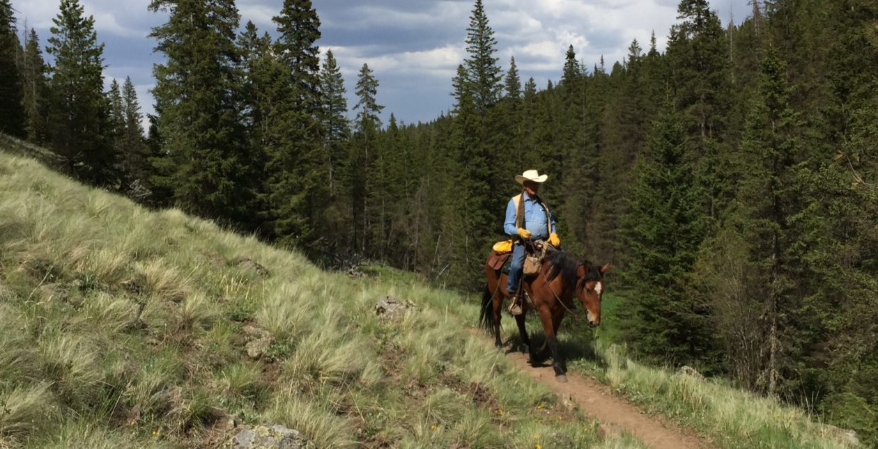
I should try to get you to come ride with us down in the Blue Wilderness Area. In my estimation, that is the best riding in Arizona. That is my favorite part of the whole wide world….so far. There’s still a lot to see.
Happened to come across this post in reference to the Sky Islands Traverse & GET, which I’ve developed. You will find that the majority of the Chiricahuas burned fairly severely in the fires of 2011 and that Indian Creek Trail drainage may be impassible in places. Also the Dos Cabezas route involves some fairly rugged cross-country travel places that will not be suitable for horses — a workaround via dirt roads shouldn’t be too hard to determine. Finally, the San Francisco River north of Clifton can be deep and swift during the spring snowmelt — class 2 whitewater in places. There are some rough trail options on the west side of Sunset Peak that could be used to minimize crossings of the S.F. until nearer the Blue, which is usually more manageable. Alternatively, from Safford you could head east (Airport Rd to Sanchez Rd) to the Gila Box, cross Bonita Creek to join the E Bonita Rim Road northbound, pick up the Safford-Morenci Trail eastbound to Eagle Creek, follow Eagle Creek north to the Painted Bluffs Trail and out to Highway 191, then use the Frye Trail, HL Trail and Pigeon Creek Road to Juan Miller Road and intercept the Blue River there. This is the GET route from the Safford-Morenci onward. Good luck!!
Ditto the Gila River and southernmost San Fran River, I should add. Can’t get vehicles up the Gila out of Safford during the spring crest (illegal anyway). Horses would probably fairly similarly (not to equate the two in any way). Fording is unavoidable at the frequent canyon bends. Fall, less of a concern. Spring with 200+ CFS on the Gila, possibly; 500+ certainly.
The SMT sounds like a good choice for me, then up Eagle Creek to Stray Horse. I can take Raspberry back down to the Blue and back onto my desired track. My concern then, would be water and feed for the horses. I can get feed in Safford and pack it on the horses, but I still need to supplement it with grass when possible. Water is the main priority. If I can find a water hole every 5-7 miles, I’ll be ok.
Would you send me a link to your forum, please? When I follow your link back I get the GET website. I would like to be able to converse with you and others who are knowledgeable about the area in a little more convenient format than this. Or you can hit my email at tony.henrie(at)westerntrailrider.com. I sincerely appreciate your input. It is the first reliable information I’ve been able to find about the area.
Tony Henrie