
I have been looking up at Loafer Mountain for the past five years, wanting to ride up there and do some exploring!
Loafer Mountain, stands 10,687 feet, located just east of Salem, Utah. There are a number of known trails cross-crossing Loafer Mountain, but only a few of them see much use. One such trail is actually a service trail that runs from Salem, Utah, up a canyon, the name of which I do not know, eventually arriving at a cellular tower station on a hilltop at 9,000 feet elevation. This route begins at a Salem City’s water tank at the mouth of a canyon and climbs rapidly for the first mile, to a satellite installation. From there the road ascends more gradually to the Cellular tower, which stands on a mountain top, just north of Santaquin Peak and west of Loafer Ridge.
Yesterday, May 30, 2020, I decided was the day to attempt a ride up this service trail, pass over to Loafer Ridge, and return down Maple Canyon (sometimes called Water Canyon, due to the Woodland Hills water tank at its mouth). I had been told there were trails connecting the two canyons, but the condition of the trails was unknown, nor did I come across anyone who had actually hiked those trails…at least not recently.
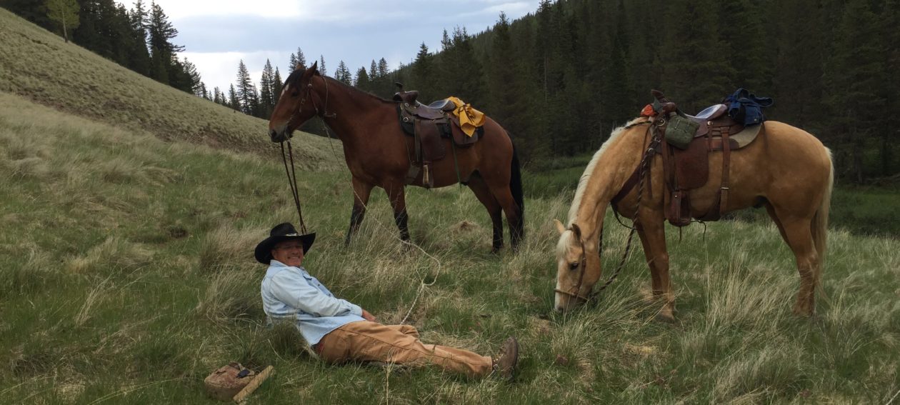
I saddled up Copper around 7:30am, equipping myself with the essentials: lunch, a 2 qt military canteen, pommel and saddle bags with my emergency gear in them, my slicker and a light jacket, just in case, and a bottle of roll-on bug repellant for Copper, against the possibility of horse flies. We were on the trail by about 8am.

Within about a half-hour we were starting our ascent on the service trail to the lower satellite installation, where the service trail joins the old mining road from the Dream Mine. I’ve written about this trail before, here. The ascent that first mile is very steep and a horse that is not in very good condition will be exhausted by the time it reaches the satellite installation there. After that, the ascent is much more gradual, though still quite a climb.
I will also comment here that the trail is extremely rocky and though I try to leave my horses barefoot as much as possible, this trail should not be attempted with a barefoot horse. He won’t make it.
On the way up this service trail, there are some pretty nice views back toward town and looking on up the canyon. At one point, you pass an old mine opening that has been closed for safety reasons. Kinda cool, though.


We followed this service trail up to a saddle about a half-mile or so short of the cellular tower, where there is an unnamed trailhead. There is also some pretty nice grass, so I had lunch there and allowed Copper to graze for nearly an hour. I figured he was going to need the strength. There are some pretty spectacular views from there.

By this point we were at about 8,500 ‘ elevation, having ascended about 4,000′ in a matter of about 7 miles. Like I said, it’s a grueling climb for a horse. If you go on up to the cellular tower, you will be at 9,000’.
The trail up to Loafer Ridge, from this point, is closed to all but foot and horse traffic. However, the USFS has not left any way to get a horse to the trailhead, having closed it off with cables to preclude any vehicular traffic. We had to go around to the north side and climb a very steep, rocky bank, to get to the trail.
Once on the trail, it was easy to follow, having been blazed by use of ATVs, but it climbed too steeply in places for a horse. I detoured a couple of times to make switchbacks to make it easier on Copper. About 3/4 of a mile along this trail, I turned off and did some bushwhacking to avoid a hilltop and make our way over to a saddle below Loafer Ridge, where we needed to go. This was a very steep hillside, as are they all at this elevation on Loafer, but Copper handled it well.
At the saddle, we found a USFS guzzler with clean water. However, as the saying goes, “You can lead a horse to water, but you can’t make him drink.” Copper wouldn’t touch it. He’ll learn. My trail horses know that when there’s water, you drink! This guzzler will likely be dry during the late summer/fall time of year.

You can’t see them, but on the hillside behind the guzzler, there are three elk. They were heading for the saddle and turned away when they spotted us. In the photo below, you may be able to pick them out.

After the guzzler, there is no more trail, other than a number of game trails heading in various directions. We chose a game trail that headed off in a southerly direction, climbing Loafer Ridge at a fairly reasonable rate for a horse. It eventually crossed an old service trail that comes up the eastern side of Loafer, probably from the small community of Birdseye, Utah, or near there, on US 89. It climbs another couple hundred feet or so onto Loafer Ridge, then descends slightly to a pair of large cellular repeater reflectors stationed on the ridge.

At this point I was very near the highest elevation of my ride, at 9663 feet. I bypassed a hilltop as I went around it to descend the other side into a saddle on Loafer Ridge. Apparently at some point I went up another foot, to my highest elevation of 9664 feet. The views from Loafer Ridge were spectacular!


After descending into the saddle, I joined an old trail that descends into the bowl below Loafer Peak on the northwest side. This is the top of what I believe is known as Maple Canyon, sometimes also called Water Canyon, due to the spring and water tank located at its mouth that supplies water to the municipality of Woodland Hills.
This trail is an old one, probably cut by a dozer. It does two switchbacks before disappearing altogether about 2/3 of the way down the hillside. By the time we reached the end of the trail, we were deep in a thicket of stunted aspen and thick undergrowth. I had been told there was a trail in the valley that joined the ATV trail further down Maple Canyon, so I decided to continue. I won’t call that a mistake, but don’t let anybody convince you that there is a trail down in there somewhere!
Getting down the rest of that hillside was a “butt-clincher” even for me! Copper really impressed me with his cool, collected temperament on that descent. It was truly some “Man From Snowy River” stuff. When I first turned him downhill, to get through a thick area to a less dense one, the ground gave way and we slid all of twenty or so feet before Copper could get us stopped. We then traversed the hillside, going from open area to open area, slowly heading toward the higher end of the valley, to make our descent trail shorter. Copper had to move with his hind quarters lower than his fore quarters, as he moved sideways along the hillside, to keep from sliding farther downhill in the loose soil. In the photo below, we started our trail-less descent about where the center of the photo is and made our way switchbacking some places and descending straight down in others. I was glad to hit more level ground in the bottom. I can tell you this photo does not do that hillside justice!

Once in the bottom, I let Copper rest a little and get his breath. Meanwhile, I took a few more photos.


From that point, I started looking for that “trail” I was told about. If there was a trail, it was indistinguishable from the hundreds of elk and deer trails in the area. I tried following several of them, but they all seemed to either ascend or stay pretty level, while the valley fell away steeply. Knowing that eventually, I would have to descend anyway, Copper and I made our way down into the dry creek bed in the bottom of the canyon. This descent was pretty tricky as well, as we were back in the Spruce and Fir trees, with their attendant deadfalls blocking the way at every turn. Copper was pretty impressive in getting over and around and through some of those tangles, some of which were on steep hillsides.
Traveling in the creek bottom was actually a lot easier than I expected. I was pleased to find it was narrow, but pretty soft in the bottom, with no steep drops or cliffs. We ran into the occasional tangle of debris, but in those cases the deer and elk left us pretty decent trails to get up and around them. That isn’t to say it was easy going, but it was easier and safer than traversing the steep sidehills.
We followed that for maybe two miles, before we came to our first and only deadfall that we could not get around. When we initially came upon it, I decided to try to go up the bank and around it on the right side. It looked like we could make it if we were very careful.

However, as Copper started up the bank, the loose soil began sliding and he began losing footing. I was concerned that Copper might get tangled in the three downed tree tops while losing his footing, so I unloaded on the uphill side.
As I did so, my downhill (left) boot didn’t come out of the stirrup. As Copper turned to get himself oriented to go back down the bank, I was still attached to the saddle! My left leg was stretched out with the stirrup pulled up over the top of the saddle, with my body on the ground trying to crawl uphill, not fully aware my left foot was still in the stirrup! As Copper turned, his right rear hoof came down on my right calf. At the same time, Copper paused, which let my left foot come out of the stirrup. Copper then got himself to the bottom of the bank and walked off a few steps, then stopped to wait for me. Lucky for me, the ground was very soft, which occasioned the whole debacle, and all I suffered was a bruised calf. Copper came through uninjured.
At this point, I realized going around this deadfall was not an option. I went to my saddle bags and pulled out my trusty rope-saw from among my emergency gear, which is actually a chainsaw chain with nylon loops for handles at each end. I have carried this thing in my saddle bags for years and this is the first time I have ever needed it. I’m pretty glad I had it.
I first tried to cut the large aspen log, with a diameter somewhat over 12 inches, but soon realized that was going to take a very long time, as the saw blade would stick as soon as it got over an inch deep. So, I reassessed and realized that if I removed the lower tree, a Spruce about 6″ in diameter at the point I needed to cut, Copper might fit under the large Aspen.
After about another half hour of work, I got the sapling cut and moved and other branches and debris cleared away. It was going to be close! By eyeball measurements I realized that the saddle horn would contact the tree, so I removed the saddle and hauled it a few yards down the trail. The photo below is deceiving and makes it look like Copper would have plenty of clearance. He was actually standing at least ten feet behind the log when the photo was taken.
Now, it was just a matter of convincing Copper that it was safe to pass under that big old Aspen log!

Well, that sounds easy, but it wasn’t . After about an hour of coaxing and sweet-talking, I finally got Copper to put his head under the log, but he wouldn’t go any farther. About that time a thunderstorm passed over, but luckily we got only a light sprinkle. Still, Copper wouldn’t move any farther. Eventually, he began to be bothered by bees and horse flies, causing him to have to move his feet. This seemed to make it easier for me to convince him to move his feet closer to the deadfall each time. Finally, I got his head and neck under the tree, nearly to his withers and could see he was going to clear with a couple inches to spare. I had to go slow, because I knew that if he pulled back and raised his head and bumped that log, I would never get him to pass under it.
By coaxing him on, inch by inch, I finally got him all the way under and past the tree. He still wasn’t sure, though, so I had to get him a couple feet past it, before he would chance walking forward.
With that out of the way, I re-saddled Copper and headed out again. The rest we had while I coaxed him under the deadfall served both of us well and Copper moved off at a good, strong walk. About another 200 yards or so along the creek bottom, we came upon the ATV trail at the point where I had ridden up and turned around a couple weeks before. Copper began to recognize where he was and moved right along, sometimes even getting into his running-walk.

We followed the trail to the water tank, mentioned above, and then followed the road into Woodland Hills. From there it was about two miles to home.

We arrived back at the stable at about 5:45pm, after a long and very difficult ride. Both myself and Copper were absolutely worn out.
After a good brushing, I checked Copper’s back for soreness and found none. I was very pleased with that. He has various bumps and scrapes on his lower legs, but nothing serious or that required any treatment. After a tough ride, Copper looked good, though tired.
I, on the other hand, was limping around with a bruised calf, which I well-deserved!
During the ride, we made an ascent of 4730 feet, making it 9,460 feet in elevation change in all. We traveled about 16 miles, although my tracker software, Ramblr, shows 15.3 miles. I paused the app twice for rest stops and forgot to turn it back on until I had gone quite a ways. You will see those gaps in the track. Our highest elevation was 9664, which is waaay up there! Here’s the link:
https://www.ramblr.com/web/mymap/trip/303226
So, another trail I have been wanting to ride was done. One I will never attempt again! It was a tough ride!
TH
Oh my goodness!!! I found myself holding my breath as I read your story! That must have been super scary getting hung up on the saddle like that.
I’m so glad you and copper are ok.
Yeah, it could have been a lot worse than it ended up. Copper is a pretty steady horse. That’s the kind of horse you need for rides like that!