I was recently contacted by a new author, who asked that I read her novel and provide a review. I was pleasantly surprised and enjoyed the story very much. The historical novel, based on the last battle of the Nez Perce American Indian tribe against the US government, was well researched and very well written. It will be released in June 2022 by Brandylane Publishers, Inc.
Here’s my review of Bone Necklace, by Julia Sullivan.
Bone Necklace is set in 1877 in the northwestern United States. It details, by way of a historical novel, the last battle of the American Indian tribes against the US government. The Nez Perce tribe, led by Chief Joseph, which had lived in relative peace and tolerance with the new white settlers, had not yet conceded to be restricted to a reservation. When trouble between the two cultures erupts, the US government begins a systematic, yet clumsy war against the entire tribe.
The story is told through the eyes of two individuals on opposite sides of the war, both of whom have great reason to hate the people of the other, yet who come to find a connection and a change of heart between themselves. It is a story of corruption, heinous crime, evil, regret, sorrow, and change. There are multiple levels of meaning embedded deep within the pages of this book. More than just a meaningful historical novel, I found it to be a powerful story of repentance, change, and redemption with a useful message for life in our world today.
The author did a masterful job researching and detailing the historical setting and content of this story, even providing photographs and historical details of some of the more important characters depicted. She was able to accurately portray the cultural settings of both the whites and the Nez Perce for the time, without falling into the current “political correctness” or revisionist history rhetoric so common in our day. In reading this story, one is able to experience the mistakes and heinous crimes committed by actors on both sides. One feels frustration with the ineptitude, arrogance, and simple antipathy exhibited by officials of the US government, yet one sees also the terrible acts committed by individuals on both sides against innocents and understands the the anguish, fear, and hate the white settlers had for the Indians tribes and the tribes for the white settlers. Sullivan was able to present both sides of the war on equal and accurate terms, telling both the bad and the good. It is a heart-wrenching story of war and suffering, yet there is beauty in it as well.
Without divulging too much of the story, which one should read for him/herself, here is an excerpt from the email I sent to the author after reading the novel:
“Dear Julia,
“I sincerely thank you for giving me the privilege of reading your historical novel. I would be interested to know how you selected me as a candidate. I’m not sure I’m qualified to offer a review worthy of publication, but I will offer my impressions.
“I think you did a masterful job setting up the story. Without the terrible atrocities described in the beginning chapters, there would have been no depth of feeling in the reader for the redemption of both Jack and Running Bird. Without understanding their suffering for the death of those they cared for, there would have been no comprehension of the forces in them that drove them to commit those terrible acts. Without seeing the suffering their acts caused in others whom they loved, there would have been no understanding in the reader of the depth of their regrets and the change coming about in their hearts. The story was beautifully constructed.
“It would have been easy for you, as the author, to fall into the common trap of simply making a story about how terrible our government treated the American Indian, but you told the other side of the story as well. It is well-documented, historically, that individuals and groups of various American Indian tribes committed appalling atrocities against innocent individuals during the American movement westward, thereby fueling the fear and hate that drove much of the US government’s actions against them, although most modern authors tend to bury that fact to expose only the atrocities committed by whites and the US Government. Viewed in a truly balanced light, it is no wonder that military leaders who were recently involved in the Civil War, were aggressive, decisive, and even heartless, in their efforts to quell another enemy of the American people. Nor is it a wonder that individuals and groups of American Indians committed similar atrocities against their enemies, as they had been doing for hundreds of years past. I found this story refreshing in that regard. There was no partisanship or “political correctness” here.
“I was surprised and pleased with the way in which you portrayed the Nez Perce characters as thinking, well-spoken individuals. As a reader I am accustomed to the common, “How. Me Spotted Horse. No speakum English putty good” sort of dialogue from Indian characters. It completely shifted my thought processes, with regard to their character and motivations, to a different paradigm as I read. This allowed me a greater field of view in the story, rather than just seeing it from the white society perspective. Well done.
“Being a horseman, the Nez Perce tribe has always been of interest to me. Bone Necklace was based on historical fact, well researched and documented. I found myself deeply involved in the story. You were able to bring into focus the atrocities that were perpetrated by men on both sides of the war, exposing the underlying hate and fear that were the impetus driving further atrocities by both the white (and hence the US government) and the Nez Perce peoples. And yet, this is not just a story about a sad part of our American history. Rather, it is a story about redemption and hope for the future. It explores the varying motivations of men; what drives them to do what they do: hate, revenge, duty, love. It reveals the deepest regrets for sins committed and the heartfelt desire to undo what cannot be undone – to change the past. It is a story about men seeing themselves for what they are and seeking to find a better way forward. The bone necklace was the perfect metaphor: a dry bone from a decayed carcass becoming something beautiful and enduring.
“Excellent, beautifully written story! Congratulations.
“Thank you again for allowing me to be among the first to read your story.
Not too long ago, I spent some time with my parents at their home in Arizona. While I was there, Dad and I had a chance to sit and reminisce about some of our rides, pack trips, and other experiences together. I got him talking about his boyhood in southern Utah and he told me about his first three horses. As soon as I got back to my room that night, I spent a few minutes writing down in my journal what he told me. I thought it might be enjoyable reading for my followers.
Dad was born and raised in Panguitch, Utah, which is the setting for the stories I am about to relate. This is taken directly from my journal entry for December 2, 2021:
This evening Dad and I sat up late talking about family history and some of his youth experiences. He told me about three horses he had as a young boy: Nick, Brownie, and Flicka. Dad has always loved horses. So have I.
When Dad was about 6 years old, or thereabouts, he and his buddy, Doug Davis, were playing in the hay loft of his Aunt Pearl’s barn (Panguitch, UT, circa 1940). They noticed an old gray horse had walked into the yard and was snatching hay from the cracks between the siding boards of the barn. He and Doug decided to catch the horse, so they went down to give it a try, thinking the horse would run away. The old horse just wanted to be fed, so they fed it. Eventually, Dad got a rope around the horse’s neck and tied it to a post. He ran across the road, to his grandpa’s house (Norm Sargent), where Dad and his family were living at the time. He told Gramp he had caught a horse and asked if he could keep it.
Gramp said, “Well, let’s go see it,” so the two of them returned to the barn yard where the horse was tied. Gramp took a long look at the horse, checking its teeth, hooves, and walking all around it. Then he told Dad, “Yes, you can keep him. I used to own this horse and he’s come home. His name is Nick.”
Dad kept Nick at Gramp and Granny’s place. He has an old photo somewhere (I’ve asked him to try to find it) of him and five other kids sitting on Nick’s back. Dad and his friends often took turns riding Nick around their block. Once, Dad and a friend were riding Nick down Main Street in Panguitch, when an older boy, who was always somewhat of a bully, stepped out of his doorway and shot a rifle at them. At the time, Dad thought it was a B-B gun, but in retrospect, he now believes it was a .22 rifle, probably loaded with .22 short ammunition, which was commonly used for killing rats. Nick jumped and tried to run away with them, but Dad was able to get him back under control and got home safely. Dad doesn’t remember seeing a wound on the horse, but he walked with a limp on a hind leg ever after.
After that incident, with Nick going lame, Gramp told Dad he had better just let the horse go and return to whoever owned it. So, that’s what they did. Years later, Dad remembers, he saw old Nick working on a local farm, pulling logs and brush for a man. He was still limping on that hind leg.
Dad’s second horse was Brownie.
One day Gramp was in another town working, when a rancher drove his cattle into town to market. He was riding a mare with a colt. He didn’t want to keep the colt, so he asked Gramp if he wanted it. Gramp, thinking about Dad, accepted the colt. He loaded it into the back seat of his 1937 Dodge and drove home to Panguitch. When he arrived, Gramp pulled Dad aside and told him, “Come see what I have for you!”
Dad raised Brownie by himself, with a little help from Gramps. He eventually broke her to ride – again, by himself at about seven or eight years of age. Being a mustang, Brownie was always ornery and hard to handle (of course, that’s from the perspective of a seven or eight year old boy), but Dad loved her.
One winter (winters in Panguitch are long and cold) his dad (my grandfather, Torild Henrie), approached Dad and explained that they just couldn’t afford to feed Brownie through the winter. She was sold to a local rancher.
During June the following year, his dad was killed in a construction accident. Dad had just turned 9 years old at the time.
Not too long after, the rancher to whom Brownie had been sold, approached Gramps and said, “Remember that mare you sold me? Well, she had a foal.” He offered the foal to Gramp, which he accepted on Dad’s behalf.
Dad went out to the fellow’s ranch, on foot I suppose, where he easily caught Brownie, who knew Dad well. He mounted Brownie and rode her back to Gramp and Granny’s place, with the young foal following. When he got there, he rode into the barn, then locked the foal inside. He then returned Brownie to her owner.
The foal was around six months old, so easily weaned. Dad said he had a tough time getting her to become friendly with him, but eventually succeeded. The 1943 movie “My Friend Flicka” had recently been released, so that is where this little filly got her name.
Dad, now at about nine or ten years old, broke and trained Flicka himself. Not knowing any better, however, he started her very young, riding her probably by the time she was a yearling. Dad believes that his riding her so early, even though he was such a small boy, may have stunted her growth a little. He remembers that she was a small horse and that her front legs seemed a bit short proportionate to her hind legs. He remembers that while she was a good horse, she was never particularly athletic.
Eventually, Flicka was sold to a local rancher, who used her to help him make the rounds on his irrigation ditches.
Dad said he had horses all through his youth and even dated on horses during his high school years. Nick, Brownie, and Flicka were his first three and they kindled in him a life-long love for horses, which I am pleased to report he passed on to me in full force.
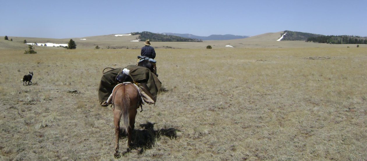
Last week I took one of my annual winter trips to the Saint George, Utah area for some good riding among the red rocks and cedar trees. I try to make a couple trips down south each winter, because there is often as much as 30 degrees difference in daytime temperatures between there and here at home in Salem, Utah, and normally little to no snow on the ground. However, to make it worth the 4-1/2-hour drive and the fuel expense, I normally plan to stay a couple days. I usually drive down on a Thursday morning, get in a short ride that afternoon, then plan for a long ride on Friday and another short ride on Saturday. I try to return home Saturday evening, so I can attend to my religious services and family responsibilities on Sunday.
Down at St. George, I have several friends with property and horse facilities, who offer their places for my riding buddies and me to overnight. The recently finished camper in the front compartment of my horse trailer saves on lodging and is quite comfortable and convenient for these short stays.
On this trip, my Thursday evening ride was on the Red Mountain Trail, which I have ridden a number of times. It has some of the most spectacular views of all the trails I have ridden, at the head of Snow Canyon, looking down into it.
The trailhead is located about 10 miles or so north of St George, off of Route 18. Take Skyline Drive past Diamond Valley toward Veyo. The entrance to the trailhead is easy to pass, though, so watch for the sign. The trailhead has excellent parking for half-a-dozen large rigs and a pit toilet, but no other facilities.
The trail is a loop of about 7 miles and is suitable for intermediate riders or novice riders with assistance. Most of the trail is easy, however, there are several places where a little trust in the horse and confidence in the rider are needed. There is no running water on the trail, but during the winter, there are occasionally a couple water puddles where a horse can be watered. Barefoot horses will be fine. The trail is fairly easy to follow, as it receives a lot of foot and equine traffic. At the apex of the trail at the head of Snow Canyon, there are several tie posts installed where horses can be tied. This is where we normally take a snack break and take a few minutes for some good photos of the canyon. The trail continues along the canyon rim for a good distance.
Just a note of caution, there are no developed view areas and there are no guard rails or services on this trail. While none of the trail follows the rim closely, the canyon rim may be approached at a number of places, which offer very tempting photo opportunities. I know of at least one horse that was lost over the canyon rim when it spooked, falling to its death. Luckily the rider was already on the ground when it happened. This is a very deep canyon with walls that drop vertically several hundred feet from the rim. Nobody routinely monitors the trail for safety and cell service is very limited.
I enjoyed my ride, as I always do on this trail, however on that particular day, the wind was howling at about 30 mile per hour. With the air temperature already in the teens, the wind-chill factor was likely below zero. By the time I got back to the trailer the sun was setting and I was chilled to the bone. I was very glad to get to my friend’s place and get the propane heater and a hot meal going in my camper!
The following day, Craig Sorenson (my host), Jon Tanner, Dave Barnhurst and a few others arrived and we started our riding day at the Elephant Arch trailhead in the Red Cliffs Desert Reserve, located just north of Washington, Utah. Take the Washington exit off of I-15 and turn north. There are actually two trailheads about a mile apart – the Grapevine Trailhead and the Elephant Arch trailhead. The linked site will show you how to get to them.
The Elephant Arch trail is a short trail ride, only a bit over an hour, but it is quite enjoyable and scenic. A section of the trail is in the bottom of a dry wash and provides riders a stretch where they can get the horses into a nice canter if they desire. There are places in the trail that are a bit steep, but overall the trail is suitable for all levels of rider. At one point in the trail, there is a short side-canyon trail that takes one through a very short slot canyon that is narrow enough that both stirrups will rub the walls for a few yards, then you turn around and head back the same way to the main trail. Elephant Arch itself is at the end of the trial (the trail is out-and-back) and it is a little hard to see if you don’t already know where it is. On this trip I didn’t get all the way up to the end of the trail, as our riding party got split up early-on and I just turned around when we met up with the group on their return from the arch (I’ve been there before, so no big deal, but I didn’t get any photos).
Normally, when I do the Elephant Arch Trail, it is tagged onto the end of a longer ride on the Grapevine and/or Dinosaur Tracks trail. This is what I recommend for first-time visitors. The longer trail takes about four to five hours and is quite spectacular. Take a lunch and water. The trail is suitable for barefoot horses. There is one long stretch up Sand Hill Trail which will require at least a couple stops to rest the horses. Having someone along who is familiar with the trail system is helpful, but as long as you stick to marked trails, you really can’t get lost. This trail system is very popular with hikers and bicyclists, as well as horse people.
On Friday afternoon, we decided to ride in the Snow Canyon State Park. There are several trails designated as equine trails, but most of the trail system is reserved for hikers and bicyclists. One should be familiar with the designations of the various trails, so as to avoid a citation. Maps are available at the trail entrance. Parking fees or a Park Entrance Fee are applicable.
While I have ridden the Red Mountain trail a number of times, this was my first ride in the canyon itself. The trail is a fairly short in-and-out of only about three to five miles (estimated). There are two branches to the canyon floor, so we rode up and back in each. The views are very nice and the trail is pleasant. Again, barefoot horses will be fine. The trail is suitable for all levels of riders, but be prepared to encounter quite a few hikers along the trail.
The parking area at the trailhead is limited for large rigs, but there is a good turnaround. When the parking area is full, getting a long rig in and out might be problematic. There is a very nice public toilet facility and, during the warmer months, running water. If the main parking area should be full, there is another good parking area (fee area) just outside the park at the lower entrance from which horses may also access the park’s trail system.
Now for the ride that excited me most: Gunlock
After Friday’s two short rides, I was looking forward to a longer ride with fewer restrictions as to the trail rules. Gunlock State Park was the answer. I had heard about Gunlock for years, but had never ridden there. On this trip to St George, Jon Tanner had coordinated with Deja Schweitzer, who is well acquainted with the area, as a trail guide for us. I’m glad we had her along.
We met Deja at a parking pullout located just south of the reservoir, on Gunlock Road. The pullout is not a fee area, but parking is limited to the side of the road.
There are no facilities. The trail crosses a stream and also approaches the reservoir, so there is plenty of water for the horses. The trail has some rocky areas, but it suitable for barefoot horses.
Deja led us on a 10-mile loop through the western side of the park, however, the park is bordered on almost all sides by BLM land, which means literally thousands of acres of land to explore with very few restrictions or limitations. It was a great place to let my colt, Trooper, run free and get some exercise as well. The area is mostly high desert, covered by sage and cedar trees, but there are also red-rock mountains, slot canyons, and, of course, Gunlock Reservoir. I used Ramblr to track our path and it is available for download here.
I really enjoyed riding this area! While most of the trail we rode follows OHV trails, there is no restriction to off-trail riding. As my horse was barefoot, I spent a lot of time riding alongside the trail, in the softer dirt, to make it easier on my horse.
I also enjoyed doing a little rock climbing, which is much safer on a barefoot horse, to expand Chief’s experience and confidence.
Toward the end of the trail, Deja led us through a fun slot canyon about a half-mile long that was the highlight of the ride.
I am very excited to have finally ridden the Gunlock area! I think I have found a new training area and playground for my horses. I expect to return there at least once each winter, during my annual pilgrimages to the Saint George, Utah area.
Many thanks to Deja for the photos she took. I rarely get many good photos of myself and my horses on my rides and this was a real treat for me.
A number of years ago I created this website for the purpose of documenting the information I was researching in preparation for a huge undertaking: a horseback trip across the western United States, from south to north – Mexico to Canada. As I asked questions on a number of forums and websites, I came to know that there was very little helpful information available and that much of what I found was unreliable. Along the way, however, several people suggested that I might start a blog, so that they might keep up with my progress, not only in the research, but with the adventure itself.
That idea appealed to me as a means of collecting and storing good information, not only for my own use, but for those who wished to follow my project. As I began to look into the prospect of starting a blog, I discovered that I would have to subscribe to one of several blog websites that would use the traffic I generated, along with thousands of other bloggers, to generate a revenue stream for the site owners through advertising. It occurred to me that I might as well purchase a domain name and make my own website and that other “horse people”, like myself might even wish to join me and create blogs for themselves under my website banner. In time, enough visiting traffic might be generated to earn the bloggers a little income from advertisers on the site. So, I bought the domain name Western Trail Rider.
I have had the website since 2011 and have authored nearly 200 posts. I was able to coax a couple of others to start blogs under the WTR banner, however, neither has kept up their blogs. It seems facebook is a lot easier when one is simply posting for personal enjoyment. The few advertisers who have contacted me wished to operate on a commission basis only, meaning that if anyone was referred to them through my website, they would pay me a small fee. The problem was that I had no means of tracking referrals or proving referrals to claim payment. It just didn’t work and I didn’t have the technical knowledge to better market myself and/or website for profit. I even paid a consultant to address some technical issues with the site and help me try to create a marketable site. My consultant was less than reliable and the effort failed. He still owes me several hundred dollars.
I have been unable to complete the Mexico-to-Canada horse pack trip, although I am still trying to make it at least to my father’s hometown, Panguitch, Utah, so my purposes for the website have evolved somewhat.
Over the past several years, the website, in connection with my Western Trail Rider facebook page, has provided a means of assisting others with the sale and purchase of horses, which brought me to create the “Horses for Sale” page in the site. However, my effort to market horses for other people began taking so much time that my own horses stood in the pasture unused. I have made the decision to reallocate my time to spend the bulk of it riding and training my own horses.
More than anything, I have used the blog as a means of documenting as a journal my rides and pack trips, as well as a place for some articles I have composed regarding horse training, product reviews, how-to-do-it, and other things I like to write about. My hope has been that my posts may be of some use or enjoyment for others as well.
So, my website has generated very little income and costs me a couple hundred bucks a year to maintain. My technical knowledge is frustratingly inadequate and I often encounter issues with the website that require hours of study and effort to remedy.
According to the statistics generated by WordPress, about 13,500 or so people have subscribed to my website, but I’m pretty sure most of them are spam subscribers, selling knock-off Ray Ban sunglasses and expensive handbags. I rarely see a comment on the site that is not a robot-generated spam comment. Lately it has not seemed worth the expense or time I spend to keep the website up.
Recently, as my renewal date came near, I thought about letting the website go. It is a hard thing to do, though, since I have put so much of myself into it. Over the past several months, I have had several conversations touching this, in which several of my subscribers told me how much they enjoyed reading my posts and hoped I would continue. This was very gratifying and led me to decide to continue. Then, very recently a very dear life-long friend, who is in poor health, told me how much he has enjoyed reading my blog posts, despite the fact that he is not a horseman, and that he hoped I would continue to publish posts about my rides and other horse-related adventures.
Well, I have paid my subscriptions and fees and the website will continue. I have made it a New Year’s Resolution to catch up on posts I have long left unfinished. I am sorry that I let things go so long.
So, here’s to you, Dan, John, Miranda, Dad and Mom, and all those I don’t even know, who have taken some enjoyment from my writings, musings, and adventures. And thanks for the encouragement.
I have been working on repairing an antique youth saddle for a young man to whom I am providing some horsemanship training. Last week, as I was trying to adjust the stirrups to fit his little brother, one of the stirrup straps broke.
I told his father that this old saddle is pretty worn out, but has good “bones” under the leather. The stirrup straps had been repaired and “cut and pasted” so many times that there wasn’t enough good leather left for any more repairs. I suggested that I could repair it to serviceable status by replacing the stirrup straps, but that the tooling was no longer available, so the repairs would be pretty obvious. He asked me to go ahead and see what I could do.
Well, I like my repairs to old saddles to approximate, as closely as possible, the original parts, so I started taking a good look at the stirrup leather tooling. After studying the stampings a little, I decided I might be able to make the two stamps I needed, one of which, as I said, is not available from any source. After tinkering a little with some steel rods I had in my shop and a couple files, I came up with a couple of homemade stamps that very closely approximate the original tooling on the saddle. In fact, you have to look very closely to tell the difference.
On Monday I cut new stirrup straps and yesterday I completed the stamping patterns, using the best piece of the original stirrup strap as a guide. I’m quite pleased with the result.
This evening I completed the stirrup straps, riveted everything together, installed the new buckles, and cut all the adjustment holes. Then I oiled the new leather well and applied Fiebings Pro Stain, in Dark Brown. I also oiled and cleaned the original sweat leathers and attached them to the new stirrup straps. The resulting repairs will be stronger and more durable than the originals.
Then I used a soapy water solution to clean the rest of the saddle leather. I got the leather sufficiently wet to allow it to dry on my saddle stand and reform the skirts and jockeys, which had dried and curled. I bound the saddle to the stand with belts and bungies and allowed it to dry. After it was dried and its new form set, I oiled it well and applied stain to make it match the new leather more closely, while not losing the patina of the original leather.
On a more valuable saddle, I would have completely disassembled the saddle and cleaned and reformed each piece individually, but for this saddle, that would be more work than it might be worth on its best day, and what I have done will extend the life of this old saddle for another 20 years or so.
As I began to reassemble the saddle, I found I had to replace one saddle string and that the cantle had broken loose from the bars. A previous repair had been made, in which the saddler made a metal piece, which he turned into a decorative piece, and attached it with screws to the bars and the back of the cantle.
It reinforces the connection between the cantle and bars, but I decided to go a little further and make a little stronger repair. I pulled the skirts away from the tree bars and pre-drilled and installed four 2″ #14 wood screws through the bars and up into the cantle. It’s solid now and the decorative metal reinforcement is just that – reinforcement, not the primary holding force for the cantle-bars connection.
The objective of this repair was not to bring this saddle back to “restored” condition, but to make it serviceable again for the purpose of teaching a couple of young boys to ride. I think I was more than successful in that regard and the saddle is now in better condition than it has been for many years past.
This saddle should be good for another 20 years or so. Might even make it to another generation of youngsters learning to ride!
I’m pleased with my work and I enjoyed it immensely.
A couple weeks ago I realized I was again going to have to postpone the next leg of my Mexico-to-Canada horse pack trip, which was planned for this month (May 2021). As it turned out, two issues arose: First, my recon of the area revealed that the drought had pretty much dried up the water sources along the route between the North Rim and the UT/AZ border, which is the driest part of the Arizona Trail even in the best years. Secondly, my riding partners for the trip had some major events occur in their lives that made it pretty much impossible for them to make the trip. Without the logistical support their involvement brought, I couldn’t see any way to continue. So it seemed my Mexico-to Canada horse pack trip would remain stuck at the South Rim of the Grand Canyon for at least several more months. That got me a bit down in the mouth.
As I considered whether I might be able to at least cross the Grand Canyon by myself, I began to realize that my hopes of eventually continuing my horse pack trip all the way to the Canadian Border are pretty much gone. I thought that if I could at least get across the Grand Canyon, I would have fulfilled one of my last remaining lifetime “bucket list” dreams and, though things looked bleak, if I were to be able to continue the big pack trip, my logistical issues for the future would be greatly simplified.
My goal now is to make it from the US/Mexico Border to Panguitch, Utah, which is the destination I originally dreamed of in my youth. That’s the trip Dad and I used to talk about when I was in high school – Tucson, AZ to Panguitch, UT. My dad was born and raised in Panguitch; that’s where my pioneer forefathers settled and my greatest desire for the trip was to re-connect, so to speak, with them, so Panguitch was our original destination. So that’s what I have dreamed about for most of my life – a horse pack trip from Tucson to Panguitch with my dad.
During about 2010, a conversation with an old friend, Dale Maples, got me started considering a cross-country trip starting at the US/Mexico Border and ending at the US/Canada Border. Neither of us had any idea what that entailed and we figured we could make it in a couple months. After starting my research, I realized this would be much more of a major undertaking than either of us had imagined. Eventually, Dale decided he could not make the trip and my dad and I began to make plans. Very early, we realized we just would not have the financial or logistical support we would need to make the trip in one shot (besides the fact that I was in my mid-50s and Dad in his 80s), so I started planning to divide the mileage into a number of legs, ranging from about 200 to 1,000 miles each.
The first leg of the trip would be a “shakeout” leg, in which we would get a better idea of the mileage-per-day we could plan on, how our horses and gear would fare, and gain useful experience to help us plan for the rest of the trip. This leg would be from the US/Mexico Border, about 19 miles east of Douglas, Arizona, to Eagar, Arizona. At Eagar, which is where my parents live, we would evaluate ourselves, our horses, and gear, and decide whether we could continue on and make the second leg of the trip at that time, which would end at Panguitch, Utah around late-July.
We completed the first leg in April 2015, making 355 miles from the US/Mexico border – actually tied up to the border fence – to Eagar, which is where my folks live. This leg took Dad and me 28 days on the trail. It was a wonderful father-and-son experience (you can read my blog posts about it on this site) and an exceptional learning experience.
Our original plan was to make it to Eagar, and if all was well, to continue on to Panguitch, all in one trip. The plan was to arrive in Panguitch, Utah about July 22, just in time to take our place in the Garfield County Pioneer Day Parade on July 24. However, we were not many days on the trail when we realized that making the entire trip, over 900 miles, in one shot was not going to be possible for us. We decided to stop for the year at Eagar and continue on the second leg the following year, planning for much shorter legs in the future.
We continued the trip in 2016, making our way from Eagar, AZ, joining the Arizona Trail above Payson, AZ, and following it to Flagstaff. Again, our plan was to make it to Panguitch this time, but after reaching Flagstaff, we found it impossible to continue. The drought in 2016 was so severe in northern Arizona that wildfires were raging all through the region and we had already found ourselves threatened at one point and diverted by firefighters in another place. Additionally, consultation with the local US Forest Service made it clear that finding water for ourselves and our horses would be a critical issue. We wisely decided to stop there at Flagstaff for the year. In the end, we made 200 miles in two weeks.
The following year, my father, in his 83rd year, got bucked off his usually trustworthy gelding while out on a ride and got pretty beat up. It took him quite a while to recover from a lacerated spleen and other less severe injuries. That year my mare was pregnant, as well, so we delayed the next leg for another year. It was during that layover that Dad finally decided it was time to hang up his spurs. So, with a heavy heart I began to plan for the rest of the adventure without my best riding partner.
During 2018, a good friend, Jeff Palmer, mentioned he would like to make some of the horse pack trip with me. During the spring of 2019, he and I made our way from Flagstaff, AZ to the South Rim of the Grand Canyon. We made a total of 92 miles in 5 days, ending a couple miles east of Tusayan, Arizona, which is only about 7 miles from the south gate of Grand Canyon National Park.
And there I have been stuck since that time.
Making it across “The Big Ditch” has been a major logistical problem. The Arizona Trail crosses the Grand Canyon via the South Kaibab Trail from the South Rim, continuing from the bottom to the North Rim via the North Kaibab Trail, a total of 22 miles. The drive for the truck/trailers from the South Rim around to the North Rim, however, is nearly 6 hours, making it necessary to stage vehicles at both the North and South Rims, have places to keep horses with water and feed at both ends, and camp permits for at least three days within the park boundaries. Due to necessary coordination with the mule train outfitters operating on those two trails, crossing from the south to the north presents difficult schedule issues that make it nearly impossible to cross the canyon in one day, not to mention the fact that the park extends another 30 miles or so beyond the trailhead at the North Rim. Therefore spending a night in the canyon was in the plan, along with another night in the park at the North Rim, before heading out to continue to the UT/AZ border.
However, securing a Back Country Camp Permit for two nights in the Grand Canyon National Park is a difficult thing. Applications for these, to have any chance at all at getting one, must be submitted four months before the desired date. Recently the GCNP started allowing submissions 10 days in advance of that 120-day span, but does not actually process them until the opening day of the application time-frame. Of course, I struck out and was unable to secure a permit. The park rangers, however, were very helpful and encouraging. They give some priority to travelers going through the canyon over those just making out-and-back trips, in an effort to assist those making cross-country trips on the Arizona Trail. I fit into that category and they assured me that if I could come to the park and wait a few days, they would be able to secure a camp permit for me and get me and my horse through and on my way.
Then came the news that my riding companions were not going to be able to make the trip. So, as mentioned above. It looked like I was going to have to wait again. I began to have doubts about the whole trip, as age is starting to catch up with me and I have been feeling the miles lately. I began to think I might have to just call everything off and just be happy with what I have accomplished so far…which is nothing to sneeze at! I mean who gets to make a horse pack trip of 555 miles with their dad? Still I felt a sense of loss at the thought of giving up on yet another lifetime dream. At my age, you begin to realize that most of those dreams just aren’t going to happen and I don’t have too many of them left.
Then, last week, someone made a comment on a post on my Western Trail Rider facebook page, to the effect that she and her husband were traveling around southern Utah with their mules, riding at various sites. She mentioned that her husband has always wanted to ride through the Grand Canyon and wondered if it might be possible for him to tag along with us as we crossed. I told her sadly that it looked like my trip was going to be cancelled after all.
Then, a few nights ago, I found I could not sleep for thinking about having to cancel my crossing of the Grand Canyon and the prospect that my opportunities for doing so were quickly waning. I began to wonder whether my new friends, Ron and Janet Erickson, and I might be able to work out something together. The long and short is that after a few communications back and forth, we have struck a plan! I decided that the direction in which I crossed the Grand Canyon was less important than the fact that I did, in fact, cross that marvelous natural wonder on my own horses! Besides, riding from north to south makes coordinating with the outfitters easier. So, if all works according to plan, Ron and I will be dropped off by Janet, with our equines (Ron rides a mule) on Thursday morning at the North Kaibab Trailhead at the North Rim. While Ron and I make our adventure real, she will drive a rig around to the South Rim, where she will pick us up when we emerge from the canyon in the afternoon at the South Kaibab Trailhead. Looks like this is finally going to happen!
So, I will be heading south on Tuesday to meet Ron and Janet, who are currently staying at Paria River Ranch, to complete our plans and maybe take a ride with them on Wednesday. Ron and I will cross the Grand Canyon, me with Chief and Missy, him with his mule, from north to south, on Thursday, May 20, 2021.
Yes, today I feel very blessed and grateful. Thanks to the generosity and willingness of the Ericksons and Ron’s dream, like my own, to cross the Grand Canyon on our own worthy steeds.
I finally got to do one of my “bucket list” rides! I have been wanting to ride Buckskin Gulch for several years now, ever since I first saw a few photos of the spectacular slot canyon and learned it was accessible by horses!
Last week, my good friend Jeff Palmer and I made the drive to southern Utah, loaded with our horses, to make the ride. The Buckskin Gulch official trailhead is located about 4.5 south of US89, off of House Rock Valley Road. The intersection of US89 and House Rock Valley Road is about halfway between Kanab, UT and Page, AZ, where the highway takes a large turn through a red rock ridge.
The trailhead has a large parking area, sufficient for even large truck/trailer rigs, and a pit restroom. There is no water and no other services at the trailhead. Visitors are requested to register and there is a permit fee of $5 per person, which can be paid either online or at the trailhead.
While the canyon is approximately 13 miles long (from what I have read), from the House Rock Valley trailhead, one can only go in about 9 miles, before reaching a place where horses cannot pass, due to a huge rock pile. Hikers are able to climb over and around the boulders, but it’s a no-go for horses. Our ride in-and-out, according to the Ramblr app on my iphone, was 18.2 miles and took us almost 5 hours. Horses should be shod, as much of the canyon floor is filled with natural river rock and is pretty tough on the horses’ hooves.
The canyon has two other entry points, one a few miles farther south on House Rock Valley Road, called Wire Pass, which is impassable for equines, and one from the eastern end of the canyon, which has its trailhead at White House. I have yet to try this one.
From the official Buckskin Gulch trailhead, we rode a couple miles through a dry wash, lined by picturesque red rock hills and sage brush, before actually entering the slot canyon, As you start into the canyon, you first get a primer of things to come as you pass through a couple of narrow passages with red cliff walls, but nothing like the canyon itself!
Once you actually get inside the canyon, the walls climb high and the floor gets narrow. The air cools down and it gets a little spooky, as you begin to realize that there is no way out, but the way you came in!From that point, it was absolutely fascinating to observe the various shades of color in the canyon walls and the way the light plays off of the turns and edges of stone.
I had brought along a spare horse, since I was working on legging-up my two horses for a pack trip next month. I let Chief wander free. He is a very calm and friendly horse and no danger to the other visitors in the canyon. It was actually nice to have him along, as he provided a means of showing the impressive scale of the canyon walls in some of the photos, since photos rarely provide the true impact of seeing these things in person.
The ride reached the mid-point after a little over two hours, at about the nine-mile mark, when we reached a blockage in the canyon that we could not pass. At this point I switched my saddle to Chief and rode him out the way we came and let Missy go free.
During the ride we passed a number of hikers along the way, most of whom entered the canyon through Wire Pass, which, as I said, is impassable for horses. We actually entered into the passage leading to Wire Pass and followed it as far as we could, which was only about 100 feet or so, then turned around and came out.
At this junction in the canyon, there is a rather spacious bottom. Along one side of the canyon wall there is a large flat wall on which can be found a number of ancient petroglyphs. Also found there are various examples of vandalism of these ancient drawings and a bit of modern graffiti. It also appears that it may be somewhat traditional, when there is moisture in the canyon, to place one’s hand in the mud and plaster a hand print on the wall, as we saw numerous examples of this as well.
Our ride out took a little less time than our ride in, as the horses sensed we were headed back toward the trailhead. However, the views on the return trip were just as fascinating and awe-inspiring as on the ride in. Seeing everything from the opposite direction was like seeing it for the first time.
Here is a video of the ride from my YouTube channel at Western Trail Rider.
Below is a gallery of photos we got during the ride. Click on the photo to see it in larger scale.
Yep! It was quite a ride! I think I may make that an annual type of thing for myself!
Several years back, my dad and I were out on a two-week horse pack trip in central Arizona, up on the Mogollon Rim. At night, we would allow some of our five-horse string to graze, while the others were tied. While none of our horses ever left us, they often moved around quite a bit while grazing. It didn’t take too many nights for rub sores to start developing on their pasterns from the 1-1/4″ nylon flat-braid hobbles. Those hobbles were well-used and soft, but still left marks on the horses. We tried fastening the hobbles tighter and putting them up on their cannon bones, but no matter what we tried, they always ended up down on their pasterns making sores.
One afternoon, as we were moving along the Arizona Trail, somewhere between Flagstaff and the Rim Road above Payson, Dad stopped and picked up a piece of soft braided nylon rope he found alongside the trail. That evening in camp, Dad took a few minutes and tied that piece of rope into a couple pairs of hobbles. He tied them so they would hang loose around the coronet area, low on the horses’ pasterns, but wouldn’t come off the hoof. He also tied them a little long, giving the horses a little more room to take steps. We found that leaving a little extra room for movement, discouraged the horses from learning to gallop with the hobbles on. They can still do it, but generally, they seem to prefer to take small steps rather than gallop. Best of all, no more chafe sores on their pasterns.
We quickly discovered these hobbles were the best we had ever used and I’ve been using them ever since.
Chief and Copper sporting my homemade hobbles on a pack trip
These homemade hobbles are easy to make. Just take two lengths of soft rope, I prefer about 3/8″ diameter nylon braided rope, 48″ long and tie them together with a few simple over-hand knots. Nothing to it!
Here’s a short instructional video I made, showing you how. It will take you all of 10 minutes…and that’s if you’re slow!
After making that video, a subscriber told me a better way to make these hobbles. Rather than starting at the ends and tying the inner knots last, he started with the inner knots first, setting the desired distance between the horse’s feet. He then moved to each end, tying those knots as desired, making the hobbles loose enough to fit loosely around the horse’s pastern, but tight enough not to be able to slip off the hoof. Also, the diameter of the rope (I suggest 3/8″ diameter soft nylon or braided utility rope) and the type of rope greatly affects the length required. Starting with two lengths, say, in the 60″ range, and starting with the inner knots first, one can tie the outer knots and then cut the ropes to the proper length.
I was just looking through old posts on my blog and discovered this post I composed nearly 5 years ago that inadvertently never got published. So I’ll just make a few additional comments and get it out there anyway.
The post was originally composed in about April of 2015. Since then I have absolutely no complaints about my saddlebags, after probably 2,000 trail and pack trip miles. Sadly, it appears these saddlebags, sadly, are no longer offered on the Outfitter’s Supply website. They now show an upgraded version, however, that have leather covers and straps, with brass buckles. The price is nearly $100 more than the ones I bought in 2015, at $149.95 (currently on sale, though), but they look like good, tough saddlebags.
ORIGINAL POST:
One of the indispensable pieces of gear for any trail ride or pack trip is a good pair of saddle bags. Over the years I have used a number of saddle bags of various sizes and materials, but the ones I keep coming back to are canvas saddle bags in the size range of 12″ X 11″ X 4″, or thereabouts. As I was preparing for the upcoming pack trip, I shopped around for a pair of saddle bags, as my old ones are just plain worn out.
Some of the things I look for in a canvas saddle bag or reinforced seams, leather straps, and steel buckles. Up until recently, all of the offerings I have looked at and seen in online stores are made of thin canvas and have nylon straps and plastic buckles. While these saddle fittings might be perfectly satisfactory for the casual trail rider, they simply don’t hold up to what I put them through. While leather saddle bags are pretty and nice, when I compare prices with the canvas bags and consider what I put them through on my pack trips, I have preferred canvas over leather. Well made canvas bags are durable and I don’t cringe every time they get jabbed by branches or scraped on rocks while on the trail.
I recently purchased a pair of bags from Outfitter’s Supply. I had spotted them unexpectedly in their online store and had to try them out.
When I received them, I was pleasantly surprised with the quality workmanship. They, of course, bear the Outfitter’s Supply Trail Max brand. The canvas is quite heavy, probably in the 15 ounce range, and all the seams are reinforced with nylon webbing. Straps of nylon webbing reinforce the canvas connecting the two bags and heavy-duty grommets reinforce the saddle string holes. The holes are well-placed for attaching the bags to the saddle with the saddle strings for both my saddles. They also have a D-ring attached to the forward side of both bags, for additional attachment points for saddle strings or clips at the sides of the saddle below the cantle. The bags have two closure straps, made of good quality latigo leather that run completely around the opening side of the bags bags and are well-stitched in place at the top and bottom. They have chromed steel buckles, which completes the heavy duty nature of these saddle bags.The bags are large and roomy, measuring 12″ X 11″ X 4″. They can hold a lot of gear without being overly bulky.
Outfitter’s Supply canvas saddle bags on Lizzy
At $54.95, these bags are quite a bit more expensive than other canvas bags offered by other vendors, however, these are very well made and have all the heavy-duty features I have been looking for. I am very pleased with these saddle bags and expect they will be the last saddle bags I ever need to buy for my packing needs…that is unless I need a second pair. That, for me is worth paying the higher price. You only have to pay it once.
I’ve had my share of lesser canvas saddle bags. I am happy with these.
END OF ORIGINAL POST
After 5 years of hard use, my Outfitter’s Supply Trail Max canvas saddlebags are still going strong. As I said before, I have absolutely no complaints. The buckles and straps are still in good shape, the canvas is wearing well. The seams are holding, with no fraying, and they are easy to clean. I expect I’ll be putting these through many, many more trail miles ahead.
I recently read a post on a facebook group page I frequent, in which a member asked for advice on buying a “good” trail saddle in the “under $1,000” price range. Reading many of the responses was almost physically painful to me! It was painfully obvious to me that there are many, many people out there who have absolutely no idea what a good trail saddle is. It was also quite obvious that many responders have a very narrow perspective from which they judge what a good saddle is, but promote or defend their view almost with religious zeal!
I read recommendations ranging from people who apparently consider a half-hour ride around the neighborhood to be a trail ride, to those who consider 50-mile endurance rides as trail rides! Most riders fall somewhere in between these extremes, and therefore, the saddles they should consider also fall somewhere in between the recommendations of these two extremes. A fairly large “grain of salt” is in order here.
The fact that a saddle is comfortable on a half-hour ride can’t be extrapolated to the conclusion that the same saddle will be comfortable for the horse and rider after 8 hours in the saddle. Nor can the fact that an endurance saddle didn’t sore the rider or horse after five hours and fifty miles on an endurance ride be conclusive evidence that this same saddle will work well for a horse that is in less-than top condition and a rider who might be a bit overweight on a 20-mile ride over 8 hours or 100 miles over 5 days.
I decided to add my two-cent’s worth to the fray. After posting it, I realized that I, too, have a fairly narrow perspective from which I judge what a good trail saddle is. Still, maybe some of my readers will find it of value.
Disclaimer: This is not a discussion about saddle fit. That is an entirely different religious and political argument!
So, here goes.
To start off, let me just take a few lines to make sure the reader understands the perspective from which I judge a good trail saddle. I ride long, hard miles, through some very difficult country. A trail ride less than half-a-day in duration is not common for me, other than the occasional short group ride or training rides. I have, on occasion, ridden 40 miles in a day with no trail, through difficult country (measured by GPS) with horses loaded with game meat and personal gear. I often carry up to 30 pounds of gear hanging from my saddle.
My saddles must have multiple attachment points for gear, such as saddle bags, pommel bags, breast collar, crupper, canteen, bedroll, coat, slicker, rifle scabbard, limb saw, axe, and more. My saddles must be heavy-duty and have a strong saddle tree with no flex to cause pressure points on my horses’ backs.
My limb saw
The covering material must be strong, durable, resistant to foul weather, and comfortable to both myself and the horse. For my needs, lightweight saddles made for endurance, or inexpensive saddles with plastic trees and fabric covers, or flexible trees, are simply ruled out. That doesn’t mean my saddle must be heavy, just that it must be heavy-duty.
Having these parameters in mind, there are some things that must be considered when I select a saddle to fit my requirements. While price is a limiting factor for me, it can certainly be an indicator of quality. However, I consider price to be a consequence of quality craftsmanship, rather than a determinant of it. Time can temper price, often making used saddles the best option if price is a limiting factor, as it is for me. One can easily find quality used saddles, in need of a little care, that far outstrip the quality and durability of a similarly priced new saddle.
We have all heard and read the many recommendations extolling the merits of saddles with flexible trees or even without trees. The party line (it’s very much like a political argument) is that the saddle tree (or lack thereof) allows the saddle to flex to conform to the shape of the horse’s back, making it comfortable to the horse. Anyone must admit that this sounds like a good and reasonable assumption, and it is clearly used to market such saddles, but if you really analyze it logically, this idea fails.
Stop and consider what happens when a flexible piece of wood, such as a popsicle stick, is held by the ends and a weight is placed in the middle. It flexes down in the middle. Right in the middle. Where the weight is. This is exactly what happens with a flexible saddle tree. It flexes down into the horse’s back exactly where the weight on top of it is! Now, this may not be a problem for a horse that is ridden for two or three hours at a time, as the flexible tree will, in fact, spread the rider’s weight and it may actually be comfortable for the horse. But, for a horse that is on the trail for 20 miles, climbing and descending, with a rider that weighs 180 pounds, like me, and with another 20 pounds of gear hanging on it, it is easy to see that a saddle tree that flexes will flex the most where the most weight is placed on it and will impart pressure points into the horse’s back. It is simple physics.
The worst saddle sore I ever saw on a horse was from a heavy rider on a saddle “made for gaited horses” with short skirts and a flexible tree (he was riding a large Tennessee Walker), for which he paid in excess of $1,500. During a long difficult ride, the saddle tree flexed, spreading the bars apart, allowing the cantle to essentially sit on the horse’s spine. Despite the heavy wool-felt saddle pad, by the time we stepped down from our saddles at the end of the day, the sore was ugly and raw. The following year, the same horse on the same ride with the same rider and similar gear, now sporting a well-made saddle with a rawhide-covered wood tree, not only showed less fatigue, but no sores or tenderness at all.
Again, for my requirements, a flexible tree or treeless saddle is not even in the running. If you are a heavy rider or if you make long rides through difficult terrain, this is something you should consider.
I prefer saddles with rawhide covered wood trees. Despite the sales pitches to the contrary, these are the trees the best custom saddle makers still use. A wood tree allows a very small amount of flexion, just enough to keep the saddle tree from being brittle, and a well done rawhide covering is one of the toughest materials known to man.
Rawhide covered trees have been around for over 200 years and there are saddles still in use with these trees that are over 150 years old. I am not afraid of new technology nor am I saying newer manufacturing techniques may not be equally tough or better. I am only saying that a well made rawhide-covered saddle tree is a proven commodity, and, according to the best saddle makers, still the king.
There are good quality saddles that use trees that used to be called “ralide” trees. These trees are plastic or fiberglass. Some brands that have used these trees are Simco, Bona Allen (sold by Sears and Montgomery Ward), Colorado Saddlery, among others. These trees are a big step down from the rawhide-covered wood tree, but they can still be the basis for a good trail saddle. These “plastic” trees are far better than a wood tree without the rawhide covering, like some older production-line saddles had.
Tree partially covered in rawhide – poor quality
I wouldn’t recommend them for the kind of riding I sometimes do, but for what most people call a “trail ride” they are perfectly sufficient and are essentially the same kind of tree that many medium-quality, moderately priced ($700-1,500) saddles are built on.
The problem with these plastic trees is that they tend to flex more than a wood tree and they generally have less surface area in the bars. In other words, the tree bars, which spread the weight on the horse’s back, tend to be about 2″ shorter and 1/2″-1″ narrower than rawhide/wood saddle tree bars on saddles of similar seat length and size. This means there is less surface area to spread the weight over a larger area of the horse’s back. A good, heavy leather in the skirts can mitigate this somewhat, although most saddles made with plastic trees are also made with lighter, lower quality leather than saddles with rawhide-covered wood trees. They are, however pretty tough and often carry a manufacturer’s warranty that far exceeds that of a rawhide/wood tree.
In recent years, certain tree manufacturers are making fiberglass-covered wood trees. I have read some good things about these trees, but they are still not as popular among the best saddlers as the rawhide-covered wood trees. Could just be tradition, though. My experience is limited here.
“Vintage” Simco saddles (photos from Pinterest)
Years ago, my father purchased a half-dozen or so Simco saddles for a riding school our family had. These all had Ralide trees. Many years later, we still had a couple of those saddles. The tree on one saddle failed and my father called Simco to see whether we could get a new tree for the saddle. The company told us to send the saddle to them and they would take care of it. Dad shipped the saddle off and several weeks later received a completely refurbished saddle from them at no cost to us! Simco is no longer in business (although their brand name is still used), but the older Simco saddles, made in the 60s and 70s, are still sought after as a good quality used saddle. They are easy to find in the $350 to $500 price range and are worthy trail saddles if the leather is in decent condition.
Endurance saddles are made for a specific purpose: To ride far and fast in a very short time. They are built on very small, lightweight trees, not intended to carry heavy gear and not intended to carry a heavy rider. A good endurance saddle, such as the Tucker pictured below, is a well-made saddle. However, it would not be suitable for a horse pack trip. Nor would it be suitable for a heavy rider for a long ride. There just isn’t enough surface area under the saddle to adequately spread the weight of a heavy rider with gear over a long ride on a horse that isn’t in top condition. I consider “Aussie” saddles to be in this same category, although there is a very wide range of build quality in these as well.
Fabric-covered saddles are, by definition, “cheap” saddles. They may be comfortable to ride for those on a tight budget, but they are not durable. These are not saddles that will ever be handed down as family heirlooms. Nor should they be considered for those riders who are heavy or who intend to put a lot of miles in the saddle on horses they care for. Saddles made with fabric coverings are very lightweight saddles. They are comfortable to ride and much easier to lift onto and off of the back of a horse for a person with physical limitations, than my 40 pound saddle. However, they should not be considered in the same vein as lightweight endurance saddles. In my mind, these fabric-covered lightweight saddles are analogous to wearing flip-flops on a five-mile hike; comfortable at first, but less so as the miles pile up. These saddles use lightweight trees, as well as fabric sweat flaps for the stirrups. This material tends to wear on riding clothing and eventually wears out itself. A much better option would be to look for a good used leather saddle in the same price range.
Several years ago, in preparation for a month-long horse pack trip, I was searching for a good trail saddle. I found what I was looking for in the local classified ads. I was able to purchase an excellent saddle made by the Utahn Saddle company of Vernal, Utah (long out of business) that was probably made in the 1960s. I paid $380 for this saddle, a rifle scabbard, a couple good saddle pads, a bridle, and a second saddle that was in dire need of repair. You can read about that score here. I have since put a couple thousand miles on that saddle.
My Utahn Saddle, fully loaded for a trip
The other saddle, that was essentially a freeby in that deal, I refurbished into an excellent trail saddle that became a gift to my niece. It required a lot of work, but I was able to do it myself at very little expense and I learned a lot in the doing of it. You can read about that experience here.
Refurbished used saddle
I will acknowledge here that as I age, lifting my 40-pound ranch saddle onto and off of my 15-2HH horse is starting to feel like hard work. I intend to make a lightweight, yet heavy-duty, saddle for myself. I have already purchased the tree, from Timberline Saddle Trees, Vernal, Utah, which is their Timberline Wade tree. I intend to cover it with high-quality leather, but minimizing the amount of decorative leather and keeping things in the 25-30 pound range. I have researched some designs and I wrote up some of my musings here.
Saddle by Out West Saddlery, Pagosa Springs, CO
So, what do I look for when I buy a used saddle (other than size and design)? I look first at the tree. I lift the skirts to make sure it is a rawhide-covered wood tree and that the rawhide is in good condition. I don’t mind if a stitch or two of the rawhide lacing has broken, as long as the rawhide itself is in good shape. I make sure the horn and cantle are tight and there is no movement that might indicate a broken or cracked tree or cantle. Next I look at the condition of the leather from an overall perspective. Leather that is dried and curled or scratched can be revitalized with careful cleaning and oiling with saddle soap and PURE Neatsfoot oil. However, leather that is cracked and checked may not be so easy to revitalize.
Sun damage
That is sun damage and it cannot be undone. Sometimes it is so bad that I feel the saddle is not worth attempting to revive. Other times, I can live with it and it can be somewhat mitigated and it’s life extended with cleaning and oil.
Leather that is torn or cut may be repairable inexpensively at a saddle shop or you may be capable of repairing it yourself, as I do.
Next I look at the fleece. Is it in good condition? Is it original or has it been replaced? If it was replaced, was it done well? Is it actually real fleece? Some cheap saddles have fake fleece that is not durable. Stay away from these. That fake fleece is indicative of the overall quality of the leather and tree. See this post.
Some old saddles had felt instead of fleece on the skirts. That isn’t a problem. Fleece on a saddle is not actually intended as padding. It is there to keep the saddle from sliding around and keep the saddle pad under it. I don’t worry too much if the fleece is in poor condition, because I can replace it without too much effort for about $100. You can have a saddle shop do it for around $350. It makes a good bargaining point, though.
Is a good cinch included? Are the stirrup leathers, stirrups, and buckles in good condition? These things can be replaced, but, again, make good bargaining points.
Worn out Hamley saddle
Repairs to the Hamley saddle
The above saddle is a Hamley, nearly 75 years old, still a sought-after saddle. It was handed down to me from my wife’s family. I refurbished the saddle and it is very comfortable and strong. It fits my narrow-built horses well. Hamley, Pendleton, Oregon, is one of the oldest surviving saddleries in the country and their saddles are very hard to come by…at any price.
In summary, the time factor brings excellent, well-made saddles, maybe in need of a little refurbishment and care, into the realm of possibilities for those, like myself, who may be restricted by price limitations. It is not difficult for one to find in the local classified ads, a saddle that was once a high-priced, sought after saddle, priced lower in the current market than the cheapest new saddle, made in India or China (read very low quality), that you can find on eBay. Very often, the quality and durability of those older saddles is still there. It may be hard to see sometimes, and may require a little elbow grease and maybe some repair work at a local saddle shop, to bring it out, but, dollar-for-dollar, they far outstrip the quality and durability one will get out of any sub $1,000 new saddle you will find marketed under any brand. All it requires is a little patience, a little searching, a little care, and only a little cash.
Just my opinion, based on my knowledge and experience. Your mileage may vary.


 Y
Y


You must be logged in to post a comment.