Today was one of those days that just keeps getting better…then it’s over.
I got up bright and early, had my breakfast, then, right on time, my buddy arrived. Our plan for the day was to deliver a horse to a buyer in Richfield, UT, then to visit my aunt and uncle in Elsinore, UT, then to find a place to ride for a few hours, as we start our tune-up rides in preparation for a long pack trip in May.
We arrived in Richfield and delivered Chance, a 12 year-old Tennessee Walking Horse gelding, to its new owner, who was overjoyed to see him. Miranda committed to buy Chance last Friday and has been chomping at the bit herself, to get him to his new home.
Chance, ready for a ride
While we were there, her sister arrived to see the new addition to the family. Now she wants one. She has decided that one of my trail horses, maybe in the Tennessee Walker variety, might be just exactly what she needs. I’ll be keeping an eye out for another as nice as Chance.
After that, my buddy and I visited my aunt and uncle, Torla and Jim Boucher, of Elsinore, Utah. I hadn’t seen them in a while and we enjoyed about 45 minutes of pleasant conversation and catching up. I completely forgot to get pictures!
My friend and I then headed back north, just as it began to snow in Elsinore. We began to consider heading farther north and east, down into the desert lands east of the mountain range, hoping for better riding weather. However, as we came near to Sigurd, Utah on I-70, we noticed some very interesting looking mountains to our north and decided to just find a place to park the trailer and head for those mountains.
We were lucky enough to find a nearby exit (Sigurd) and turned north of the freeway. We found a two-track road that headed back toward the west, that took us to a good place to park the truck and trailer. We saddled up there and headed northward into the hills, my friend riding Trigger, a registered Tennessee Walking Horse, and I riding Lizzy, my registered Missouri Fox Totter and favorite trail companion.
Shortly after heading out, we came upon a canal we had to cross. Of course, there was no water in it this time of year, but the sides were steep and we had to find a suitable place where the horses could descend in to the bottom of the canal. Once in the bottom, the sides looked much higher and steeper that they did from the top! We eventually located a place where the horses could scramble up out of the canal. It was a good training obstacle for ourselves and the horses. They handled it with aplomb and grace. We, on the other hand, just held on and stayed in the saddle, while the horses did all the work. Seems that when we do the most difficult obstacles, we never get photos! I guess we are pretty busy keeping ourselves upright and had no time to be concerned with a phone-camera in the hand.
After crossing the canal, we headed northwest toward the mountains. We came down into a creek bed and followed it deeper into a canyon surrounded by steep red rock cliffs, accented by streaks of snow. It was quite beautiful. We rode back into the canyon a quarter-mile or so, before heading back to the east, across the foothills at the mouth of the canyon. We followed no trail. Just made our way through the cedars.
Once out of the foothills, we headed back southeast, toward the trailer. It was getting on toward evening and temperatures began dropping, but luckily, the snow storm never moved up into the area in which we were riding. We could see it off to the south, shrouding the mountains in snow and clouds.
On the way back across the flats, Trigger, the horse my buddy was riding, stepped into a deep hole and nearly went down. My buddy lost his hat, but kept his seat. Trigger went to his knees, but regained his feet and all was well.
We arrived back at the trailer quite satisfied with the day’s activities. both horses, Lizzy and Trigger, seemed to have enjoyed the ride as much as we did.
My buddy, incogneto, on Trigger, a registered TWH.
My friend and I then unsaddled, brushed, and loaded the horses into the trailer, then headed into Salina, Utah. My friend bought me a nice dinner at Mom’s Cafe, which has been an icon in Salina since 1917.
I recorded my ride with Ramblr. The link is here:
https://www.ramblr.com/web/mymap/trip/303226
The dinner was nice, the conversation enjoyable and the time well-spent. The drive home was uneventful and filled with enjoyable conversation.
Tomorrow I will be hauling Oreo, another Tennessee Walking Horse, up to Syracuse, Utah to show her to prospective buyer. I’m looking forward to that as well.
What a great day!
Lizzy, a registered MFT, my favorite trail companion.
This is the second installment of my four-part blog post about my trip in September 2018 to Alaska for a moose hunt with my friend, Derek Habel.
Part 1 ended with Derek and I arriving at our trailhead destination of Beaver Creek, Yukon Territory, Canada, where we parked the rig and prepared to head out on the horses to Derek’s hunt camp.
After arriving at Beaver Creek about 7pm (local time), we got the rig parked and the horses fed, watered, and cared for, then headed into town for a fine dinner at Buckshot Betty’s Restaurant. We made it just in time, before they stopped serving. It’s pretty much the only game in town for sit-down eating, but it was also surprisingly good food for a one-dog town like Beaver Creek! Derek had made friends with Betty during his previous visits. She owns the parcel where we park the rig and set up camp at our trailhead. She allows Derek to park there during his stay during the moose hunting season.
The following morning, which would be Thursday, September 13, I believe, we loaded up our horses and headed up Beaver Creek to Derek’s special hideaway hunt camp. There really isn’t a trail. It’s just about 19 miles of rough riverbed country with close to 30 river crossings between the trailhead and the camp.
Heading out from Beaver Creek
As we started out, while it was beautiful country, the visibility was limited to the river and the trees lining it. While there was no trail, to speak of, Derek’s experience of the previous years in getting to and from his hunt camp proved valuable in picking shortcuts through the thickets and cutting off long bends in the river. There were a couple times when Derek told me to take the lead and I got us into a mess in the thickets.
With our string of Missouri Fox Trotters and Tennessee Walkers, we made great time packing in. My DeLorme (now Garmin) GPS gauged our mileage at 18.4 miles (a later run had it at 18.7 miles). We made it in 4 hours and 10 minutes, including stops and about 30 river crossings. Our top speed was 9.6 miles per hour and our average moving speed was nearly 5 miles per hour, through some absolutely treacherous country. Doing that kind of speed on Quarter Horses would have resulted in our gear being strung all along the trail and our backsides being seriously pounded, but on Fox Trotters and Walkers, it was easy.
These are the actual readings from my GPS unit at our camp:
Location: N6*11.2104 W141*2.3048 (accuracy 16′)
Time moving: 4:10:38
Mileage: 18.4
Max speed: 9.6 mph
Average speed (moving): 4.5 mph
On the trip in, Derek’s big Tennessee Walker, Finn, took a few missteps here and there. There was one instance, during a river crossing where I was leading and was just coming out of the river, when I heard Derek yell. I turned back to look and saw him looking like a fishing bobber on the water! His horse had tripped and gone completely under and all I saw was Derek sitting the saddle, thigh-deep in the river. The horse quickly got his head up and regained his footing, however, and made it safely across the river. Derek said that happened three times on the trip in. On the trip out, we put Finn under a pack saddle.
Luckily, both Derek and I wore waterproof pants, and so stayed pretty dry. Derek also had waterproof boots, but I had on my leather packer boots. Despite all the care I took to treat and wax them, by the time we had made a half-dozen river crossings, my feet were wet and cold.
We saw tracks of both Grizzly and Black Bear in the sand along the river shore, but we didn’t actually see a bear. The tracks made it exciting, though, whenever we headed through the thickets to make shortcuts to bypass bends in the river!
Here’s a short video of us just after starting out, during our first river crossing:
We rolled into camp late that afternoon, due to a late departure from the trailhead. We situated the horses and immediately set up our camp. Derek brought a small four-man tent for sleeping quarters. He also had a camp kitchen disguised as pack panniers, made of welded sheet aluminum with a cook top in it. Pretty cool.
As the framework for the canopy from the previous year was still standing, we pulled out the tarps and other gear Derek had cached nearby from previous years, and got our kitchen area covered. Once we got our camp area settled and set up, we made ourselves a very tasty dinner.
The hunt camp on Beaver Creek, southeastern Alaska.
I thought I was a pretty experienced and learned horse packer, but I learned plenty from Derek during our preparation and execution of this trip. For instance, Derek’s wife, Traci, provided home made dinners for us, including lasagna, beef stew, ham, chicken pot pie, and other things, which she packed in freezer bags and froze. Derek has two large Yeti cooler bags in which all these frozen meals were packed. One Yeti went in each side of a set of soft panniers, where they fit much better than a set of hard-sided coolers. Even after 15 days, we still had frozen meals in the cooler bags in weather hovering around 50 degrees F most of the time.
Our camp kitchen
I also learned Derek’s system for loading top packs. I have always tried to compartmentalize everything: sleeping bags tightly packed in stuff sacks, clothing in nylon bags, doc kit, accessories, all things in their proper bag. Derek, on the other hand, simply throws everything loose into a top pack. Effectively, each person has their own top pack and it becomes one’s personal suitcase. In other words, no compartmentalization, no little bags. Sleeping bag goes in loose. Clothing loose. Small personal items, like soap, toothpaste, toothbrush, and meds (Ibuprofen came in handy!) in a small bag, but that’s all. In this way, the top pack contents stay loose in the top pack and the top pack stays soft and balanced. It does not have the tendency to get off-balanced by all the bagged and bundled items getting jounced around and settling to the heavy side. With everything loose in the top pack, it stays in place better. I found Derek’s system to be very effective and efficient. You have to sort of dig around to find your socks, but that’s a small tradeoff for not having to re-settle a top pack every few miles. In the past I solved that issue by covering the top pack with a canvas manty and binding everything in place with a diamond hitch. Derek’s way saved weight, time, and effort.
Derek also packed in a small chainsaw for clearing trails. It is a Stihl with about a 12″ blade. The model is normally used at the end of a long pole for trimming tree branches. It is perfect for packing on a horse and for clearing trees up to a foot in diameter. Perfect for clearing trails in Alaska. I’m going to have to take a look at getting one like that.
The view from camp toward the east
We packed in about 200 pounds of feed for the horses, which was supplemented by local grasses. However, the grass isn’t as nutritious as what the horses were used to, so the sack feed went fast. We saved a bag for the last day of the hunt, to give the horses an energy boost for the trip packing back out to the trailer. It would have been nice to have been able to bring in more feed, but that would entail another pack horse to feed, and there wasn’t enough local grass to begin with. There comes a point of diminishing returns…
Once we got everything settled in camp, we did a little camp maintenance and then just relaxed. In the evenings and mornings we glassed the surrounding hills for moose and other game, but it was apparent early-on that we had arrived before the moose rut season had begun. So, our first few days in camp were pretty easy and involved a lot of time spent reading Louis L’Amour novels and pleasant conversation about life, liberty, and the pursuit of happiness. We got a sprinkle or two of rain, but in general, the weather was surprisingly pleasant.
I noticed the first evening that the Northern Lights were showing a pleasant glow in the western sky. It wasn’t the spectacular display I have seen in some documentary shows, but it was plenty beautiful for me. That was one of the “bucket-list” things I was hoping to check off on this trip. I enjoyed watching the display every evening when the western sky was not obscured by clouds. Sadly, it wasn’t bright enough to get a good video clip.
After a day or two lazing around camp, Derek guided me up a trail he has developed over the past several years, which leads up into the foothills to the northeast of camp. Up in those hills is where Derek has done most of his hunting and has had good luck in coming out with some very nice bull moose over the past six years.
Heading up into the foothills
On the way up the trail, we passed a very fresh Grizzly Bear rub on the trail. We were happy we had Lucky, Derek’s trail dog, with us. Lucky is half Bernese Mountain Dog and half Border Collie and Derek has trained him to run ahead of the horses about 10 yards or so, to warn us of bear in the trail. When the dog senses a bear, he sets up a very noisy warning for us and allows the riders to get set up defensively in case the bear becomes aggressive. In camp, the dog is also a very effective bear alarm. He slept right outside the door to the tent. As it turned out, we had no bear in camp on this trip, but it has happened in past years. It is particularly dangerous when there is meat on the meat pole after a successful hunt.
Interestingly, we had a bull moose walk right through our camp area one night, passing not far behind our tent, and Lucky didn’t make a sound. I was the one who heard the moose snorting as he walked by. I couldn’t even wake up Derek. I had to show Derek the tracks the following morning, so he’d believe me!
Grizzly Bear rub, pretty fresh, too!
When you get into the thick forests in that area, it’s a bit spooky, knowing there are Grizzly around. You can’t see very far in any direction and the footing is poor, so you can’t rely on the horses for a quick getaway. In the event of a bear encounter on the trail, if the horse were to spook and bolt, it is likely both horse and rider would end up on the ground.
In the photos on this post, you will see what looks like beautiful ground upon which to ride, but in reality it is tundra-like, in that most of what you see is covered in about a foot of moss with mud underneath. The moss and mud is spider-webbed with roots of all sizes, hidden in the moss, creating a serious footing hazard for the horses. It is truly tough going for them and they need to be in top condition before the trip. Derek has found that MFT’s are very capable horses in that country and can move through it well and quickly. My grade TWH seemed to handle it well, but Finn proved to be pretty much a stumble-bum in it. It was probably the particular horse and not the breed in his case.
Derek’s trail has been used and maintained annually by him and is also used by game in the area, so the trail has stayed pretty open. However, it is sometimes hard to stay on, due to many game trails crossing it. Even after several passes on the trail, I still found a way to lose it in one particular spot. Once up into the foothills, however, we just found our way across the hillsides and gullies. We had particular difficulty finding our way across certain areas that were so soggy our horses would sink up to their knees in the mush. We tried to avoid those spots, but it was sometimes difficult to see them. We also had trouble finding our way across some gullies, as the streams would cut deeply and the sides were covered in dense growth. We looked for game trails passing through them, but even so, moose can go places where a horse and rider cannot. We had at least three occasions in which we narrowly avoided injury as horses went down crossing gullies.
The view from our hunting area looking west, into the Yukon Territory, Canada
In one such instance, Derek’s big Tennessee Walker stumbled coming up out of a deep cut and went over backwards. Derek was able to unload safely, but the horse continued rolling over backward and ended up in the bottom nearly folded in half, with his feet in the air. Derek and I were able to use the lead rope and get enough weight behind it to pull him out of the hole and back over on his side, to where he could get his feet under him enough to get back up. That was a close one, but there was no permanent damage to man, horse, or equipment. We felt pretty fortunate that there was no damage to Derek’s very expensive hunting rifle or scope on that one.
As you can see from the photos in the gallery below, we arrived in the area just as the seasonal change of colors was beginning. By the time we left, it was over and everything was brown for the winter.
We were in camp 15 days. During the latter part of the second week we discovered the moose rut had begun and we began to see a few moose. Nothing yet like the bull we were after, but game all the same. We also saw one black bear sow with a cub from a great distance, who roamed a particular hillside for several days before disappearing. We also saw numerous Dall Sheep up on the steep hillsides above us. Their white coats stand out in sharp contrast to the surrounding terrain and they can be seen from a great distance even with the naked eye.
Dall sheep about 1,000 feet above us on the hillside
Since I was the horse-handler and Derek was the hunter (I didn’t even buy a hunting license), I spent a lot of time just glassing the areas and enjoying the tasty berries that covered the hillsides. We found patches of late-hanging blueberries and hillsides of low-bush cranberries. I snacked on them as often as I could. There were also a couple other kinds of berries available, but I didn’t like the taste as much as the cranberries.
Our camp was on an island, several acres in extent. As it was completely surrounded by the river, we felt comfortable allowing the horses to range freely to graze on the local grasses. For the first few days we had no trouble, but then a couple of the horses began crossing the river near camp to graze. We decided to start putting hobbles on a couple of them, but continued to allow the rest to roam freely. That seemed to work. Sometimes they would be gone for hours and then return to camp.
The horses coming back to camp after grazing across the river
One evening, on the 11th day out in camp, two of our horses decided they had enjoyed enough of the outdoors, so they headed back toward the trailer at the trailhead. The lead horse, Ginger, a Missouri Fox Trotter mare, who has been on this trip several times before, led out at a pretty good pace, with her trail buddy, another MFT, following. My Walker, J Golden, who was grazing with them at the time, decided he’d rather stay with us. He whinnied at them a couple times, as they crossed the river headed north, then returned to camp. When I saw him come into camp alone, I suspected what had happened. I hiked over to where they had been grazing and their tracks were plain to see, where they entered the river on the trail back up Beaver Creek toward the trailhead.
I’ll save that story and the rest of the hunt for another post. Enjoy the photo gallery.
The view from our hunting area looking west, into the Yukon Territory, Canada
Well, I finally got around to documenting my Alaska trip for the blog. A friend of mine got on me for delaying so long. When I started writing it up, it got so long I decided to break it up into three parts: The trip there; the two weeks in camp; and the trip home. Here’s part 1.
You will remember from my last post, that I was invited to go with Derek Habel, a good friend of mine, on his annual moose hunt in Alaska. Derek has a spot he researched and located in the very southeastern part of Alaska, where he goes each year to hunt moose. He’s come home with some beauties. Derek has his own herd of Missouri Fox Trotter horses and a couple other breeds. He selects a few that have proven themselves reliable and each year he hauls six of them to Alaska and back. It was my privilege to be able to go along this year, and to take my horse, J Golden.
After settling a handful of issues that set us back a bit, timewise, Derek and I finally pulled out of his place near Spanish Fork, Utah and headed northward, on Saturday afternoon, September 8, 2018. We had planned to head out a bit earlier in the week, but, like I said, several unavoidable matters detained us.
Camp near Monida Pass, MT
The first day we drove to Monida Pass, Montana, where we followed a dirt road a ways from the highway and camped for the night. The following day, we took some time to take a nice morning ride for a couple hours, before loading up and heading on up the road. That was a very pleasant ride through some beautiful scenery. We saw deer and elk and even a coyote. I’d like to ride there again someday.
Near Monida Pass, MT
We headed back out on the road in the late morning the following day. Not far out of Great Falls, we discovered a rear tire on the truck losing air. We had to stop at a rest stop to change it. We stopped at a Walmart, which was the only tire place open on Sunday, and had the tire repaired. We ate a late lunch there and were finally back on the road in the late afternoon. That put us crossing the international border about midnight. We had all our paperwork in order for the horses and vehicles, so the Canadians were quick and easy about getting us back on our way. Just a note of caution, transporting long firearms is no problem, as long as you declare them, but handguns are not permitted. Don’t even think about it.
We made it almost to Cardston, Alberta, Canada that night, but ended up camping in a pullout off the highway, with the horses tied to a fence. We stopped in the early morning hours, slept a few hours, then headed on in to Cardston, where Derek’s parents live. They fed us a good breakfast and allowed us to use their shower, then off we went again.
We pushed on to Grand Prairie that day, arriving at an equestrian center on the west side of town in the early evening. There were corrals and water available and nobody to tell us we couldn’t stay, so we enjoyed a pleasant night at their facility. We met one of the caretakers the next morning, who was pleasant and wished us well as we prepared for departure.
We pushed on again, making a long day of it, finally stopping in a very small town in British Columbia, of which I can’t recall the name, where Derek has made friends of a family who owns a horse facility. They have left him an open invitation to stopover whenever he’s coming through. They had a nice corral and water there, as well as a nice, level area where we parked the LQ trailer and spent a restful night. We stayed the night and left the next morning without ever seeing anybody.
The following day we made a stop in White Horse, the capital of British Columbia, where we bought a few grocery items, then hit the road again. We made it to Beaver Creek in the early evening and set up camp and got the horses situated just in time for us to make it to Buckshot Betty’s restaurant for a nice dinner. As it turns out, Buckshot Betty has a small parcel a little ways out of town with access off the highway, where she allows Derek to park his rig and leave it there for the duration of the hunt.
The drive across Alberta, British Columbia, and The Yukon Territory, was amazing. The golden rolling hills of grain fields and the endless green forests of Alberta gave way to the magnificent rocky mountain peaks of British Columbia. I was never aware of when we left BC and entered the Yukon Territory. The views were absolutely beautiful! We saw plenty of wildlife during the drive as well, including mountain caribou, bighorn sheep, deer, black bear, Dall sheep, elk, buffalo, and even a nice grizzly bear.
There was one area we passed in BC called Toad River. I told Derek that when I die, when (if) I get to Heaven, I hope it looks like that. Here’s a photo:
Toad River: what I hope Heaven looks like!
Take a look at the gallery I assembled from some of the photos from the trip up to Beaver Creek, Yukon Territory, Canada.
Here’s a video I shot of the Grizzly Bear by the roadside:
He wasn’t a BIG Grizzly, but certainly big enough to be impressive!
Stay tuned for part 2, about the pack trip into the back country hunt camp and our moose hunt.
Well, by about the end of this week, I’ll be on the road headed for Alaska!
A couple weeks ago, a friend, Derek Habel, invited me to accompany him on his annual moose hunt. He hauls his horses up there every year about this time and spends most of a month out in the back country hunting moose and enjoying the outdoors of our northernmost, largest, and one of the least populated states in the union. As things turned out, this year he was going to have to go it alone.
It has long been a dream of mine to do a horse pack trip in Alaska. You know, you have that “bucket list” of things you’d like to do before you kick-the-bucket. Then there’s that wish list of dreams you know you’ll never get to do, but wish you could. My pack trip to Alaska on my own horse just moved from the wish list to the bucket list, and by the end of September, it will have it’s box checked off! For me, this is literally a dream-come-true!
Sheds anyone?
Derek has done this trip each of the last four years (this being his fifth trip). He loads up six horses in his stock trailer and heads north. The travel restrictions aren’t too bad, considering. You have to have proof of ownership, current negative Coggins test, and a health certificate, then you have to get some federal paperwork done. Don’t forget a passport for yourself. After that, the papers are presented at the Canadian Border, so you can pass through Canada on the Alcan Highway. No handguns are allowed, but long-guns (hunting rifles) are ok. The trip to where Derek hunts is about 1900 miles from home here in Utah. Tok, Alaska is the nearest US town, about two or so hours from our trailhead. Derek says the trip takes four days, after which we’ll pack in about 18 or so miles and set up camp.
This year, instead of hauling in a stock trailer, Derek bought a nice… make that a very nice, living-quarters horse trailer that will accommodate six horses. That will make it nice for both man and beast for the trip up and back. We’ll actually be in the backcountry for about two weeks or a little more. We expect to be home during the first few days of October.
Derek on Jade, 2017
Over the past month or more, I have been helping Derek “leg-up” his horses for the trip and doing a little horse training for him as well. That’s how I worked myself into an invitation. You see, I had the third leg of my Mexico-to-Canada trip planned for this month and Derek didn’t want to upset my plans. I was concerned about him heading up there to Alaska by himself, what with five horses, Grizzly bears, and trying to haul out a dead moose by himself, but he never put out the invite. So last week, when he started dropping hints about how tough it was going to be to do this trip alone and how he wished he had someone going with him, I finally decided he was not going to outright invite me and I was going to miss out if I waited for it. So, I finally asked what would he think if I rearranged my plans, so that I could accompany him on this trip. Well, Derek lit up. Funny how we both wanted the same thing, but kept beating around the bush. So, I’m going to get a wish-list thing done and Derek gets a willing body to carry luggage and wrangle horses. Tough job, but somebody has to do it!
DJ on the 2017 moose hunt
I had a tough time deciding which of my horses to take with us. We’ll have five of Derek’s horses, and he has more available, but I really wanted to take my own horse on the trip. It’s a thing, you know. So, at length, I decided on J Golden. He’s not quite the trail horse Lizzy is, but he’s a better saddle horse. Besides, I wanted him to get the experience. He’s only been on one pack trip with me, but he’s turning out to be a pretty good trail horse.
We’ll we’re all set and ready, just waiting on some mechanical issues on the trailer to be resolved. Looks like we’ll be hitting the road this weekend.
The photos were supplied by Derek from his 2017 hunt with his son, DJ.
I can hardly wait!
P.S.
If you want to keep track of us, I’ve linked my Garmin mapshare page to the website. Just click on the Trail Map tab above.
During July, this year (2018), a friend invited me to head into the Wind River mountains for a fishing horse pack trip. As things turned out, however, the fellow who was to guide us to his favorite fishing hotspots was unable to go. So, since my friend lives in Arizona and I needed a chance to visit my parents there, we decided instead to head for the Blue Range Primitive Area in eastern Arizona.
When I was 15 years old, way back in 1974, my father took my younger brother and I on a hunt trip into the Blue Range Primitive Area in eastern Arizona. We had three horses with us. Only Dad was successful in bagging a deer, but all three of us had a successful father and sons experience.
At the end of the hunt, Dad drove our truck and trailer to the top of Red Hill Road and parked it at the upper trailhead for Red Hill Trail. He then hitchhiked back down to us and we rode the horses up Red Hill trail to the top. It was a true old west adventure for Craig and me. We stopped for lunch near the peak of Red Mountain, under a huge juniper tree. We had forgotten to bring any silverware, so we all ate from a can of Van Camp’s Pork-n-Beans with a wooden spoon carved by Dad. That wooden spoon experience on Red Hill Trail started a tradition in my family. It remains one of my fondest memories from my boyhood. All my kids know that story and all have eaten pork-n-beans with a hand-carved wooden spoon.
Since that first trip, the Blue Range Primitive Area has been my favorite part of the whole world. Partly, I guess, because of the memories, but also because of the rugged and interesting terrain. Falling from just under 9,000 feet elevation at Hannagan Meadow to about 5,000 feet on the lower Blue River, the trails of “The Blue” pass through a broad spectrum of terrain and plant life, from Douglas fir and aspen forests to scrub juniper, red cliffs, and desert brush. A wide variety of game and other wildlife make the Blue their home, including the recently re-introduced Mexican Wolf.
So, in light of our current situation, my friend, Sterling Beus, and I decided to take advantage of the opportunity for me to haul my horses down from Utah and take a pack trip that I have wanted to do for many years, while at the same time allowing me to visit my parents in Eagar, Arizona.
I hauled my two horses, Lizzy and J Golden, along with my daughter and son-in-law’s two Tennessee Walkers, Bandit and Trigger, from home in Salem, Utah, down to Eagar, Arizona, on Thursday, August 2, 2018. My 2005 Dodge Ram 3500 recently received a remanufactured transmission, so this was a good break-in trip for it. The drive was about 10-1/2 hours, but all went well. At my parents’ house, I let all four horses into their corral with my mustang, Jimbo, and Lizzy’s yearling colt, Chief. After some running around and getting rank and file settled, they all settled into a friendly relationship.
Setting up camp at the trailhead
Sterling and his son, Tyler, showed up on Friday afternoon and shortly thereafter we departed for the two-hour drive to the trailhead. In my trailer were the four horses I brought down. We camped at the trailhead at Hannagan Meadow and spent a pleasant evening getting reacquainted and eating some tasty steaks cooked over a fire.
Ready to head out
The following morning, we packed up and headed down the trail. As usual, when beginning a pack trip, it took a few minutes for the horses to settle down and get their minds on the business of gaiting on down the trail. This is one of the times in which I truly appreciate the value of our Tennessee Walkers and Missouri Fox Trotters on the trail. We moved on down the trail averaging about 6-7 miles per hour, while enjoying the smooth running walk (my Fox Trotter, Lizzy, was our pack horse) of the Tennessee Walking Horse.
Overlook above Paradise Park
We started our descent into The Blue on Foote Creek Trail (#76), following it to P-Bar Lake. Somewhere near P-Bar lake, we encountered a pair of hikers, who were out scouting for elk. They told us Foote Creek Trail was impassable below Paradise Park, which agreed with information I had from other knowledgeable sources. Because of that information, the route we chose was to descend to the Blue River by Grant Creek Trail (#75) from Paradise Park. Just southeast of P-Bar Lake, which is actually nothing more than a small stock pond, Grant Creek Trail separates from Foot Creek Trail. The “Y” is pretty plain, but the trails are not marked. With the aid of our USFS map and a rock cairn locating the trail, we took the trail leading in a southerly direction and were pleased to find further along that it was the right trail.
We found a couple official trail markers along our route, one marking a shortcut over to Moonshine Park, but we stayed with the trail we were on and descended into Paradise Park. Paradise Park is a small valley which spreads out over maybe 30 or so acres, with large pine trees, grass, and, at times, a few small ponds of water. It would make a very nice camp area for hikers, but the inconsistency of water makes it only a stopping area for horses, where they can graze while resting. This area was touched by the Wallow Fire, but not entirely destroyed. It is recovering well.
Below Paradise Park, the trail is marked, although poorly, by a series of rock cairns. The trail itself is difficult to see in many places, but by keeping a sharp eye out, we were able to locate just enough rock cairns to keep us on the trail. About a half mile or so below Paradise Park is a turnoff to White Oak Spring. We found the fence and gate in disrepair and the trail marker stuck in the wire on a post, not in its original position, nor accurately pointing the way to the spring. Having been to the spring many years before, I knew the way. The spring lies just over a hill and down into a small gorge. It has been improved by ranchers over the years and currently consists of a capped spring with a plastic pipe running into two water troughs. Canteens can be filled without concern from the pipe and there is plenty of clean, cool water for the horses. There is also a small wire corral and a good patch of grass. This was our lunch stop. We unloaded Lizzy and loosened cinches for a nice rest.
White Oak Spring
From White Oak Spring to the bottom of Grant Creek, the trail was very difficult to stay on. We lost the trail a number of times, reacquiring it only by scouting back and forth until we located some sign of a trail. Sometimes the only indication of a trail was the smooth edge of a tree branch that had been cut off by a saw to clear the trail many years before, or the remnants of a log set in the trail to divert runoff water. In most places the actual trail was no longer visible at all. In this section there were no rock cairns. This area was only minimally affected by the Wallow Fire, but there is so little foot or horse traffic that the trails are simply vanishing. It is important to try to stay as close to the trail as possible, as the terrain becomes quite steep and there are bluffs in places and one can get himself into a jam pretty easily. The trail follows the only safely passable route to descend through the lower part of this area to Grant Creek. A good, reliable and experienced trail horse is a great comfort to the rider here.
Once into the creek bottom, the trail was easier to follow, although it was not an easy trail. Much of the trail has washed out and there has been no trail maintenance in many years. However, due to the close and very vertical terrain, it is pretty easy to determine where the trail has to be. With a little brush-busting and a lot of log crossing, we made our way down the trail.
Heading down into Grant Creek
About 3/4 mile or so from the confluence of Grant Creek with the Blue River, we noticed clouds building north of us and heard the unmistakeable roll of thunder in the mountains. We decided to make camp a little early, so that if we got caught in a monsoon shower, we would be not be unloading packs in the rain. As it turned out, the storm passed north of us and we got no rain at all. Still, it was a nice camp area.
Surprisingly, while the weather was mild, it was very, very humid. July and August are the monsoon season in Arizona. I am an Arizona boy, but I have never experienced such humidity in Arizona before. It reminded me of summers in Virginia. Still, and even more surprisingly, flies and mosquitoes were not a problem. It was nice to have a good flow of water in Grant Creek, in which we could bathe and cool off a little. There was also plenty of grass for the horses. It was a nice camp area.
Camp on Grant Creek
We enjoyed a small camp fire and good conversation that evening. Our meals were dehydrated package meals. They were surprisingly tasty. We got no rain that night, so we stayed dry on the outside. Inside our clothing, however, we sweated. It was so warm that we ended up sleeping on top of our bags most of the night. Luckily, as I said before, mosquitoes were not a problem.
The next morning, we packed up, cleaned up our camp, and headed on down the trail. I decided to give J Golden a try as a pack horse, since I had broken him to the pack way back in June. I rode Lizzy and put Tyler on Bandit. Sterling remained on Trigger. At first, J gave me a little trouble, as he still didn’t like the hard panniers. He kept trying to get up next to Lizzy, which caused the pack to bump her rear, making her more concerned with J than with the trail ahead. After giving J a couple good “whops” on the nose with a loop of lead rope, he began to stay back and Lizzy resumed watching where she put her feet on the trail. It didn’t take long, before all I had to do was raise my hand and J would fall back in line behind Lizzy. He became a pretty good pack horse.
Just a short way down the trail, Tyler came upon the largest Western Diamondback Rattlesnake I have ever seen! It was lying just off the trail, sunning himself. His rattlers were going full blast, but he would not move. I have never been too concerned with rattlesnakes bothering my horses, but Sterling’s Labrador would have been in real danger from this fellow. After we took a handful of photos, Tyler got off the horse and held Missy’s collar while we all walked around this big old snake. Without exaggeration, he had to have been at least a full 4″ in girth and 5′ long, possibly 6′ (we didn’t get close enough to measure). His head was as big as my fist. He was a big ol’ boy!
One BIG rattlesnake!
After getting past Mr. Rattler, we made our way on down to the Blue River and onto Blue Road. Our plan was to follow Blue Road to the Foot Creek Trailhead, where we planned to check out the lower part of Foot Creek Trail (#76) up to Cleveland Spring Trail, then take that over to the Red Hill Trail. However, it seems the trail marker for Foote Creek, that used to be there, is no longer there and we missed it. We had passed it by more than a mile before we realized it, so we just continued on Blue Road to the junction with Red Hill Road.
At Red Hill Road, we took a break and had a late lunch. There is a designated camp ground there, complete with restroom, camp shelters, picnic tables, and even ancient petroglyphs. We stayed outside the campground, though, where the horses could graze on the lush grass on the shores of the Blue River.
After relaxing a while, I started thinking about the trail back to the top and realized we probably would not see any water anywhere on the trail. We were also starting to see large storm clouds gathering around the mountain tops. We decided we were not likely to find a better campsite than right were we were, so we crossed to the south side of the river and set up camp under some trees. The horses were more than happy to continue grazing on the grass that reached nearly up to their knees.
I again learned that I can’t leave Lizzy free at camp, unless at least two other horses are tied. She tends to move a lot while grazing and the other horses follow her around. I had her and Trigger both hobbled, yet, when I looked up to check on them a while later, Lizzy had led all the horses across the Blue River and they were grazing on the other side. I walked over, crossed the river, and walked in among them. I caught up Lizzy and Trigger and removed their hobbles, then decided to try something I have not done in a very long time. I decided to see if Lizzy would allow me to ride her bareback. She had never been ridden bareback, to my knowledge, and I hadn’t tried it in nearly 20 years. I got her up near a small bank and slipped up onto her back, only then realizing I hadn’t tied her lead rope up to make reins. I reached up, leaning on her neck, and tied the tail end of the lead rope onto the halter ring. Then I gave her a leg cue and away we went. Didn’t even need the reins. She calmly took me back across the river and over to camp, with the rest of the herd following. I was quite pleased. We decided to highline the horses, not wanting to chance them wandering off in the night.
A nice camp on the Blue River
This was a very nice camp. We decided to forego a campfire, because we were simply too tired, and just cooked our meal on the single-burner Coleman propane stove I have used for years on my pack trips. After eating our re-hydrated meal, we laid out our beds and relaxed a while before bedding down. While we still suffered from the humidity, a storm front passed through, dropping the temperatures a few degrees. We only received a few drops of rain, however, but the thunder rolled around the mountain tops most of the evening and the lightning gave us a very nice light show as evening drew on. Again, mosquitos were not a problem. It was very pleasant.
The next morning, we packed up and started up Red Hill Road to Tut Creek Trail. The trailhead is about a quarter-mile west of Red Hill road about a half-mile above Blue Road. There is a decent dirt road to the trailhead, where there is a sufficient parking area for several large rigs. There are several metal corrals, as well. No restrooms, though.
J leading the way
We packed J again, he having proved himself a pretty good pack horse the day before. He had learned and performed his job so well, in fact, that I tied his lead rope up on his pack and let him go. Interestingly, whereas J doesn’t
J checking out the corrals at Tut Creek Trailhead
normally care much for leading the group and generally does a lot of looking around to make sure everyone is following, with his pack in place, he just took off down the trail. I think he was happy following Missy, the Labrador. When we came up to the Tut Creek Trailhead parking area, he took off on his own and decided to go check out the corrals. I enjoyed his new-found confidence as a pack horse.
About a quarter-mile down Tut Creek Trail from the trailhead, we came into the creek bottom, where we found the trail marker indicating Red Hill Trail heading north, while Tut Creek Trail continued west. We headed up Red Hill Trail, following the creek bottom and watching for rock cairns marking the trail, as the trail was seldom clearly visible. There was no water in the creek bottom.
Ascending up out of the creek bottom
About a mile-and-a-quarter up the creek bed, we were lucky enough to notice three rock cairns in a row about 25 or so feet apart, which, when lined up, pointed off to the west side of the trail. This is the point at which the trail leaves the creek bottom and starts up the mountain. The trail, at this point, looks like a game trail, rather than a designated foot trail. There has been little traffic and no maintenance on it in a very long time. This trail ascends the mountainside along a ridge at the rate of about 1000′ in about a 1/2 mile. I’m her to tell you it was a tough climb for the horses.
About 3/4 of the way up this hill, there is a quick jog in the trail, where it turns around the corner of a fenceline. There is a rock cairn there that marks the switchback, but it is easy to miss and apparently it has been missed before, because the trail goes on past the switchback and ends up, who knows where? We were lucky enough to spot the rock cairn. We checked the map and it also showed a quick jog at that point, which confirmed to us that the switchback was correct. From that point, the trail heads up the sidehill toward a saddle. This trail was extremely rocky and steep. This is not a trail for a beginner. It was hard work for our horses, which are seasoned trail horses. We stopped several times to let them take a breather.
As we crossed the summit in the saddle, we completely lost the trail. We dismounted and spent nearly half an hour searching for the trail. We kept coming back to an old, barely visible blaze in an oak tree, right where the trail crossed the summit. Finally, we decided to continue following what we believed was the trail, which now descended into a valley on the opposite side of the mountain. We crossed a number of downed logs in an area that was somewhat affected by the fire and, picking our way along carefully, near the bottom discovered an old blaze on a standing Ponderosa Pine. From there, we followed the only logical route for the trail, which lead up a ravine heading northwest, finding the occasional old blaze to assure us we were still on the trail.
Now, I should clearly state here that these blazes were long healed over and only visible if you knew what you were looking for. We looked for a scar on a tree that had a matching scar on the other side. They did not look like blazes, only healed scars on the trees. If there was a matching scar on the other side of the tree, it was likely a blaze. We were lucky to find enough of them on trees that had not been burned down, that by also consulting the map we were able to find our way up the trail.
Throughout the ascent on Red Hill Trail, we were treated to spectacular views. With the recent rains in the area, the air was crystal clear and visibility was well over 50 miles.
About halfway up the trail, it crosses Red Mountain. Where it crosses near the peak, there is a broad open area with several huge Juniper trees on it. That is where, when I was 15 years old, my younger brother, Dad, and I stopped for lunch and ate a can of Van Camp’s Pork-n-Beans with a hand-carved wooden spoon, under the shade of one of those ancient Juniper trees. Sterling, Tyler, and I stopped under that very tree and had our lunch. I’m sorry I didn’t have a can of beans to celebrate my “homecoming.” It was for me a pleasant thing to return to that spot and recall fond memories from nearly 45 years before. That was one of the highlights of the trip for me.
(I got some video of the big old juniper tree on my GoPro. I’ll try to extract a photo from it and insert it later)
After lunch and a much needed rest for the horses, we continued on up the mountain. Again, the trail was difficult to stay on and we lost it a time or two, but within about a mile we again began to see the occasional rock cairn. While the ascent was still quite steep and was tough on the horses, it was much less precarious and difficult than the section of trail we had just completed. We were now back up into the Ponderosa Pines and tall grasses. The air was also drier and cooler. We had ascended nearly four thousand feet above the Blue River in a very short distance, as the crow flies.
By this time, we could tell the horses were thirsty. At one point they wanted to leave the trail and head off down a deep gorge. We can only assume they smelled water in that direction. Once over the last summit, we descended into the valley in which Red Hill Road is located. As we descended, we came through an area where there were many blowdowns. We crossed log after log in that last half mile before the trailhead.
The upper Red Hill Trailhead
We reached the upper Red Hill Trailhead about mid-afternoon. The horses hadn’t seen a drop of water since we left the Blue River that morning and they had had a very tough day. In all, our trip was about 30 miles in three days.
At the trailhead, we unsaddled Trigger and J and rode the quarter-mile or so to Red Hill road. We found a small water hole a little ways east of the trailhead road, where we watered the horses. After they all had their fill, we headed back to the trailhead, where we had previously staged a pickup. We left Tyler with the horses, while Sterling and I went to retrieve my truck and trailer from the trailhead at Hannagan Meadow.
Water, at last!
After loading up, we headed home, stopping in Alpine to celebrate our successful pack trip with a nice dinner at the only decent cafe in town. Sorry, but I can’t recall the name of the place. Food was good, though.
I love the Blue Range Primitive Area. It remains my favorite part of the whole wide world. I can never get enough of riding my horse through that country. There is no end to the interest it holds for me. I have, at various times in the past, seen elk, both whitetail and mule deer, desert bighorn sheep, pronghorn antelope, black bear, and even a wolf in that area. I took the largest mule deer I have ever harvested down near the lower trailhead of Red Hill Trail, many years ago. I absolutely love that area and have many good memories attached to it. It’s too bad I live so far away. It was a real pleasure and a choice opportunity for me to head down into that country with good friends and good horses for an excellent three-day pack trip.
Last Tuesday, I took a couple good friends for a nice horse ride out near Soldier Summit, east of Utah Valley off of Route 6. It was an area in which I have wanted to ride for a while now, so I took the opportunity, while it is sooooooo hot in the valley. Temps in Utah Valley have been in the 90s, which may not sound like much to somebody from Phoenix, but when I can head to higher elevations within 45 minutes and see a temperature drop of 15-20 degrees, well, why not?
Starting the ride
So, off we went.
My friends, John Fife and Rob Prody, haven’t done a lot of mountain riding, so this was a pleasant break for them as well. John rode Trigger, my daughter’s Tennessee Walker, an excellent horse with a superbly smooth gait. Rob rode J Golden, my Tennessee Walker, who also has a very nice gait, and I rode Lizzy, my Missouri Fox Trotter. Now, I’m still working on smoothing out Lizzy’s gaits, but she is still the best trail horse I’ve ever ridden.
We started our ride, just off of USFS Road 047 just a few yards south of where it comes off of USFS 081. I’ll give all the details about how to get there at the end of the post. We started out following game trails southward, along the eastern side of a large gulch, which descended away before us. Our plan was to ride the eastern side, then cross over and return on the western side, making a nice, long loop of it (I avoid in-and-out trails if I can; I much prefer loops).
Our path joined an actual trail
However, as we descended the canyon, our path joined a fairly well-traveled trail that descended to the bottom of the gulch and followed it out. Further down the trail we even saw signs of trail maintenance. Still, we crossed a number of deadfalls and blow-downs on the trail. We also crossed a few sagebrush meadows and eventually got into pine groves and aspen. The elevation was in the 8,000 foot range.
The scenery was pleasant, but we didn’t see wildlife, although there was plenty of elk and deer sign. In all likelihood, we were talking too much and too loudly to see anything.
As we descended lower, keeping to the trail following the bottom of the gulch, we came to a couple of springs that quickly made a decent flow as a creek in the bottom. As we began to look for a place to have lunch, my mare, Lizzy, who was in the lead, began acting up a little and it became evident she was smelling something that worried her. I thought maybe she smelled a bear on the trail. Still, the brave girl she is, she kept going forward and eventually we heard the bleating of sheep. We stopped short of the flock and had a lunch break. A couple of the sheep wandered up to where we were and showed themselves. The horses stared and snorted, but quickly accepted that they were not dangerous critters.
After a nice, relaxing lunch break and some good conversation, we mounted back up. Rather than head back up the trail we had just descended, I decided to give John and Rob the experience of ascending a steep hillside and do a little bushwhacking to get us back to the trailer.
We headed due north, right up a hillside, on which we climbed about 1,000 feet in elevation in a very short distance. I showed them how to pick a trail and gauge the angle of climb and distance between switchbacks, and when to rest the horses and give them a breather. This is the kind of riding that teaches you to trust your horse and gives you confidence in his/her abilities.
Ascending a steep hillside
As we came over the mountain and made our way back up toward the trailer, we crossed through aspen groves, aspen thickets, hillsides covered in Douglas Fir and other conifers, and areas of many blowdowns. I always consider that
Aspen thicket and blowdowns
kind of terrain to be good trail training for the horses and riders.
My mare Lizzy is an excellent trail horse who always keeps her head down and her eyes on the trail. She will cross the most difficult trail obstacles, carefully picking her way. She has learned this over many miles of rough terrain. Both J and Trigger are learning mile by mile.
After many miles on backcountry trails, I have learned that horses aren’t very good at picking a good route through difficult terrain. I place the duty of picking the path on the rider, while leaving the horse to pick where it places it’s feet on that path. A horse that keeps it’s head high and looking down the trail, rather than down at the trail immediately before it, is one that may stumble and get itself and its rider into trouble.
Back at the trailer
We arrived back at the trailers safe and sound about three hours after we started, having enjoyed a very pleasant and somewhat challenging ride.
The trail we rode has no name that I am aware of and I was unable to find any name on any map for the gulch we rode down, however, I recorded the trip on Ramblr. You can find all the specs of the ride there.
The area we rode is accessed from Utah Route 6, just east of the Soldier Summit service station. Turn east on USFS 131, then about 1/2 a mile along, take the right fork onto USFS 081. Take that road about seven miles and it comes to a long southerly elbow. At the apex of the elbow you will see USFS 047 heading about due south. We just found a parking spot near a USFS weather station (or something of the sort), but a little further down we found some decent log corrals and a nice, wide area for parking a trailer. It would accommodate about any size horse trailer and there is plenty of room for turning around. No services, though, and no water. The trail is unmarked, but just head down the gulch to the east and you will find the trail.
Just a note of caution, USFS 081 is a very narrow dirt road with a lot of bends. It is fairly decently maintained, but passing another rig coming the other way at certain spots could be “touchy.”
I discovered later, by looking at Google Earth, that the trail we rode down continues down the gulch, eventually meeting USFS 081 about 3.5 miles from Route 6 in a place called Trail Hollow. I suppose that might be a good place to start a ride to ascend the trail we descended, but I don’t know whether the trailhead would be on USFS property or privately owned. Maybe I’ll try that on a future ride.
The view back toward Soldier Summit from the hill we climbed
The trail we rode, as documented by Ramblr, is not particularly difficult, except that we bushwhacked on the return, rather than staying on the trail. That part should be considered moderately difficult for experienced horses and riders, due to the steep ascent up the hillside and the brush busting through aspen thickets. We considered it a training ride, so it was all in good fun for us. The entire trail is suitable for unshod horses. In fact, J Golden had lost a front shoe before we started and showed no tenderness by the end of the ride.
Overall, a very pleasant ride.
Back at the trailer
Aspen thicket and blowdowns
The view back toward Soldier Summit from the hill we climbed
At the end of May, my horse pasture landlord called and said he had sold the land and I needed to find a new place for my horses. We were lucky enough to find a suitable location that very week, right across the street from the other location, which is very convenient to my home. The place needed quite a bit of work to make it horse-safe again, since it hadn’t had horses in quite a while. That took a solid week of dirty, sweaty work, the kind that is good for the soul: post hole digging, repairing fence, hauling hay…
I have also been working on redesigning and replacing my front lawn (wife’s idea). There is so much construction going on in our area lately, that we couldn’t get a landscaper to even return our calls, much less give us a bid. So, wife and I have been in DIY mode. I finally got the sprinkler system redesigned and installed. And, it actually works! Yesterday I tilled in 8 yards of compost into our rock and clay “topsoil.” Maybe next week we’ll get some grass in.
On top of that, I have been trying to get some things done on my regular part-time job, which pays most of my horsey bills.
Then, a good thing happened. A friend offered to pay me to train one of his horses. Well, not really train him, but more like tune him up. He’s a Tennessee Walker nearly 17 hands tall and lean. Nice looking horse. He has had some good training, but wasn’t hitting his gaits like he should. So, I have been riding him two hours in the mornings and coming home to ride my own horses for another hour or so. I’m getting some good miles done on horseback lately. Looks like I may be “tuning up” several more of my friend’s horses. It will certainly help with the horsey bills.
Then, last week Jon Tanner, who I believe knows about every horse trail in Utah, texted me to ask if I wanted to head up to the Highline Trail on Saturday. I had to tell him I’d get back to him as soon as I knew whether I could go. I had a load of compost coming on Friday afternoon that would need to be moved from the street to the yard, so I was thinking I wouldn’t be able to make it.
Happily, when I got home from training my buddy’s TWH on Friday morning, there was the load of compost in a big pile on the street. A couple calls to another buddy landed me a small tractor with a bucket and by about 3pm I had the entire load moved and spread over the front yard. So, a call to Jon confirmed that we’d be heading to the High Uintas the following morning.
L-R Easton, Caden, Amber, Jon
As things turned out, the group Jon had going with him all cancelled one by one and it looked like it would be just Jon and me…which is no problem at all. I posted the information on my facebook page, just in case anybody else wished to join us. That brought in Amber Pierce and her two boys, Caden and Easton.
Jon and I met at 9am in Kamas, Utah, where I put my Missouri Fox Trotter, Lizzy, in his trailer. The trailhead parking lot is a bit restricted and fills up quickly on busy days, so we normally consolidate when we can. Amber and her boys met us there at the trailhead.
Equine parking area at Highline Trailhead
The trailhead for the Highline Trail is on Route 150, also known as the Mirror Lake Scenic Byway, between Evanston, Wy and Kamas, UT, right at the Summit/Duchesne County line, just north of Mirror Lake (the trailhead is in Utah). There are two parking areas, one for cars only and the north one for horse rigs. As I said before, the lot can accommodate several fairly large rigs, but on busy days can fill up with non-equine parking pretty quickly. The parking lot has two entrances, so turning around with a trailer is no problem. There are restrooms, but no running water. A water trough is provided for horses right at the trailhead and riders will cross a number of running streams along the trail. There is no camping allowed at the trailhead and parking requires either an annual permit or a $6 fee.
The trail starts about 10,350′ elevation and the highest point is nearly 10,700′. While the trail is pretty rocky, I have ridden it on a barefoot horse, as has Jon. Our horses have good, hard, healthy feet, and they were tender by the end of the ride, but it’s doable. I recommend shoes or boots. If you try the trail before the July 4th weekend, you’ll have to expect to cross numerous deadfalls, but it’s no problem. There’s always a way around them. There are several man-made wood path sections, crossing muddy areas, as well as several stream crossings, but there are no sections of this trail that I would consider particularly technical or challenging. It is appropriate for riders and horses from advanced to accompanied beginners. The scenery is spectacular including waterfalls, small lakes and numerous streams. Most of the lakes and streams have brook trout. Expect to pass numerous hikers and their dogs, however, since this is a Wilderness Area, there will be no bicyclists.
The trail, according to Ramblr, is about 6.3 miles (to the point at which we stopped for lunch in the basin) and is an in-and-out trail. You will follow the Highline Trail until the fork where the Naturalist Basin Trail turns northeast and the Highline Trail continues southeast toward the Four Lakes area. That fork is at about the five mile mark and there is a sign marking the two trails. The place where we generally stop for lunch and turn around is at the entrance to Naturalist Basin. The trail actually continues a bit farther, but we generally do not follow it out. The in-and-out is about 5-6 hours, depending on the pace of your horses and how long you take for lunch.
The trailhead is about 2 hours from my home in Salem, Utah. Jon and I normally meet at Kamas, combine our resources, then head on up. It is about 30-40 minutes north of Kamas, Utah. I think it is a little shorter coming south from Evanston, WY. Jon and I generally make it back to Kamas around 5-6pm, at which time we enjoy a delicious hamburger and fries at a small hamburger joint there in Kamas, before heading our separate ways. That’s how the trip went last Saturday.
You can take a look at my Ramblr link here for complete details.
This trail is one of my favorites in the state of Utah. What a great way to spend a Saturday on a horse. It just doesn’t get much better.
In fact, I’m heading up there with another group this Friday!
From the first day I moved to Salem, Utah, the trail up to Santaquin Peak has been calling my name. I can see it from my house.
The trail up the mountain, as seen from my house.
This trail is actually an ATV service trail for a radio transmission tower located right on top of one of the smaller peaks of the mountain. However, up in the tops of the mountains, which are part of the Wasatch range, this trail connects with a small network of trails that traverse the ridges, connecting Santaquin Peak and Loafer Mountain peak, and return to the lower lands surrounding them on all four sides.
Google Earth: Loafer Mountain, Utah
There are a number of points at which one could start a pack trip and access those trails, but the one I can see from my house is the one calling me.
The Dream Mine
The problem, however, is that the foot of this trail runs through private property located near the foot of Santaquin Peak, which is owned by a family corporation that owns the Dream Mine. In order to get permission to pass through, one has to know the right people. I know people who know the right people, but you know how that is.
Well, for the past couple weeks I have been taking rides toward the mountain, keeping an eye out for anything that looks promising as a trail to go around the private property on public lands and connect with the trail higher up, above the Dream Mine. Today I think I found a way.
I took a nice long ride on J Golden this afternoon and we decided to explore a little. We headed northeast on the Highline Canal road, out of Salem, practicing J’s run-walk (which gets better all the time). About the time we left Salem and entered Spanish Fork’s territory, we found a place where the canal is covered, which allowed us to cross over to the eastern side. At this point we were north of the Dream Mine area and there was no fence or “posted” signs (I’m still not sure it is public, but there was nothing to indicate otherwise).
Heading up above the Highline Canal road
We followed a trail up into the foothills and it eventually connected with an ATV trail that runs north-south along the base of the mountains. We took the north fork last week, so this time we headed south. After about a half-mile, the trail turned into Flat Canyon and continued to climb. We followed it probably a half mile or so further, before turning around. On the way back down, I spied what was once a road, which probably connected the mine to a spring in the canyon, now completely overgrown with thicket. Since the road led off toward the mine, we decided to give it a try.
The trail up Flat Canyon
As luck would have it, the old road connected with a fairly good two-track that, in fact, led right to the mine. We found an unlocked and open gate on this road. Since there were no “No Trespassing” signs and the gate was open, we felt comfortable passing through. We followed it up until I was sure the road connected with the service trail to the radio tower, then turned around and headed back toward home.
The trail we rode took us a couple hours and the climb was a good workout for J, whom I am working on getting “legged-up” for a trip up the mountain sometime later this summer.
The view coming back down
The discovery of this trail and the fact that it seems to pass above and north of the private property of the mine (referring to the trail up Flat Canyon) has me excited. I may not be able to ride the trail I can see from my house, but at least I now know I can start my pack trip up the mountain directly from my pasture and return the same way if I want.
So, I am now officially planning a short pack trip, maybe three days, up in the mountains east of Salem, Utah, during which I will see if I can get horses to the top of Loafer Mountain and Santaquin Peak. Looking at the peaks and trails on Google Earth, it appears possible, but I won’t know until I get up there. Regardless, it should be a very nice pack trip.
I promised myself a couple summers ago, that I was going to ride over all the major trails on Loafer Mountain and its foothills. I’ve ridden a few on the south side, but have yet to actually make a serious try toward the peaks. I’m looking forward to it.
Well, let’s see now. What does my calendar show for June?
Doesn’t get much better than to take a ride like this in an afternoon, right from my pasture.
Seems I have been so busy with life that I seem to be forgetting to live.
Hehehe. That sounds really good and rolls off the tongue nicely, but it really isn’t the truth. The truth is that I have, in fact, been busy, but not so busy that I couldn’t take the time to hammer out a few posts. I have been lazy and remiss. That is the fact. My mind has simply been on other things.
So, I’ll catch everybody up on what has been going on and what I have planned for the not-too-distant future.
Chief, brand new, not even an hour old.
First off, I’m sure my readers are aware that my mare Lizzy had her colt on September 14. He’s now two months old and growing fast. He’s a handsome fellow and will be a credit to his sire and dam. He was born a sorrel and white tobiano, but has since changed colors drastically, to black and white. He is still showing some sorrel highlights and there is some sorrel still in his mane and tail, but I’m pretty confident he’ll end up black and white. His registered name will be Touch the Clouds, named after a Sioux war chief from the late 1800s, known for his great height (he was about 6’5″ and 260 pounds by one account) and strength. His barn name is Chief. I have the papers in process, but had to call the Missouri Fox Trotter Horse Breeders Association and have them hold off when he started changing colors. His photos and description would have been wrong! I sent in a DNA kit as well, so he’ll be “gold-papered.”
Chief at one month, changing colors
Over the past several months I have been working to earn money to pay for some improvements on my place in Eagar, Arizona. I had actually planned to spend the money on refurbishing my horse trailer and finishing out the camper compartment this year, but after spending some time in Eagar with my parents and spending some time walking over and dreaming about my 20 acre parcel there, I decided my priority should be getting that place to where it can be productive and actually pay for itself.
So, a couple months ago I bought a load of 4-1/2″ pipe, so I could rebuild some fences, start a pipe fence on one side of the place, and build some corrals and a pole barn. Dad and I got started on it a few weeks ago.
In the process, I came across a tractor in Eagar that had been sitting in a yard for a long time. I made the owner an offer, which she accepted, and I took it home. Drove it home, actually…well, to my place there in Eagar. So I am now the proud owner of a 1962 John Deere 3010 Diesel tractor and several implements, all in need of some tender loving care to make them work again. I don’t know what it is about old stuff, but I thrill over making broken stuff work again.
My JD 3010 Diesel with post hole digger
The tractor is now running and working, after adding about $2,500 in parts to the initial cost of $1,500 (and $500 for the implements). I’m told I’m still under the value of the tractor, so I’m happy.
Last month I bought a new heavy-duty three-point post hole drill and a couple augers, which ran about $1200. Dad and I punched a bunch of holes with it and set some fence corners and line posts as well as all the upright posts for a pole barn and corrals. I also spent about $1,500 for lumber for the barn and shed roofs. Now I need to save up some money for the metal roofing and siding and some pipe for the pipe corrals and fences.
The corrals will be 16′ wide and 42′ long with a 32′ X 16′ hay barn at the east end and a shed roof covering the south end of the corrals. I like the plan and will likely expand it to add more corrals as the need arises.
Setting posts for corrals
As I increase my little herd, currently three horses and a colt, most of them will be kept on the place in Eagar most of the year. Several close relatives also keep their horses there. I hope to end up with several more horses and a couple mules eventually.
The plan is to split the 20 acres into four 5-acre pastures, with the southernmost being used for barns, corrals, arena, training area, and trailer parking. The other 15 acres will be pasture, which I hope to be able to irrigate from a well. There is a dry irrigation pond at the northwest corner of the place that used to have tail waters from two irrigation ditches running into it. A number of years ago the ditch company put those ditches in pipe and the former owner of my place sold off the irrigation shares, so the pond is dry. My intention is to hire somebody to expand and deepen the pond and level out the banks, so that it actually resembles a pond about an acre or so in extent. I hope to have a well drilled near it and install a windmill on it to fill the pond and maintain a constant flow. I will then irrigate the whole acreage from the pond.
My place, looking northward
My place has a well down at the southwest corner that has been tested at 65 gallons per minute. I’m in the process now of getting it back into working order – new pump and controller, well head, etc. However, 65 GPM is a bit low to effectively irrigate the whole 20 acres. If I can fill that pond from a separate well with a windmill on it, like plan to, I can irrigate directly from the pond at the flow rate I need to maintain the proper pressure and flow rate to the sprinklers.
As I was working all this out in my head (since I don’t actually have the money to do it right now) it occurred to me that my place might make a good place for folks coming to the White Mountains with their horses to stop over. I participate in a number of forums and facebook pages about horses and I have noted that every day there are folks seeking “horse camps” where they can park their living-quarters trailer overnight as they pass through the area, or for several days while they ride local trails. I posted a query to one of those groups to try to gauge the interest and see whether it would be a good idea for me to try to place several short-stay RV spaces on my place for horse-campers. I was surprised by the response. It appears there is plenty of demand for such a place, even in little old Eagar, Arizona! There just aren’t enough places that cater to horse folks.
I also received more than one query in the responses about long-term horse boarding on the place. Maybe I’ve found a way to make the place support itself after all.
So, my plan is to approach the Town of Eagar and find out whether they will allow me a permit to install maybe 10 short-stay RV slots on the place, along with a bathroom and shower, with full hookups and a dump station. If the town allows it, I will start with five spaces and go from there. l’m not sure they will allow it. If not, I’ll just look at boarding horses. We’ll see how it goes.
And now for the grand finale – for this post, at least. I have set the dates (tentatively) for the next leg of my Mexico-to-Canada trek. Dad and I have discussed ways to make our pack trip a bit easier for our better-halves to deal with. We decided that if we cut it up into legs of 7-10 days, rather than a month at a time, we might just be able to finish the ride before we’re both too old to ride.
So, since we had to stop in 2016 at Flagstaff, Arizona, having made a grand total of 555 miles since we started (at least that’s what the GPS said), we plan to start right where we stopped and go to the North Rim of the Grand Canyon. Yes, we will be crossing the Grand Canyon on this leg…finally! As close as I can figure, the distance to the South Rim is about 108 miles. The distance rim-to-rim is about 22 miles or a bit more, so we’re looking at a grand total of about 130 miles. Toss in two rest days and maybe another day at the Grand Canyon as a fudge-factor, and I think this will be a 10 or 11-day trip.
So, I will be applying for a back-country camp permit for the Grand Canyon for May 1 and 2, 2018. Which means we’ll be departing Flagstaff on April 23, 2018. If we have a mild winter, that time frame should have good grass growing along our route to keep the horses in weight without us having to haul all our feed and should have the water sources along the route full. At the same time, it should get us through the Grand Canyon before the mad summer rush begins.
We will end this third leg of our trip at the North Rim, where we’ll be picked up to return us and our horses home. That should have us home by the weekend of May 5.
A couple of my riding friends have expressed a wish to make the trip with us, so this should be fair warning to them! I’ll get in touch with you shortly, so we can all plan toward it.
This afternoon I was re-watching a few segments of video I took while my dad and I were trekking across the arid lands of southeastern Arizona, as we embarked on our Mexico-to-Canada horse pack trip in 2015. It inevitably brought to mind the adventures we had on the second segment of the trip, from Eagar, Arizona to Flagstaff, Arizona in 2016.
It is a curious thing to me, how different the two trips were. As I prepared for the trip in 2015, it seemed like everything just fell into place. As we packed across southeastern Arizona, it seemed that every near disaster resulted in a simple learning experience for both men and horses. It was as if we had protection and help from above. It was as if some power unseen was smiling upon our efforts, saying, “Let me help you accomplish your goals.” I believe we had help from our Heavenly Father.
The trip in 2016 was different. Not that I think the Lord abandoned us, but it is apparent to me, in retrospect, that he had other things for us to learn. From the beginning, even during my preparations, things didn’t go smoothly. In the couple of months before we started, I had to get an axle changed out on my trailer, I blew the engine in my truck and had to have it rebuilt. On the trip down to Arizona, fully loaded with all my gear and horses, I blew two tires on the trailer and had to stop in Blanding, Utah to have them replaced. I learned that on a Sunday, there is only one tire shop open between Spanish Fork, Utah and Flagstaff, Arizona…and I had missed it way back at Green River. A kindly soul in Blanding opened his shop for me and replaced my tires. I was sorry to have disturbed his Sabbath Day.
The day Dad and I started out on the horses from Eagar, Arizona, which is home for Mom and Dad, the wind was blowing directly out of the west at about 50 miles per hour, gusting to well above that. At 7,000 feet elevation, that was a cold and stiff wind into which we faced, as we headed west on US 260 across a treeless high plain for the first ten miles. We made camp shortly after we entered the trees not far from Greer, Arizona. We made 13 miles that day and we were beat at the end of it.
Camp about 13 miles west of Eagar, AZ
When we arose the next morning, it was to an empty camp. Our horses were gone. They had headed for home, which was Eagar for two of them. I was lucky enough to find them stopped at a fence less than half a mile from our camp. That day, Dad and I, following a topographical map, attempted to cross through an area from one trail to another. After trying several routes and being stopped by thick stands of young ponderosa pines, choked with undergrowth, we gave up and backtracked. We ended up following US 260 another three miles or so, until we found a gate in the USFS fence that took us back toward the trail we wanted to locate. By the time we had gotten back where we had hoped to be before noon, it was time to be looking for a campsite. We made a total of about seven miles that day, but deducting for the backtracking we had to do, we effectively gained about 3 miles on our trip.
We were lucky enough to find a nice camp area at Fish Creek, with good grass and plenty of water in a stream close by. We let the horses graze, making sure we had at least one tied at all times. but the next morning the loose horses were gone. After having tried a number of combinations to allow our stock to graze, and having to track them down five different times over two days, we learned that if any three of those horses got together, they would head back down the trail. During our stay there at Fish Creek, we learned that we had to keep three of our five animals tied at all times, and only allow two to graze freely at a time. We kept up that protocol the rest of the trip.
Camp off of Fish Creek
On the fourth day of the trip, Dad and I made our way from Fish Creek, into the Apache-Sitgreaves National Forest, headed toward Show Low, Arizona. We figured to take two days to reach Show Low, where a friend of ours was to meet us and continue with us a couple days. We made a good 17 miles that day, as I recall, and made camp in a nice treed area not far off the road, near a small creek, just at the north end of Gillespie Flat.
Crossing the White Mountains east of Show Low, AZ
That day, Dad and I followed US Forest Service roads, as that was the best way to cross the area. It was one of the most pleasant days of my life. This was the kind of day Dad and I had envisioned all those many years ago, when we first spoke of such a horse pack trip. On this day, the fourth day of the second leg of our big pack trip, we rode side-by-side through the mountains, taking in the beauty of the White Mountains of Arizona, talking of life, aspirations, experiences, religion, faith, and just enjoying each other’s company as father and son, doing something together that we had dreamed of for many years. The riding was easy and our pace was relaxed. Even the horses seemed to have enjoyed the ride that day. We made camp that evening, two men, father and son, with full hearts, at peace and content with our world.
Ranger, on his last day.
That was the night Ranger, a horse with which I had truly bonded and which had become my favorite trail partner, with which I had hoped to complete my Mexico-to-Canada trip one day, got tangled in his lead rope in the middle of the night and broke his leg before I could free him. He was a horse with which I had expected to spend many pleasant miles over many years in the saddle. That was the night I had to put him down. It was a heart-wrenching experience for me and one I will never forget.
The following morning, Dad and I were able to contact a friend, who came with his trailer and hauled us back to Eagar. After a couple days of grief and consideration, we decided to continue the trip. I had brought Lizzy from Utah with me, but had left her at my pasture in Eagar as a backup horse, in case we had a horse go lame. I continued the trip with Lizzy as my primary horse. She handled the trip well and turned out to be the best trail horse I have ever had, even better than Ranger. The rest of our trip was enjoyable and pleasant, but that last day before I lost Ranger was the highlight of the trip.
Since then, I often think of that day and the power of the emotions thoughts of the events of that day bring to me, from the joy and fulfillment of riding and conversing with my dad, doing what we enjoy most, to the loss of one of my favorite friends, Ranger. While I miss Ranger as I ride mountain trails on my other horses, I remember the joy and contentment I felt as I rode him alongside my dad, as we made our way through the mountains on that last day of Ranger’s life. It is a good and pleasant memory.
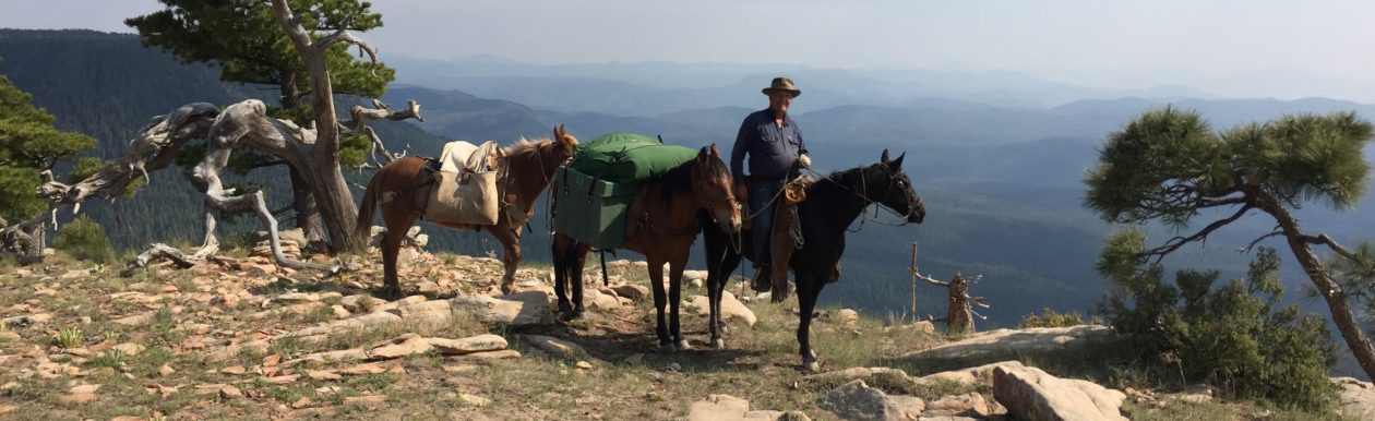


 We were lucky enough to find a nearby exit (Sigurd) and turned north of the freeway. We found a two-track road that headed back toward the west, that took us to a good place to park the truck and trailer. We saddled up there and headed northward into the hills, my friend riding Trigger, a registered Tennessee Walking Horse, and I riding Lizzy, my registered Missouri Fox Totter and favorite trail companion.


 Once out of the foothills, we headed back southeast, toward the trailer. It was getting on toward evening and temperatures began dropping, but luckily, the snow storm never moved up into the area in which we were riding. We could see it off to the south, shrouding the mountains in snow and clouds.
 On the way back across the flats, Trigger, the horse my buddy was riding, stepped into a deep hole and nearly went down. My buddy lost his hat, but kept his seat. Trigger went to his knees, but regained his feet and all was well.


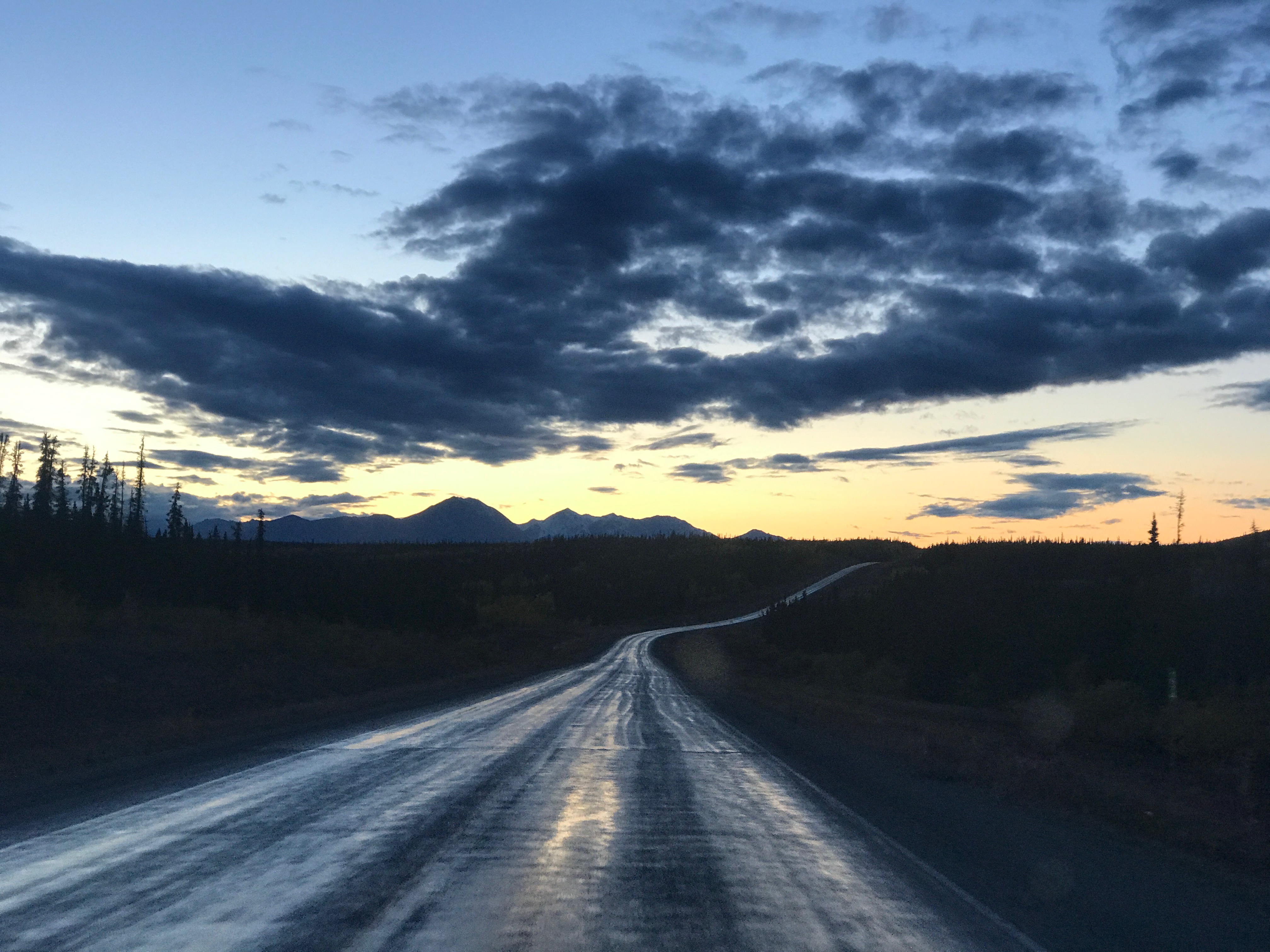

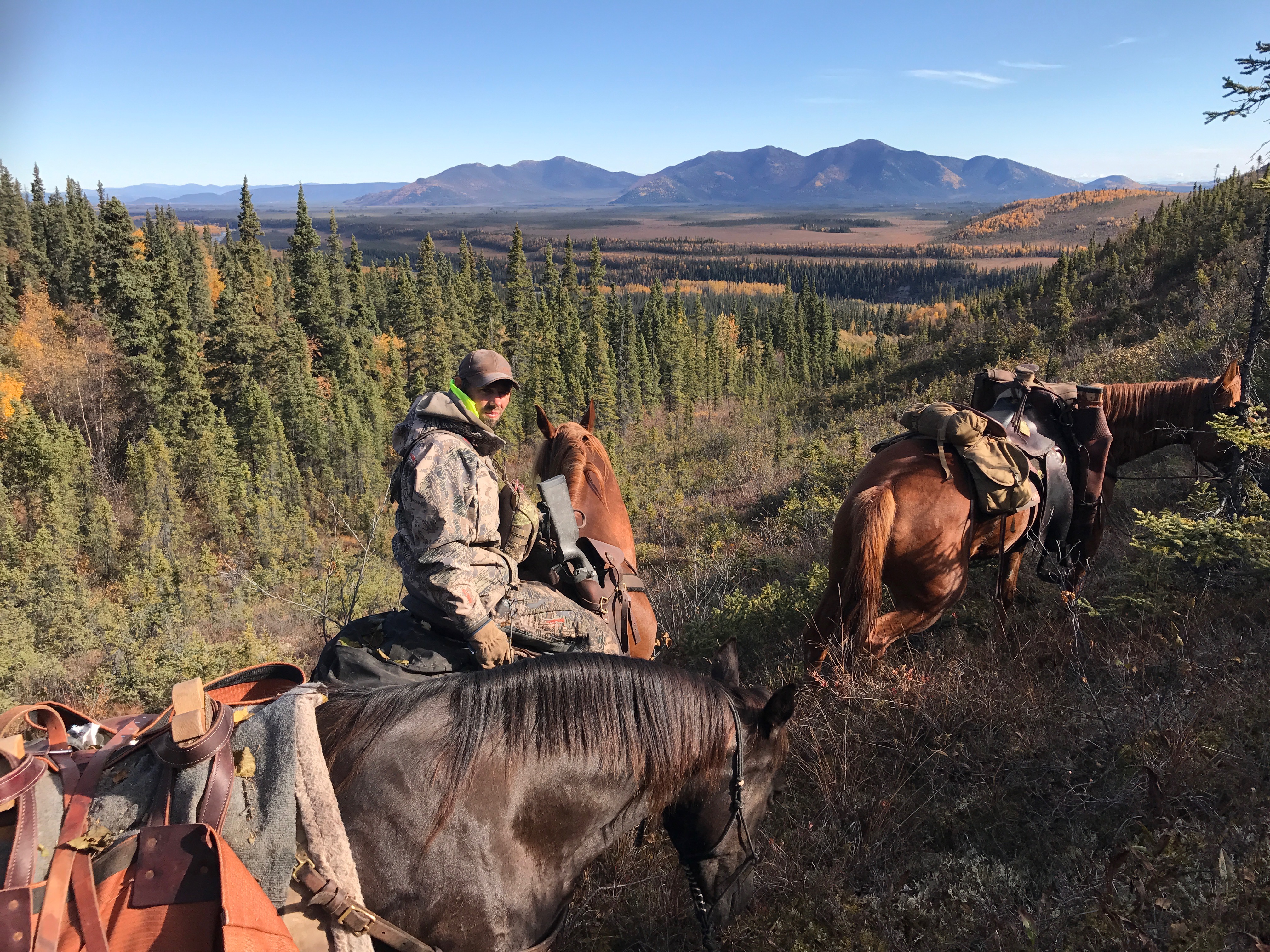


You must be logged in to post a comment.